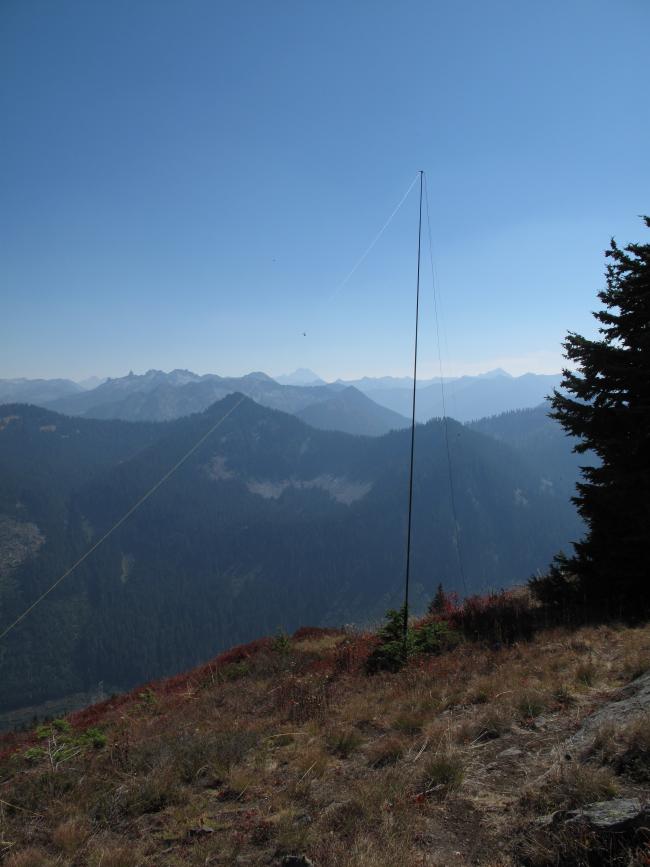
A clear, sunny and warm day; beautiful fall colors of yellow, gold, red and purple; a successful activation; and the company of my wife, Sharon and Dexter the SOTA Dog - all made for a very pleasant outing. Summit Chief Mountain is a 6 point SOTA Summit in Chelan County, above the Stevens Pass Ski Resort area. It is accessed via highway entirely, being located at Stevens Pass, on SR 2.
At 5,858 feet, Big Chief Mountain is not tremendously high, but having over 2,800 feet drop looking NE to Mill Creek valley and over 2,400 feet drop looking North to Nason Creek valley from the summit, one feels like one is in a small airplane flying over the Central Cascades. The total elevation gain is approximately 2,000 feet, including some short up and down sections over small "false summits". The approximate total RT distance is between 6.5 and 7 miles.
The trail access starts on the Pacific Crest Trail section Southbound from Stevens Pass to Snoqualmie Pass, and so affords an opportunity to meet and speak with Through Hikers doing the entire PCT, especially in the late Summer / early Fall. The route begins by travelling on the well graded PCT, South from Stevens Pass. The TH is found in a large gravel parking area east of all of the main lodges at the ski resort. The actual TH sign is about 100 lineal feet above the gravel parking area. See picture of TH sign. Travel about 2 miles on the well graded PCT, at first through the more visible portions of the ski area, and then through very pleasant and wonderfully colorful (Fall) forest. On occasion passing under the Big Chief chair (old name) and later the Tye Mill Chair of the ski resort.
After approximately 2 miles on the PCT, reach the crossing of the long ridge defining the upper boundary between the main ski area and the backside slopes descending to Mill Creek valley. This is a very obvious way point. Turn left, heading NNE and later NE on a mostly well-defined boot beaten path towards the summit of Big Chief. Along the way you will cross under the double terminus of Southern Cross chair coming up from Mill Creek valley, and the Big Chief chair (old name) coming from the front side of the mountain. This point is at approximately 5,584 feet. From there continue on the boot beaten path nearly over point 5,765, descending a bit trough some boulder fields and steepish terrain (max class 2), and then a final beautiful section of open ridgetop terrain to the summit. This last section, from 5,765 to the summit is entirely out of sight of the ski area, and so has a more "wilderness" feel to it. On this section we were startled by 3 grouse taking sudden flight just a few feet from us. We also saw signs of deer, elk and coyote along this section of the ridge.
The summit is a smallish rock hump, with outstanding views in all directions! However, due to the ongoing forest fires in Eastern Washington, the distant views were significantly affected by the smoke and haze. Looming to the North was glaciated and snow covered Glacier Peak (10,541 feet) and to the SE the mighty Mount Stuart (9,415 feet).
I set up for 40M / 20M SSB ops using the inverted V dipole strung from the 25 foot carbon fiber fishing pole. I also tried several times 2M FM, without success. I made a total of 7 40M contacts, with a couple being very difficult copy...the band conditions were not favorable for SSB. Perhaps another wakeup call to CW?...
Return trip was a little quicker because of trail familiarity. At the TH we found a "Hippy Bus" parked in the gravel parking lot, with a sign greeting PCT Through Hikers to: "come and joint the party". We politely declined, but took some pictures...
Thank you to my Chasers / contacts: W7PK; W7ZRC; KB6EMC; K7HGK; WI7E; WK7F; W6LDC, all on 40M SSB.


