KK7DS' SOTA file generator
This tool will generate custom query files of
SOTA
summits. Insert the parameters for one of the query methods and
click "Submit" to download the resulting file for offline use. See
below for instructions on how to make this update "live" in Google Earth.
Note that in areas in the western hemisphere, the absolute value of your "Min Longitude" will be greater than your "Max Longitude". Format is decimal degrees.
Note that in areas in the western hemisphere, the absolute value of your "Min Longitude" will be greater than your "Max Longitude". Format is decimal degrees.
What does it look like?
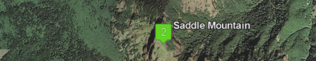
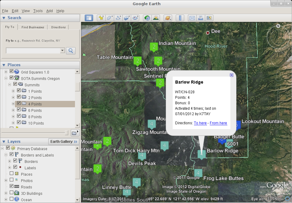
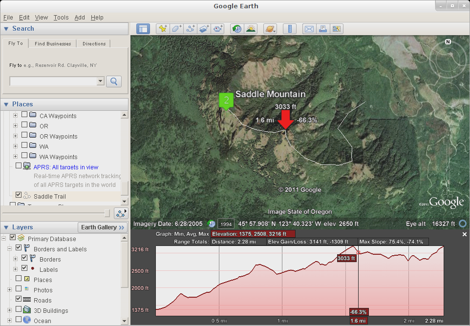
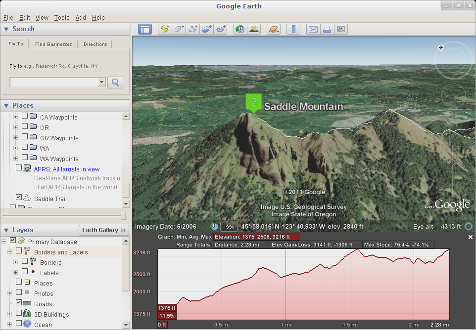
To see what it looks like in Google Earth, see the following screenshots from the Mt. Hood area in Oregon: Nearby Summits, Summit Detail, Elevation Profile, 3D view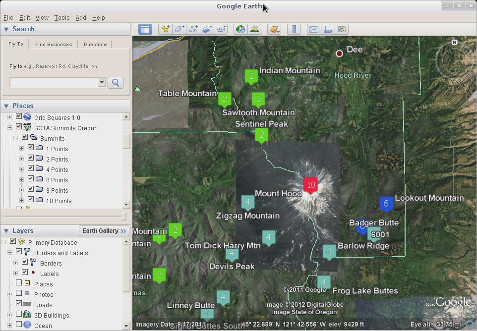
How do I get a live feed?
By adding this source as a network link in Google Earth, the status of the SOTA points will be updated automatically any time you are online. Enter the appropriate values above and then copy the URL from the box below:
Add this to your Google Earth places by going to the Add menu, choosing Network Link and adding this url.
- Changes 02-06-2012: Added query type selector, as well as query by association/region. Also fixed exporting summits with strange names (such as those with characters like ñ and ã)
- Changes 02-05-2012: Fixed a bug in the database import code that was ignoring any summits with a comma in the name
- Changes 12-05-2011: Added min/max score options in "advanced" section
- Changes 12-04-2011: Changed KML folders to be by points
- Changes 11-28-2011: Added auto-calculation of the Google Earth network link URL for easy copying
- Changes 11-18-2011: Fixed altitude reporting
- Changes 11-11-2011: Added "by name" and "by id" options for GPX. Also, exclude summits that are no longer valid in the database.
- Changes 11-10-2011: Added GPX output format.
- Changes 08-22-2011: Added gridsquare lookup method.
- Changes 08-21-2011: Added color-coded icons to indicate point values.
- Changes 08-16-2011: Added additional metadata to each point about activations. Put all points into two subfolders for "Already activated" and "Not yet activated"