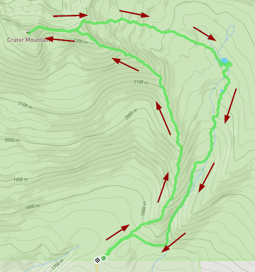
This summit is accessed from Highway 20 in the Island Park area whether coming from the north or the south. The road west you take is marked as Antelope Flats Road and has a large historical marker at the entrance. This is a dirt/gravel road. On Memroial Day weekend torrential rain washed out a lot of the road. UTV/ATV, or 4wheel drive is highly recommendEd. You will pass one major intersection, but you just go straight. This road leads to the flats of course (don't take any of the side roads), where you will reach a “Y” intersection with signs.
Activation Reports

Submitted by N0DNF on
Summit:
This summit is located 6 miles East of Lava Hot Springs, Idaho. Take Highway 30 East towards Fish Creek Summit and turn South approximately 1 mile from Lava Hot Springs onto Baldy Mtn Road. Stay on the main paved road which heads South and the turns into gravel/dirt road. Watch for a sign on your left that says State access 1.5 miles. You will come to a junction near 42.547° -111.900°.
Submitted by NR7Y on
Summit:
NC-075 is an unremarkable peak in the Tillamook State Forest. Easy enough to accomplish if you happen to be nearby or in a completionist mood.
Access appears to be available from the west at the coast near Wheeler, but I routed from the east near Triangulation NC-005.

Submitted by K7RNJ on
Summit:
To get to Rocky Top from the Valley, take Hwy 22 in Marion County east past Gates, OR to Niagara Hts. Rd, across from Niagra Park at the intersection with the red and white waterwheel, well-known to area residents and weekend travelers to Central Oregon. Watch out, the left turn approaches fast as you round the corner and I still miss it despite having been up there several times.
Submitted by KI7VEM on
Summit:
The trip report by K7ATN is good but there are no signs anymore. Check out the attached map from Google Earth for guidance. We were not sure what road to take but we eventually figured it out based on K7ATN's report.
I was at the Malheur Field Station, about 31 miles from the turnoff on Lava Beds Rd so I decided to activate this summit. All went well until I discovered that I left my radio at the Field Station.
The one steep area mentioned in the trip roport is quite steep for anything but a 4-wheel drive vehicle. I didn't make it up until I switch to 4WD.

Submitted by N7UN on
Summit:
Follow other blog entries for accurate directions to the access road. The first gate at FS60 road is gone, at least destroyed. A second gate about a mile in was also open but might be locked later in the season.
Normally, from FS60, this is a 3.3 mi/ 1600 ft elev gain hike but I was able to drive to with 1/2 mi of the summit where I hit snow drifts covering the road. I would expect these to melt out over the next 3-4 weeks or so, making the summit potentially a drive-up where parking would be available.
Submitted by N7UN on
Summit:
FS6801 Rd is not obscure to find and clear of windfall until about 1 mi. in. Directions to FS6801 are available by other blog entries. Going east on FS60, if you get to the PCT, you've gone too far.

Submitted by KJ7SYX on
Summit:
What will become a theme with these summits in the Mountain Lakes Wilderness, is that there isn't really a trail to the top. I elected to get to the top by following the ridge which leads, almost in a crescent shape, to the summit from the Clover creek trailhead. I feel as far as distance/ease of travel this is the best route. See the image below.
Submitted by KJ7SYX on
Summit:
Compared to nearby Mount Carmine, getting to the trailhead of this one is a breeze. I parked at the Varney Creek trailhead off of Highway 140. The road is well signed and in good shape with plenty of parking. This summit though, at least the way I went, uses absolutely zero official trail. From the parking lot I headed south along what looked to be an old logging road that has since been overgrown It didn't take long for that to fade away then you are left with open forest to find your way. The lower part of this route had been logged previously which mad
Submitted by KJ7SYX on
Summit:
Fair warning, this one is a bit of a tricky one. This summit doesn't have a trail to the top at all. You could possibly access it from the Mountain lakes loop trail but it would be a very steep scramble over loose rock, it looked a bit too dicy to me when I did my scouting hike around the loop a few months earlier. I elected, instead, to use part of the old moss creek trail which was abandonded by the forest service but is still maintained by individuals. The old moss creek trailhead is located on land owned by green diamond and is only open to vehicle traffic