Grivets, FR | May 2019

Summit
Grivets is a simple "SOTA-car" (drive-up) summit about 30km south of Grenoble, France. There's nothing remarkable about this one-pointer, but it could be a quick activation stop along the A51.
Trail contains no technical obstacles
Grivets is a simple "SOTA-car" (drive-up) summit about 30km south of Grenoble, France. There's nothing remarkable about this one-pointer, but it could be a quick activation stop along the A51.
Le Pet du Loup is a simple and easy summit in the lovely Parc Naturel du Pilat, about 45 minutes south of Lyon, France. Google Translate might let you know that "Le Pet du Loup" really does mean the Fart of the Wolf - a fun name.
It was great to meet club members at SEA-PAC. I came back motivated to earn my first point! WV-095 (https://www.sota.org.uk/Summit/W7O/WV-095) is Mt Scott and has been frequently activated. It looked pretty straightforward and I had already cycled to the top a few years ago.
May 18th was the Puget Sound S2S party. I had plans to take my son dirt biking in Walker Valley in the afternoon, so I needed a quick summit that was resonably close to Walker Valley ORV park. Mount Cavanagh fit the bill nicely, and was surprisingly pleasent!
After reading K7EEX's warning about Stimson land, I reviewed the maps and Peakbagger reports, and found that a 2.6-mile trail existed starting right from the edge of US 26, up Shields Road, and staying on Tillamook State Forest land for the majority of the trip. In fact, this summit can be activated without ever stepping foot on Stimson land, as the boundary of their land is just a little higher than the activation region, but Stimson has a permissive access policy for non-motorized, leave-no-trace day use, so read their stipulations and head right up.
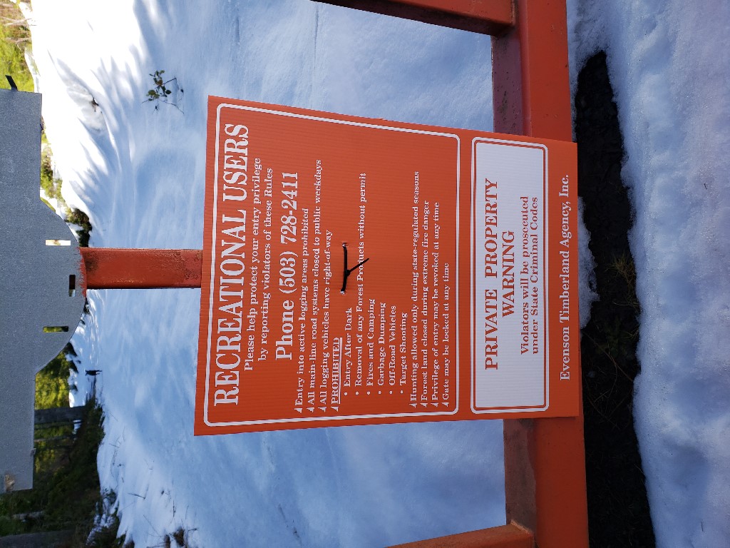
I just wanted to post a quick update on W7O/NC-044 the previous write up is still accurate but as I understand some people have found it posted no tresspassing I just wanted to post an update from my recent activation there.
I won't give all the details of how to get to Red Top, etc. This summit has been well covered by others. Here is an interesting report from K7MAS for comparison:
Summary: On 28MAR19 I decided to knock out the first activation on Field Effect Hill (aka Megler Mountain). The weather started out beautiful and sunny but I ended up having to complete my activation in the rain which contiuned until I had started the hike back down when the sun returned. Overall, the hike isnt bad but the the horrible wide band RFI in the vincinity of the summit made this less fun for an HF activation than most summits which tend to be far quieter.
After abortive failures earlier in the day due to lack of access I finally completed an activation on this awesome summit on a beautiful day.
Access to the summit is via gated logging roads with recreation use permitted signs and no motor vehicles allowed.
Parking is directly off Highway 47 south of Clatskanie at position: 46.041460, -123.248066
There is ample parking for multiple vehicles as seen below:
I completed the first activation on Doppler Shift on 04MAR2019. The hike is roughly 2 miles from a logging gate. In my case this gate was open however as with all these gates they can be closed and locked at any time so pass them at your own risk. I was able to drive about 3/4 of the way up before finding a 'Unauthorized Motor Vehicle Access Prohibited' sign. At that point I found a spot to park and hiked the rest of the way to the activation point.


