Signal Mtn, MT | August, 2016

Summit
1.7 miles, +1,260 ft, -160 ft (From Lake Levale); 18.8 mile approach from Silvertip TH
Trail contains no technical obstacles
1.7 miles, +1,260 ft, -160 ft (From Lake Levale); 18.8 mile approach from Silvertip TH
After going "0-for-Powers" last week, I decided to lick my wounds with an easier activation. Shamelessly, I cribbed from the recent visit by Phil, NS7P, to Roman Nose Mountain.
Roman Nose is almost TOO easy. One can drive all but the last half-mile or so. I parked another 1/2 mile before the locked gate, to ease my conscience. (There's no specific distance of hike required. Personally, I aim for at least a mile or so. If you're young and vigorous, you might want to be tougher on yourself).
On November 11, 2016 I was making a blitz trip from Boise down to City of Rocks to activate it in the ARRL’s National Parks on the Air program. I had always wanted to run up to Mt. Harrison and had just enough time in my schedule to do so. I had read W7IMC’s short summary of his 2013 trip, as found on the SOTA Summit Summary. A paved drive up to a 6 pointer! In Idaho! Hard to believe and it is likely the only one of its kind. Sure enough that is what it is.
Tiffany Mountain’s 8242 foot summit classifies it as a 10 point SOTA summit. With only a few exceptions, 10 point summits in the W7W association are technical climbs, or exposed Class 3 or 4 scrambles. Tiffany Mountain offers a well maintained and well graded trail to the summit. Starting with a gentle climb along a sparsely treed ridge, the trail gradually makes it way to a large grassy meadow about 1.5 miles into the hike. From the meadows, the wide rocky topped summit is viewed.
I finally got an activation completed today (Dec 1, 2016). I chose a relatively easy summit that is within 20 minutes of my home, Peak 1094. This peak is in the "back yard" of some rural/suburban houses and is apparently owned by a timber company. I asked for permission to hike from a neighbor. He felt that it was ok as long as I wasn't hunting. Asking first keeps it above board.
Even leaving Bigfoot aside...
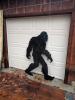
...Southern Oregon has a lot to offer. If you'd like to try SOTA from exotic Oregon, there's probably no easier place to do it than Palmer Butte, W7O/SC-185. It's off US-101 south of Brookings, the first major town north of the California border.
Directions:
Take US-101 to around Milepost 357, south of Brookings, OR. Turn East at this Signal:
This summit is not very noteworthy. It's best feaure is being only a few miles from Cummins Peak, allowing an easy two summit activation. You are on a road right of way that is surrounded by forest. No views, but lots of trees to support antennas.
The road that got you to Cummins Mountain will take you on to Klickitat Mountain. Stay on this road (Klickitat Ridge Road) and drive 4.1 miles to the Klickitat “trailhead”.
This is a fine hike that many should try at some point - it's 4.4 RT miles and 800 feet of gain for the 'short' version described here, with a summit pinnacle that makes for a fun scramble if you feel the need to get to the tippy top.
UPDATE February 2021 - The "Three Corner Rock Trail" is closed - however, the directions below don't use that trail. It's much longer: https://www.alltrails.com/trail/us/washington/three-corner-rock-trail.
Crater Peak is a small 7263’ shield volcanic summit that is located a few miles south of the lake.
The trailhead can be accessed at the Vidae Falls picnic area that is about 3 miles east of the Park Headquarters. Drive back into the picnic area and find a place to park. The trail begins here. The trail is about 2.7 miles each way with about a 600’ net elevation increase. The first two miles are moderately strenuous, but the altitude over this segment gently rolls along without any big ascents. You keep wondering where the mountain is.


