
Good Parking At Trailhead

Trailhead has ample, free, accessible parking

Round Top, OR | July 2022

Submitted by N7KOM on
Summit

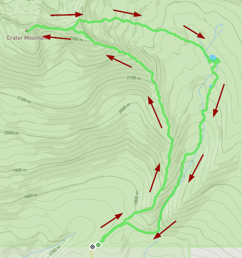
Round Top is a nice mostly drive up activation. Being me, I had to do it the hard way: Mountainbiking from Gale's Creek Campground. It is an 18 mile round trip ride with ~3000' elevation gain. 

I recommend doing some stretches or warmups before heading out because the hardest part of this ride is the first few miles: steep trail that gets the blood moving. Overall the trail is a singletrack and mostly follows the creek through the forest. Not much for views, but there are the occasional waterfall and views of Gale's Creek. 

Umpcoos Ridge, OR | July 2022

Submitted by K7ATN on
Summit

This one-point summit is likely not worth the time driving 40 minutes RT on forest roads. In fact, the roads in this area are quite convoluted - I found it best to navigate using GPS with turn-by-turn directions. You may end up bushwacking through a tangle of coastal brush...or get lucky and find a way to the path visible on sattelite images that I found after the fact. Any "hike" might be less than 0.10 mile and several hundred feet of gain.

Muttonchop Butte, OR | July 2022

Submitted by K7ATN on
Summit

Muttonchop Butte, Oregon is west of the intersection of Highway 58 and Highway 97. The bushwack from the north was not pleasant, see if you can find the trail that leads to 0.5 mile west of the Quarry OHV area. Take Highway 58 4.2 miles from Highway 97 and turn left onto Road 5825. Follow to the Quarry OHV area starting from about here:43.3617 -121.8485. 

Cady Mt, There is another way!

Submitted by N6WT on
Summit

Cady Mountain, W7W/RS-084 has been on my radar for a while. My wife's family owns a home in Friday Harbor so I have always wanted to activate this summit. I was bummed by ATN's report that it would be difficult to activate from the south side because of private property, so I did not think I could. I arrived here on Saturday and I started looking at GAIA GPS. I could see there was public property owned by the San Juan County Land Bank to the north of the summit that was still in the AZ. I could see a hiking trail just below it. I decided to give it a try.

Rocky Top, OR - June 2022

Submitted by K7RNJ on
Summit

To get to Rocky Top from the Valley, take Hwy 22 in Marion County east past Gates, OR to Niagara Hts. Rd, across from Niagra Park at the intersection with the red and white waterwheel, well-known to area residents and weekend travelers to Central Oregon.  Watch out, the left turn approaches fast as you round the corner and I still miss it despite having been up there several times.

Crater Mountain, OR | August 2021

Submitted by KJ7SYX on
Summit

What will become a theme with these summits in the Mountain Lakes Wilderness, is that there isn't really a trail to the top.  I elected to get to the top by following the ridge which leads, almost in a crescent shape, to the summit from the Clover creek trailhead.  I feel as far as distance/ease of travel this is the best route.  See the image below.

Crater track


Mount Harriman, OR | Sept 2021

Submitted by KJ7SYX on
Summit

Compared to nearby Mount Carmine, getting to the trailhead of this one is a breeze.  I parked at the Varney Creek trailhead off of Highway 140.  The road is well signed and in good shape with plenty of parking.  This summit though, at least the way I went, uses absolutely zero official trail.  From the parking lot I headed south along what looked to be an old logging road that has since been overgrown  It didn't take long for that to fade away then you are left with open forest to find your way.  The lower part of this route had been logged previously which mad