
So in my continuing series on how to summit the easy way, I loaded up the family for the tail end of spring break and headed over to Bend, OR. The weather was gorgeous with just a bit of wind blowing. That contributed to delaying my activation time by an hour due to the lift not yet in service. In the meantime, we skiied the lower slopes. Snow was icy in places particularly the sides of runs and the upper reaches. Once the Summit lift opened, I grabbed my pack and headed up.
Activation Reports

Submitted by AG7GP on
Summit:
If ever in the area I highly recommend detouring up to Agency Hill. The mountain itself recently burned in the 2-4-2 Fire but the view from above is amazing. You look down at Crooked Creek, a winding creek in the basin that eventually gets to Agency Lake. Upper Klamath, Shasta, Mountain Lakes caldera, Crater Lake rim, McLoughlin, Pelican. You can see so much. This whole area has a lot to offer. Lots of eye candy! High clearance vehicle recommended. Follow any map straight up to summit. Plenty of area to set up but you may get a little sooty and it can be dusty.
Submitted by AG7GP on
Summit:
A cluster of summits in the northern Klamath Basin have been on my list for a while but it is quite a drive and wildfires and smoke have also stopped me. However, with the limited snow, I thought I would see if I could make it work for Wocus and Little Wocus Butte before the end of winter bonus, making the day trip a bit more worth it. It took a little bit of effort and luck to make it happen. This summary is for both since I did both in one day and encourage others to possibly give it a try too.

Submitted by AK7U on
Summit:
The Nestucca River Byway is a very secluded and off-the-beaten-path route through the North Coastal Range, between HW6 to the North and HW18/HW22 to the South. It's paved from Carlton at least as far West as the turnoff South to Willamina, but not maintained in the winter, so the sign says when approaching from the East from Carlton.

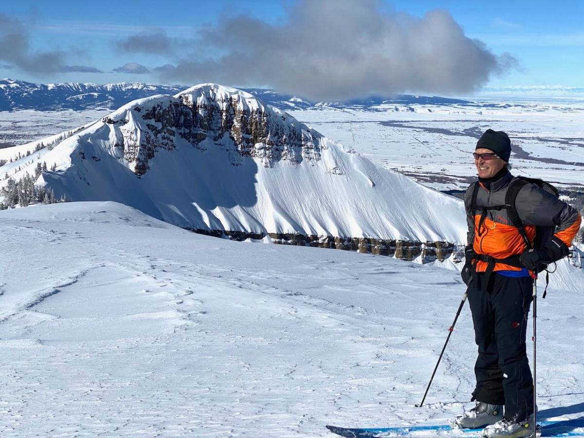
Submitted by K7GUD on
Summit:
I activated W7Y/TT-086, AKA Steve Baugh peak, last summer. It's a beautiful summer hike with spectacular views of the Tetons. The approach is pretty moderate in summer or winter. I decided to do it again this winter and had a perfect, calm, bluebird day with specatacular views of the Teton range.

Submitted by N0DNF on
Summit:
This summit is directly north across the township of Lava Hot Springs ID. located on state land. This summit is located above the Lava Hot Springs Idaho hot pools. It is a short 2 mile round trip hike. Sometimes snowshoes may not be needed but are nice to have just in case. This is mostly a bushwhack hike. After this hike enjoy the Hot Springs for a nice soak.
You can either hike from Lava Hot Springs or drive a short distance crossing highway 30 from the main exit into Lava and park next to the RR tracks near 42.622500,-112.011667.

Submitted by KI7EMX on
Summit:
This was a winter activation and I had hoped for a one-way ride on the Pomerelle Triple Chair lift. After an e-mail and phone inquiry I received no response. I then planned a hike from the Pomerelle parking lot along established roads to the top of the lift and then a very short hike to the summit.
Submitted by NR7Y on
Summit:
Previous writeups and activations have accessed Wildcat via the Stimson parcel that starts at Northwest Hayward Rd. Email communication with Stimson confirms that they have closed this parcel to public access, and activators should not use this path. Signage has been mixed, but the core issue is firearms use in the area that bothers the private neighbor. According to Stimson, "The entry point is actually on their property and we try to be accommodating with our neighbors."
All is not lost! Fortunately the summit itself, and a complete path of access, is on public state land.

Submitted by W7MDN on
Summit:
7 Mar 22: Parked at the "Blanchard Hump" parking area on East Blanchard road. Ample parking, only one other car present on a weekday. I elected not to take snowshoes based on trail conditions at the parking lot. Most of the trail is exposed; almost no snow in sunlit areas. I followed the trail and track from K7DJL [available on SOTL.as] to the summit, about 2 miles. The trail is an ATV track and goes steeply up the face of the summit. There are a couple false summits and snow coverage increased approaching the final hill.