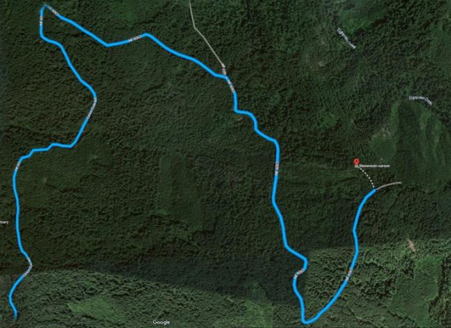
The route I took to 2700 – Circuit Peak was 3.6 miles round trip with 1100’ vertical. It was a combination of forest road walking and moderate bushwhacking. I think it may take a few activators summiting to get the best route to the top identified. There are smaller ridgelines and drainages not shown on the topo maps, and it may be possible to follow the old roadbed nearly all the way to the summit.
Take Wind River road north from Hwy 14 at the roundabout and turn right onto NF60 (45.82460, -121.91565). I parked at the intersection of NF-60 and NF-6063 (45.84859, -121.91428). Getting to this parking location is all on paved road.
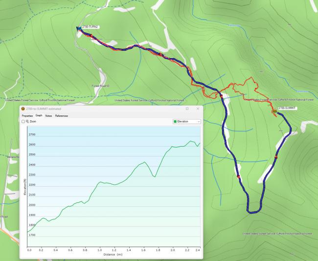
I originally planned to follow what Google showed as NF-6063. Part of the road is there: NF-6063 exists up to the intersection of NF-039 it is drivable but has sections with a lot of branches that will likely scratch your paint. The remainder of the road is blocked to vehicles via jeep traps, and I estimate that it’s been blocked off for about 10-12 years. It has saplings growing out of it and quite a bit of blowdown. Its path is marked by blue “forest boundary” tape, so maybe some logging is coming in the near future.
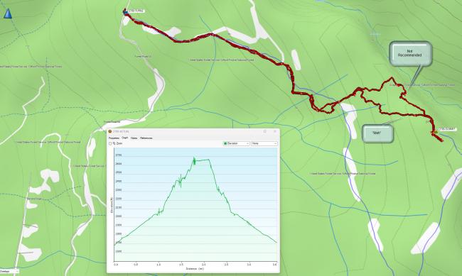
After following the roadbed for a while I saw I was nearly directly West of the summit. I made the decision to bushwhack for the ridgeline and traverse it to the summit, rather than continue with a “U” shape following the old roadbed. Future activators will have to tell me if that was a bad call. Below are graphics of my estimated and actual tracks.
Due to various drainages and smaller ridgelines, my progress was slowed, although in Feb the brush was not that heavy so the bushwhacking was not heavy. I did attain the “top” ridgeline, but I ran into a saddle on the ridge line that looked like it is a path for high winds. It was very heavy with blowdown and deep snow that really slowed me. So I really do not recommend going this way (see graphic below). Once past this choke point, continuing up the ridgeline was easy.
The summit has a good view to the West of Trout Creek Hill and I think D-Layer Mtn, but is treed in other directions (summit pics on SOTA Atlas). When I got to the summit I saw the blue forest boundary flagging which tempted me to try the road bed on the decent, but I stuck with an alternate bushwhack down as shown below.
Trees on summit for attaching wires/poles. I had ATT voice / data coverage and APRS from the summit. I lost my black Diamond Dual Band 2m/70cm HT Antenna on the bushwhack down, so if you find it let me know!


