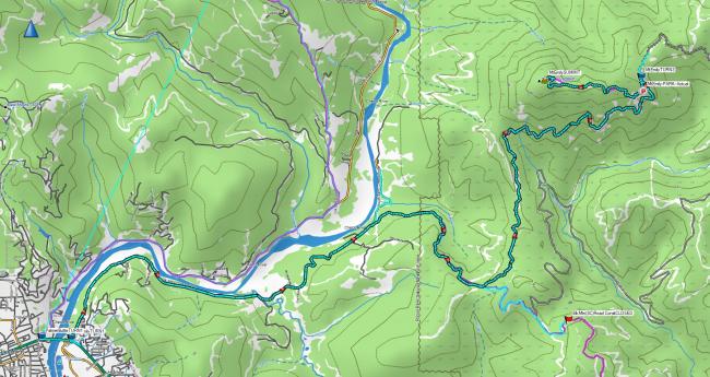
After activating Palmer Butte, I crossed the bridge over the Chetco River on 101 and headed East on Chetco South Bank Road to attempt the first activation of Mount Emily. I posted the GPX track of the drive up and hike. The gravel roads are in decent shape. You could get all the way to the final access road without high clearance. There is a closed gate shortly up the final road so you wouldn't have to hike much further.
There is space to park at the closed gate (42.100533, -124.129250) and the hike to the summit is approximately 2 miles up a pleasant forest road. I met a park ranger (see Elk Mtn attempted FA (W7O/SC-196)) who said they were dealing with vandalism of the the repeater site at the top so are trying to keep the gate closed.
Broad slightly fire damaged summit with space for wire antenna and trees to hang antennas if needed. Summit pics posted to SOTA Atlas.


