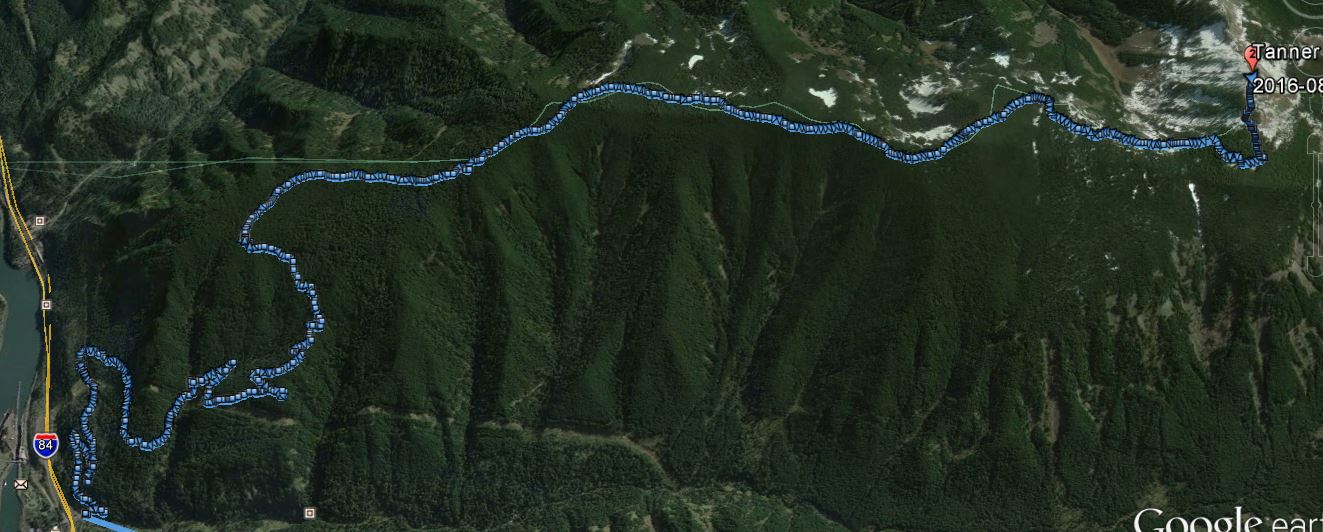
Tanner Butte is perhaps the most remote SOTA summit in Oregon's Northern Cascades. Despite many resources that point out the trail length at 17 miles, measured from the GPS track it shows up as right at 20 miles round trip, with 4500 feet of elevation gain. You won't see many other hikers on these remote trails. NOTE that this area burned in the Eagle Creek Fire in 2017 and trail conditions have likely substantially changed.
The links below describe starting out at different locations - the most straightforward trailhead can be found at Exit 40 from I-84. You can park on the freeway offramp, or if there's room, in the parking lot for Wahclella Falls (NW Forest Pass required).
http://www.oregonhikers.org/field_guide/Wahclella_Falls_Trailhead.
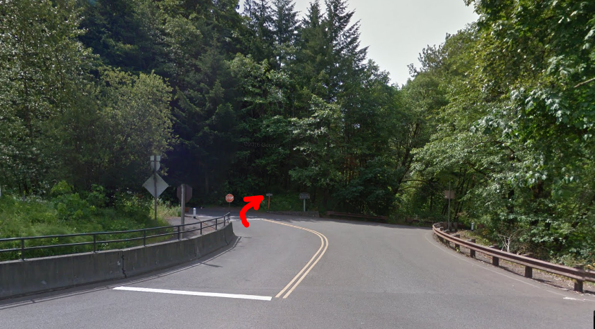
We used the trailhead that starts from near the Exit 40 ramps as you head towards the Wahclella Falls parking lot. Pictured below, it winds upward as Gorge Trail #400, eventually turns into a road and continues until it meets Road 777 under power lines where you turn right.
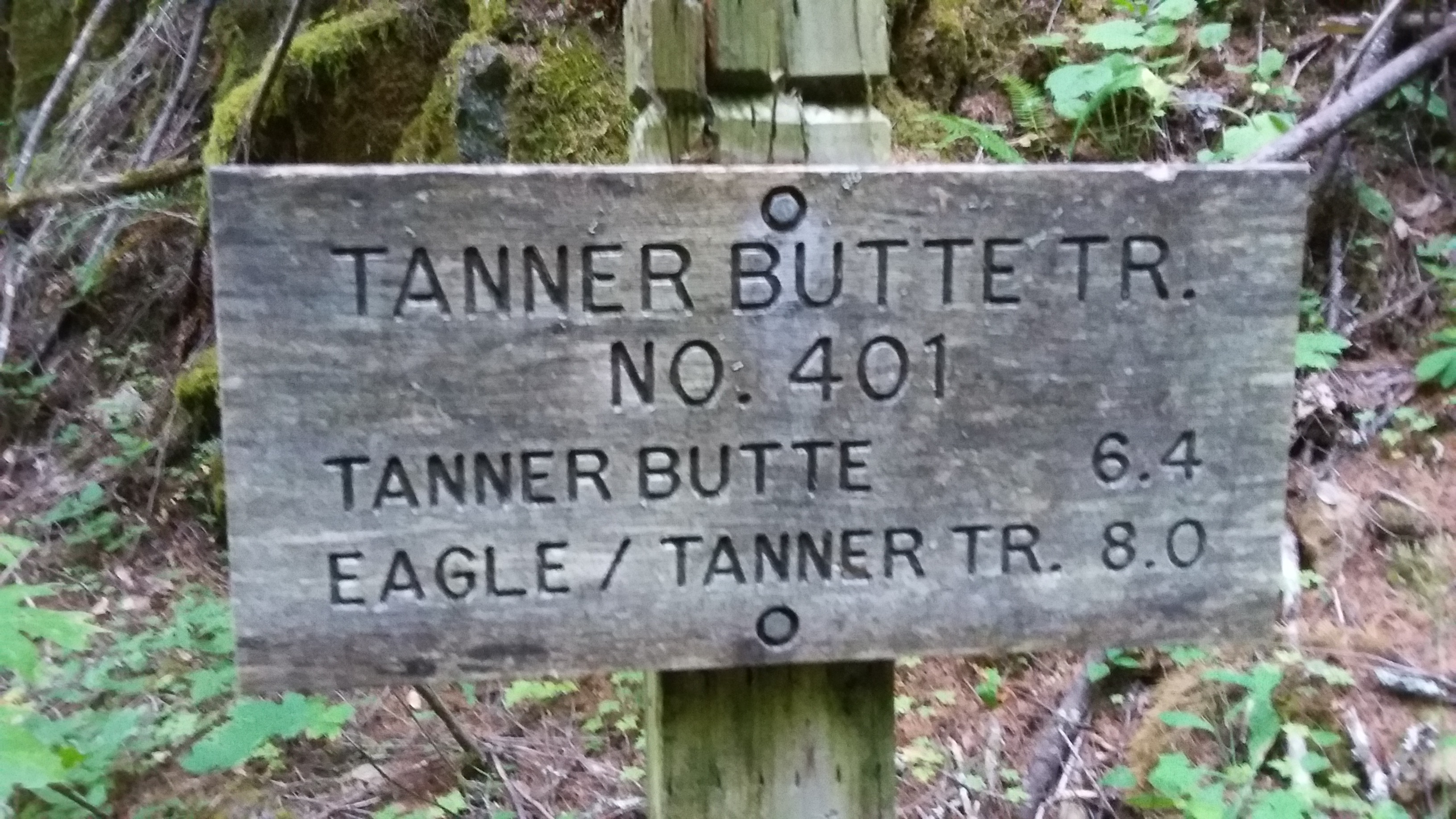
You'll travel on Road 777 for an even 1.0 mile to find the trailhead sign for Tanner Butte #401. There are a couple creek crossings and a few challenging spots where trees have blocked the trail. Here you'll start climbing in earnest and will find a small camp after about 4.6 miles at 2700 feet elevation that's a good spot for a rest. Shortly thereafter you'll enter the Mark O. Hatfield Wilderness and will be on the gradual ridge trail heading towards Tanner Butte.
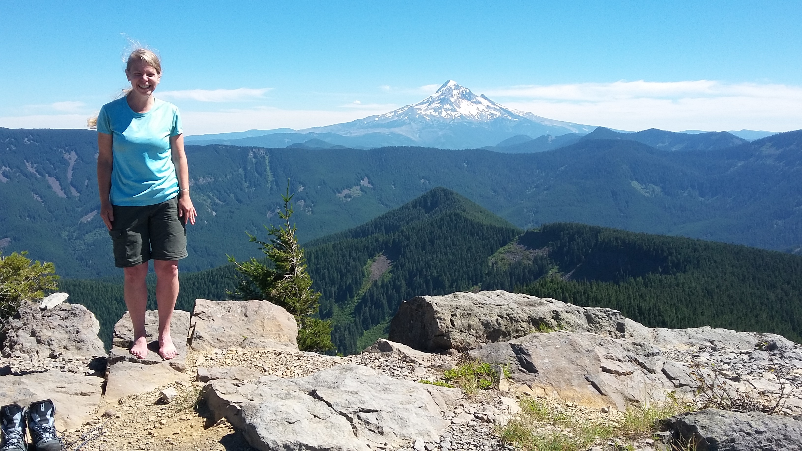
The climber's trail for Tanner was marked with surveyor tape and a cairn near 45.56586˚,-121.91433˚. From here the last 0.4 mile of trail gets you 500 feet to the site of a former fire lookout. We set up just below the summit in the shade of a tree that we used to put up an antenna. We were able to work several people on 2m FM,and had good success on HF as well.
The following links have additional information on Tanner Butte:
http://www.nwhiker.com/CGNSAHike26.html
http://www.peakbagger.com/climber/ascent.aspx?aid=420848
http://www.summitpost.org/tanner-butte/153319
http://www.oregonhikers.org/field_guide/Tanner_Butte_Hike
http://www.oregonhikers.org/forum/viewtopic.php?f=8&t=20630