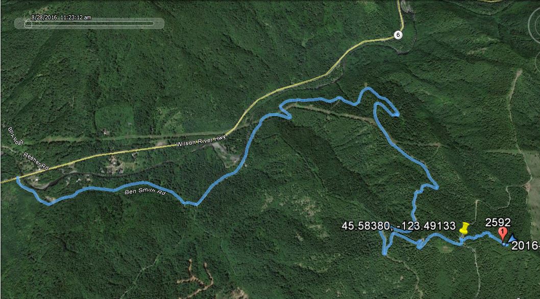
Ben Smith (Peak 2592) is a summit with a short but steep hike in the Coast Range of Oregon - specifically in the Tillamook State Forest. Roads in the Tillamook Forest are usually good - however the signage and documentation are remarkably poor. What's on the ground doesn't necessarily match your GPS map or what in Google Earth and vice versa. Roads are passable in a passenger car.
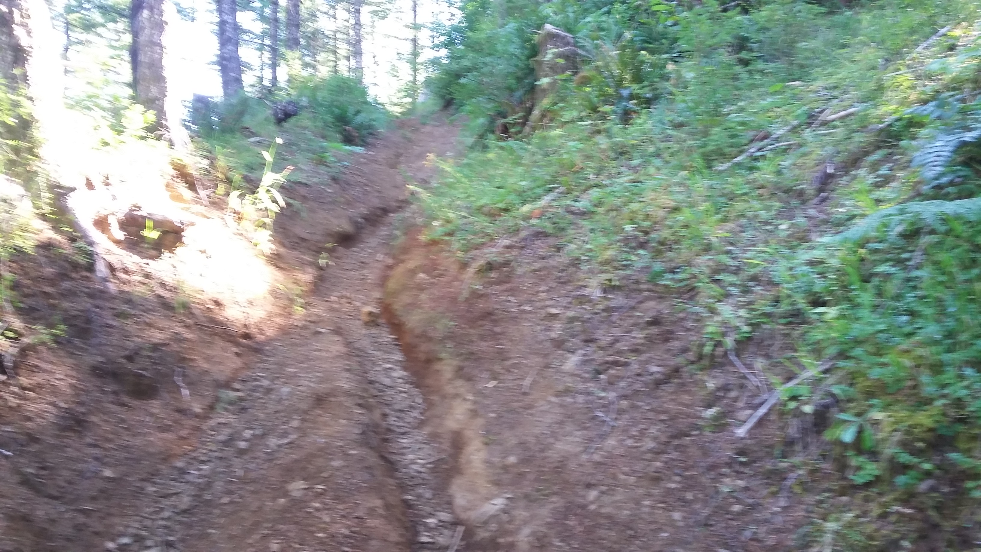
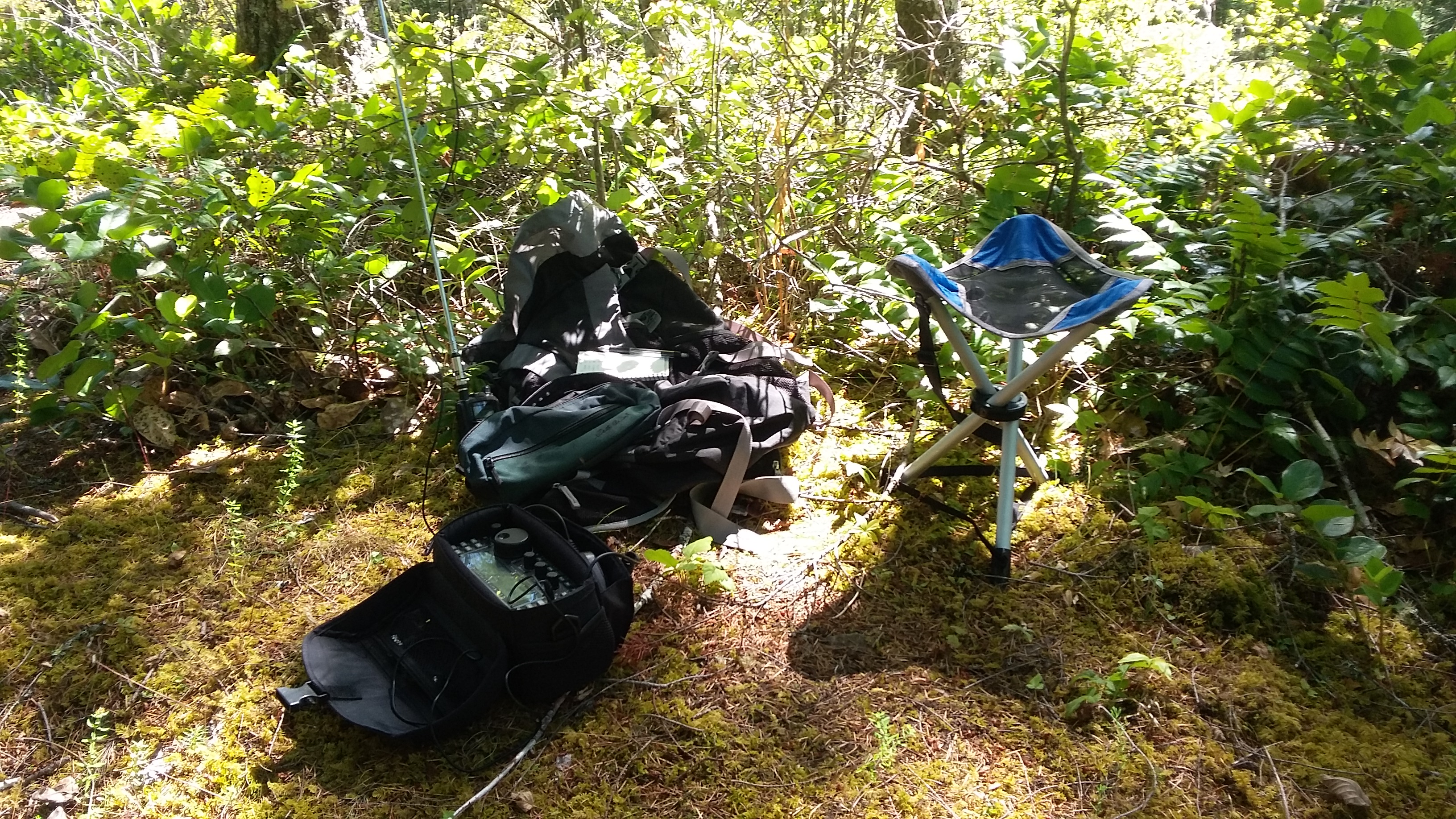
Take the Wilson River Highway 6 west from the turnoff from Highway 26. You'll go about 27.5 miles and turn left onto Ben Smith Road. You'll follow this road about a mile to turn left. You'll continue on up another 3.8 miles and ending up in small triangle of roads about 0.2 miles from the summit proper. I parked near 45.58380, -123.49133 and headed up a very steep motorcycle trail. Poles and good boots will be helpful to climb this track. There may be less steep alternative trails, but I used the shortest route. There is a bit of room off the trail at the summit where I set up. You are in close forest but there's enough room to set up an EFHW.