This is a short one mile hike 400 feet of gain that you reach by driving about five miles on a poor road. There's some bushwacking required to make the Activation Zone.
Travel to Government Camp on Highway 26 and over the pass 0.5 miles to the Still Creek Campground. Drop down through the campground and turn right onto Chimney Rock Road. Now travel about 4.0 miles west on Kinzel Lake Road to where you'll find the Fir Tree / Veda Lake Trailhead near 45.24797, -121.78766. We parked aways down and across the road.
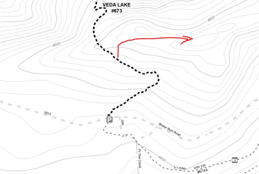
You'll travel on this nice trail towards Veda Lake for perhaps about 0.4 mile to where the trail crosses the ridge - from here you'll go cross-country to the activation zone. Per the map, that's about halfway past the left turn. You may want to use a GPS to find the AZ and summit, and perhaps also to find you way back to the trail!
The summit is dense with trees and rigging an antenna for HF is not a problem. There's not much coverage into Portland on 2m fm from here.