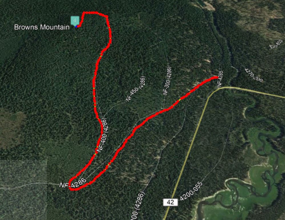
Browns Mountain, west of Sunriver, despite being pretty close to a paved road, was a tough bushwack for Roland-K7FOP and I, as we pursued several "shortcuts." So we recommend walking about 2.4 miles on forest roads, and a final steep ascent of about 1/10 mile. Total is about 900 feet of gain. If there's a better way to get to the AZ, please write up an updated trip report.
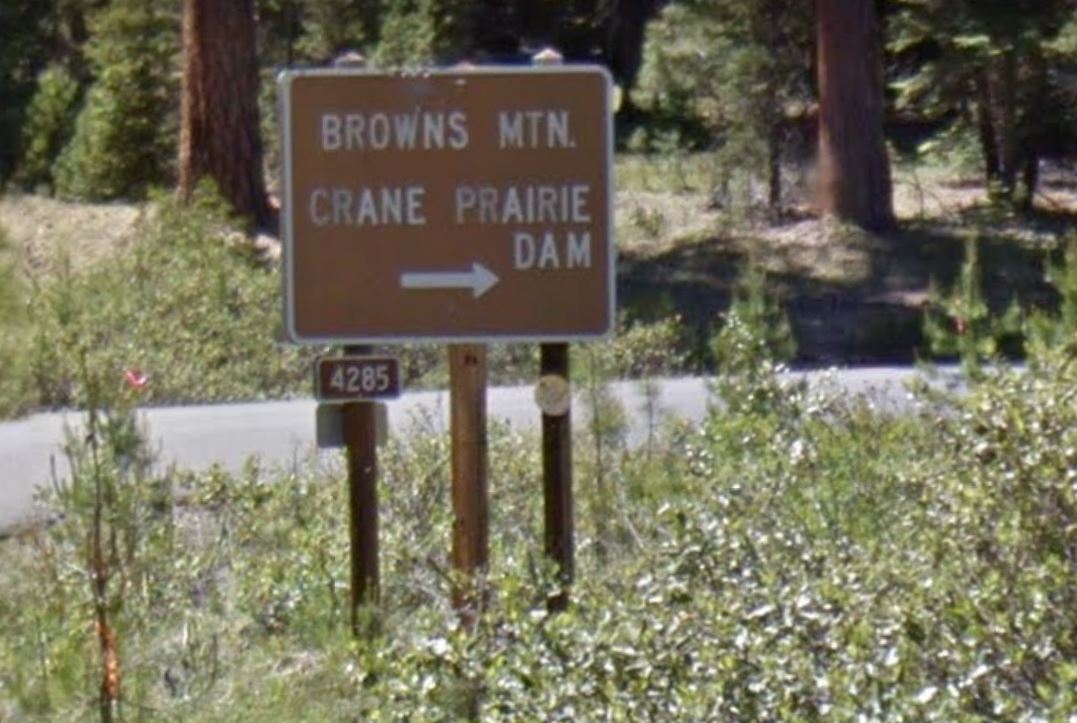
From Highway 97 south of Sunriver, proceed west on South Century Drive, NF-42. You'll pass two easier summits, Bates Butte and Pistol Butte. Just after you cross the Deschutes River you'll turn right at a large sign saying "Browns Mountain" - NF-4285. The very next left (~150 yards) is a gated road where you'll start your trek.
You might best be served by taking the road as it winds up towards the summit - see the notated map below. Know that the east side where you are approaching the summit is Very Steep, and you'll need to go cross-country at some point, since there is no trail or road access to the AZ that we found or can see on Google Earth. It appears best to go about 2.4 miles on roads before heading up to the summit - perhaps approaching from the north.
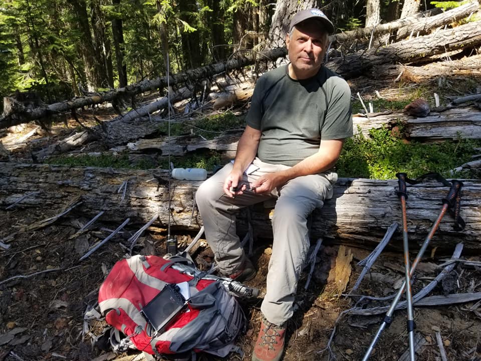
The summit is heavily treed with no views. 2m FM was crickets - pretty much typical for Central Oregon.