Activation of Mount Langley, 14,042 feet, High Sierra's of California, Inyo County. Sunshine, blue sky & endless granite...but with a little price to pay.
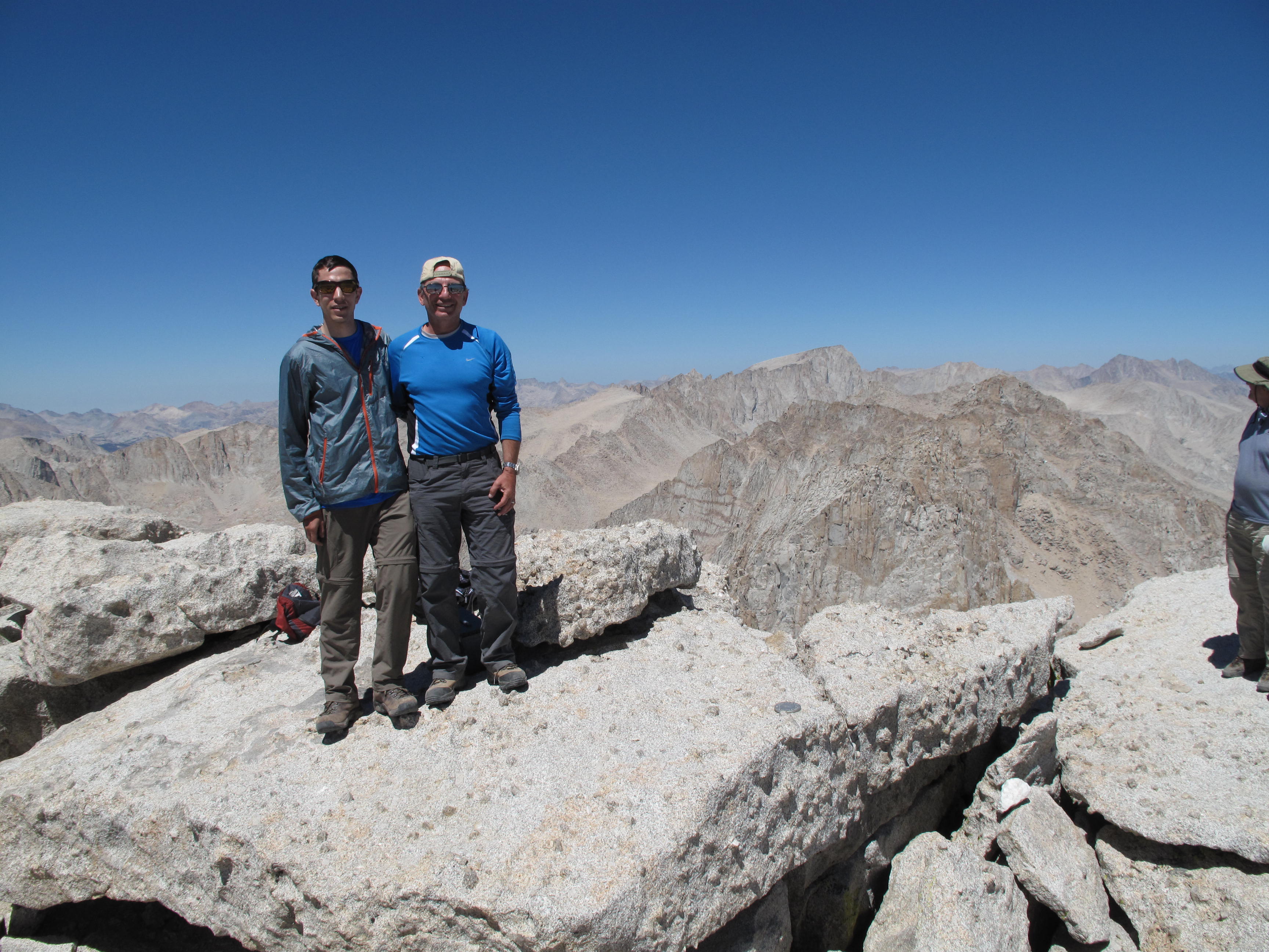
The Hike (Scramble) is 4.75 miles south - southeast of Mount Whitney, California, and 9.5 miles southwest of the town of Lone Pine, California. This was a father / son outing with my 28 year old son, who lives in the Los Angeles suburb of Sherman Oaks (sea level), and I, a 62 year old who resides in Bellevue, Washington, at the high altitude of 728 feet.
From the town of Lone Pine on Highway US-395, drive 5 miles west on Whitney Portal Road. Go left on Horseshoe Meadow Road and continue 20 miles up a remarkable set of switchbacks to the Horseshoe Meadow trailhead. The peak may be approached by hiking up New Army Pass (as for Mount Langley, which we did) or up Cottonwood Pass to Chicken Spring Lake. The trailhead is at 10,050 feet! In researching this outing, I came to realize that there are only 5 points in Washington state that are higher than the trailhead…and all of them are the summits of strata volcanos.
Trip Diary:
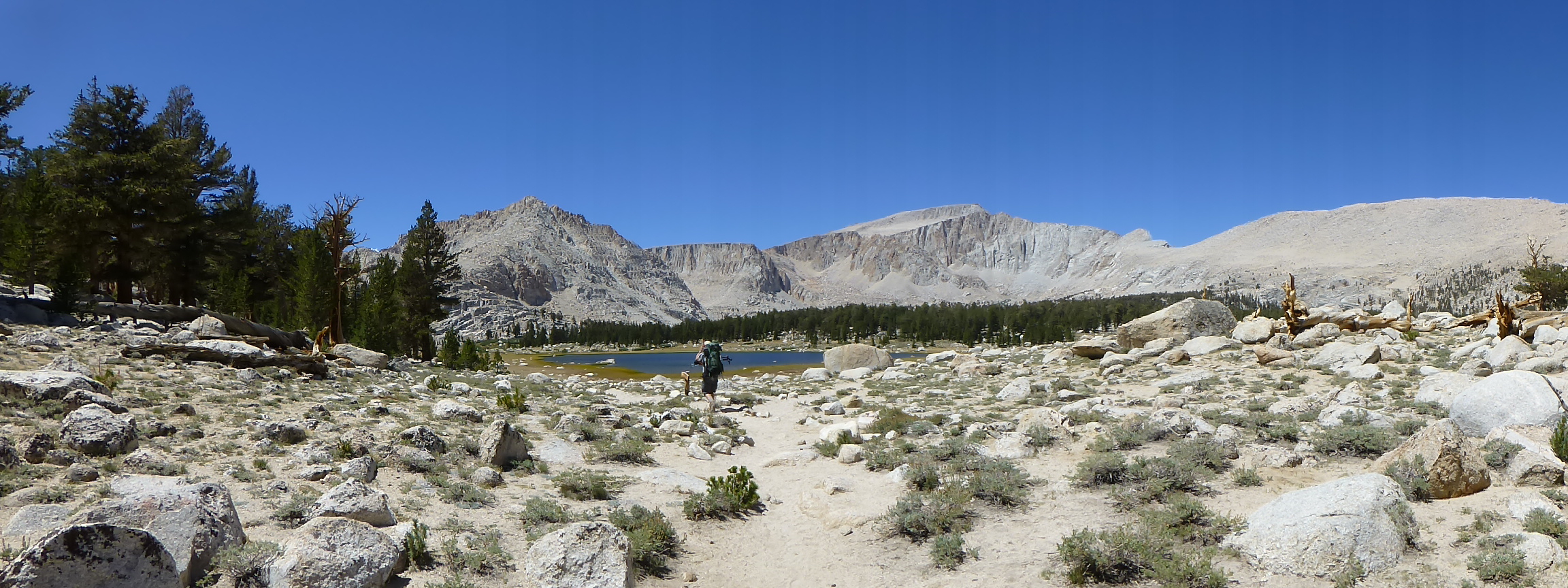
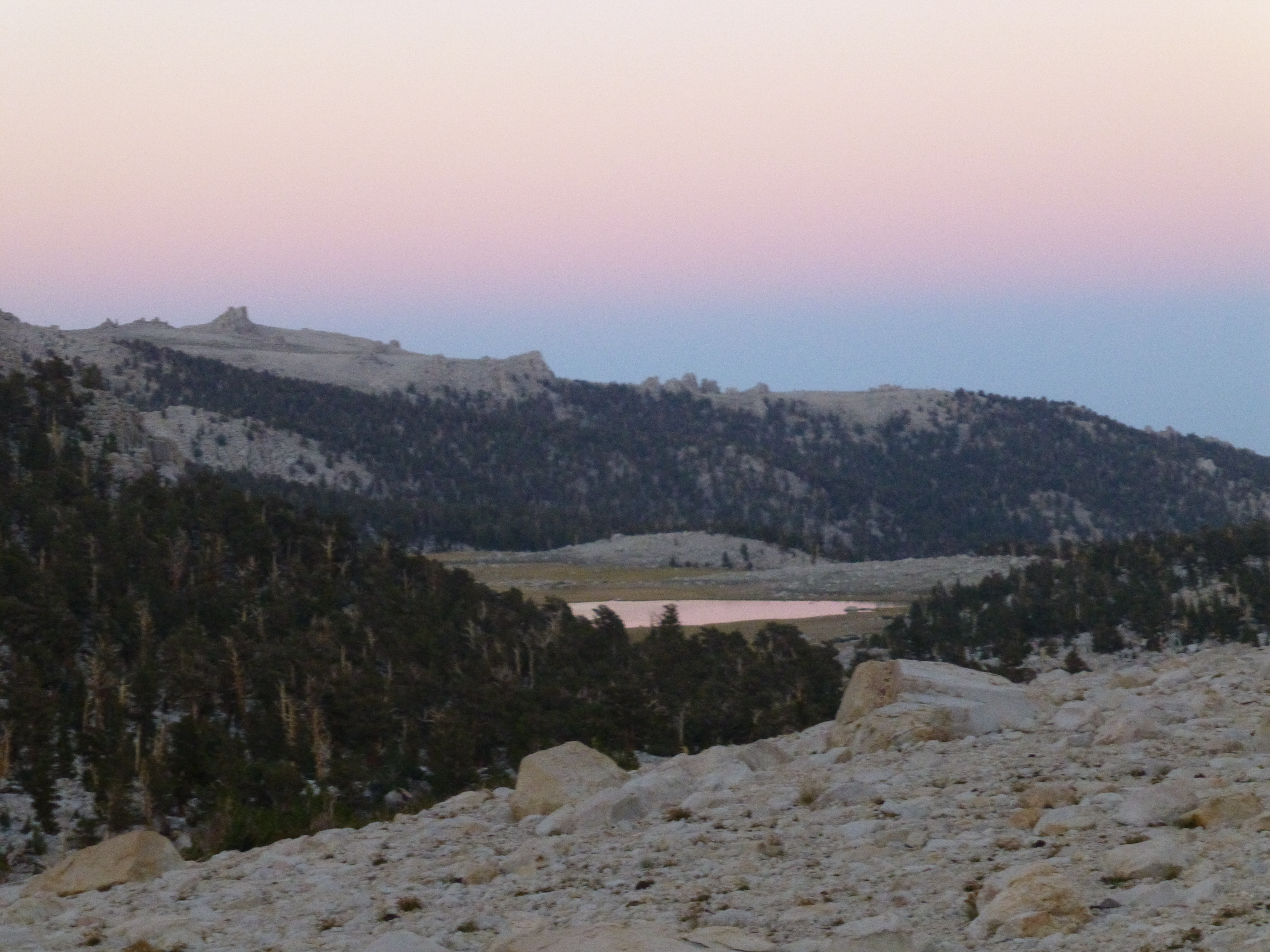
Day 1, hike from Horshoe Meadows TH at 10,050 feet to Base camp at Long Lake, 11,150 feet and 6.75 miles.
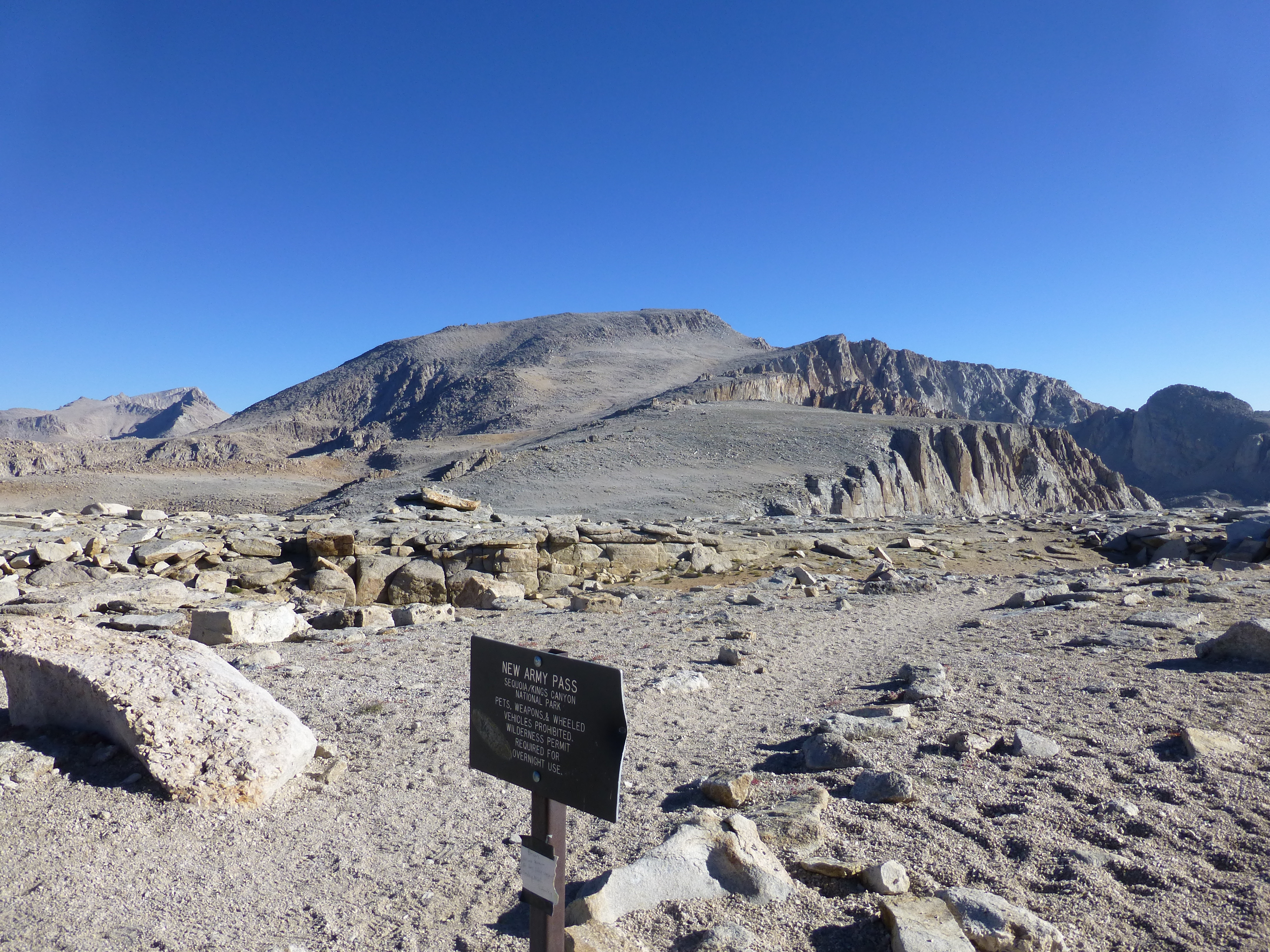
Day 2, hike / scramble to Cirque Peak, 12,900 feet via "New Army Pass". This is an easy ascent, except for dealing with the altitude. A little bit of headache and heavy breathing to suck in every bit of rarified oxygen. 1,750 feet elevation gain, 6 miles round trip.
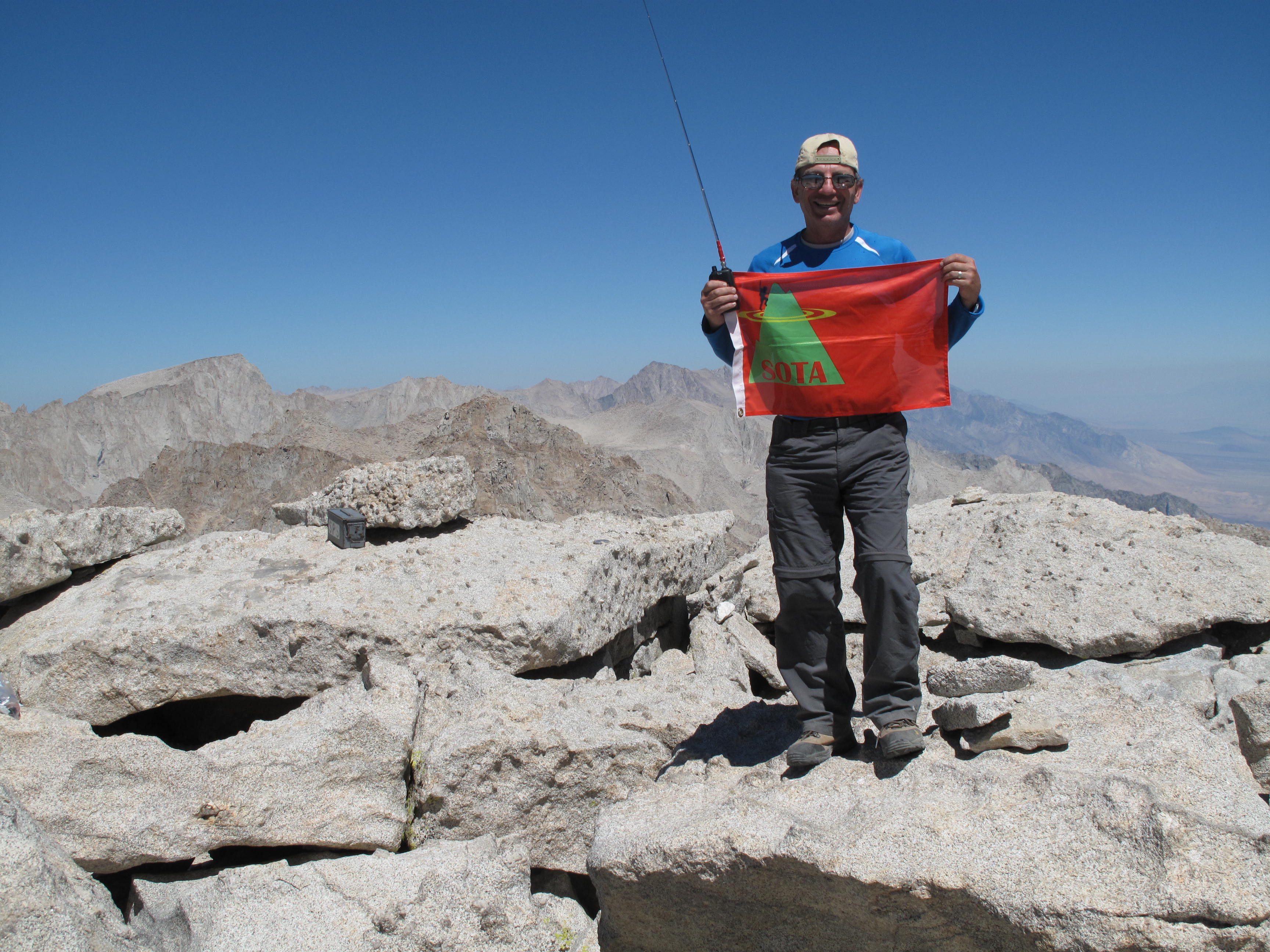
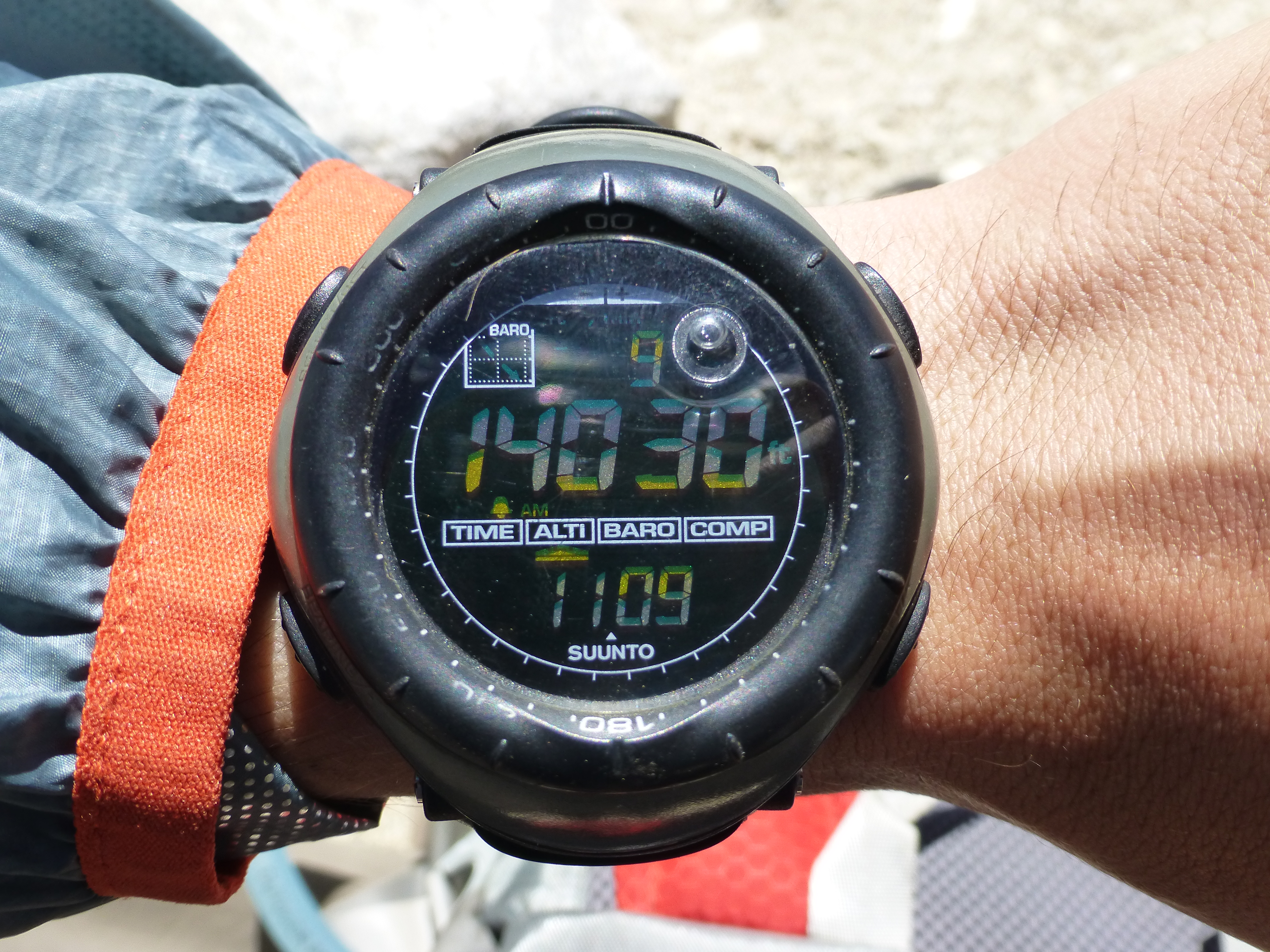
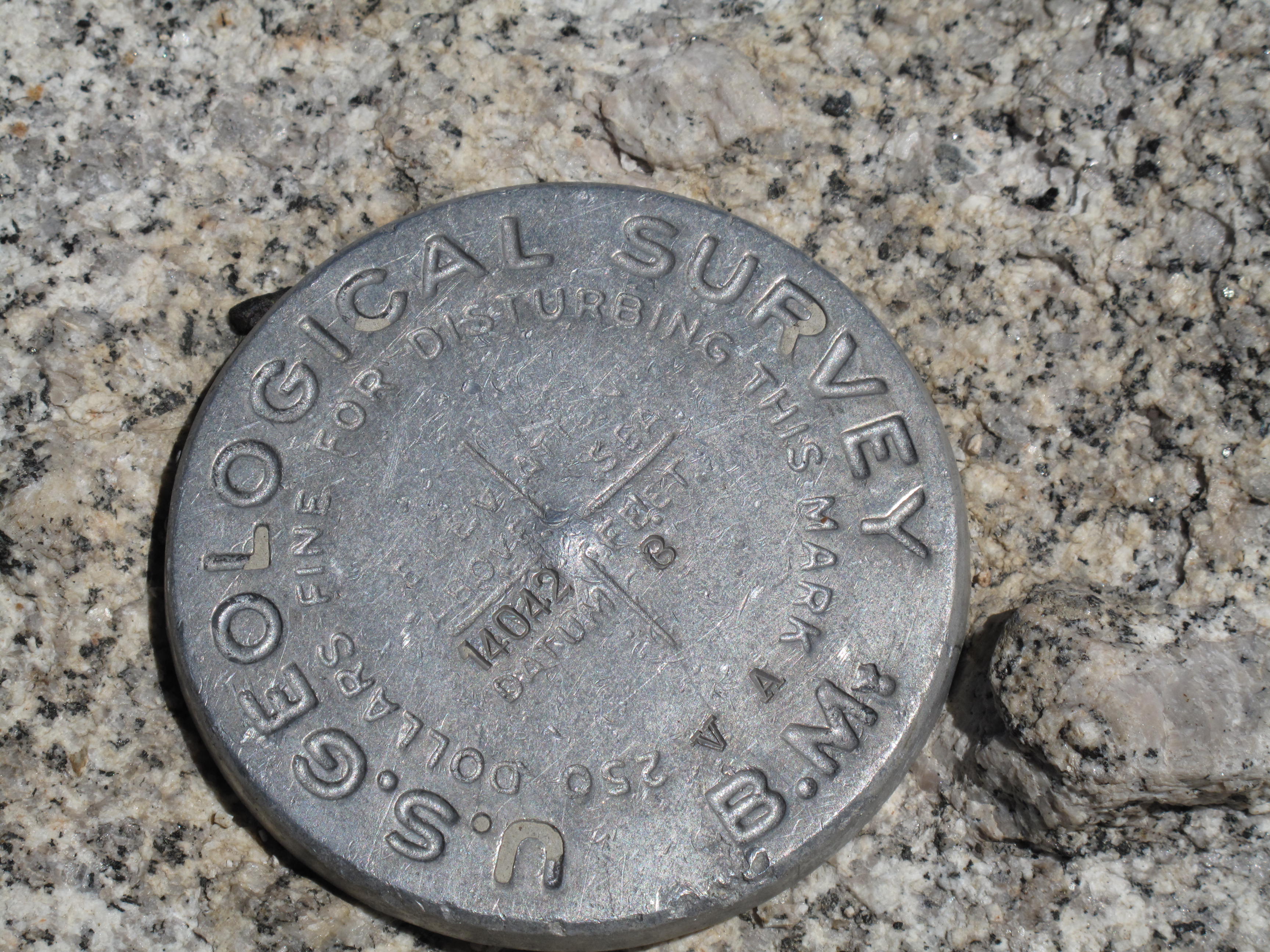
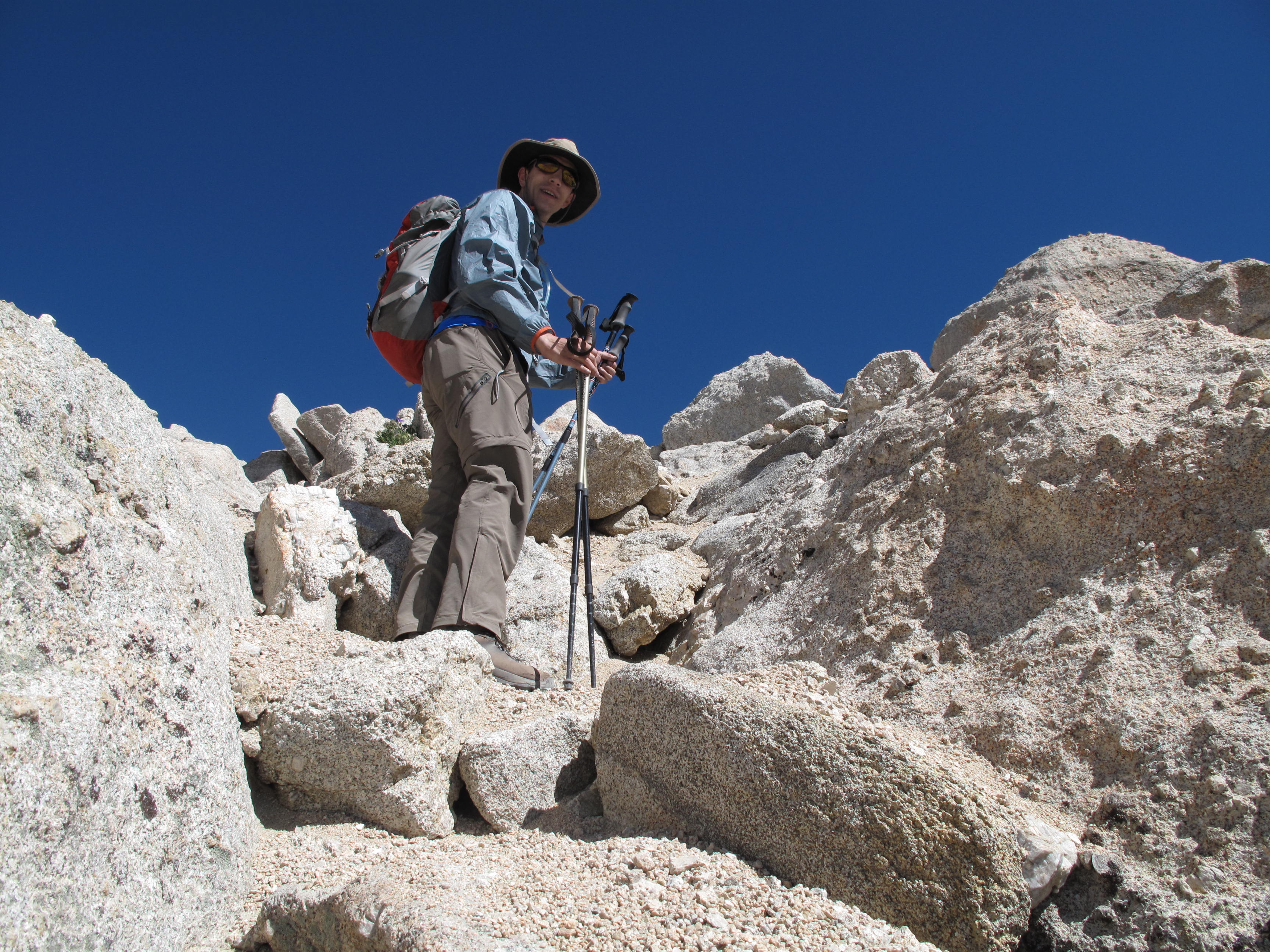
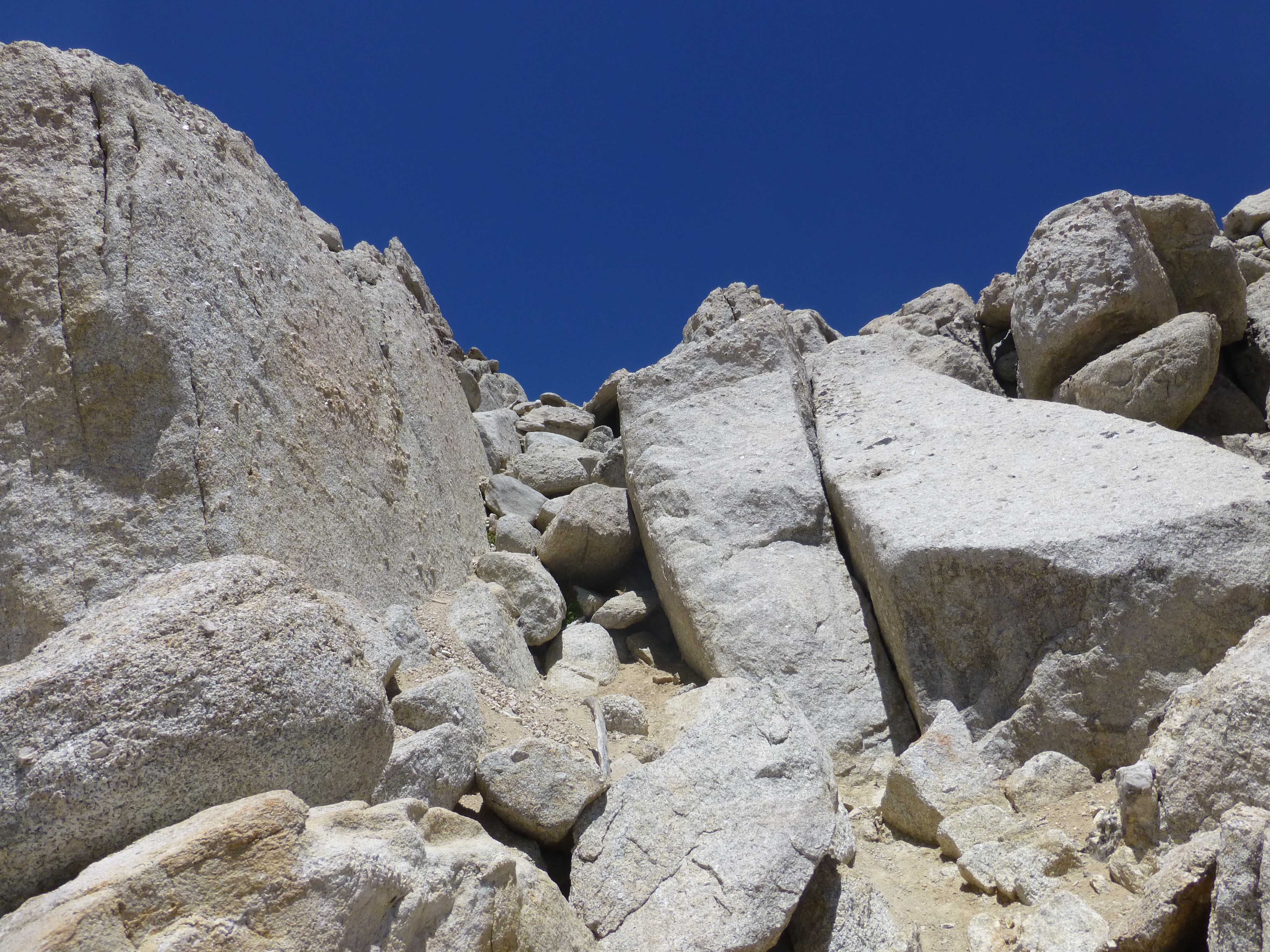
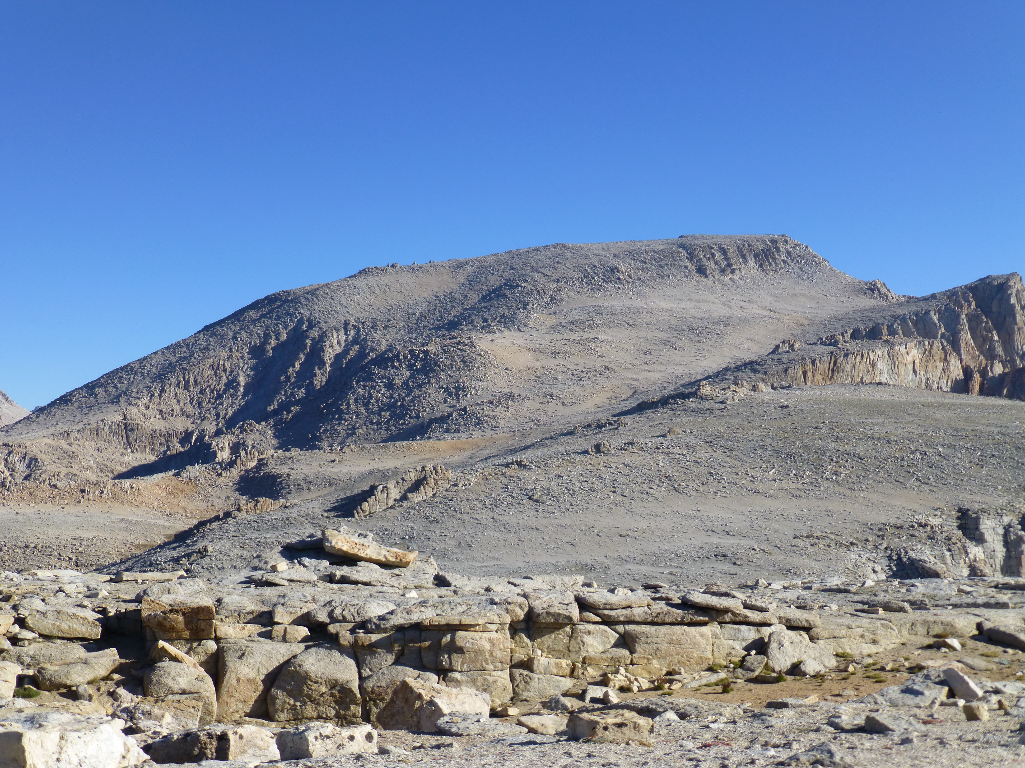
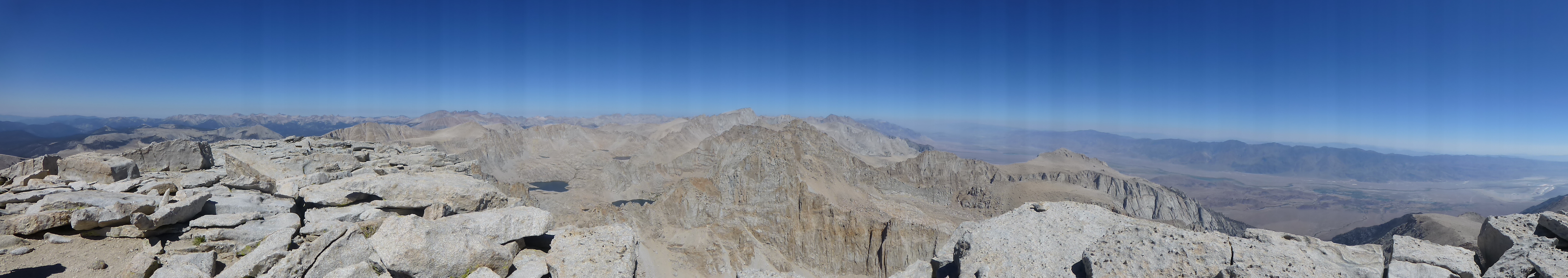
Day 3, hike / scrabmle up Mount Langley, 14,042 feet. This route was 11.5 miles round trip, and 3,700 feet elevation gain. The climb involved going back over "New Army Pass", at 12,230 feet. Then you need to drop 400 feet elevation and re-gain it, before continuing to summit of Mount Langley. The final summit section route we chose is the "3rd Class Variation", climbing over a very nice steep section of large and medium size granite boulders to gain the summit plateu, and then the summit. On the way back to camp, through New Army Pass, we again had to re-gain the 400 feet previously dropped. All together we saw 4 other people on the peak that day.
SOTA Data: On Mount langley, 100% 2 Meter Simplex, using my AEA "Hot Rod" pull up telescoping whip antenna, and 7 watt Icom IC-V85 hand held 2 meter radio. Because Mount langley is located directly above the Owens Valley basin, I did not use the 4 element Yagi. However, I did carry it all the way to the top at 14,042 feet.
Trip Statistics:
Duration: 4 days (72 hours), Monday 08/12/13, at noon, to Thursday 08/15/13, at noon
Total Miles Hiked / Climbed: 31.5
Total Elevation Gain: 5,000 feet
Peaks Climbed and Activated for SOTA: Cirque Peak, 12,900 feet & Mount Langley, 14,042 feet (separate report).
Next Ambition in Area: hike / climb Mount Whitney, high point in continental USA, at 14,505 feet, and do a SOTA Activation. Will try for permit Lottery again for next summer, 2014.
Photo Credits: Jeremy Sandler, all panorama shots & altimiter, others, Mark Sandler