Attempt #1:
The rough road up to Kepros Mountain is only open during the fall hunting season. I had concidered attempting this peak with a friend who has one of those cool RZR 4x4's. However, that trip early last winter was called on account of bad weather. So I waited until Spring to make the first real attempt.
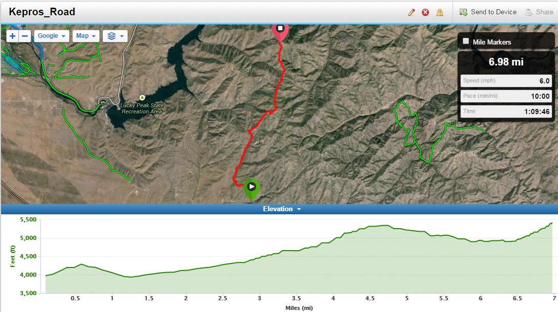
The first real attempt was going to be along the road, but on mountain bikes. So my son and I set off fairly late on a Friday afternoon a few weeks ago. The double track road starts off tame, but soon becomes steep and loose. Some crashes ensued as we encountered the tough spots. The unfortunate thing that happens (while on a SOTA expediation) when you crash your mountain bike, you end up landing on all your gear. Having a couple iPhones, KX3, 2M rig antennas and a pushup mast cushion your impact with the ground isn't something that you want to have very often!
After the initial climb, you turn and descend to a creek crossing. Not only will you have to go back up that on the way out, but you are now lower in elevation than your car! The next part of the route isn't all that bad on a mountain bike. It is a steady climb, but the road is in fairly good shape.
In the end, the miles were ticking off too slowly so we bailed 2.5 miles in. Only one other crash on the way back to the car.
This route is longer than the hiking route by 2 miles and I would only recommend it to advanced mountain bikers or intermediate mountain bikers that had more time on their hands (to push) than we did! Definitely something to try with a motorized off-road rig in the fall when the gate is open.. Maybe this is what W7IMC did for his December activation?
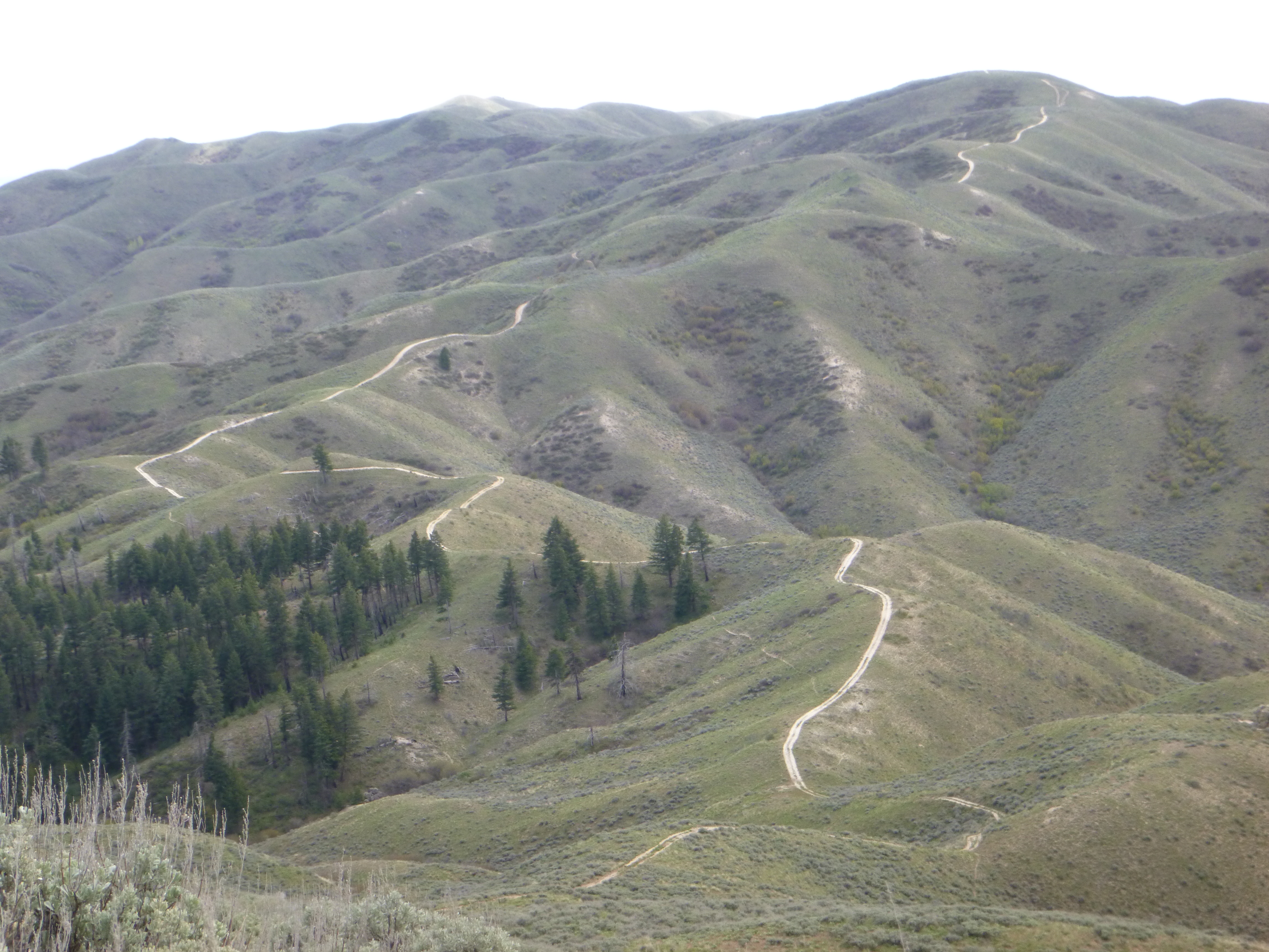
Picture of the route is here: http://www.pnwsota.org/sites/pnwsota.org/files/blog_pictures/K7MK/Kepros_Road.jpg
The road turns off of Blacks Creek road and is the fairly obvious turn up. There is a small parking area next to the green gate. Multiple signs are around the gate.
Attempt #2:
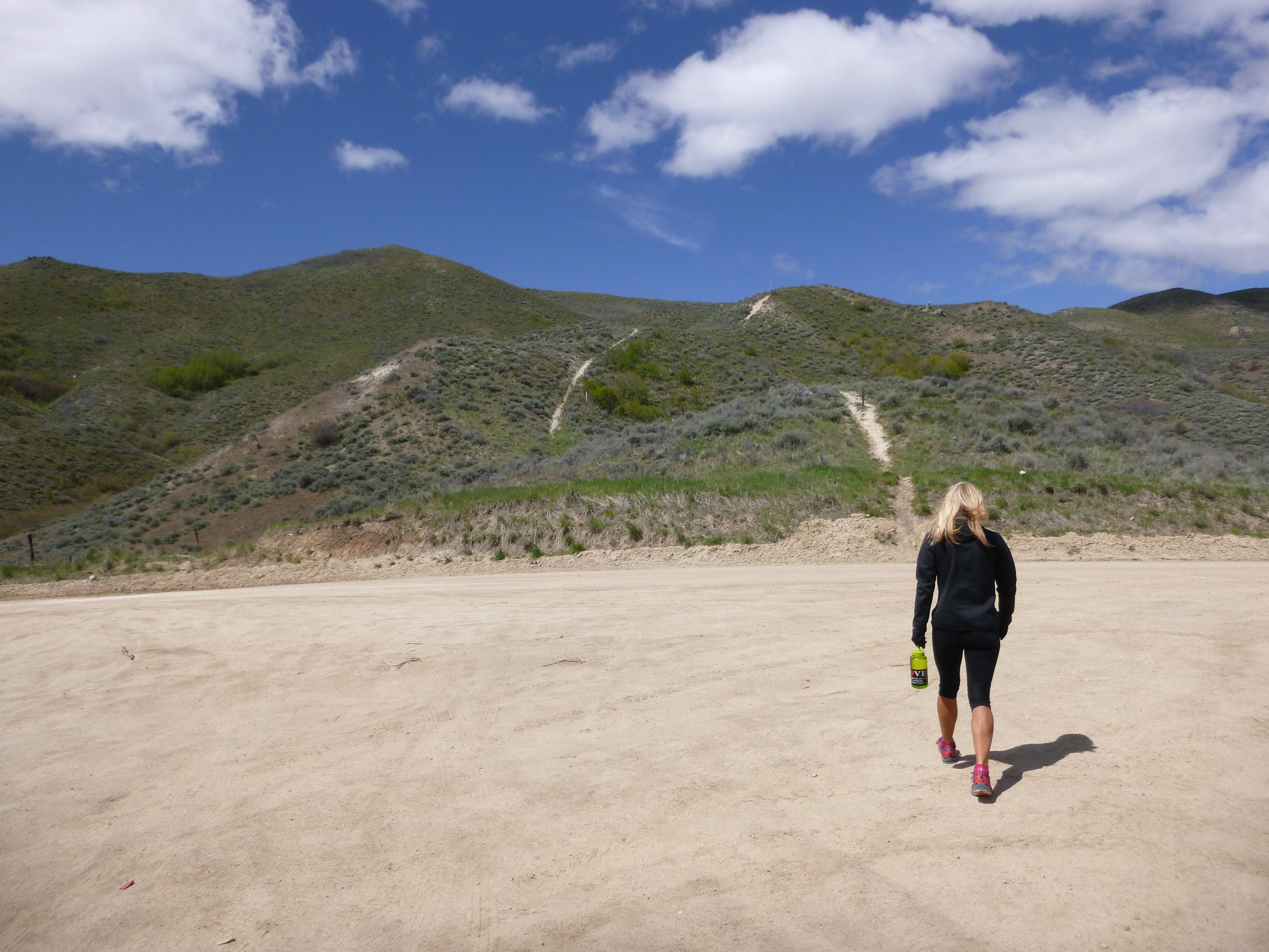
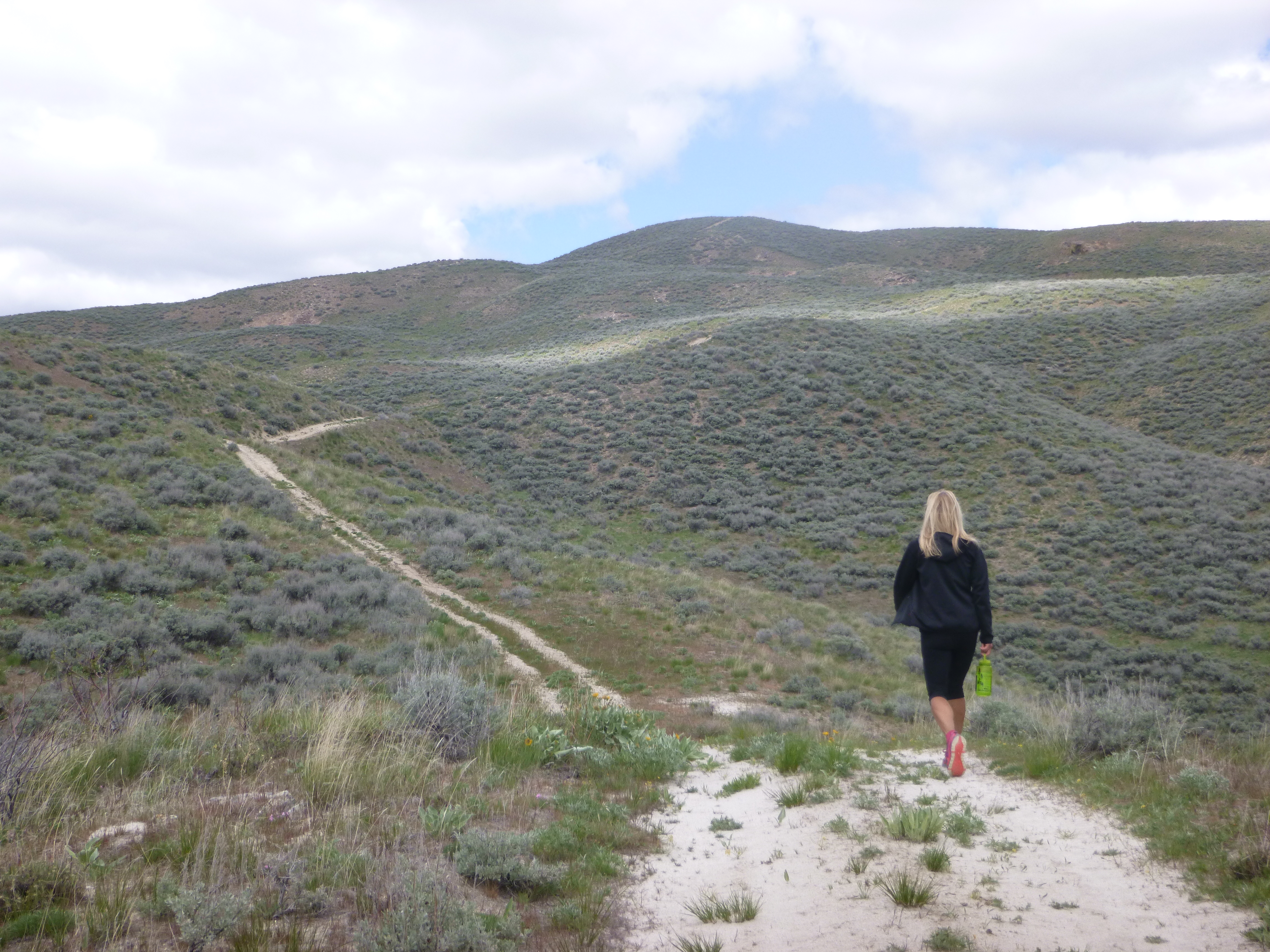
My wife and I decided to try the standard hiking route the following weekend. Various hiking guides provide good directions. Here's one: http://www.idahosummits.com/kepros/kepros.htm Good parking at the trailhead. The trail climbs up steeply to a ridge line. Turn right and follow the ridge down to a saddle. When the trail heads up the next hill take a left and skirt around this hill to the backside to rejoin the old (faint) road. Continue to do this skirting over and over until you finally reach the road. At this point you will finally realize the peak is still far away and it is downhill to get to the start of the actual mountain. Hang in there and you will eventually get there. Once you finally reach the base of the mountain it is a very steep climb up to the flat summit top. A serious off road rig would be needed to get up this pitch.
One word of caution/helpful tip... as you take the skirting side trails (that avoid going up and over the big humps) mark the ground with a stick or arrows drawn in the dirt. On the way up it is pretty obvious which way to go. On the way down the side trails are almost impossible to see. I realized this early on and started marking them. The trackback feature of my Garmin Vista C also kept us on track.
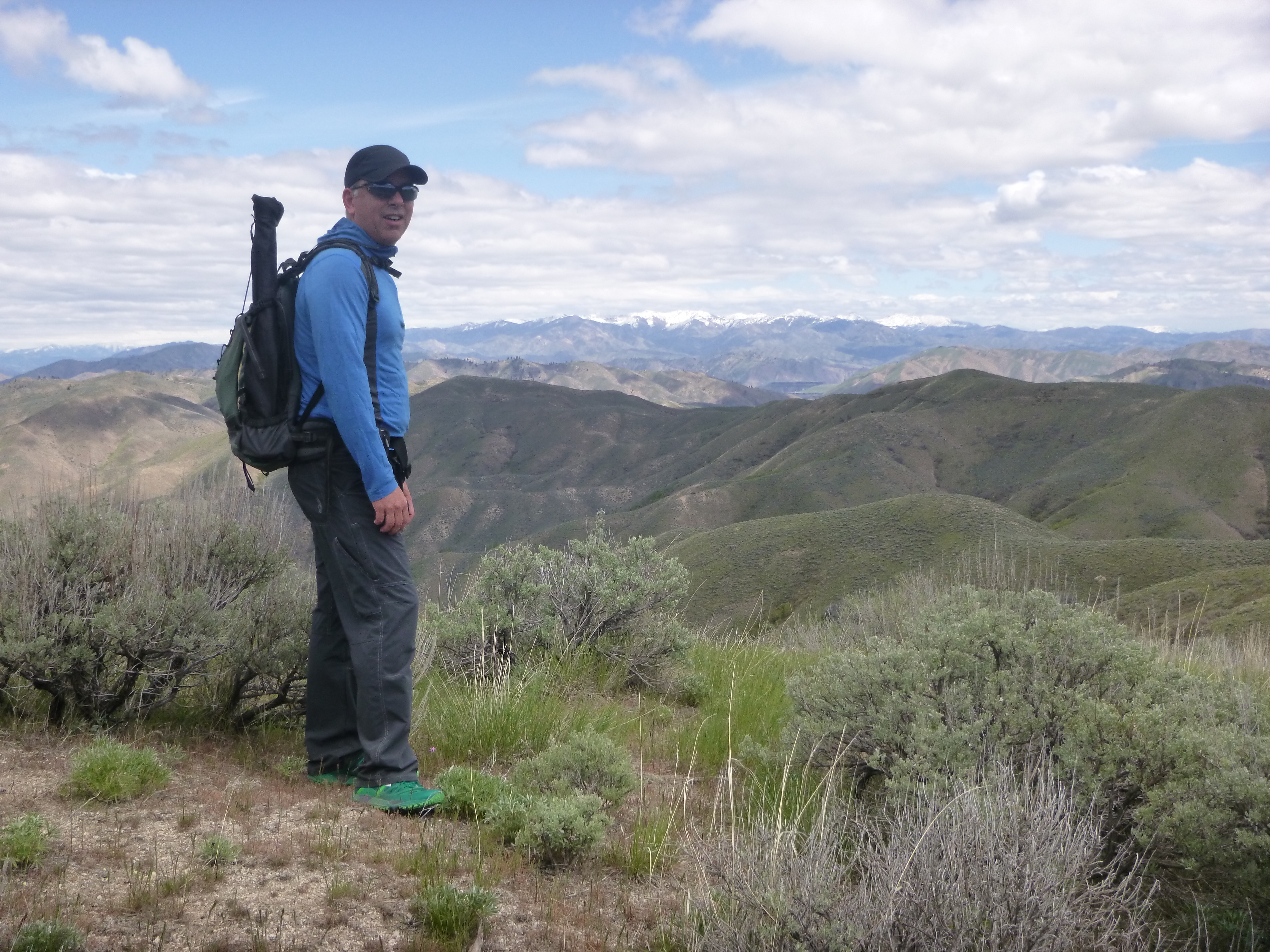
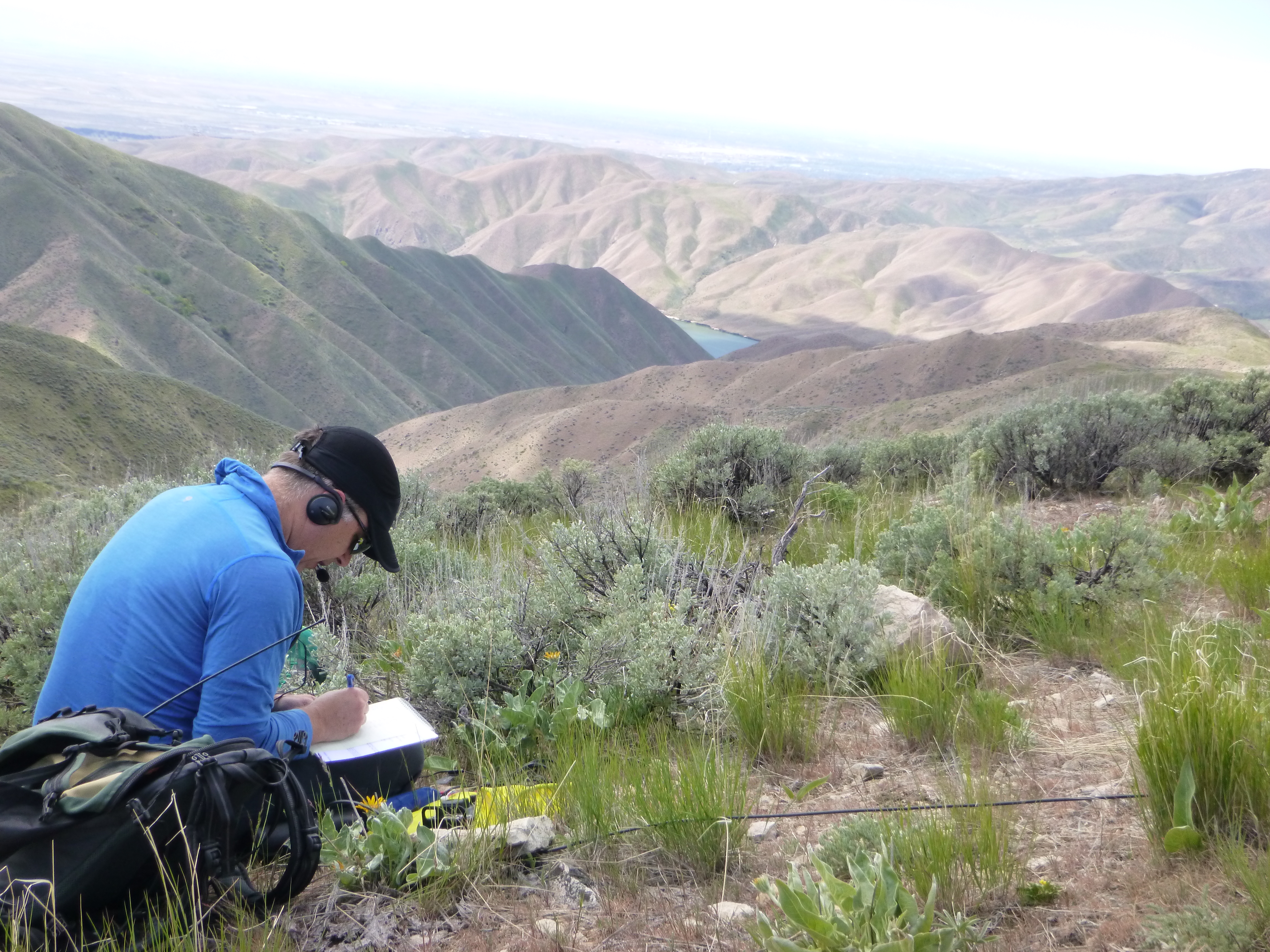
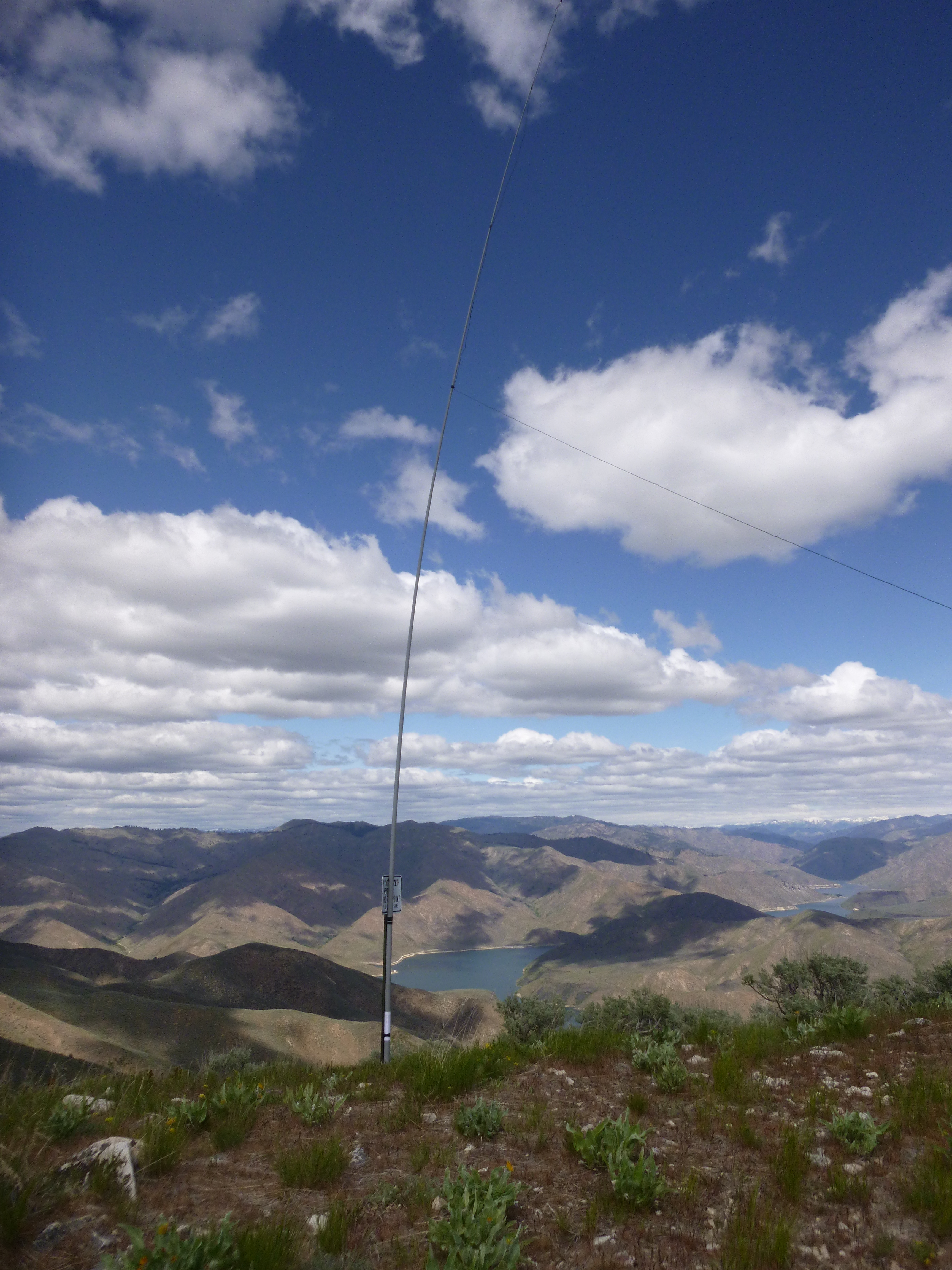
At the summit, there is a signpost which makes for a good antenna support. The winds were probably 30+ mph up there as the winds at the Boise airport were 25 mph at the same time. Getting my 30' sotabeam pole in the air was a bit of work, but once I got it taped to the signpost all was good. The wind was bending it around, but the signpost was pretty stout. I used some black tape to hold it to the post, but I am thinking some ball bungies would be great for this purpose.
A quick spot using the sotagoat app had created me a nice pileup on 20m. Once that worked down I switched to 40m as I knew NS7P was probably lurking out there for the contact as he did the previous day when K7ZO and I activated Zephr Ridge. After 3 contacts on 40m it was time to abandon ship before my wife and I were blown off the summit.
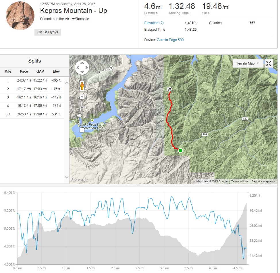
Time up was 1:33 as we ran portions of the flatter and downhill sections. Yes, running with full SOTA station is possible! Time down was about the same at 1:33 since we kept at a hiking pace. There is about 800 feet of climbing on the way "down"!
Gear KX3 + Zippy 4200 LiFePo4 + sotabeam travel pole 10meter + KX3helper.com endfed + 25ft coax + paper logging. APRS setup was iPhone + pocketpacket + Baofeng BF-8HP + homebrew interface.
Hover over pictures below for annotations.
73, Jim K7MK