
With a clear weather window during a wet week, my wife and I decided we should go hike/run up Lucky Peak. The trail head is only a couple miles from our house so we spend quite a bit of time on the first few miles of the trail. This would be our second time hiking all the way to the top. It would be the first time hiking/running the peak with the SOTA gear on my back though!
...
There are about 3 ways to get to the summit of Lucky Peak.
- The most common hiking/biking route starts on the Homestead trail near the Harris Ranch subdivision.
- You can also go up Highland Valley Rd above the "Crow's Inn". This is also a hike/bike trail.
- There is also a driving option on the South end of Highland Valley Rd. Take Highway 21 almost to "Hilltop" and you will see the road on the left. This road is closed in the winter, but is a easy way to get near the top if you have a 4x4 vehicle. There are occasional ruts to be concerned with, but reasonable for standard high clearance passenger rigs (i.e. pickup, suburban, jeep, etc). There is a small parking lot before the top that is used for the people visiting the bird observatory. The summit is only a short walk from the parking area.
We decided to take the first option as it is the most common option and probably the shortest. The trail starts out as a fairly popular hiking location for the local residents. It is also a common mountain bike test piece. There are 5 distinct hills to get up to the "green gate" on the trail that is now known as "Homestead". The old name was Squaw Creek Trail, but has been changed for sensitivity reasons. Either way, those 5 steep pitches are always a good workout.
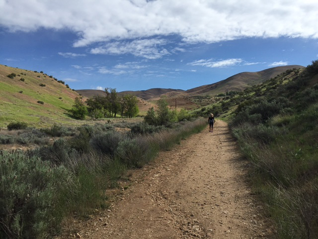
Just getting started on the trail. The summit is out of view behind the peaks in the middle of the frame. (Click image for larger view)
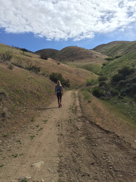
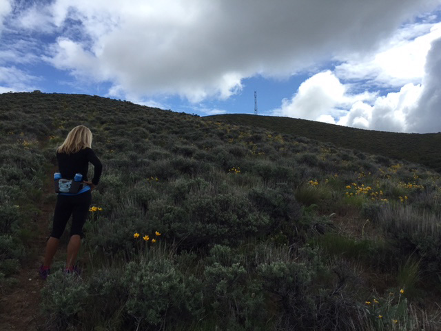
This image is about midway to the green gate between hills 2 and 3. (Click image for larger view)
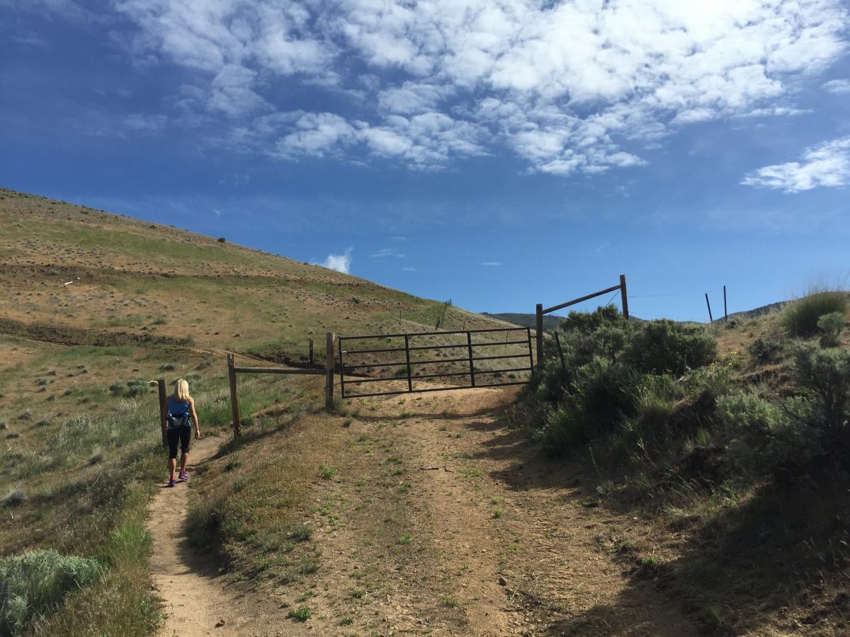
After 2.1 miles and 940ft of climbing you reach the "Green Gate". Turning right here will eventually bring you over to Cobb Trail where you can go down and create a fairly common mountain bike loop (i.e. Up Homestead and down Cobb). Turning left will get you headed up to the summit of Lucky Peak. The summit is just coming into view in the distance above the gate. Another 3 miles and 2000 ft of climbing to go though!
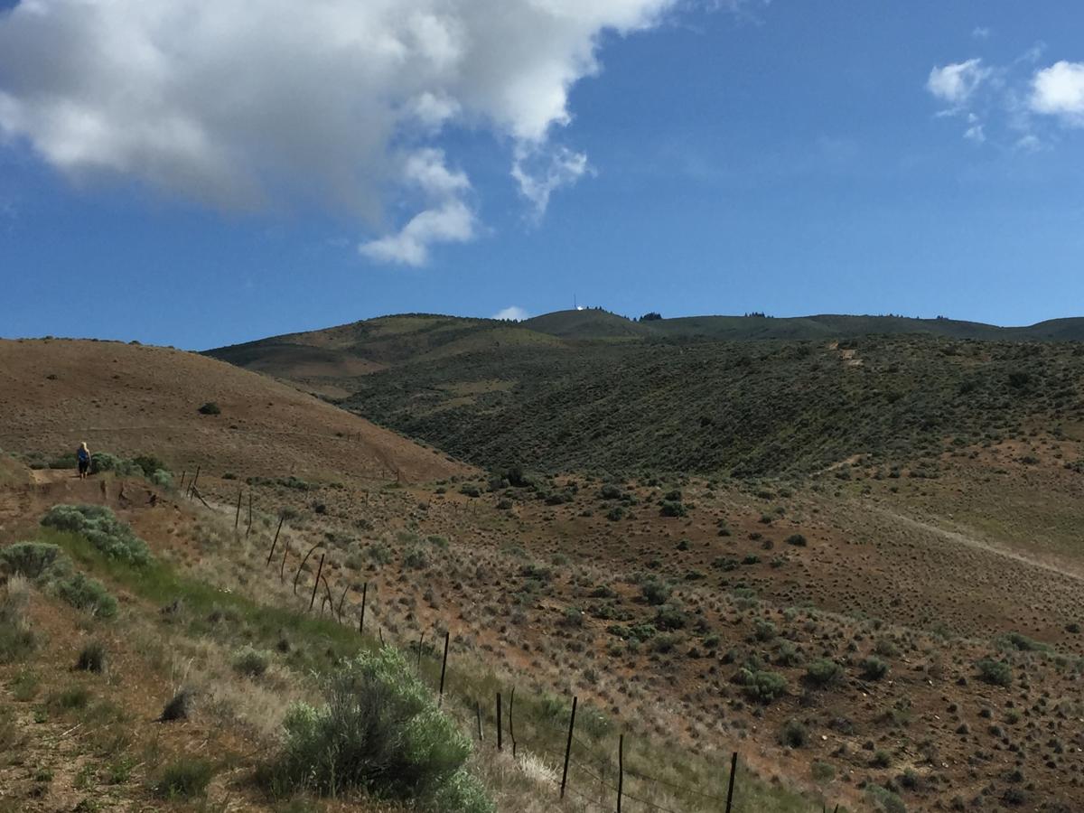
After the green gate the road/trail generally gets steeper, rockier and ruttier (is that a word?). However, the summit starts to com into view so you can see your intended destination. In the image you can see the tower and the shiny solar panels at the summit. Click on image for a larger view.
As you get abreast of and within a mile of the summit there are 3 options to get to the top. Referencing a topo or my attached GPS track below: there is a long ridge option (first option you will come upon), a shorter steeper ridge option (more obscure trail) and the option to stay on the road. The road option is longer, but nice in that you end up going through the trees and have a nice view to the north as you come around the backside of the peak.
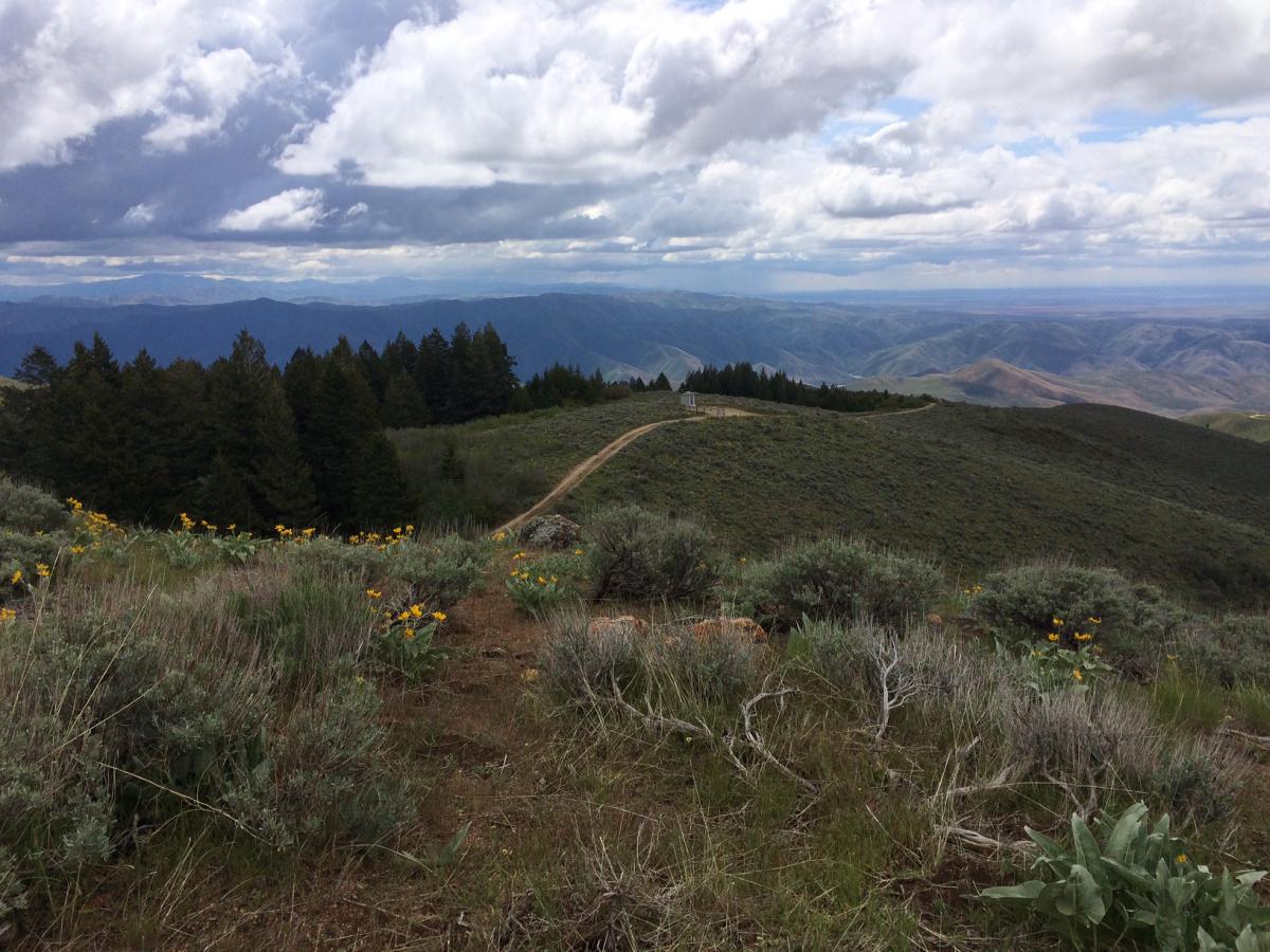
We chose to ascend the second trail option and eventually descend the longer ridge option (clockwise loop on the GPS track). Here a shot of the summit from the start of the second shortcut option. Click on image for larger view.
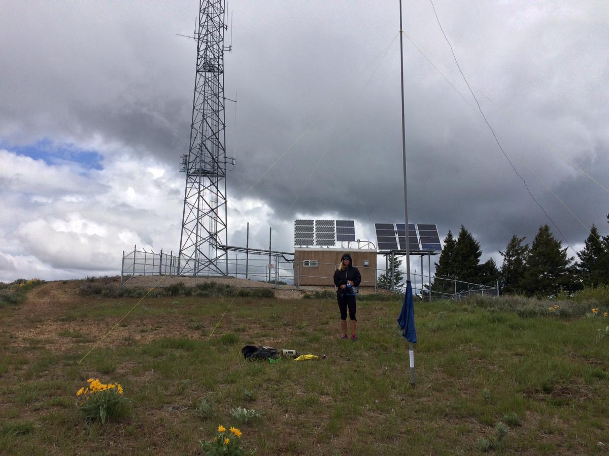
You will soon be on top where there is ample spots to setup an antenna and start operating. There are quite a few trees on the north side of the summit where you could throw a line over to hoist an antenna if you weren't carrying a pole. Click on image for larger view.
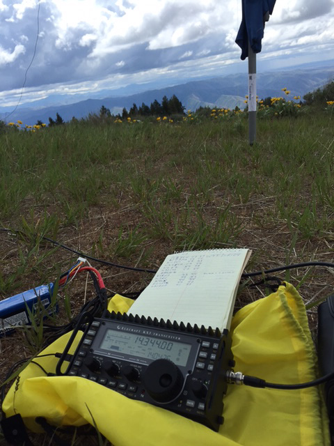
Unfortunately a black cloud came overhead when we reached the summit, so the XYL wasn't ready to hang out all day. Luckily the log filled up fast after a spot on sotawatch using the SOTAGOAT application on the iphone. I didn't get any QRN from the nearby transmitters when on 20M or 40M, but seemed like 10M was pretty noisy up there any may have been due to the tower proximity.
SOTApole in the shadow of the public service tower ontop of Lucky Peak. Click on image for a larger view.
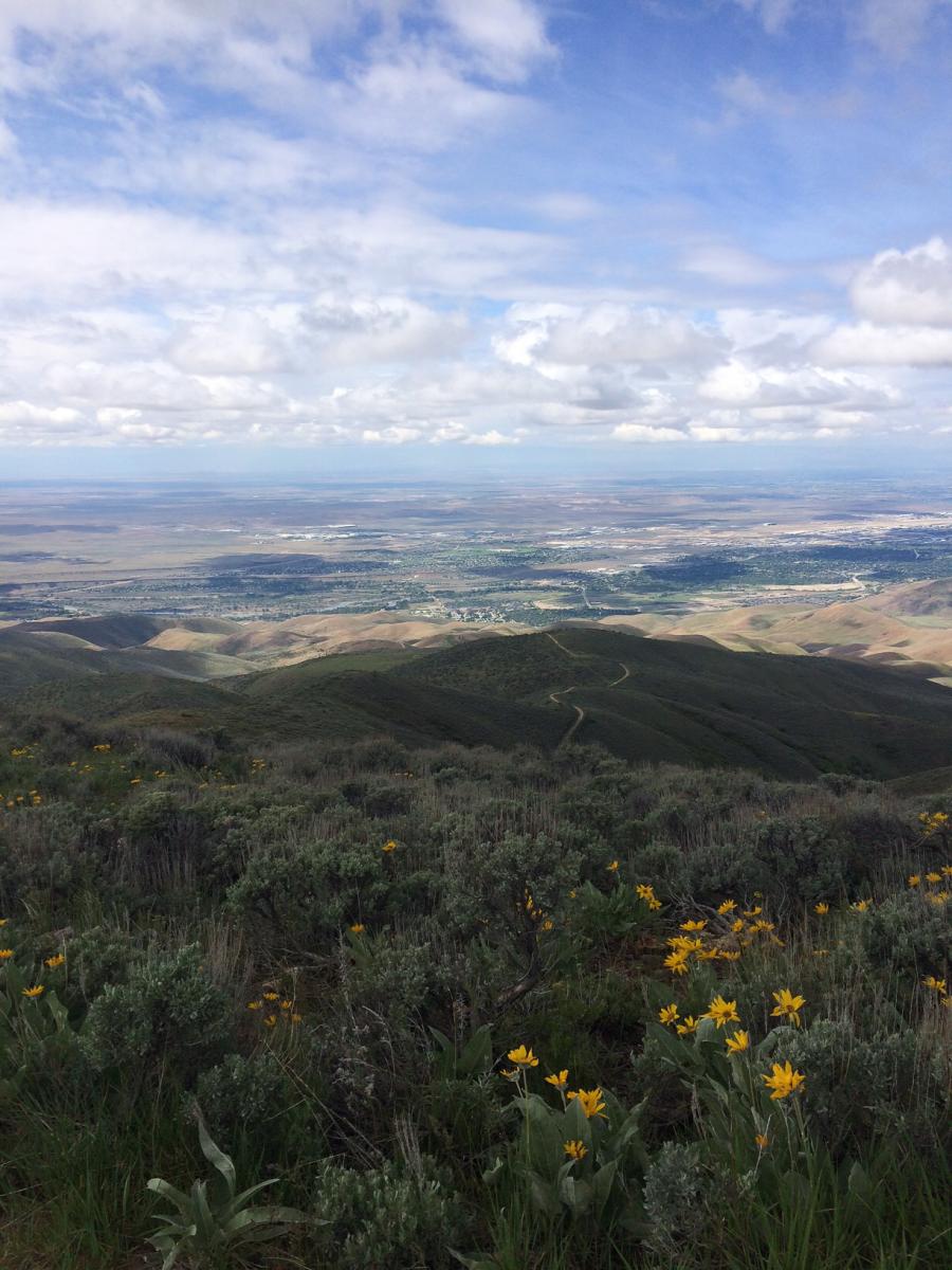
Looking back down the ascent road SW towards Boise. Click on image for larger view.
View to the SE from the operating position showing the Highland Valley approach road and the Bird Obervatory parking area. Click on image for a larger view.
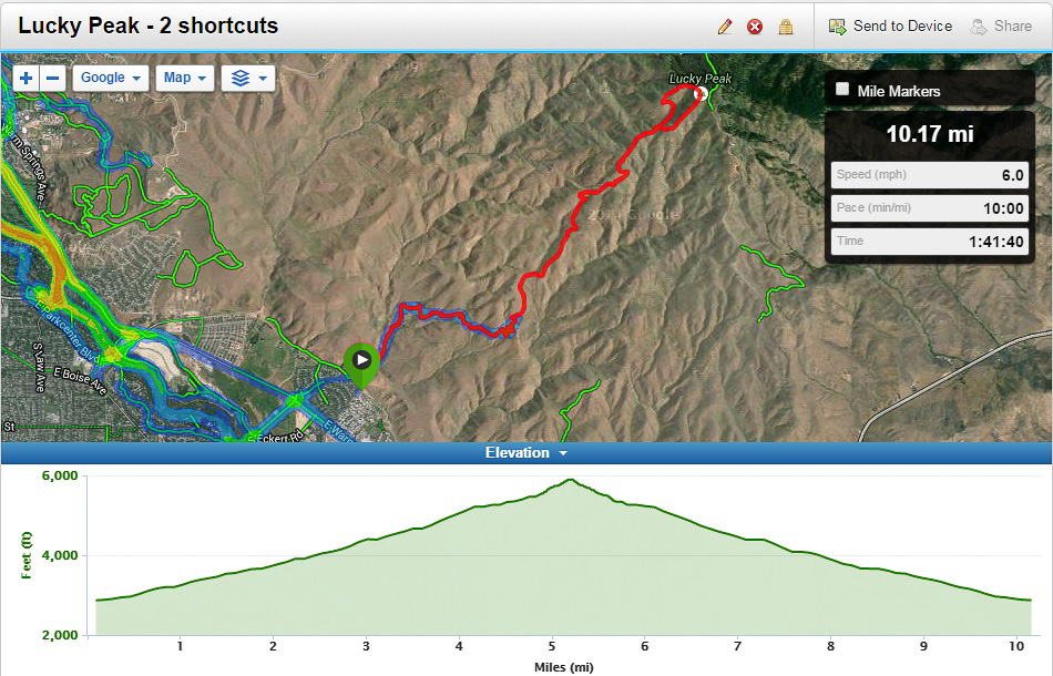
Here's the GPS map of the trail and the elevation profile. 10.17 miles and 3000 feet of climbing to claim the 2 points! We hiked the uphill, but ran the downhill. Definitely the longest run I have done with a ~17lb pack! The SOTA gear is nicely padded in my backpack and does fine while running. Click on image for a larger view.
So, this is my 5th SOTA peak and having a great time. SOTA is such a good excuse to get out hiking. However, if you are looking for SOTA activator points, Idaho is a brutal place to acrue them. I am only up to 8 points after 28 miles of hiking and 7000 feet of elevation gain. You definitely earn the points out here. Ouch!
Standard SOTA setup was used (KX3 + LifePO4 + endfed + sotapole). Q's on 20M only. I tried 40M for locals, but no contacts. Thanks for the QSO's. See you on the next summit!