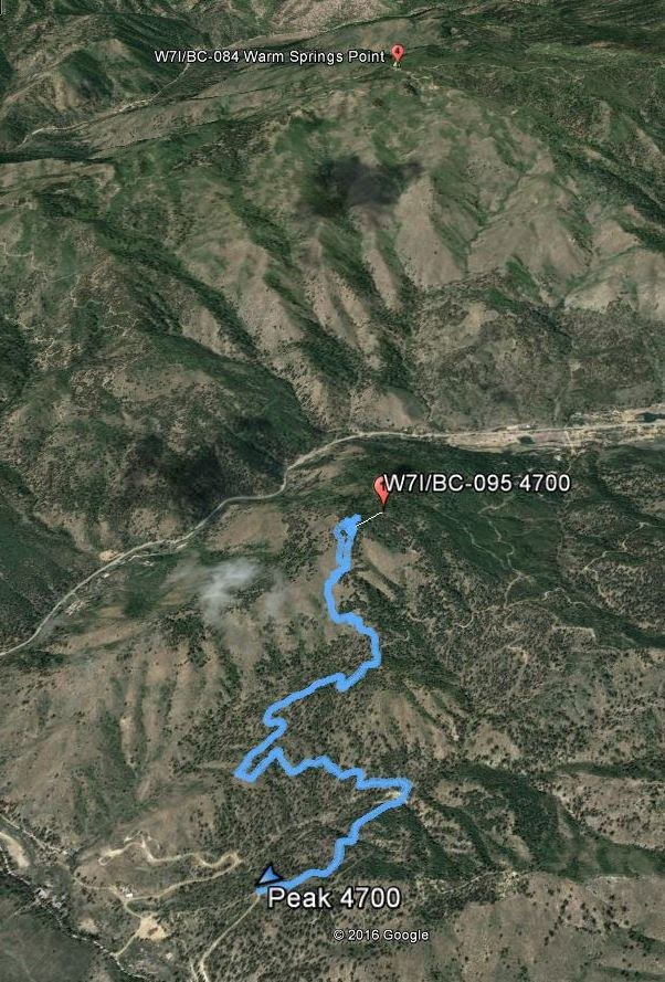
This was the first activation of "Peak 4700" off Hwy21 on the way to Idaho City from Boise. The peak rises right from the hwy, but access is from the opposite (South) side. This was my second attempt at the peak as an impromptu mountain bike attempt late in 2015 was thwarted by snow.
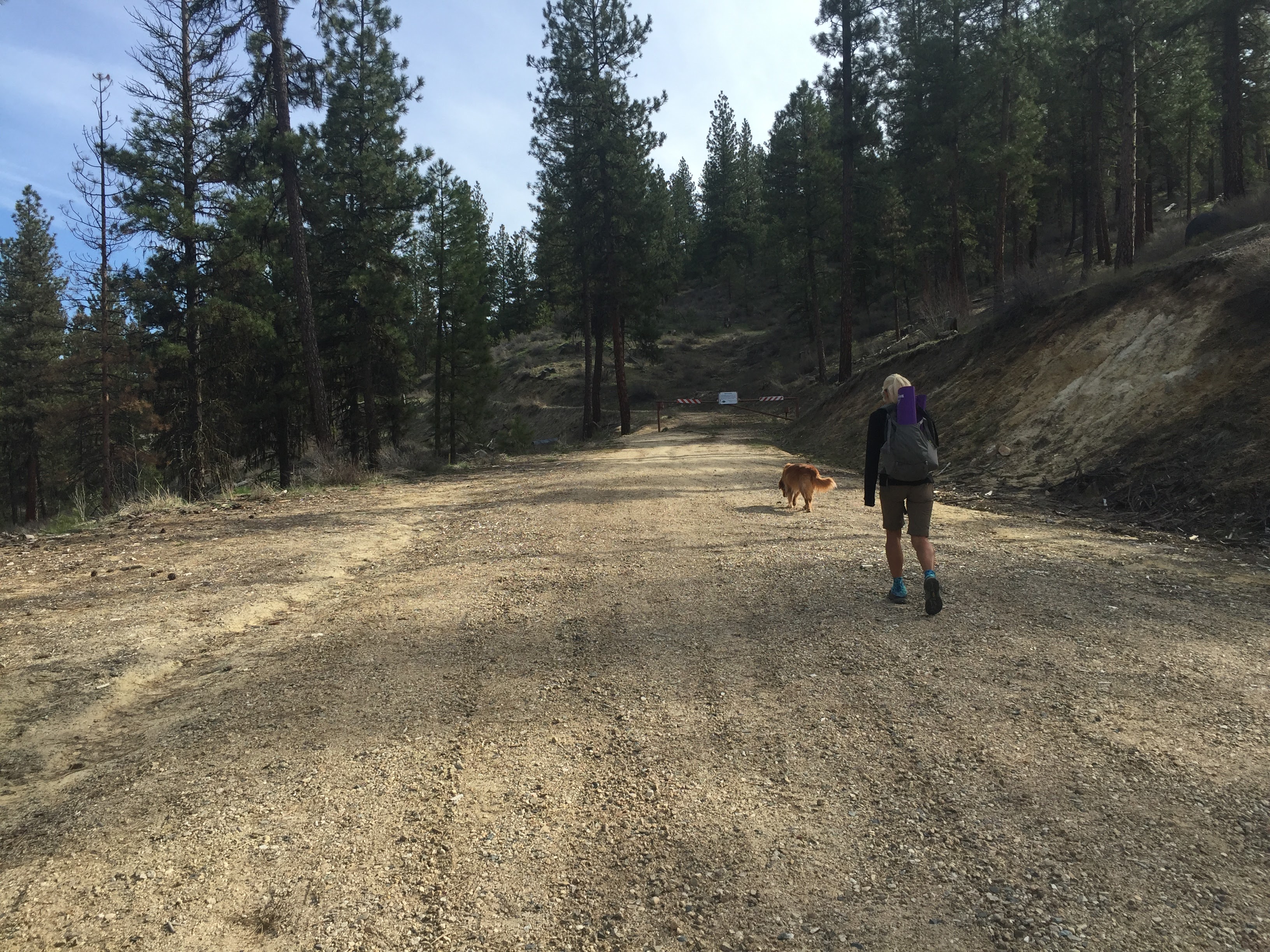
This attempt was snow free and was on a spring day that couldn't have been better for hiking. There are numerous ATV and motorcycle trails around this peak. If you had a motorcycle, accessing the peak may just be a matter of minutes. For a hiking approach, it was 5.5 miles round trip and 1070 feet of climbing. See the attached pictures and Strava report for the actual route. Scoping the peak out on google earth ahead of time, there are a few "short cuts" up to the peak, but trail conditions were unknown. We took the safe and guaranteed route as this was my last opportunity/day for a 25-Idaho activation in a one year span! Didn't want to not summit and only get 24 Idaho summits for the year!
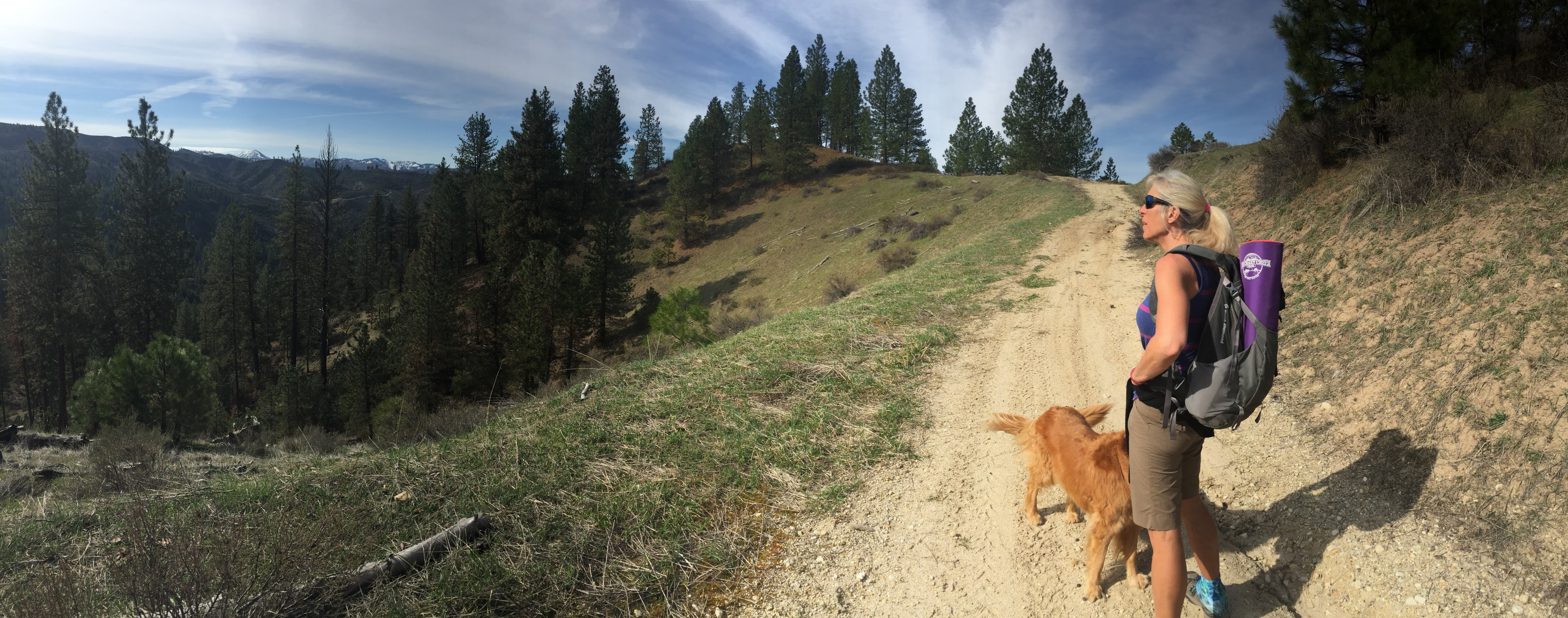
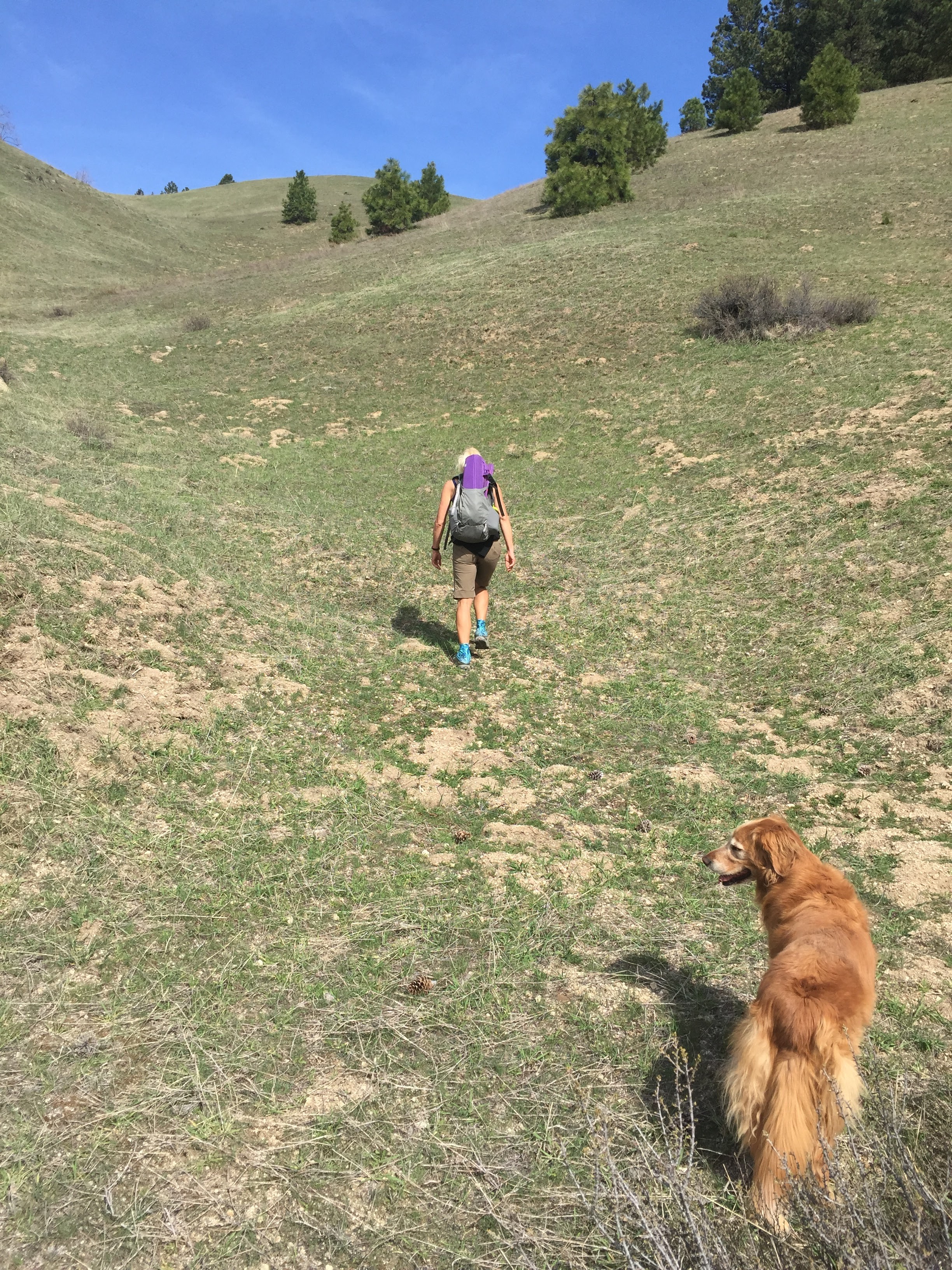
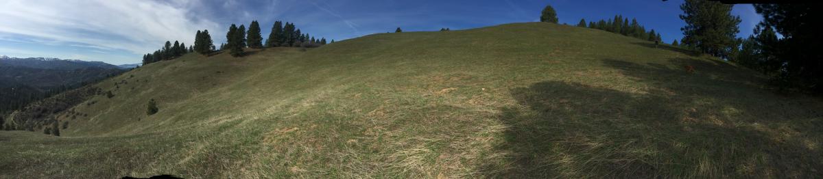
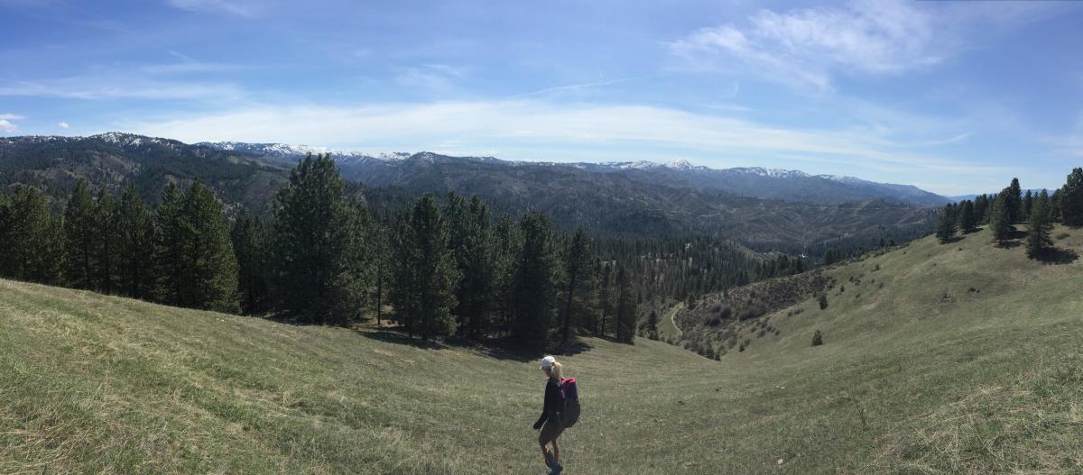
The route we took is mostly an old logging road. We eventually forked off on a motorcycle trail that encircles the summit. When we had the summit block in view, we went off trail and made a bee-line up this amazing grassy slope that was terraced and in a bowl like amplitheater. Just amazing! Views off to the still snow covered Shafer Butte, Heinen Peak and Thorn Creek butte were amazing!
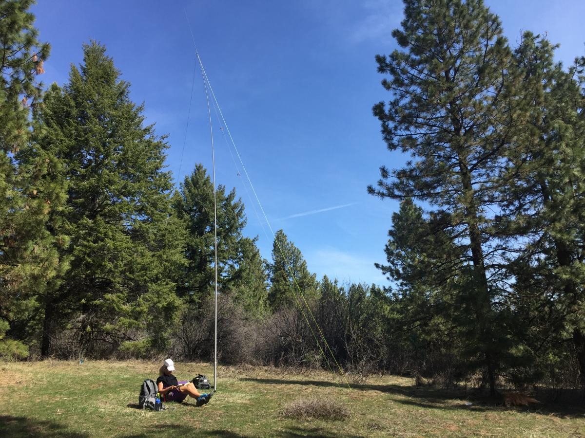
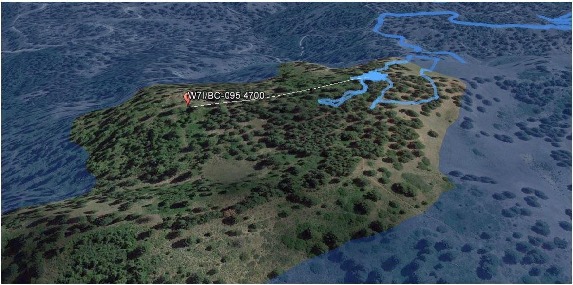
The summit it self is very forested and blocked from the side we came up. However, there was a nice open patch adjacent to the summit and only 1 foot lower in elevation. See the Google Earth flood picture for the activation zone.
Cellphone and APRS from the summit is very limited to non-existant. Definitely no cell coverage on Verizon and AT&T and getting an APRS signal out to Cinabar mountain in the Owyhee's would be questionable. Unfortunately the APRS repeater on Shafer Butte (Bogus Basin) has been deactivated as this was a crucial link for these peaks between Boise and Idaho City. So plan ahead for activations here. CW RBN/spotting may be the best to guarantee getting the word out.
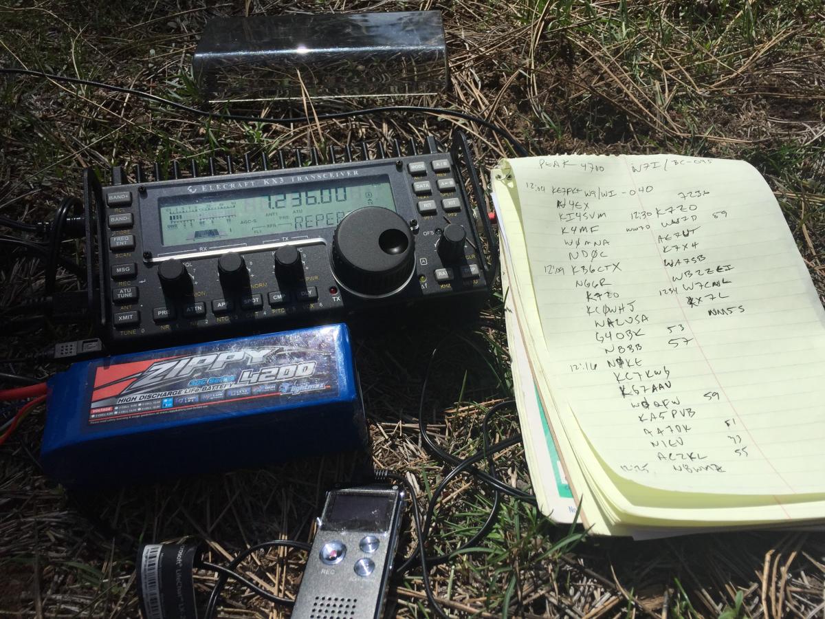
Once setup I tuned to 14.347 and found another SOTA activation in progress. I worked them and luckily N4EX was still monitoring that frequency when I asked for a spot on 344. N4EX slid down to 14.344 and worked me then sent out the SOTA spot. Propagation and chaser activity was good on 20M. NG6R was relaying to K7ZO my impending switch to 40M. When I switched to 40M someone was on the intended frequency, but luckily K7ZO scanned the band and found me. He sent out the 40M spot and I was off to fill the log up again.
The next time I activate this summit I may try accessing it via some of the other obscure trails which may take some of the miles and time off (if they are not overgrown). Thanks to all the chasers!
All the photos here: https://goo.gl/photos/dc2yKL39XsahiL1r9
Strava report here: https://www.strava.com/activities/535070947