Boulder Mountain is one of prominent mountains to the East of McCall Idaho. It is just north of the very recognizable Jughandle Mountain. Boulder Reservoir, Boulder lake and Louie Lake (at the base of Jughandle Mountain) are fairly popular summer day hikes in the McCall Area. Boulder Mountain itself is probably rarely visited as it quite a bit farther than the popular lake destinations.
I have wanted to get to Boulder Mountain for quite some time to do the first activation. We chose our attempt on the same weekend that the McCall Trail Running Classic - http://mccalltrailrunningclassic.blogspot.com/ Ultra Marathon was going on - for a couple of reasons. 1) we had some friends running the 40 miler, so it would be cool to see them out on the course and 2) we knew the course and trail up to Boulder Mountain would be marked. I didn't know how good the trail was from the lake up to the summit so having the race trail markers relieved me from any extensive trail research!
It turned out to be a great day for the hike as the temps were moderate, the insects were few and the comradery of the racers made it fun to cheer them on which broke up the miles of trails. The views were good enough, but the occasional racers coming by made it unique.
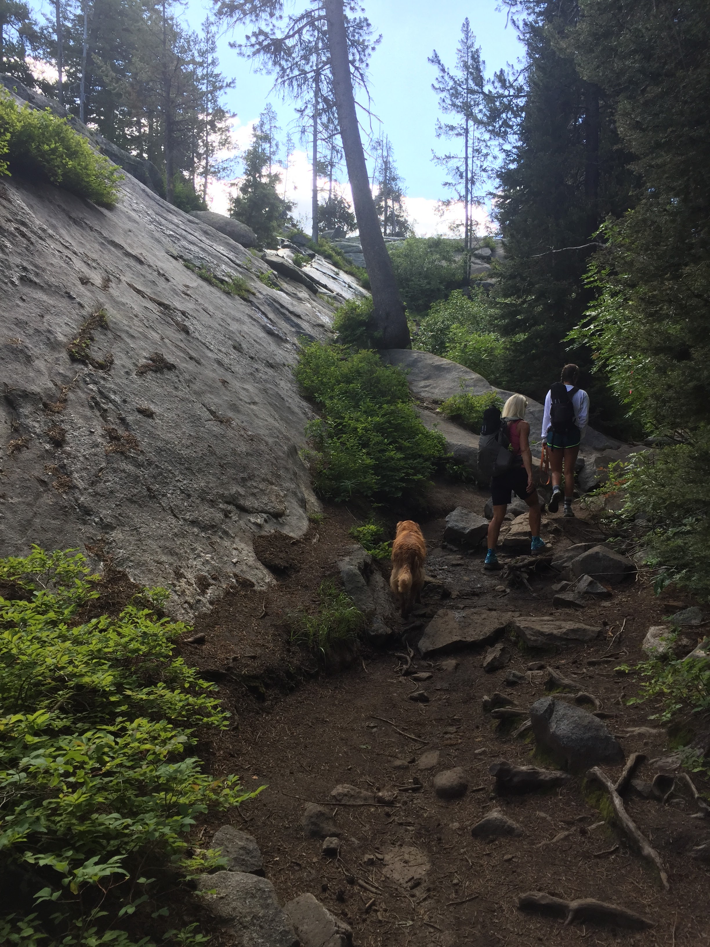
To get to the trailhead from McCall: Take Hwy 55 south of McCall a few miles to ELO Road. Follow this for a few miles until Boulder Lake Rd Forks off to the left. This road will shortly turn to gravel. There are a bunch of turns off this road, but just keep following the most graveled road and this will take you to the (sometime crowded) parking for the trail to Boulder Reservoir and another trail (south) to Louie Lake (Jughandle). Head East through the parking areas and you will quickly find Boulder Reservoir. Follow the trail on the north side of the reservoir, past the reservoir, into the trees and then it will climb up to Boulder Lake. The trail will cross the creek at the end of the lake and continues along the south side of the lake. Once past the lake you will initially see a trail coming in from the right. This is the loop trail from Jughandle to Twin Peaks. Continue past this trail until you come upon the next fork where you will take a left and head up to Boulder Summit (a saddle actually). At the summit take a left and climb the final pitch up to the summit. There are a few steep sections climbing out of the Boulder Lake area, but very enjoyable. Numerous stream crossings made it enjoyable for our dog to cool down in. More info on the hike here: http://www.summitpost.org/boulder-mountain/587069
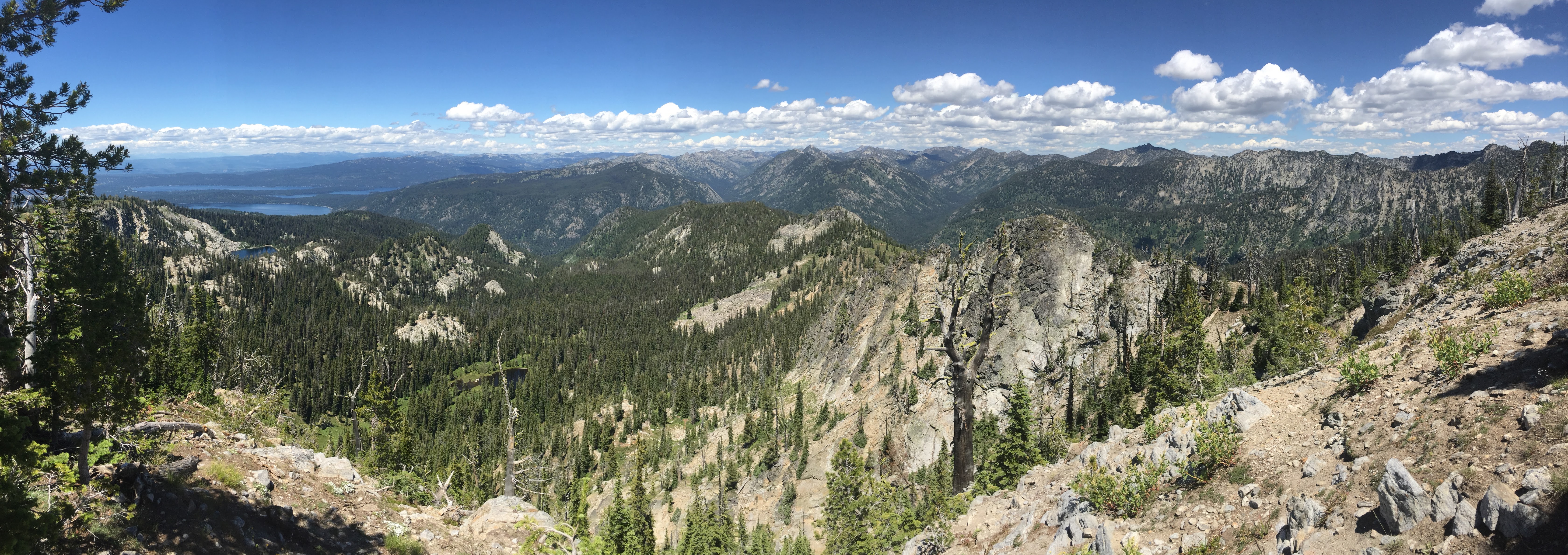
At the summit there is remnants of a fire lookout as well as good views all around. Plenty of places to strap an antenna mast to or throw a wire over a tree. Cell service down into McCall was good on Verizon and AT&T. APRS should be easy as well since the Cascade (Snowbank) digipeater is in view 30 miles to the south. This was another of my all CW activations so fun to be gaining confidence on CW. All the regulars called in as well as my first QSO with the Goat Man WG0AT. I was star struck! QSO's were on 20M and 40M with KX3 and KX3helper.com endfed as usual.
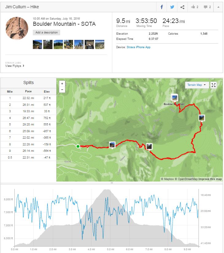
Strava report here: https://www.strava.com/activities/643278080
73 de Jim/K7MK