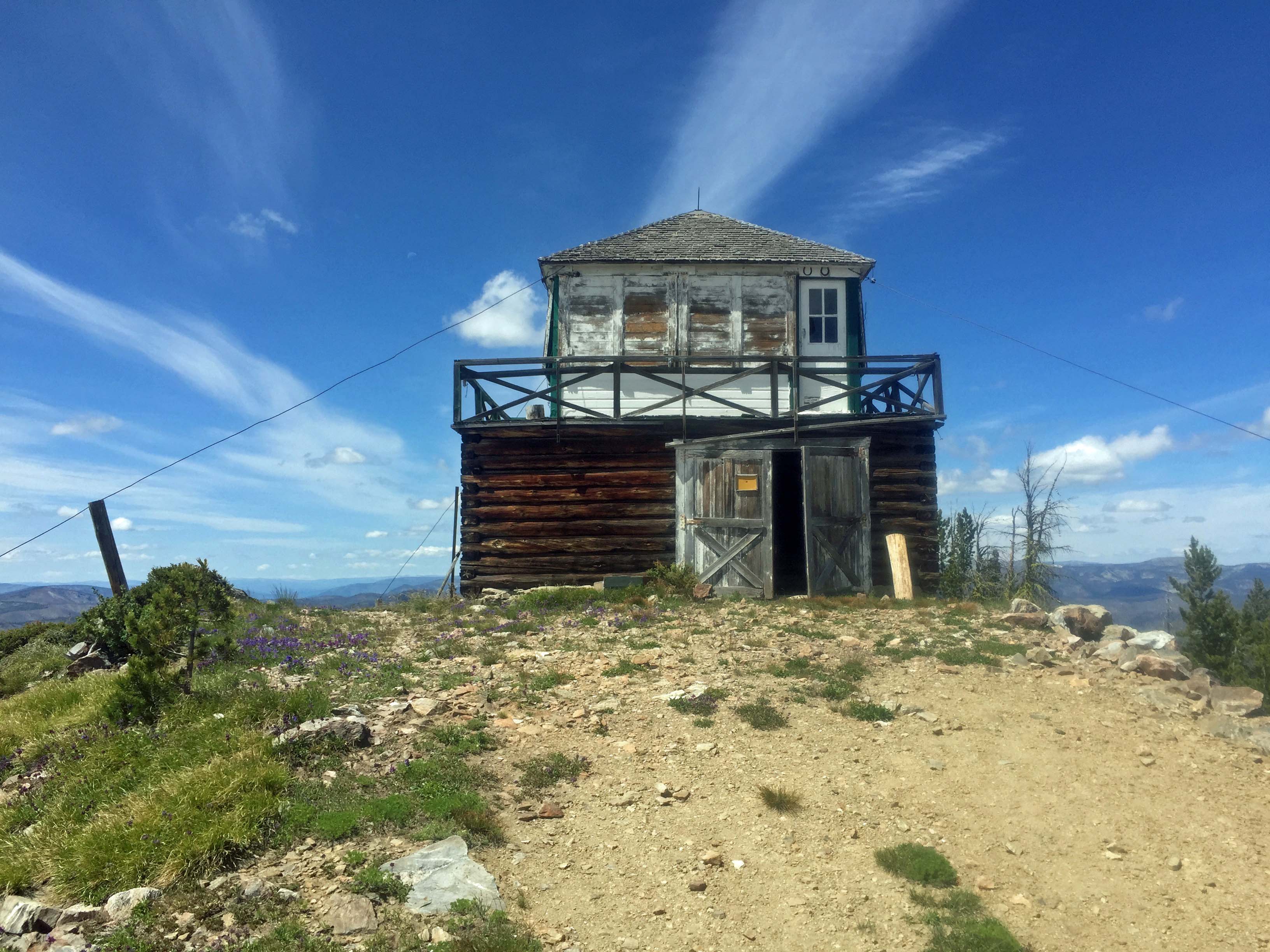
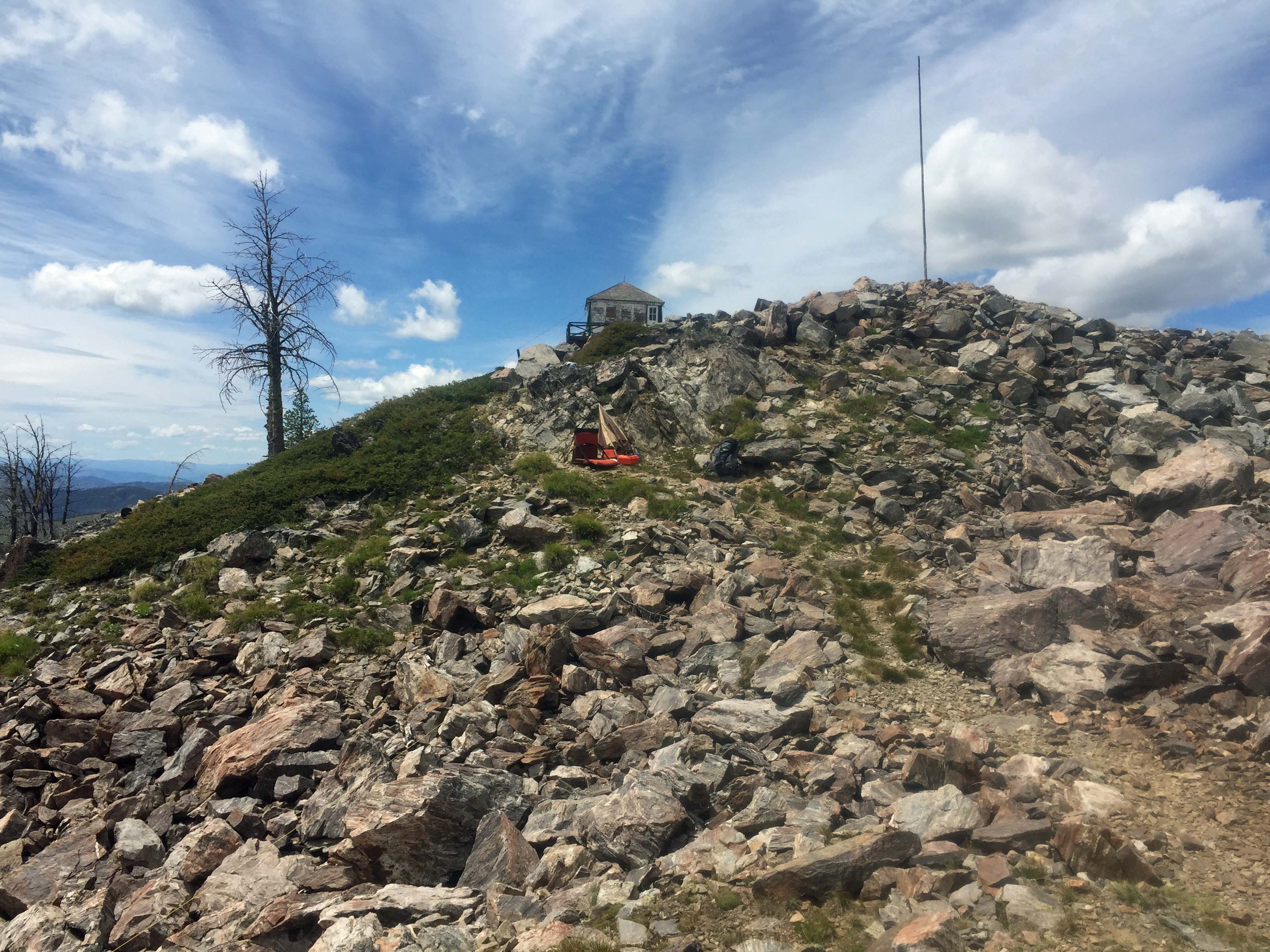
Blue Nose is a US Forest Service Lookout built in 1934. The structure still exists. From the summit are good views of the steep slopes of the Salmon River Canyon and high summits of the Frank Church River of No Return Wilderness. The final access road is a bit steep and rough. It is an OK drive-up for a ‘high clearance’ vehicle, ATV or a mountain bike.
The summit is on the Idaho/Montana border. There are several summits along the roads in this area for multiple summit days, provided one is camped nearby.
A developed Campground, Alta is located approximately 4 miles south of Painted Rocks Reservoir, approximately 30 miles from Highway #93. It has potable water. Elsewhere water is available only at a few small stream crossings. It is probably best to bring water with you. The road is paved to this campground. Dispersed camping is available in a few sites along the main roads above this point.
Large areas of this landscape have been burned in wildland fires. Travel at times is through snag filled forest. Beware of where you park, camp and travel especially on windy days. A saw can be handy in case any trees block your route.
Along the access road #310 exists an elk wallow, a water hole frequent by animals. Several elk were seen here on the route to the summit.
Elevation gain: 0’ if you drive to the summit. Else, about 500’
Access road miles: 0 if driven. Else about 2.5 miles round trip following the road.
Water: There is no nearby water source.
Bear Pepper Spray: Highly recommended in all North Idaho/Montana summits.
Maps: US Forest Service, Bitterroot National Forest
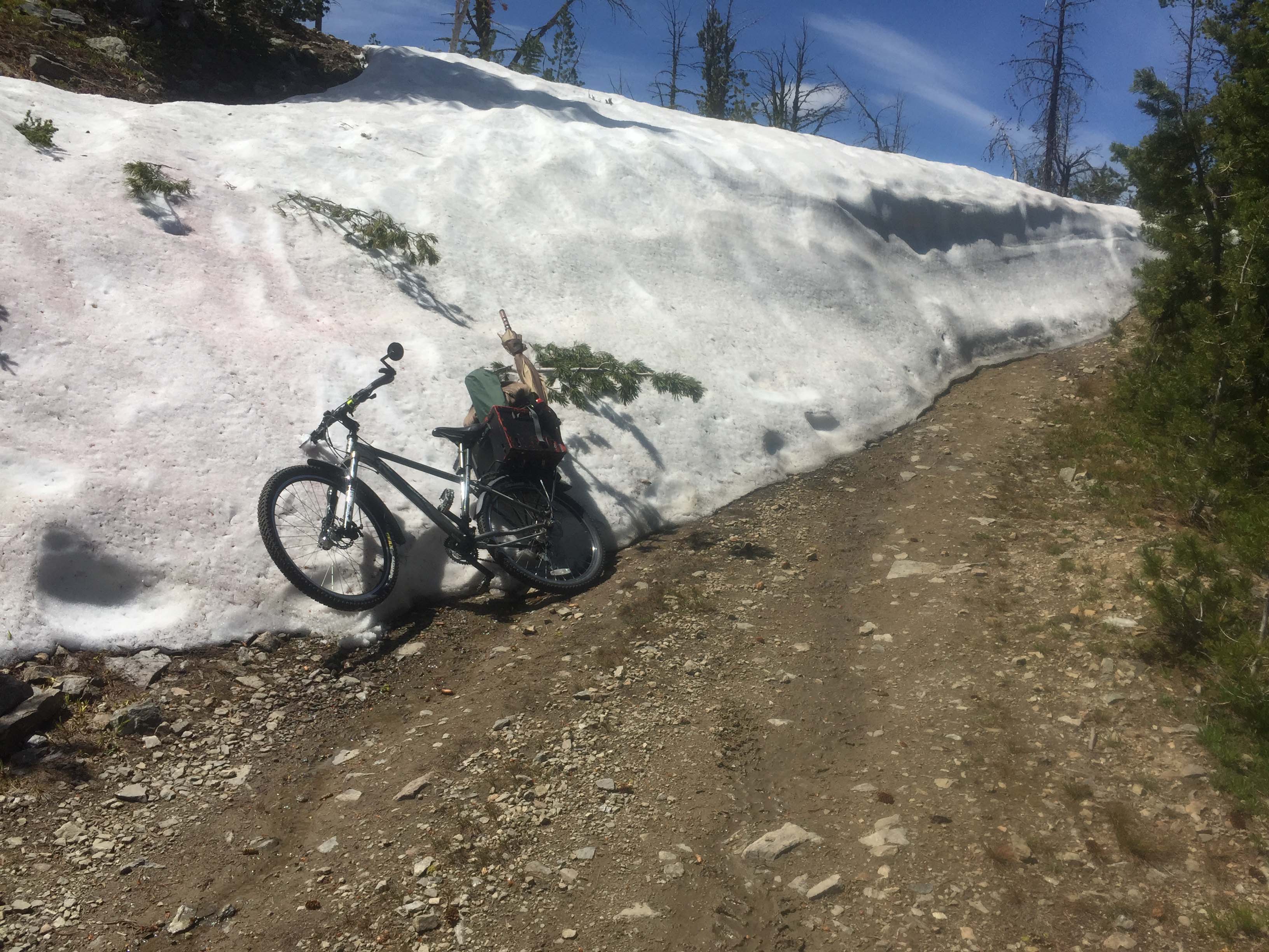
Directions: 4 miles south of Darby, turn south onto the West Fork Road #473/9600 to Painted Rocks Reservoir. Continue up the east side of the reservoir for approximately 13.5 miles to the junction of FS #91. Travel up #91 for approximately 9 miles to Horse Creek Pass. Turn southeast on FS#044. Travel approximately 3 miles to FS#038. Take 038 east another 2 miles to the access road to Blue Nose Lookout, FS#310. If you drive continue up FS#310 for 1.25 miles to the summit. If you elect to not drive #310, continue a few hundred feet up the road to a pullout to park. Also, through mid-July, the road to the summit maybe blocked by large snow drifts near the summit.