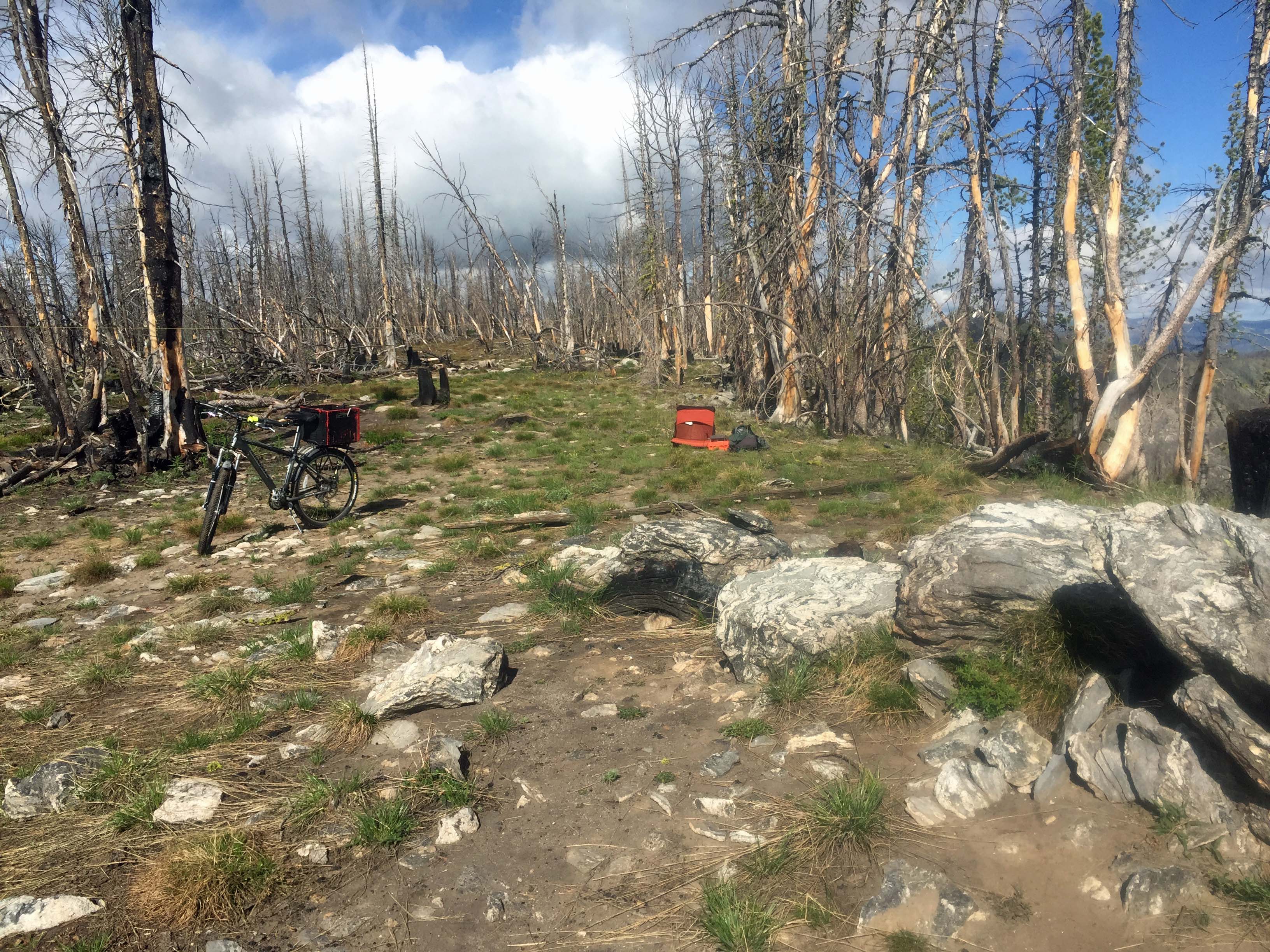
This is a burned-over flat-summit on the Idaho/Montana Border. Access is via an obscure 4x4 road that takes off to the north from FS#038. Along this road after several hundred feet is a flatten area used as a dispersed campsite most commonly in hunting season. Beyond this area the road becomes an ATV track weaving through a snag forest and leading to the summit.
There are many snags to hang wire antennas.
A developed Campground, Alta is located approximately 4 miles south of Painted Rocks Reservoir, approximately 30 miles from Highway #93. It has potable water. Elsewhere water is available only at a few small stream crossings. It is probably best to bring water with you. The road is paved to this campground. Dispersed camping is available in a few sites along the main roads above this point.
Large areas of this landscape have been burned in wildland fires. Travel at times is through snag filled forest. Beware of where you park, camp and travel especially on windy days. A saw can be handy in case any trees block your route.
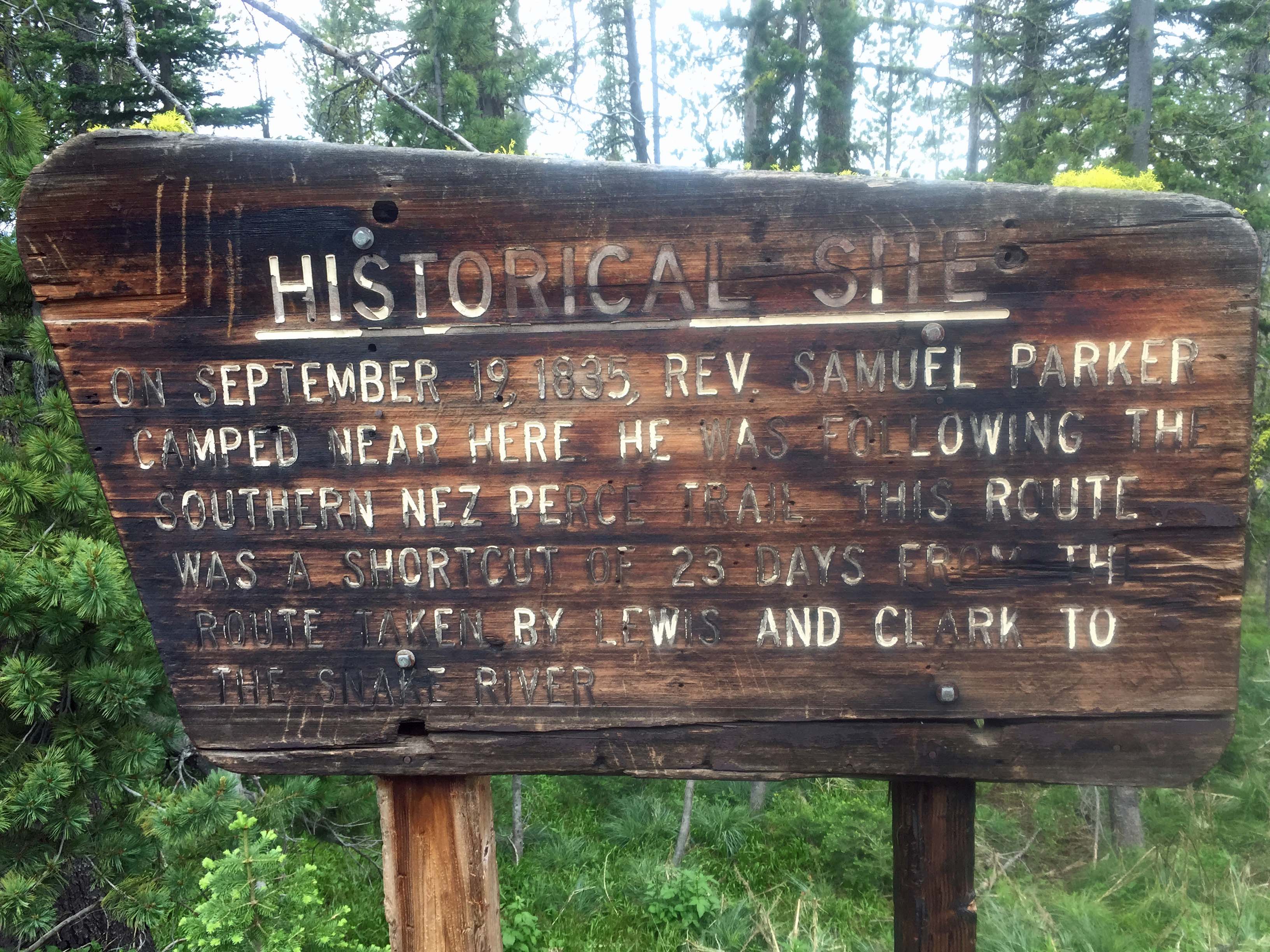
A historical site describing an 1835 campsite is located 0.3 miles beyond the junction of #038 & #310. The interpretive sign follows below.
Elevation gain: from the dispersed campsite 100’
Miles of ATV track: 0.6 roundtrip
Water: There is no nearby water source.
Bear Pepper Spray: Highly recommended in all North Idaho/Montana summits.
Maps: US Forest Service, Bitterroot National Forest
Directions: About 4 miles south of Darby, turn south onto the West Fork Road #473/9600 to Painted Rocks Reservoir. Continue up the east side of the reservoir for approximately 13.5 miles to the junction of FS #91. Travel up #91 for approximately 9 miles to Horse Creek Pass. Turn east on FS#044. Travel southeast approximately 3 miles to FS#038. Take 038 east another 4.25 miles to an obscure 4x4 road that turns into an ATV track for access to the summit. The access is approximately 2.25 miles east of the Blue Nose access road #310.