(NOTE: This report covers both Shafer Butte W7I/BC-064 and W7I/BC-070. It is posted twice so that it can link to both summit references on pnwSOTA and SOTAWatch.)
Summit Master K7MK's plan for the "Idaho Kool-Aid Kids" was to go for our first dual summit Exacta of the season. We have decided to call ourselves the "Idaho Kool-Aid Kids" after K6DGW's note in the May 2015 SOTA News -- "...We had a number of first activations in April, commensurate with a number of people introducing themselves on the NA SOTA Yahoo group. Mark, KT5WX; James, K7MK; and Scott, K7ZO successfully drank the SOTA Kool-Aid."
Our targets were W7I/BC-064 Shafer Butte and W7I/BC-070 Mores Mountain. We thought these would be the 5 & 6th and 2 & 3rd activations respectively of these summits. What we didn't know is that W7/DL6AP/P had made a brief visit to our neck of the woods and activated both summits on May 21. Too bad we didn't know he was in the area We could have had an eyeball QSO.
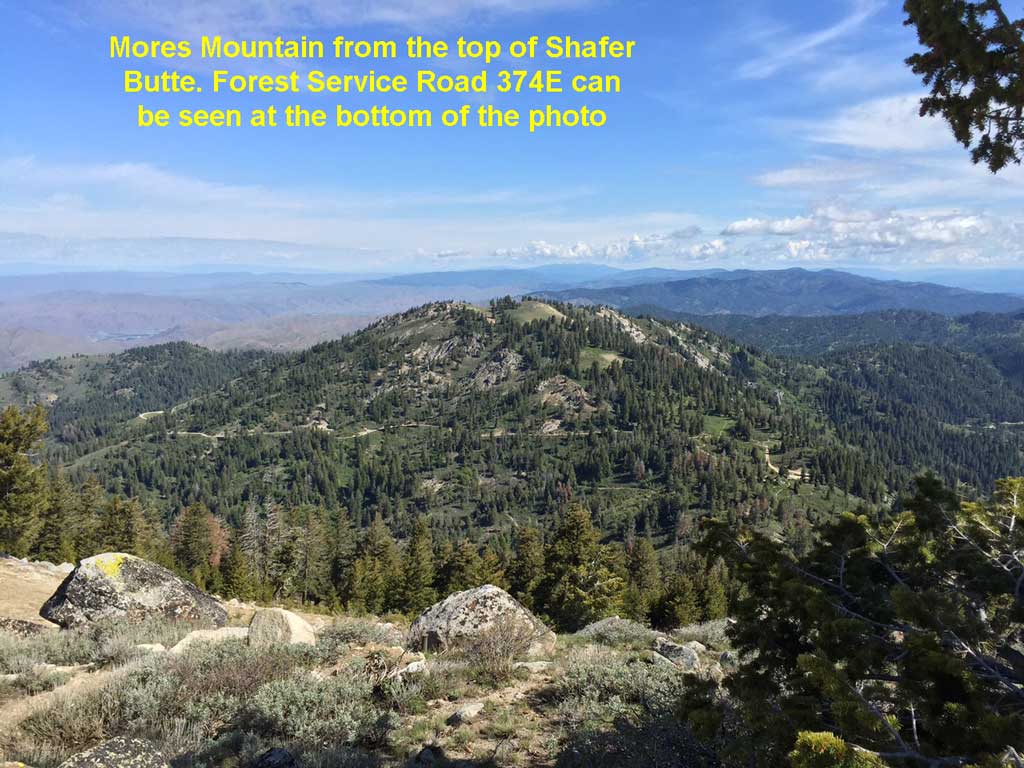
After a week of daily thunderstorms the weather forecast appeared to give us a one day respite on Monday, May 25th. So, off we headed to the mountains north of Boise and around the Bogus Basin ski area where these summits are located. The plan was to park at the Mores Mountain/Shafer Butte picnic area which is in a saddle between the two summits. We would then hike up to Shafer Butte, activate it, come back down the cars and resupply, then hike up to Mores Mountain. Finding the picnic area is quite easy. Just drive up to the Bogus Basin ski area, head past the cross country ski lodge on the dirt road (Forest Service road 297 on Google Maps), go 2.7 miles until a well marked road heads off to the right 1.3 miles up to the picnic area. (Forest Service road 374E on Google Maps.) Goggling around can also uncover plenty of information on the area. For example: http://www.fs.usda.gov/recarea/boise/recarea/?recid=5125
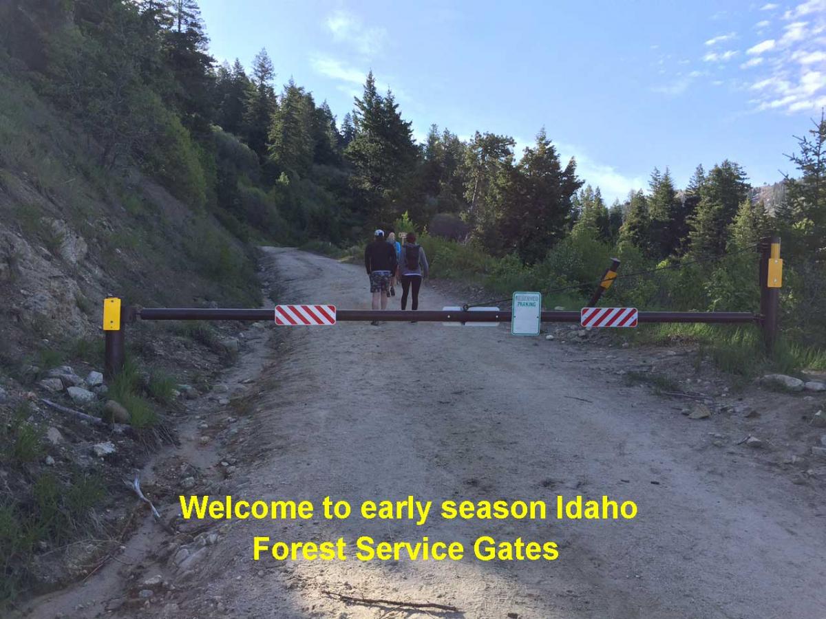
This plan seemed great until we were met with a gate turning off FS 297. Oh yea, I seemed to remember seeing somewhere that this road does not open until May 31. (Actually it is June 16th after checking the Boise National Forest Motor Vehicle Use Map. Note to self and others -- in early season check this map before leaving the house!) This is the bane of early season activations in Idaho. Though we had a relatively lite snow year, and snow is off the lower peaks already, the road closure plans don't change because of that. We just have to come to accept that the realistic activation season in Idaho is only 4 months long, mid-June through mid-October. Unless you want to hike 20 miles, happen to have a helicopter, want to snowmobile into summits in the winter, or go through other extraordinary efforts to get to the top. Luckily, in this case, the gate only added an extra 2.6 miles and about 400 feet of vertical to our plans so we decided to hike in from the gate. Once we got up to the picnic area we were back on track with our original plan.
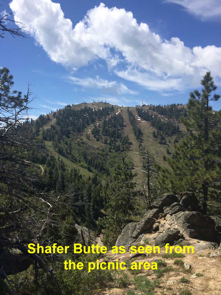
From the picnic area getting up to Shafer Butte is pretty easy. A nice trail/jeep track heads off south from the group parking area. The trail shows up quite well on Google Maps. There are a number of switchbacks on the way up, some of which have "now which way" decisions to make. It seems if you just make the choice of "when in doubt just keep climbing" you will make the right choice. It took us about 35 minutes to make the 1.75 mile and 850 foot vertical climb. Along the way we encountered just a couple patches of snow in the shadiest part of the trail. You can also get to the summit from the upper parking lot at the ski area if you want a different route.
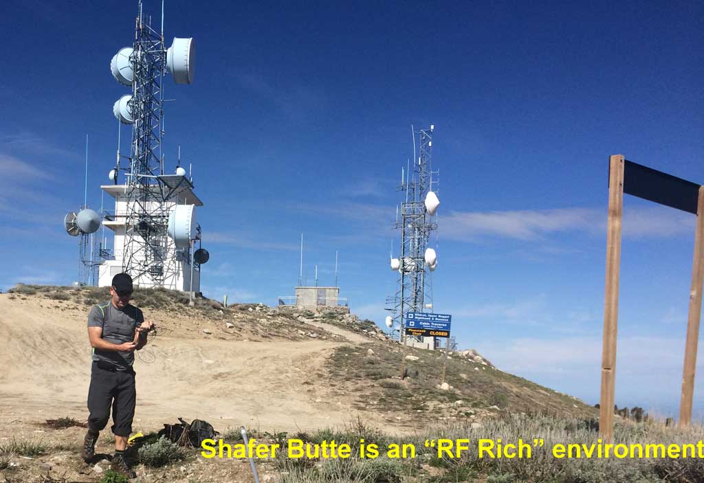
The top of Shafer Butte is festooned with commercial and government antennas of all sorts connected to amplifiers of unknown but likely high power. It is also the site of a APRS digipeater so no trouble using APRS from here if you want. You could probably use 1 milliwatt and still have a good connection into the digi. :) Cell phone service including data should also be solid on the top, though absent on the hike up as we are on the back side of the mountain. Upon reaching the summit we each had 4 or 5 dots and 4G on our AT&T phones. However, after setting up and trying to make spots from our operating location we got "No Service" messages on our phones. Walking a hundred yards away from our site brought service right back. We conjecture that a high level of local RF from a nearby building was swamping the cell signals. We could hear quite an electrical sounding hum from the building. So, if you head up there be aware you might have this problem. We noted no problems nor interference on the HF bands we operated on 40, 20, and 15 meters.
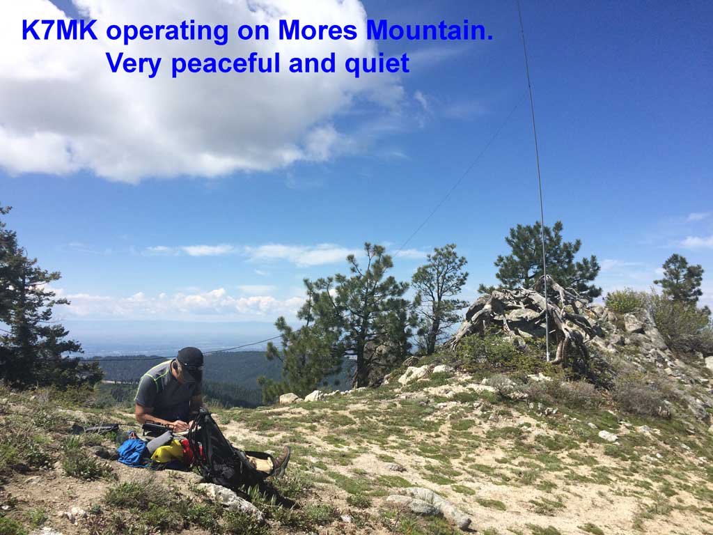
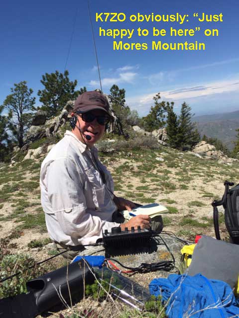
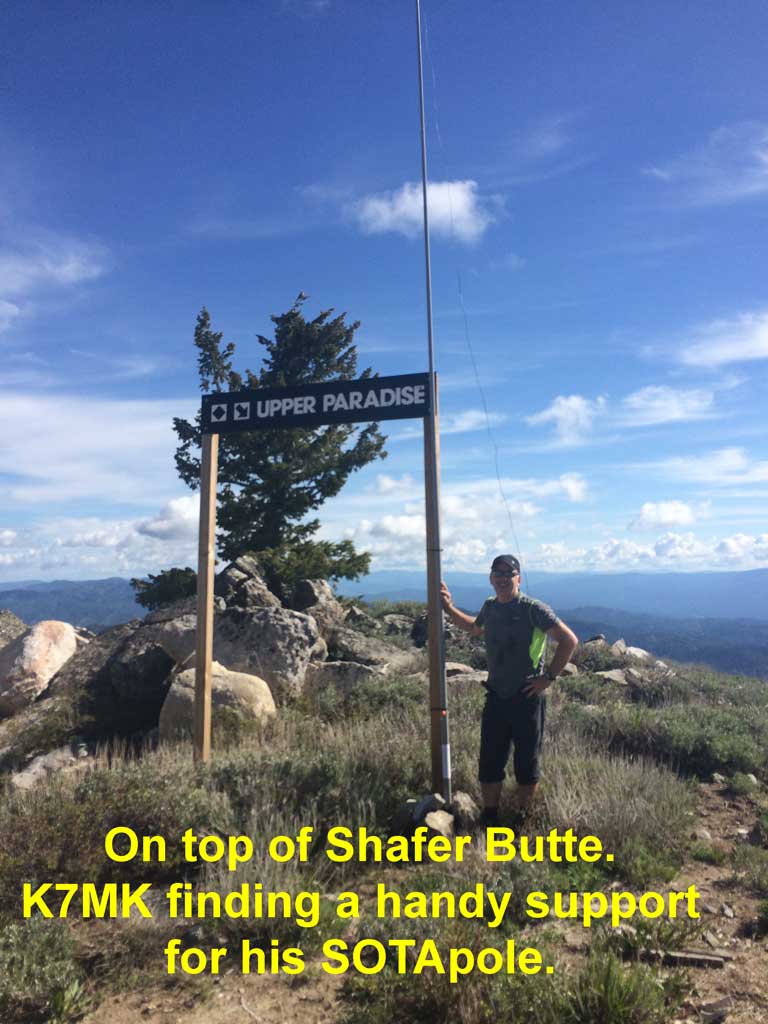
Our operating on Shafer Butte was pretty short. We erected K7MK's standard SOTA setup of a KX3, LifePO4, endfed vertical and sotapole in less than 5 minutes. K7MK worked down the pileup of the usual suspects on 20 SSB and K7ZO cleaned up on 15M and 40M, the later for the local west coast gang. The highlight QSO was K7ZO working DL3JPN on 15M loud and clear. He even got a 44 back from him so we were getting out pretty well. However, we had others in our outing party who were interested in pushing on. After 20 QSOs in 20 minutes we were off. So sorry if you missed us.
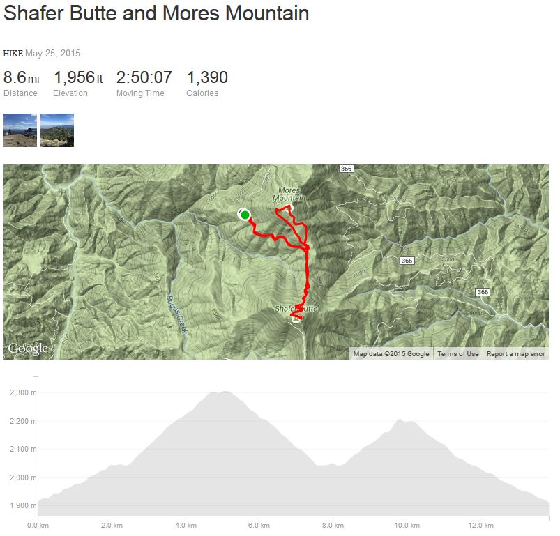
The hike back down to the picnic area was uneventful then it was off to Mores Mountain on a well marked nature trail. This is an easier hike taking us just 25 minutes to reach the summit in about a mile and 550 feet of vertical. Setup was easy and from this location cell phone connectivity was solid with no local RF issues like on top of Shafer Butte. Our operation was even briefer with K7MK making 5 QSOs on 20M SSB and handing the mic over to K7ZO for a quick few more followed by a short QSY to 40M for the west coast folks. Tear down took less than three minutes. We feel like we are a NASCAR or Grand Prix pit crew with a well timed coordinated effort getting everything into the backpack. Then it was a hike back around the nature trail loop and back down the Forest Service Road to the car. By now it was around noon and as we hiked down the road to the car we passed many families hiking up. They too were probably surprised by the gate still closed at the bottom of the road. But with a car full of energetic kids the last thing they were going to do was turn the car around and head back down the hill without burning off some of their energy. When we got back to the car our total hike was 8.6 miles with 1,956 feet of elevation gain for the day. Total moving time was a bit less than three hours. If we had been able to drive to the parking lot our numbers would have been 6 miles of hiking with 1,556 feet of elevation gain.