Getting there: from highway 12 , when you get to the town of Randle, turn South on state route 131. After about a half mile, there is a fork in the road. Stay to the right on highway 131. Do not take the left fork to Cispus road. After another half mile route 131 turns into Forest Service road 25. Drive about 10 miles down the 25 road until you get to the 2516, where you'll take a right. Here are coordinates for the turn: 46.34766, -121.97049.
Cell Phone coverage will disappear about 5 miles in on the 25 road and you will not have reliable coverage again until you get to the activation zone, which has good coverage, so you'll be a able to spot and call your loved ones from there. Bring a satellite communicator. The AB7F repeater has excellent coverage throughout the Dark Divide area: 444.875 +5 100Hz.
The 2516 is gravel and sort of rough but you can make it to the trail head in a Prius if you're careful. Strawberry Ridge is a frequently shuttled trail that's very popular with mountain bikers, and Trans Cascadia runs a full size van laden with bikes up and down this road regularly. If a rear wheel drive passenger van can make it, so can you.
The Hike: The hike starts out very steep and then mellows out a lot after the first 1/4 mile. The first 1/2 mile is in the woods, but the majority of the hike is very exposed as you're out into the far reaches of the blast zone from the 1980 eruption of Mount Saint Helens. That leads to beautiful views, but make sure you bring sun protection. The entire out and back hike will net you 6.6 miles with 1100 feet of elevation gain, most of which you'll experience on the way to the summit. The trail does undulate a bit as it is a ridge line hike. The trail tread is a bit like walking on a giant bowl of Cocoa Puffs through the exposed areas. Wear gaitors if you have them. Overall, the trail tread is in good shape. There's some trenching from mountain bike use, but it's nothing like the moto damage you'll see in other parts of the forest nearby. You'll enter back into the woods about 2.5 miles or so into the hike. Pay attention to your topographical map here as you'll need to leave the trail and start bushwhacking to the summit around the 3 mile mark. Here are the coordinates for where I left the trail and started bushwhacking for the summit: 46.38406, -122.03963. If the trail starts descending really steeply, you've gone too far and need to turn back. The bushwhack to the summit is a very steep climb up forested slope for about 250 vertical feet over about 1/4 mile. Trekking poles are recommended. Gloves might be nice too. I got lots of pine sap on my hands from grabbing trees on the way up.
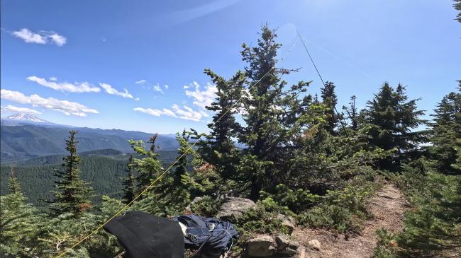
The Summit: The activation zone is pretty large on this summit. There are a few decently open meadows just barely below the summit but still in the activation zone that would make for a very easy antenna setup. If you're a glutton for punishment, you can push up the very steep hill to the little partially exposed knob that represents the actual summit. This summit would be a very good candidate for your favorite free standing vertical antenna. I was barely able to find space to set up my wire antenna, and I had to run it down to trees well below the summit in order to do it. There is a great view to the South but only partially obstructed views to the north. The trees are thick in here and that makes it difficult to move around and get your antenna in the air. The exposed part of the summit had a lot of bugs the day I was here.
This is an HF summit with very limited line of sight to any populated area. You may as well try some VHF if you brought your HT, but don't count on it working. Bring your HF rig. You're right in the middle of the Cascades here and there is some pretty serious terrain between you and most population centers.
Here's a video to give you a better idea: https://youtu.be/_ZeiZciz1d4


