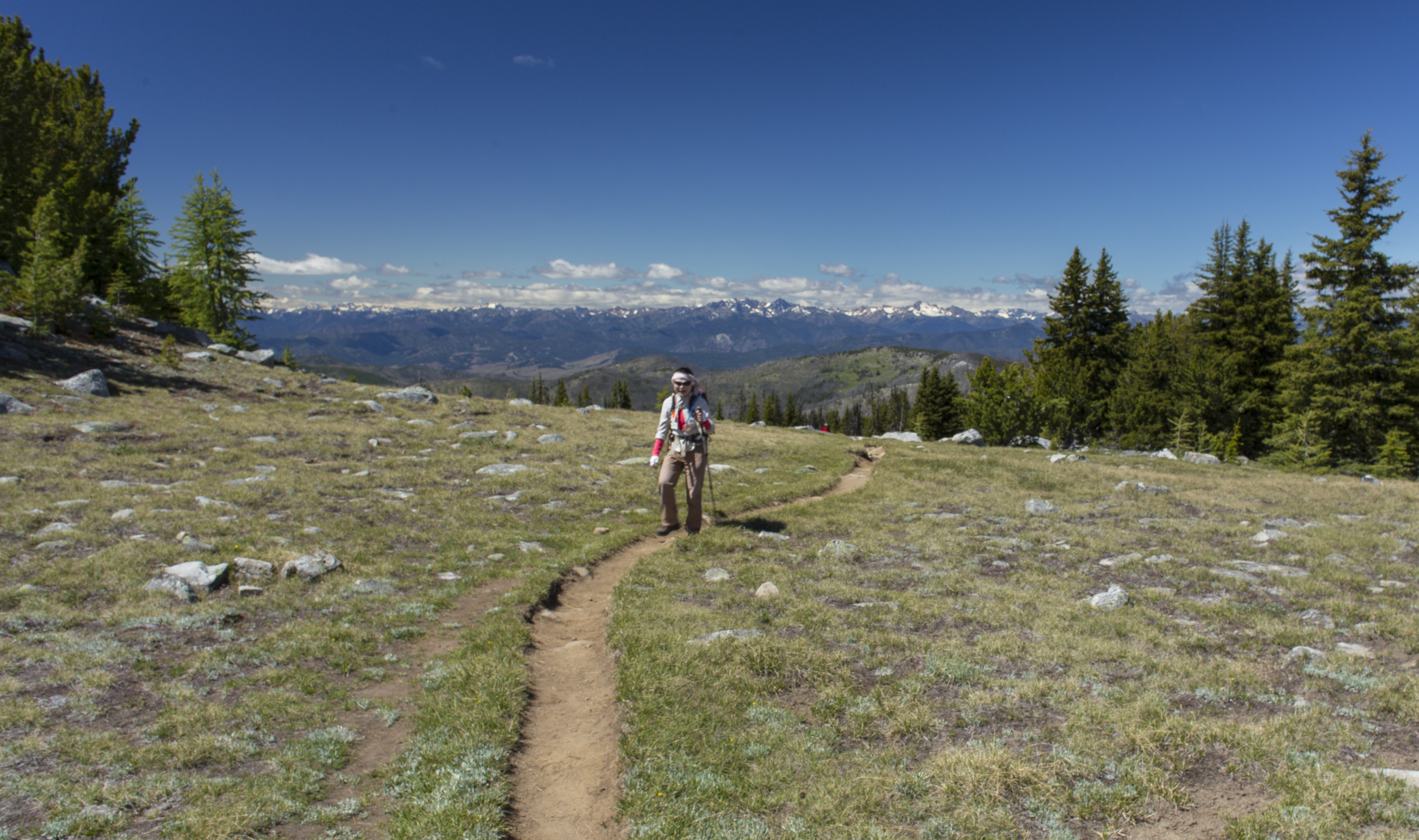
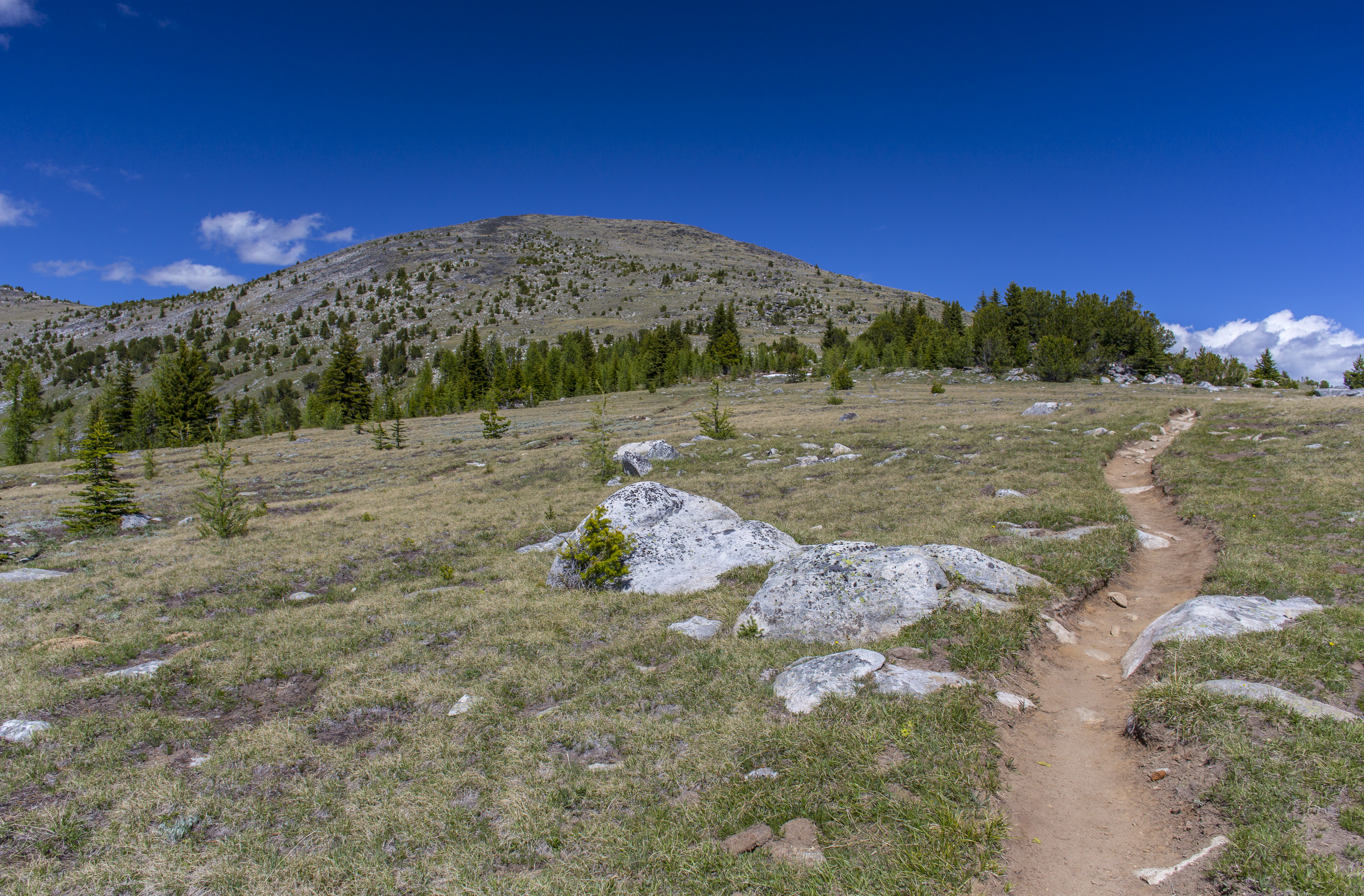
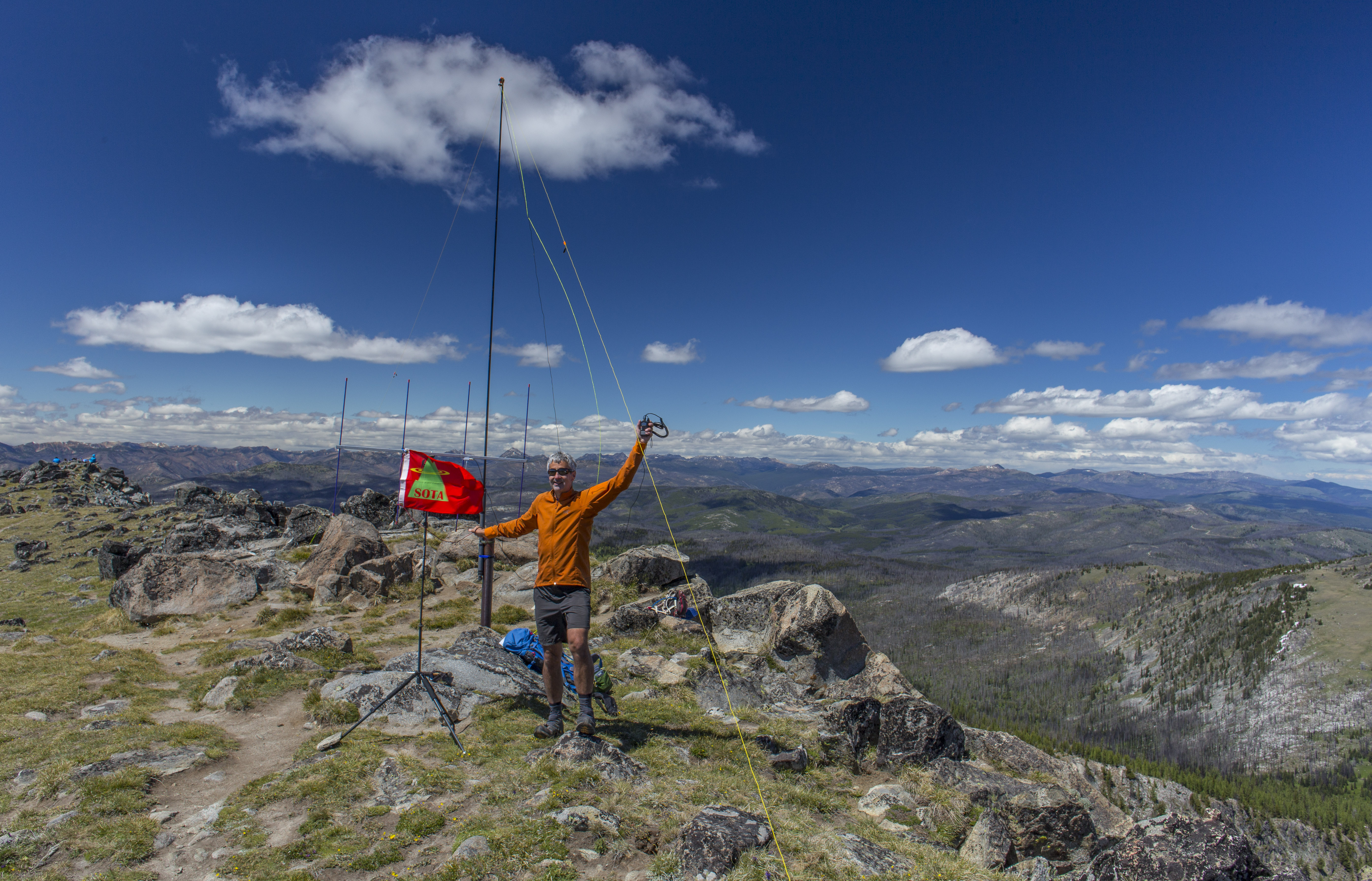
Tiffany Mountain’s 8242 foot summit classifies it as a 10 point SOTA summit. With only a few exceptions, 10 point summits in the W7W association are technical climbs, or exposed Class 3 or 4 scrambles. Tiffany Mountain offers a well maintained and well graded trail to the summit. Starting with a gentle climb along a sparsely treed ridge, the trail gradually makes it way to a large grassy meadow about 1.5 miles into the hike. From the meadows, the wide rocky topped summit is viewed. The trail makes its way across the meadow to the base of the summit area, and then switchbacks several times to obtain the broad summit ridge. A few small trees decorate the summit block and ridge. Remains of a metal pole make the perfect anchor for attaching an antenna pole. The summit views are expansive 360 degree views.
The Activation
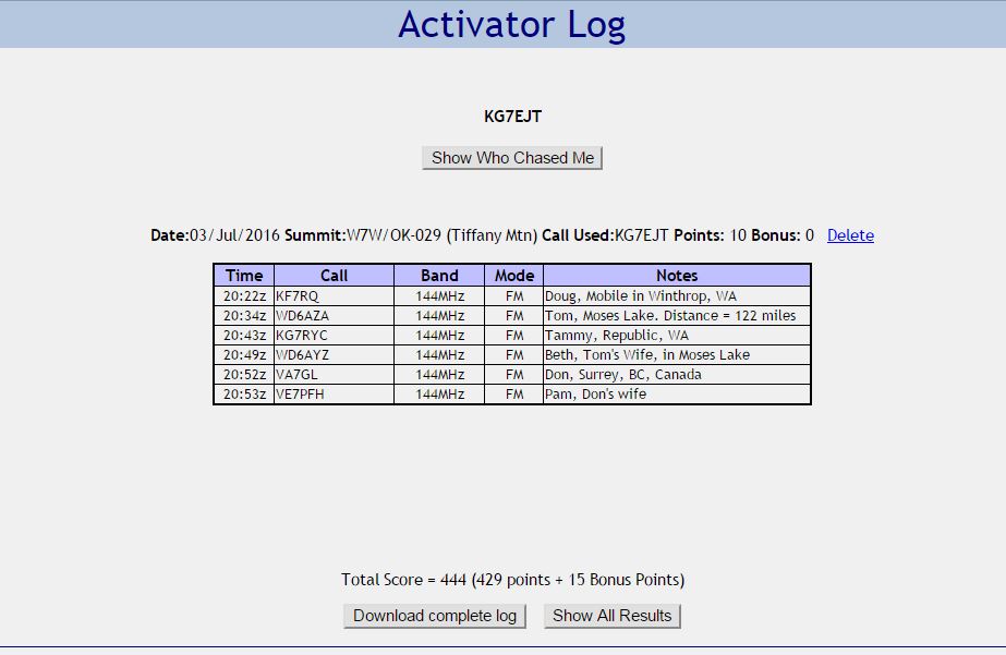
There is no cell phone coverage in this remote region, so I was unable to “self-spot”. After calling CQ on 20 meters for an hour or so, with no success, I decided to try 2m-FM. Using my 4-element Arrow Antenna connected to my Yaesu VX-6R, I made 6 contacts in a relatively short time!
Driving Directions to Trailhead (Courtesy of wta.org)
From Winthrop head north on East Chewuch River Road (County Road 9137) toward Pearrygin Lake State Park. In 6.5 miles (just before the road crosses the Chewuch River), turn right onto paved Forest Road 37. The pavement ends at 7.5 miles, and at 13 miles come to a junction. Turn left onto FR 39, following this sometimes rough road for 3.2 miles to Freezeout Pass (at a cattle guard). The trailhead and limited parking are on the right side of the road (elev. 6500 ft).