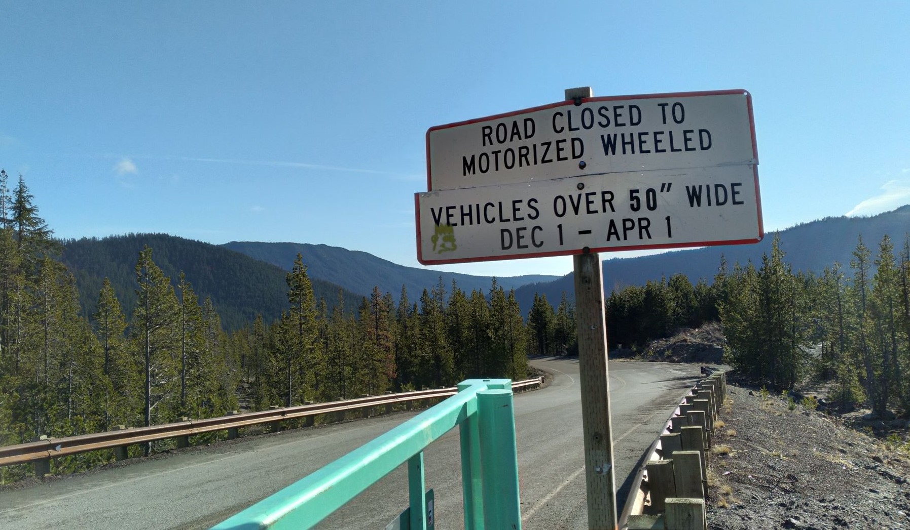
UPDATE Dec 2021 - High Prairie Trailhead for Lookout Mountain (and other summits in the area) are not accessible from Dec 1 to April 1 due to closure of NF-44 and other routes to vehicles more than 50 inches wide. SO - if there's snow and you've got a snowmobile, have at it. See the photo below.
Shortest route is 2.2 miles round trip.
From the trailhead (described below), cross the gravel access road, then begin following the dirt road that once lead to the High Prairie Guard Station and the summit lookout, and now serves as the return route for this loop hike. You can also go to the right as there are a few different ways to get to the summit. The alternate route is not much further and there are additional trails that you can extend your hiking if you like!
Our activations were best done by pointing my directional antenna north of Mt Hood. No contacts were made pointing my antenna south of Mt. Hood. Got an unepxected Summit to Summit from Etienne! Great Views of Mt. Hood, Mt. Adams and Mt. Saint Helens!
High Prairie Trailhead: From Portland, the trailhead can be reached by following Highway 26 past Government Camp, then turning north on Highway 35. Pass the Mount Hood Meadows interchange and continue several miles down the East Fork valley to Highway 44 (Dufur Mill Road). Turn right and follow Highway 44 for 3.8 miles to Road 4410. Turn right onto this gravel road and climb 4.8 miles past numerous spur roads to a T-intersection with Bennett Pass Road at the west edge of High Prairie. Turn left, and travel a short distance to the trailhead parking area. There is restroom at the trailhead, but no water.