If you want to practice being a mountain goat, this is the summit for you. This peak is technically in NE Oregon, but you drive there from Eastern Washington. The access road near the summit is better suited for high clearance vehicles and has space for 1 car to park. From there you will need to traverse to the summit without a trail up some very steep terrain. You can navigate around the treed sections easily, so although it is very steep with delicate footing, you won’t have to bushwhack.
From Walla Walla Community College it is 29.5 miles. 17.8 of that is dirt road, and 2.6 of that is high clearance vehicle terrain. From WWCC, take Isaacs Rd/Mill Creek Road east for ~12 miles then turn right on Tiger Creek Rd. Follow this winding road up, it turns into NF-65 seamlessly at a hairpin turn at one point and you don’t realize you are now technically on NF-65. At the top there will be a hard left. This is NF-64 aka Kendall Skyline Rd. From this point on, recommend high clearance vehicle, when I was there on Labor Day weekend traffic through the road from a previous rain had caused massive ruts in the mud. It is 2.6 miles to the bottom of the peak access from this turn onto NF-64.
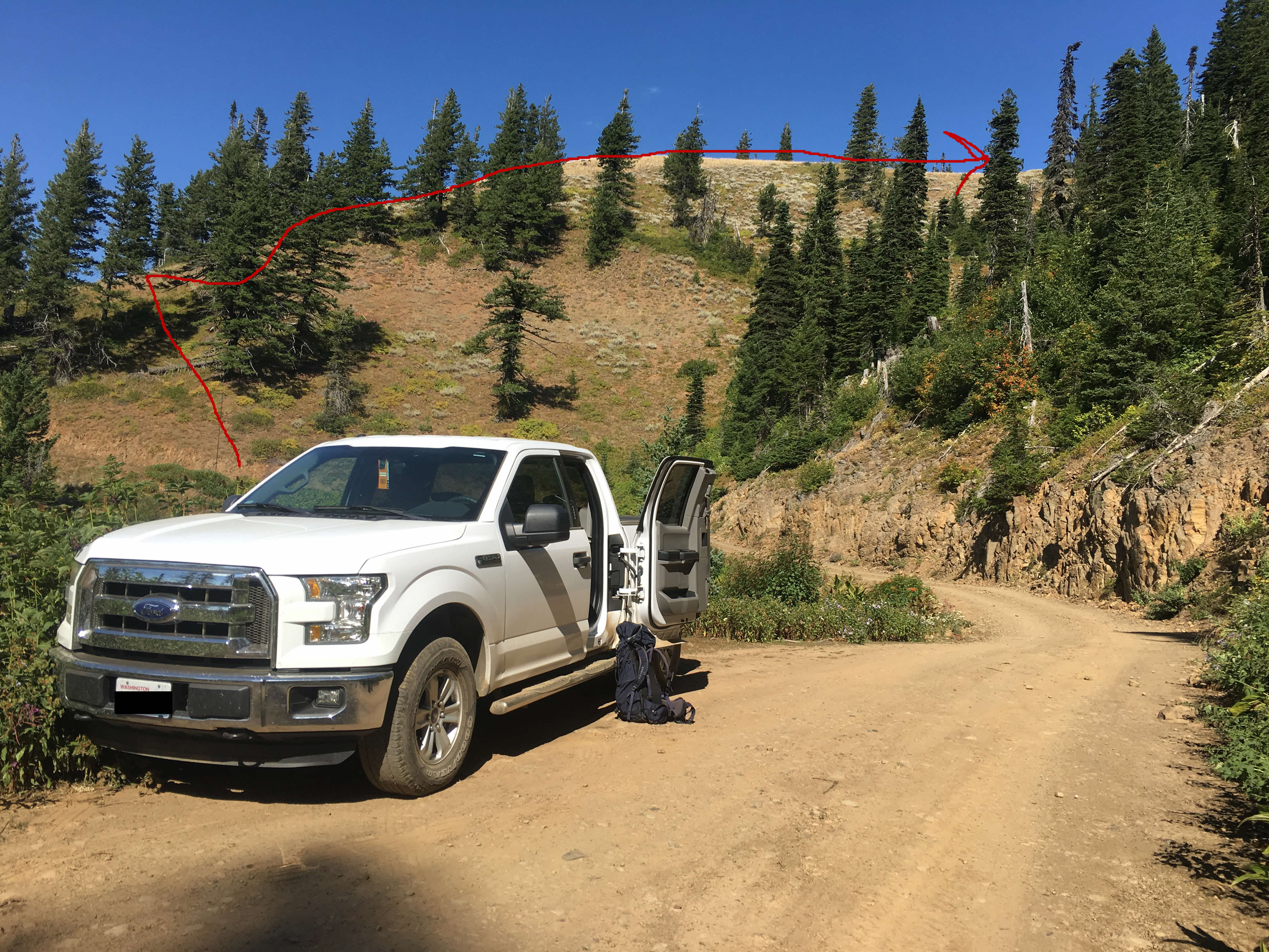
There is a slight widening of the road at N45.99198° W117.93314°. This is where I parked. See picture for how I traversed straight up the ridgeline from that point. The actual peak is a second rise to the east, in the direction of the red arrow shown in the picture. Actual vertical gain is only 550 feet, but it felt like more to me due to steepness. At the top, there is great visibility and small trees to attach masts to. I worked 2M and got good local QSOs on 146.520. The Spout Springs repeater is at 146.620 with a tone of 123Hz, so you can go fishing there to ask to QSY to simplex if things are quiet.
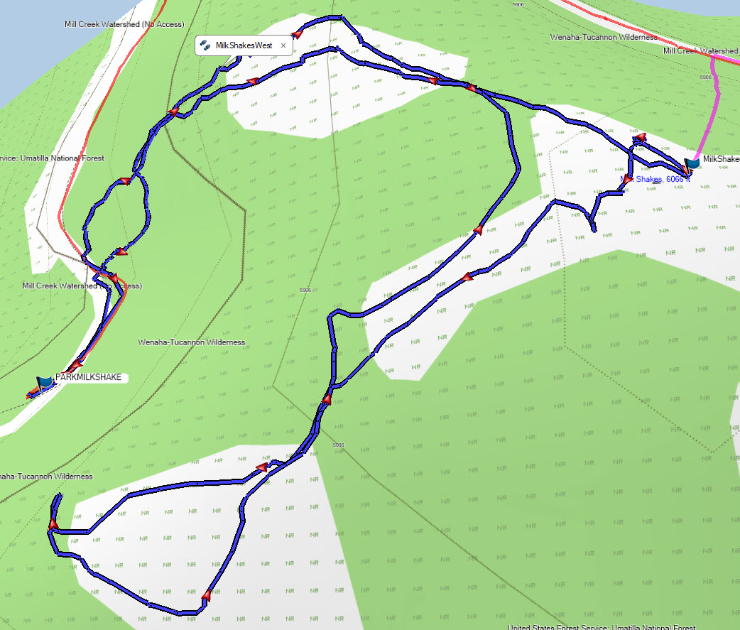
Attaching my GPS track; the funky track I laid on the way back was a failed attempt to get a more direct route to where I parked-it turned out to be too steep for me to go that way. You can also see on the track where I originally had planned (pink route) to traverse up from the North side, but I found that way heavily forested, so approached from the South.