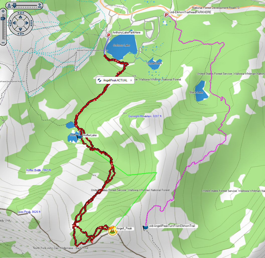
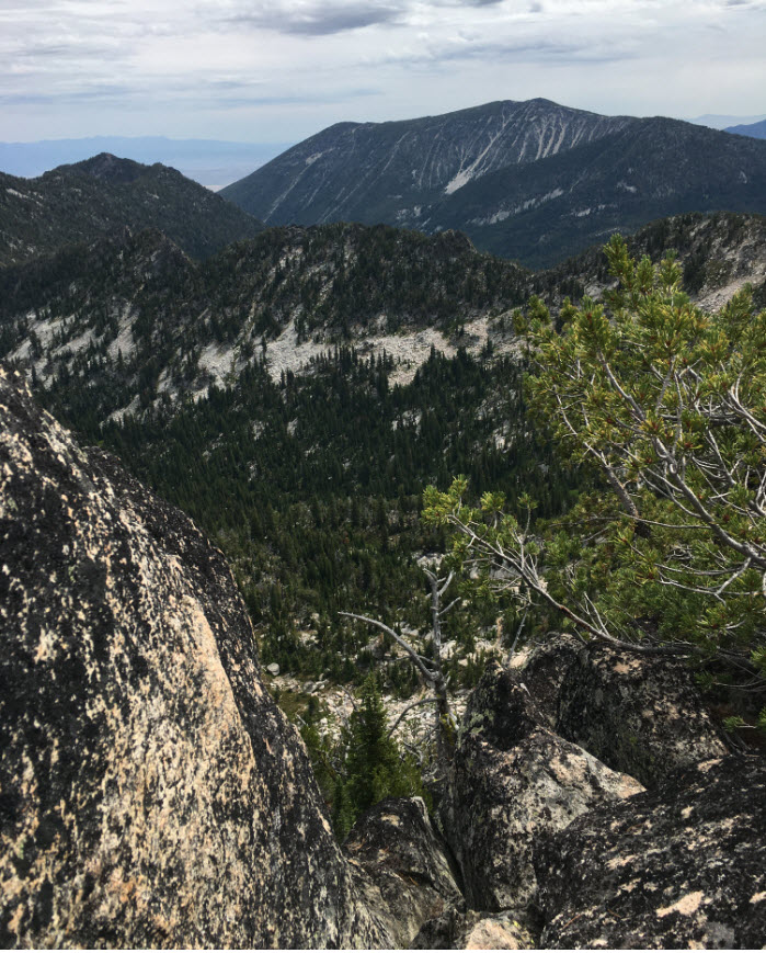
This summit is a progressively more difficult climb as you ascend. The activation is challenging but rewarding. The route I took starts with an easy well trafficked trail, but the second part of the ascent has no trail and involves navigating through the Angell Basin which consists of areas of large granite boulders. You can activate the summit while your family enjoys a nice day use area at Anthony Lakes, which also has camp sites that would allow you to spend the night before or after.
In researching this summit, I used information from Peak Bagger (https://www.peakbagger.com/peak.aspx?pid=3126) which indicated that peak access from the NE would be difficult because the jagged peaks along the back side of the ridgeline. The Elkhorn trial goes by the North side but I decided against pursuing that route. I read that it was possible to access the ridgeline from the Hoffer Lakes side and that is the approach I took.
I used Google Maps to navigate to Anthony Lakes Ski Area Lodge and it worked fine. The turnoff to the Anthony Lakes area is the left turn before the ski lodge. Full directions: Take US84 to exit 285 for US-30/OR-237 toward North Powder/Haines. Continue straight onto River Ln 3.9 mi. Turn left onto Ellis Rd 0.7 mi. Turn right onto Anthony Lakes Hwy 6.8 mi. Continue onto Anthony Lake Rd 1.4 mi. Continue onto NFD 73.
There is nice parking at Anthony Lakes Day Use area ($4 fee). There are several day-use sites here, so you could go with your family and they could enjoy the lake and shaded picnic areas while you do the activation. (I activated on a day when it was 103 in the flatlands and it was 78 at the lake). I parked at the farthest south day use area and from here hiked the Hoffer Lake Trail until it ended. When you get to Hoffer Lake the trail T’s. Turn left onto the “Anthony Lakes” trail which sort of peeters out after you cross a few log bridges.
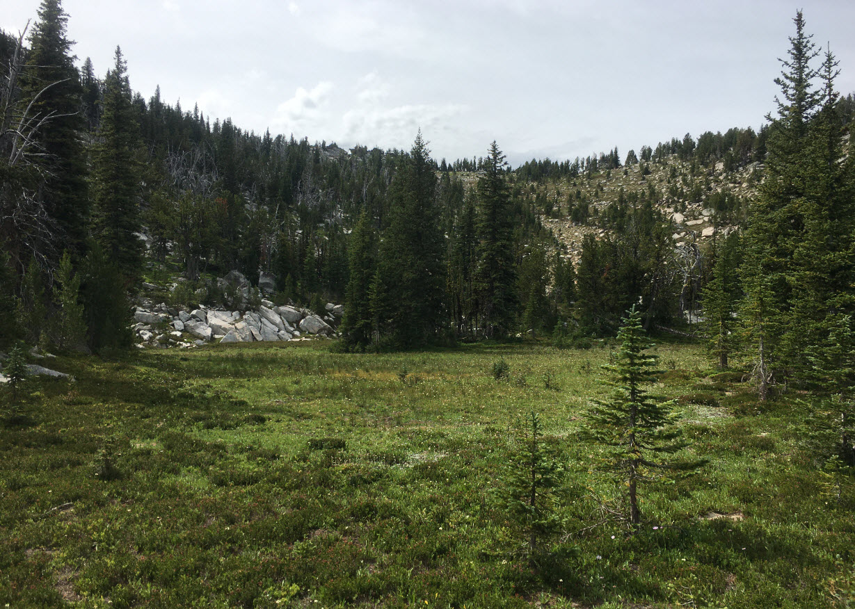
There is a small stream near the end of this trail, head for this stream and you will then see a small trail on the north side. I did not see this path as I ascended but found it on the way down. You want to basically follow this stream all the way up to a bog and granite "bowl" you will encounter before the final stairstep to the ridgeline.
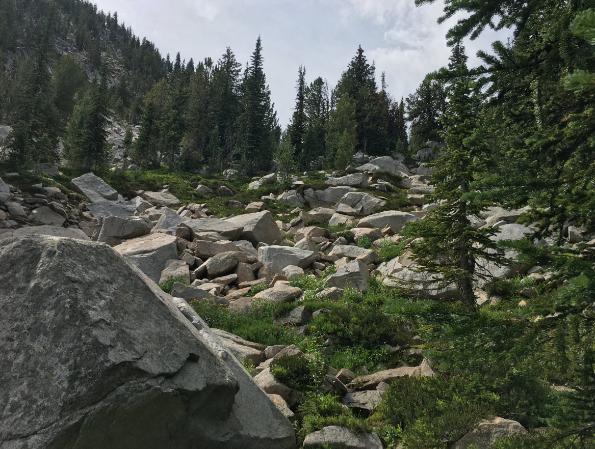
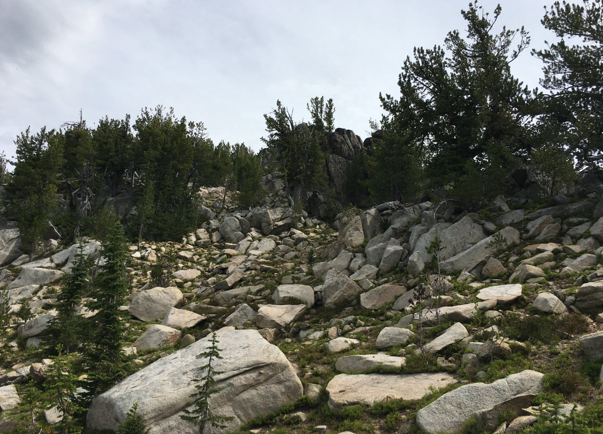
You will navigate through/around large boulder fields, but even in August the brush was not too thick, and you could walk through it as you navigated around the large boulders. You will pass up through a series of stair steps towards the ridge. I found I had to be quite careful with my footing and the ascent is step in places.
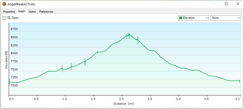
Once you attain the ridge, then follow it NE towards the summit. Check your GPS as what looks to be the summit from this approach is not, you need to keep going a bit further to then see the true summit. Total ascent was about 1500 feet in around 2 miles. A GPS is very useful, it helped me find the true SOTA summit. I had cell service one at the top. APRS worked great, there is an APRS digipeater at the top of the ski lift. Pictures below of the boulder fields and the GPS track I ended up taking. The green line was my estimated approach and red was actual.