I activated Monte Carlo in May 2021 and wanted to provide updated information about the summit.
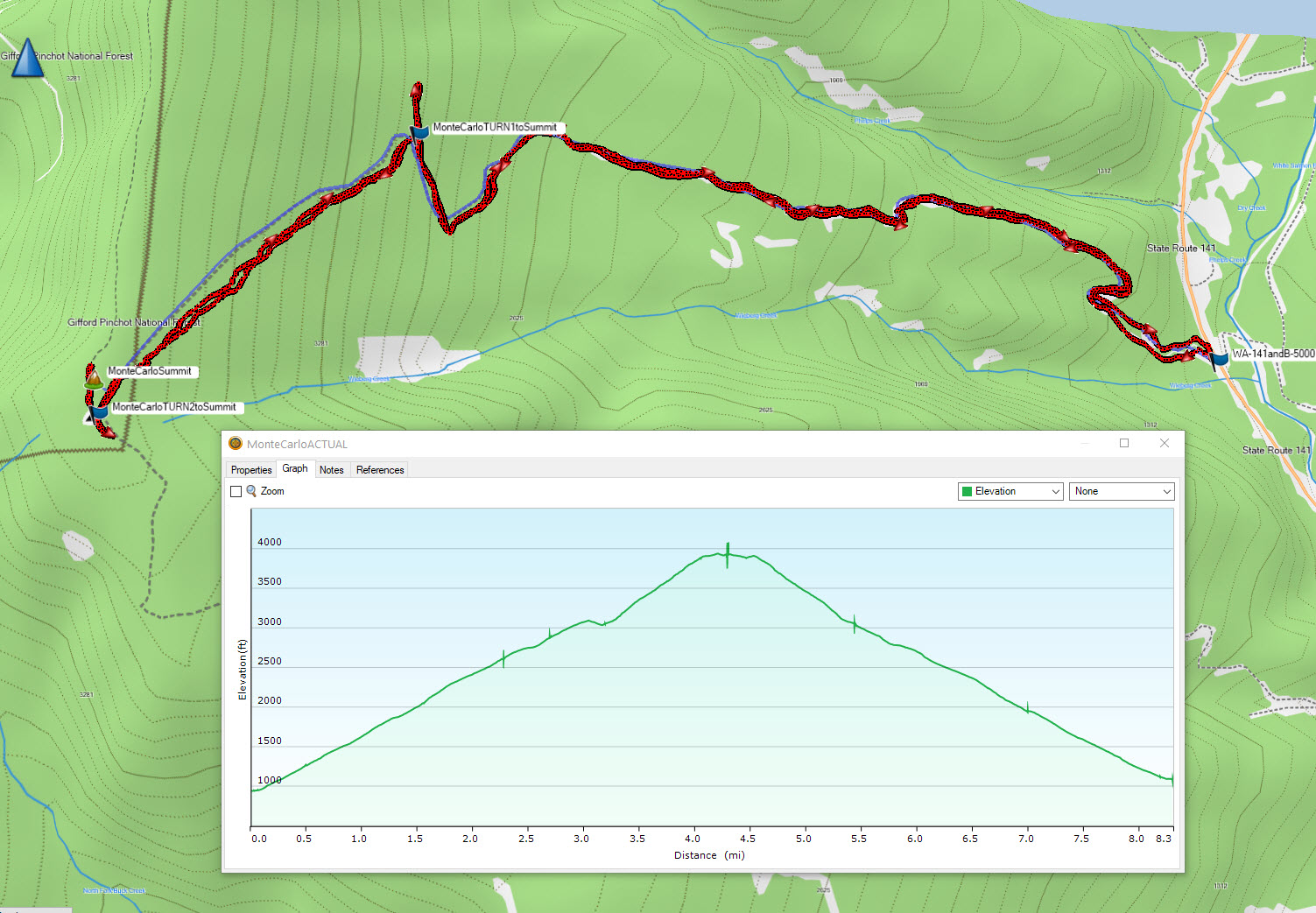
K7ATN reported (http://www.pnwsota.org/node/182) that there is now a gate at Hwy 141 and B-5000. I parked at that entrance point and hiked to Monte Carlo summit. I include the track and climb summary images below. The two key turns are at N45.88194° W121.56132° (TURN 1 to summit in image below) and N45.87098° W121.57094° (TURN2 to summit in image below). You can see on my track I overshot those key turns a bit. As K7ATN reported its 8 miles RT; I logged it as 3080 ft vertical gain. The exact summit coordinates look to be off on this one, if you try and go to exact spot you start descending down into forest. The meadow at the top is a really nice place to activate. I put summit pics on SOTA Atlas.
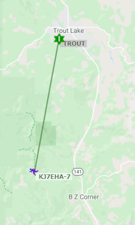
I had ATT LTE cell coverage at the top for voice and data. I also had APRS to “TROUT” APRS repeater. So I had no problems spotting and could track S2S targets.
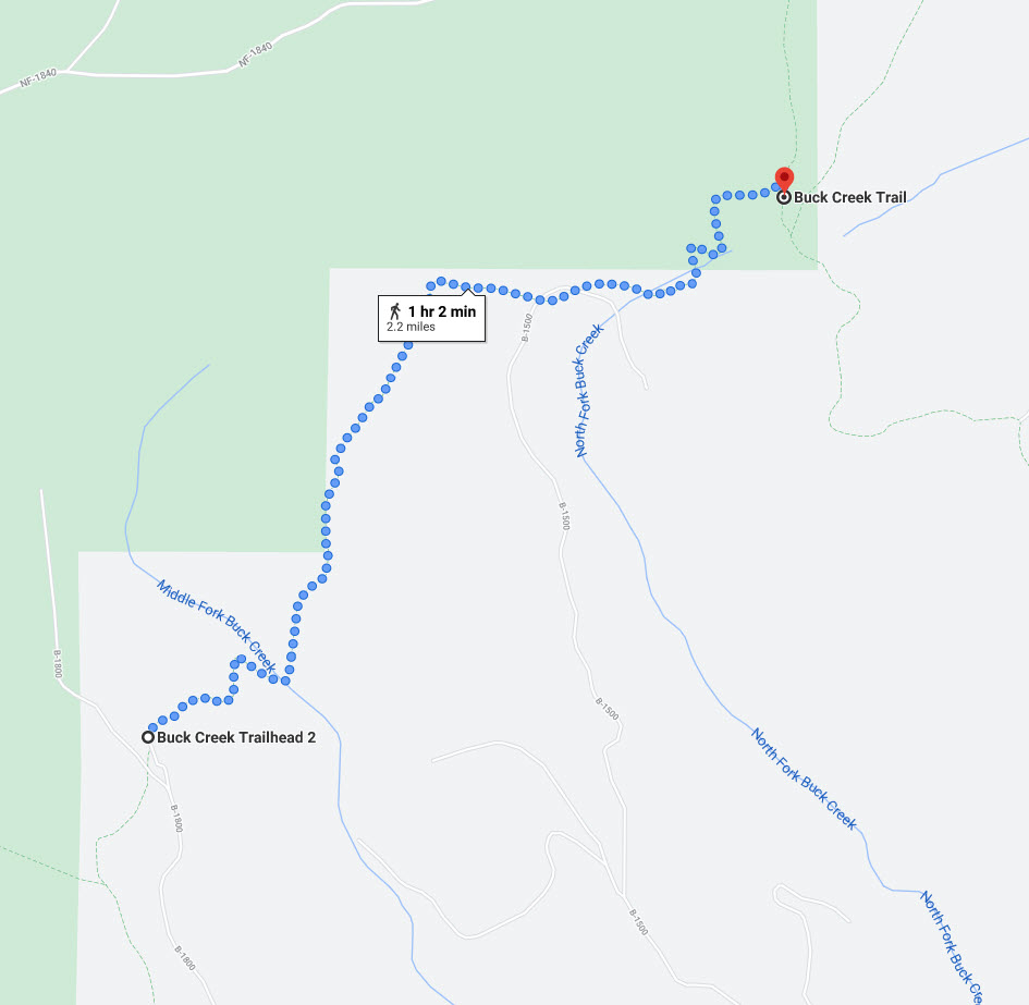
I also wanted to report that I met two hikers at the summit that confirmed a ~2-mile ascent. This trail was not visible on my topo map, but you can see it on Google Maps (image below). This would cut the RT hike from Hwy 141 in half. It looks like this alternate route would be to park at the Buck Creek Trailhead #2 on Road B-1800 near 45.85716463999915, -121.59626056759927.