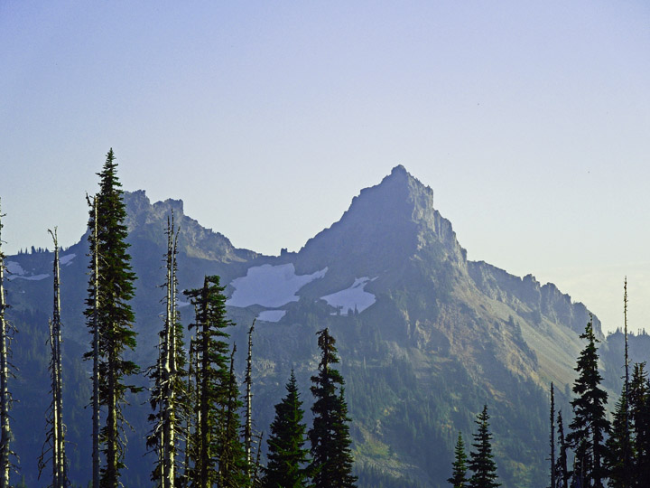
Fred Beckey's book, 'Cascade Alpine Guide' tells readers that Pinnacle Peak is not the highest in the Tatoosh peaks, but Pinnacle's central position and attractive form have made it the most popular ascent in Mt Rainier National Park. He's right about that... as 80 to 90 percent of the folks who visit the park go to Paradise visitor area. On a clear day from the Paradise area the Tatoosh range pops out in your face to the south. Pinnacle Peak was once called "The Matterhorn of the Cascades" by the Portland Oregon Mazamas (which I am alumni) in 1897 when they first climbed it. Photo 1- From the Paradise parking lot: Pinnacle Pk on the right and The Castle on the left.
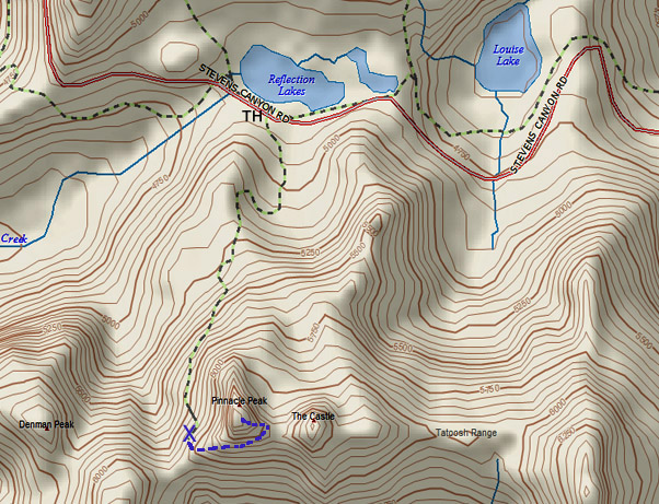
Photo 2- Delorme Topo Map, shows Fred’s route: From Reflection Lake on the Stevens Canyon Rd - take the trail to the Pinnacle-Plummer saddle for 1.3 miles. Follow the loose talus slope east then ascend the western portion of the south face up an easy gully to the ridge crest just below the summit. There is some exposure, as the route lies near the edge of the face.
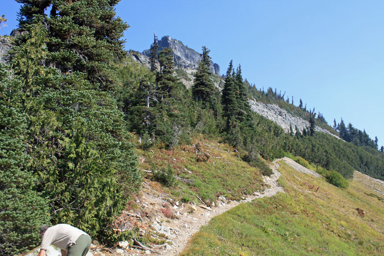
On this sunny fall day... I and hiking companion, Ms Pat, (WT7N) set out to follow Fred's route, which is the popular route. The trail up to the Pinnacle / Plummer saddle has very nice tread, great views, and is moderately steep. At this location I calibrated my altimeter to 6000 ft per the new Green Trails map of the park. Photo 3- shows the popular route boot track looking east. X marks the spot on the Delorme map
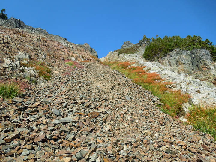
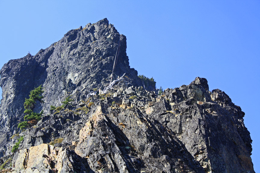
Photo 4 shows the gully that leads up to the ridge that Fred describes. I climbed up this gravel pit of a gully which turned out to be an energy consuming mistake. From higher up it was evident that the boot track went past and around the big rock with the shrubs on it (upper R of foto). Pat found an easy route on the rocks to the left of the gravel gully.
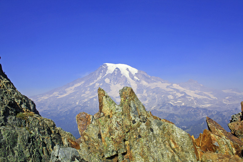
Photo 5 shows Mt Rainier and Little Tahoma (to the north) from the ridge at the top of the gully. My altimeter reads ~6250 ft. Normally the big mountain would show up more clearly... but there was still some Eastern WA forest fire smoke lingering. Looking south Mt Adams, Mt St Helens, the highly scenic Goat Rocks, and sometimes Mt Hood in N Oregon can be seen... but not on this hazy day.
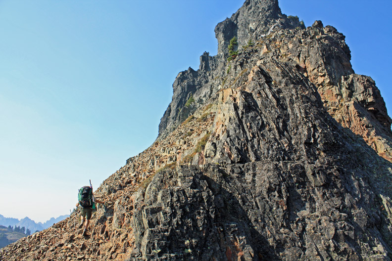
Photo 6- Pat stayed at the ridge above the gully. I felt comfortable heading up the rocky ridge to a perch within the activation zone... however; I did not want to climb out of sight of my hiking companion.
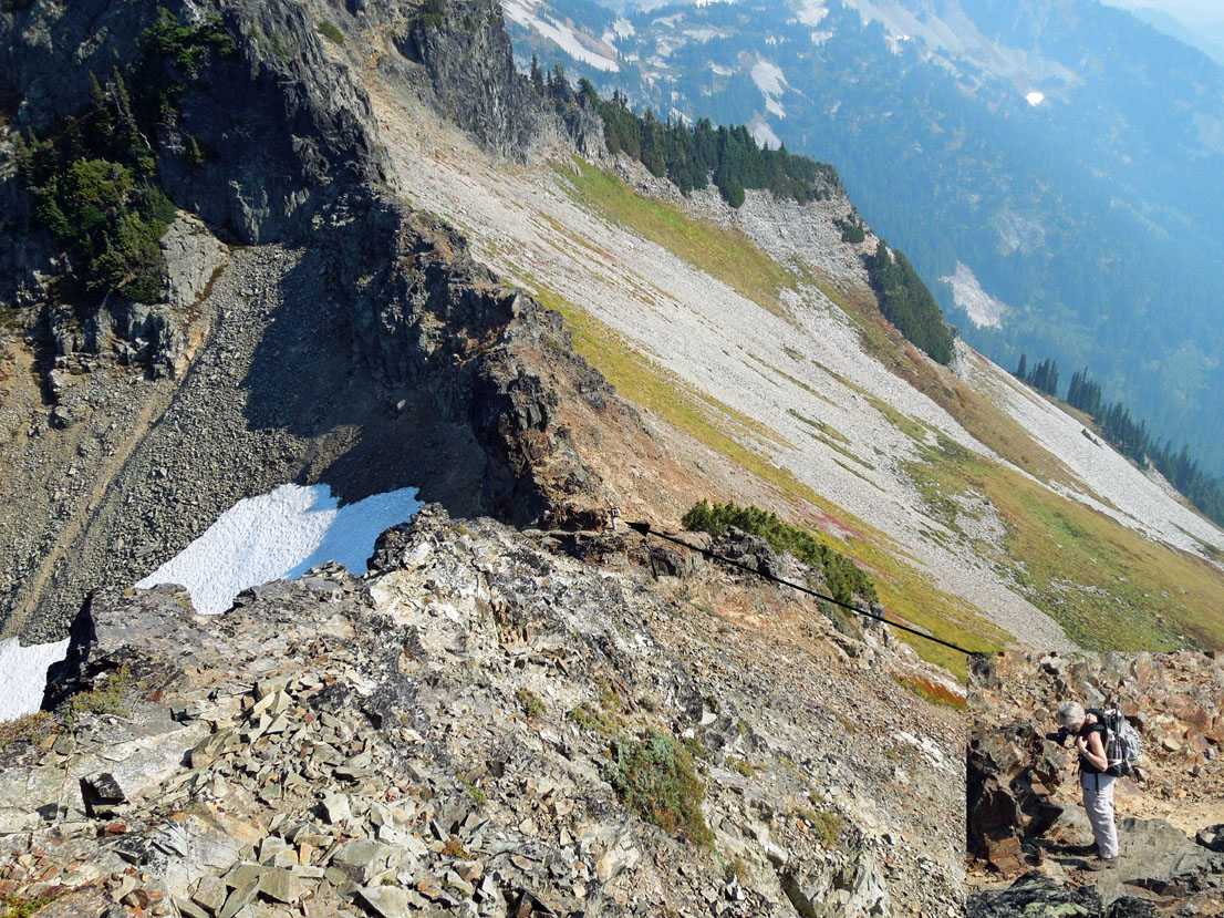
Photo 7- I've almost reached my Op position and am looking back down the ridge where Pat is. She's just a speck in the rocks from this view. The telephoto inset photo and arrow shows her location. I did eat my Wheaties that morning... but didn't have my lucky rabbit's foot. It seemed too risky to ascend any higher up.
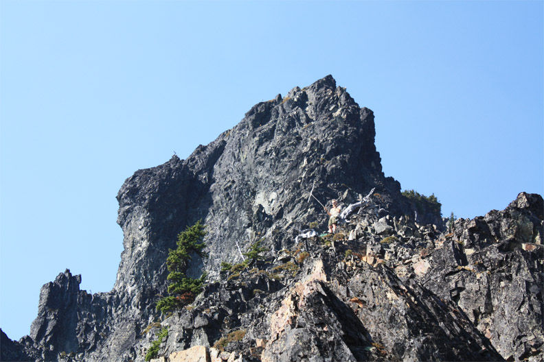
Photo 8- Pat took this foto of me on my ~6450 ft perch zooming in as far as her camera would allow. I am using my collapsible PVC 2 meter dipole attempting to make contact with a ham in Eatonville, WA with good line of sight per Delorme Topo. The 2M repeater worked well for initial contact, but on 146.520 SX I could copy but could not be heard. Even though it is extra stuff to carry... I like to make contacts with hams from my local club... the ops at both ends of these QSOs seem to enjoy the contacts... and it is good to know that someone out there is listening if help is needed… as there's no cell phone service at most places I go.
Photo 9- 20 Meter HF operation. The shiny pole is my 16 ft fishing pole vertical dipole. A PVC pipe mast is strapped to the old white tree and the fish pole which supports the 16 ft wire sits on top. A 16 ft counterpoise wire extends uphill tied to my trek pole jammed in the rocks. There were not as many chasers today as usual... maybe the ionosphere or my location was poor or I was on the air later than my alert announced. Only six CW QSOs were made. I tried 14.342.5 SSB, but no joy. I had a bite to eat, put things away, and carefully hiked down the ridge. This is the class 3 part of the climb that Fred's guide book speaks of.
Normally I take fotos of my station set up... but I was having some technical difficulty with my new KX3 and was in a precarious place without my lucky rabbit’s foot... so snapshots of station equipment didn't come to mind. One of the techy issues was that I could not hear my CW sidetone. Luckily I was using my small Russian tank straight key where I could hear the clicks and feel the dits n dahs and didn't totally need the side tone. I wudda been SOL if I was using paddles. The techy issues were cleared up back home by RTFM.
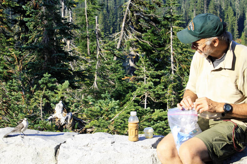
Photo 10- Back at the Stevens Canyon road TH… we stopped to enjoy a snack with the camp robber gray jays. Then another miles hike to the car and homeward to Tacoma.
That’s All Folks. Thanks for reading. Best Regards… Rich KR7W