On Sept 9, 2012, I and hiking companion Ms Pat WT7N and her brother Mike hiked to Deadwood Peak, W7W/RS-052 for SOTA activation.
Google “Visit Rainier Deadwood Lakes” to find an article by Karen Sykes to get you to Deadwood Lakes… which describes part of the route.
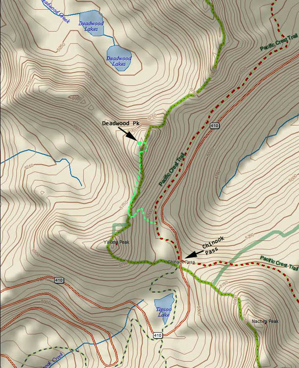
The only place that I have seen this peak named Deadwood Peak is in the SOTA database. All of the maps that I’ve had access to do not have a name or number for this peak. In Karen’s article (mentioned above) she mentions of Peak 6468, but I’ve not seen that name on a map either.
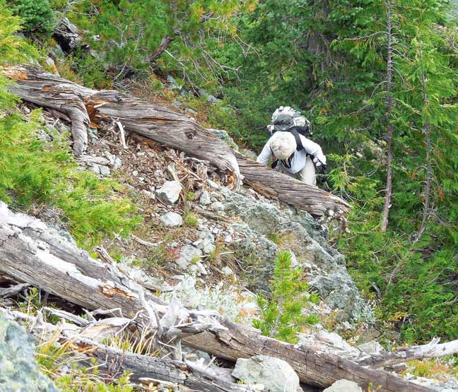
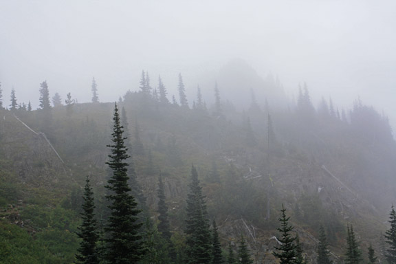
This hike began at the Forest Service Privy stop just east of the Chinook Pass summit. The temperature was 45 degrees with heavy fog. The Pacific Crest Trail north route passes right by here at 5450 ft ASL. We trekked north on the PCT (actually goes east for a while) for about ¼ to ½ mile until the elevation dropped to 5200 ft. Be looking up hill for a boot track that heads up to a saddle between Yakima Peak and Deadwood. The boot track is easy to see as it’s been covered up with branches and sticks to tell people that this trail is abandoned. Once on top of the ridge there is another fainter boot track that follows the ridge going north. This track quickly fades out but the ridge is obvious even in the fog. We came to a giant rock wall which is the summit face with no easy route up. Trekking around to the south gained us some dirt, trees, and rocks to ascend steeply 300 vertical feet up to the summit.
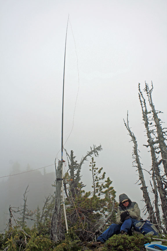
My activation equipment consisted of my trusty FT-817 at 5 watts, Lithium battery, Russian SK, HB 20M vertical dipole, and HB 2M collapsible dipole.
The ARRL Fall VHF contest was in its second day of operation and I got lucky on two meters. I made one CW and two SSB QSOs with one of them in E WA. No one was raised on 2M FM. On 14.061 CW 14 Qs were made. I called on 14.3425 SSB with no success.
At about 1330 LT the radio was put away as the sky became darker and the fog was getting thicker. Climbing back down was difficult with no trail and not being able to see very far ahead. Every once in a while we’d find our own tracks and hail a cheer. Once back down at the saddle where the fog was less thick… we head down the west side of the saddle to Deadwood Lakes. This proved to be a very nice hike even though the visibility was limited.
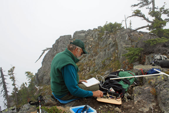
Photos below:
>Topo Map
>Team member climbing an easy part of the route up the last 200 V ft
>Deadwood in the fog from below the ridge saddle
>Antenna on peak in fog w/ team member keeping warm w/ back to the wind
>Station set up on a rock shelf. Behind the operator is a steep drop off.
Thanks to the chasers who provided me Qs to complete this SOTA activation.
Best Regards… Rich KR7W