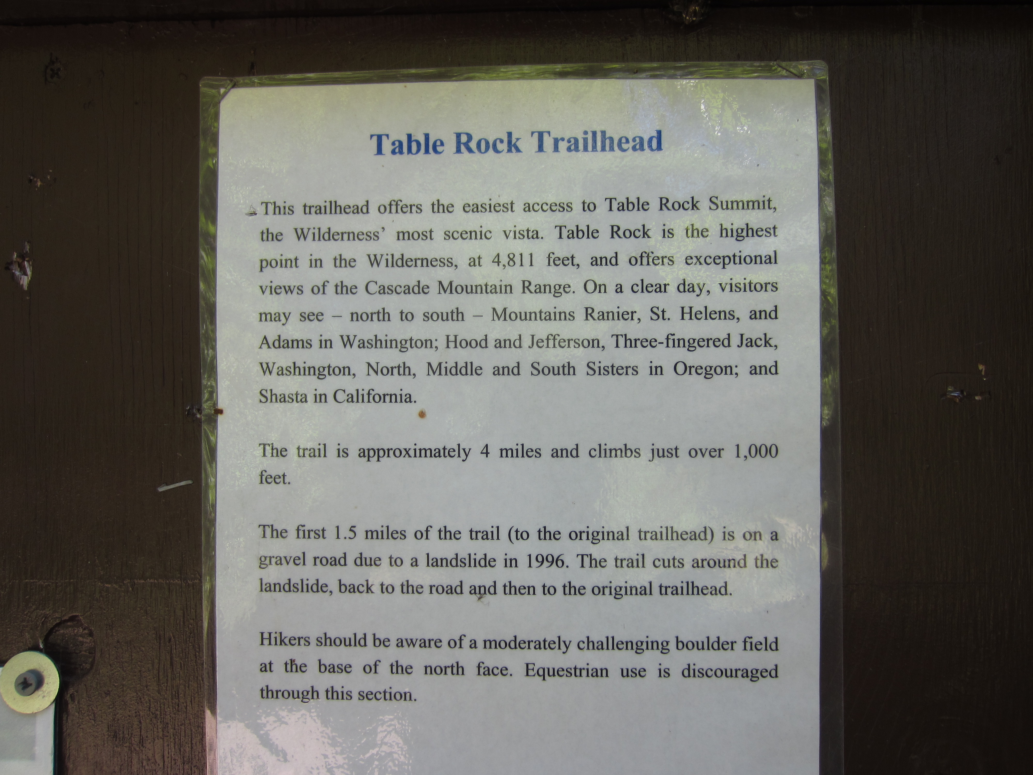
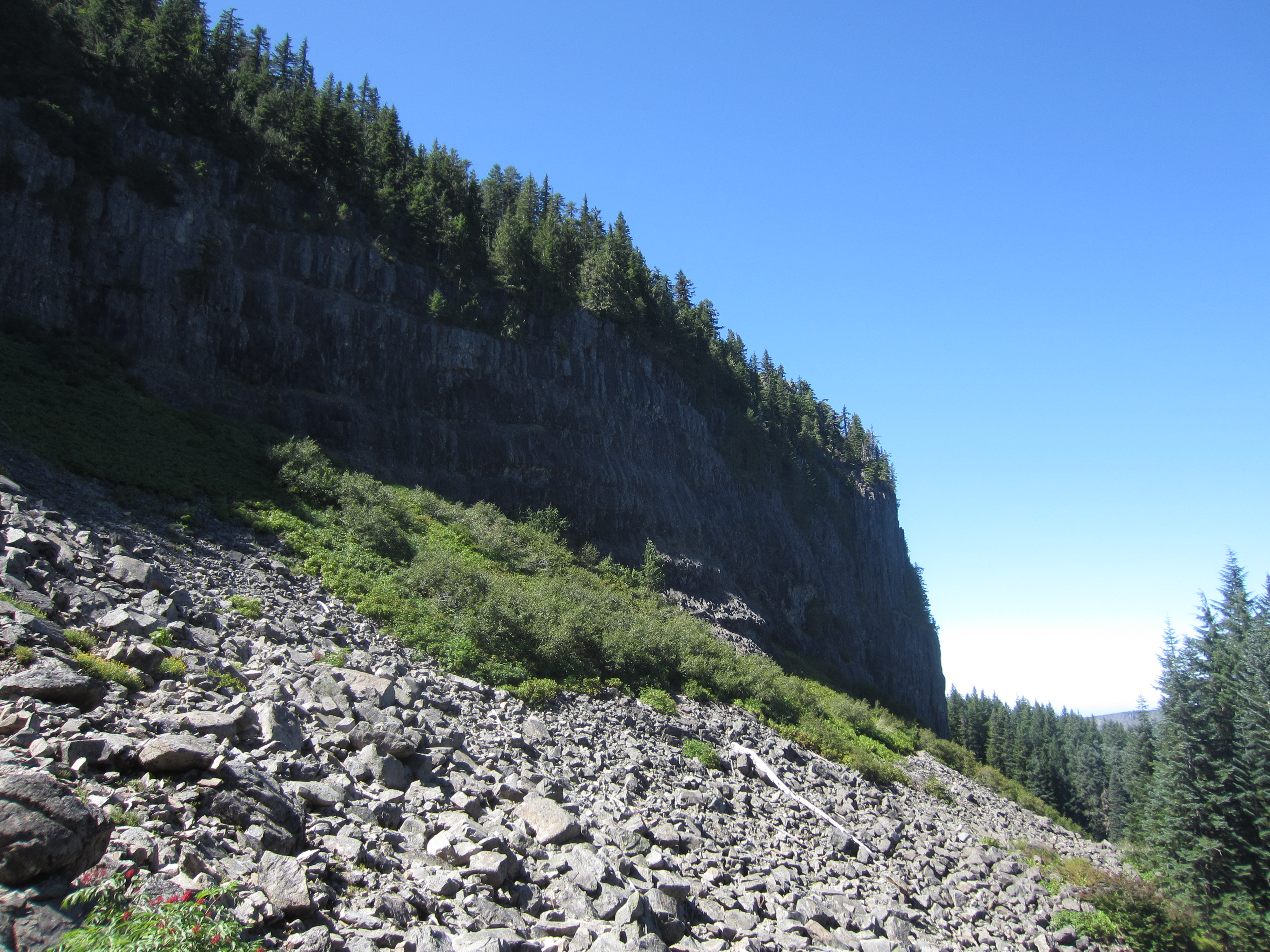
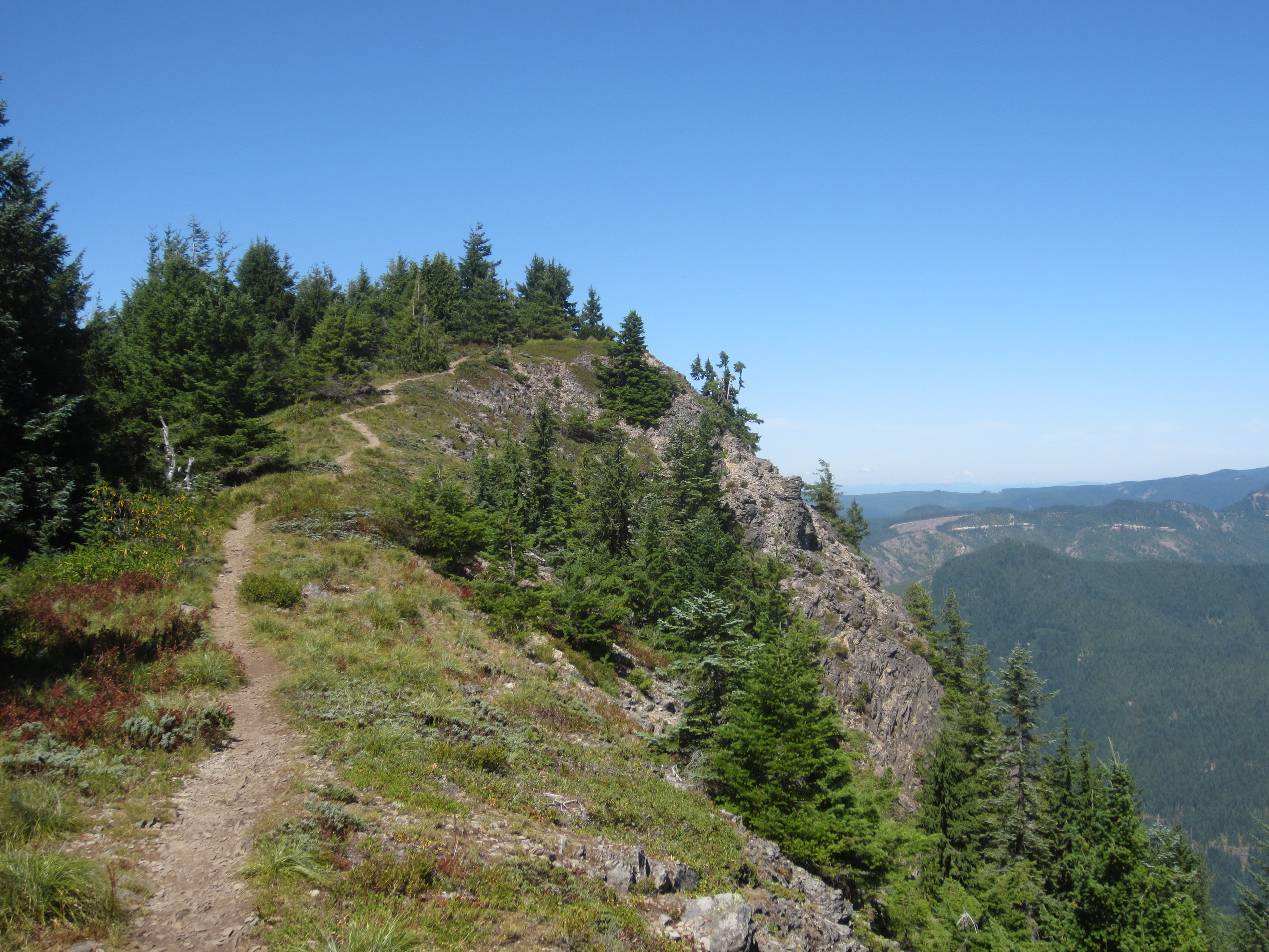
Overview: Table Rock is just south of Mollala OR. Although it is in the Table Rock Wilderness Area, active logging occurs in the area. Watch out for log trucks! This is a popular hiking destination so expect to see a lot of hikers on the weekend. On a clear day, Mt Rainer to Mt Mount McLoughlin can be seen. The east side of Table Rock has the 1000 ft cliff face seen in most pictures.
Getting There: See SummitPost.org for some good pictures, trail descriptions, and logistic information. Once you turn off the paved run (left) on to the gravel road, IGNORE the SummitPost.org directions. In November 2019 there were good signs directing you to the Table Rock Trailhead - however, in years past there were none, so take these directions with you. Go approximately 2 miles and turn right at a FS Rd cryptically marked "E-41-?" . There is a very "new" concrete bridge crossing the Table Rock River. The turn to the Table Rock Trailhead is 1/4 mile before that bridge. See for a current map of the area. Keep left at the next intersection (about 2 miles) and continue to the deadend/trailhead about another 2 miles. This is a 3.5 mile/1300 ft elevation gain hike.
The trail starts out on an abondoned road for 1 mile then turns steeply into the forest for about 1-1/2 miles until you come to a boulder field at the face of a basalt cliff. Boulder hop to the west thru the salmon berry bushes and descend for a while. Then start a climb again thru the forest with a sharp left turn at a trail junction. About another 1/2 mile to the ridgetop summit.
Red Tape: None. No Parking Permits required. Parking is limited to about 10 cars or so at the trailhead without much room to turn around. There is a vault toilet at the trailhead.
When To Climb: Summer and Fall. There are a lot of deciduous trees so this area would be beautiful during the fall leaf color change.
Caution: Watch out for log trucks! The Summit is exposed if the wind is blowing.
GPS Track: See my Motion X webpage for a .gpx trail file.
Forest Service/Mountain Conditions: Salem District Office of the BLM (501.375.5646) or http://www.or.blm.gov/salem
FM Repeater Coverage: The Mary's Peak 145.13 repeater is full strength. There are a number of folks (WB7AYC) that monitor 146.52 with loud signals.