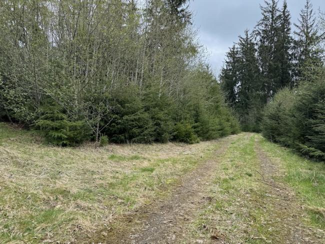
Bill's writeup for Cougar might instill fear to those activators who refuse to drive through open gates. Fortunately, there is a gateless route that makes this a pretty easy-to-access peak, and it deserves some more activations.
The gate-free route also applies to nc122 and Cole nc056; all 3 are easily accomplished in a day, and are Prius-able if you are willing to drive about 30 miles of gravel total.
The road to Cougar is about 11 miles of gravel one-way, just a few potholes mainly on the back half, and can be driven in a passenger car. I saw a lot of evidence of blowdown cleanup, so as with most forest roads in the Tillamook/Clatsop, maybe don't try to do this one right after a winter storm.
This gps route is posted to Sotamaps/SOTLAS.
Start on Hwy 26, take the turn south onto Hwy 53 and travel just shy of 1 mile to turn left on Hamlet Rd (paved). After about 3.5 miles, turn right onto the graveled Hill Rd. The rest of these points are given as distance starting when tires hit gravel:
- At 1 mile (45.8476, -123.7139), you'll enter a public easement into private land. No gate, just a sign saying "stay on the surfaced road" - this is the Hill Family Ranch property and the likely provenance of Hill Rd's name.
- At 2 miles (45.8361, -123.7058), stay straight/left at the fork. Take note of the turn to the right/west as that is Cole Mtn Rd which is the route to -- you guessed it -- Cole Mountain.
- At 2.5 miles (45.8325, -123.7090), stay straight but take note of the fork to the left. That is Section 8 Rd and will take you to NC-122. Note that the drive from this intersection to the summit of nc122 is only a mile, so if you want to activate it first, it's very doable.
- From here on, the road travelled to reach Cougar will be a backtrack if you want to do the 3-fer.
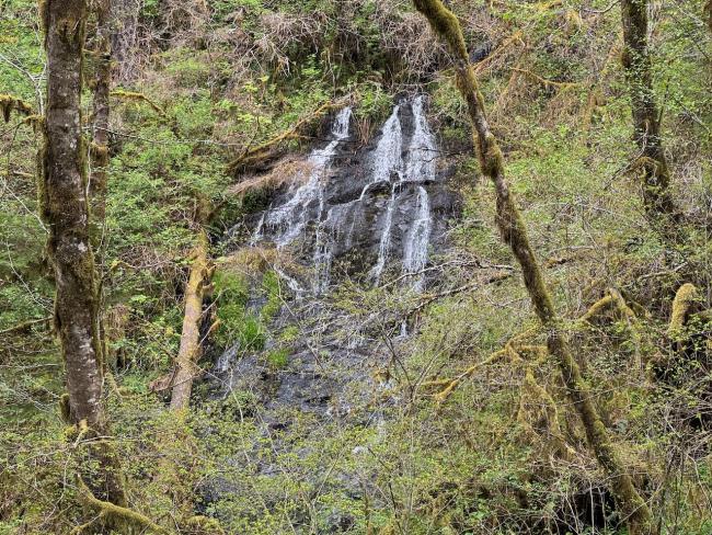
- At 3.5 miles (45.8200, -123.7029), the property returns to Clatsop State Forest public land, and somewhere around here the road changes names to Fall Creek Rd. Over the next mile of the drive there are some lovely little waterfalls to the left and right.
- At 5 miles (45.8070, -123.7057), fork left on to North Fork Rd
- At 6.2 miles (45.7993, -123.6902), turn left onto Hopinhome Rd
- At 9.3 miles (45.8184, -123.6592) is an intersection complex; you'll skip the first right turns as you arrive, but follow the main road that forks gently to the right as you exit. The exit has a slight climb and becomes Mountain Rd.
- At 11.2 miles (45.8334, -123.6351), turn right at the tee then follow the curve around to the left
- After a few hundred feet, turn right at the intersection, then park just ahead at (45.8355, -123.6341)
The final approach to the summit is less than a quarter mile walk and less than 100ft of gain. You can drive it, but there are some encroaching trees.
The summit area is still solid forest with the approach road cutting through the center and some decent open patches. Plenty of space for setup.
Travel back to Section 8 Rd to get nc122. If you are doing Cole as well, you can either take Cole Rd from the intersection with Hill Rd, or you can backtrack all the way north to Hamlet Rd, go 1 mile back up the road, and take Cole Mountain Ridge Rd south starting at (45.86625, -123.7340). The two routes are nearly equivalent, but the south route from Hill won't have backtracking and the views are better.


