There have been quite a few activations for this 1 point summit in Snohomish County near Sultan, WA... With it staying light much later, decided to try an after work activation.
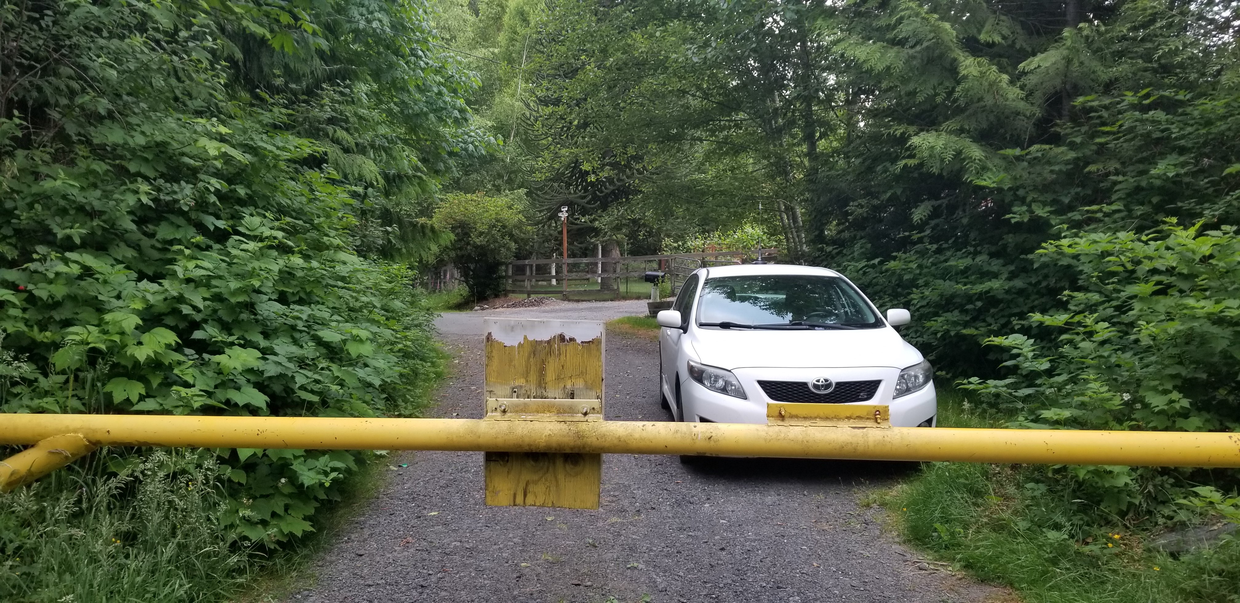
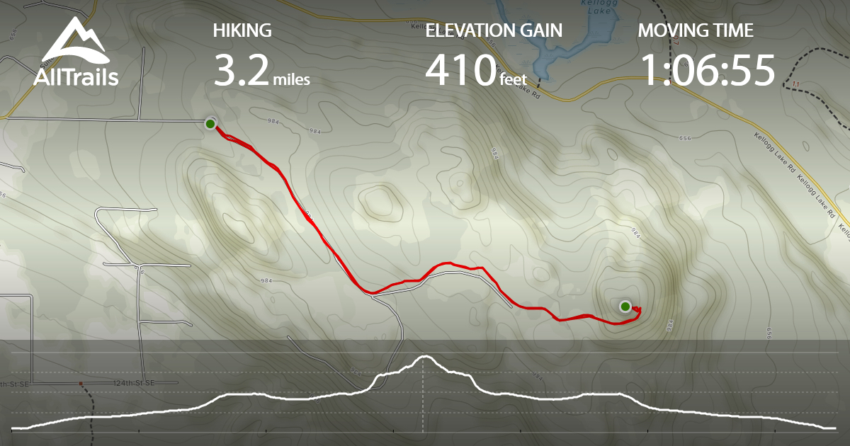
Heading East on Highway 2, you will start going through Sultan and then turn left onto Sultan Basin Road. After 2.6 miles on Sultan Basin Road, continue straight onto 112th St SE. In .6 miles you will be at the closed gate, and ready to begin hiking 3.2 miles round-trip with 410 feet of gain. There is very limited parking at the gate (please see picture). No passes were required, and the gate said day use / non motorized use permitted.
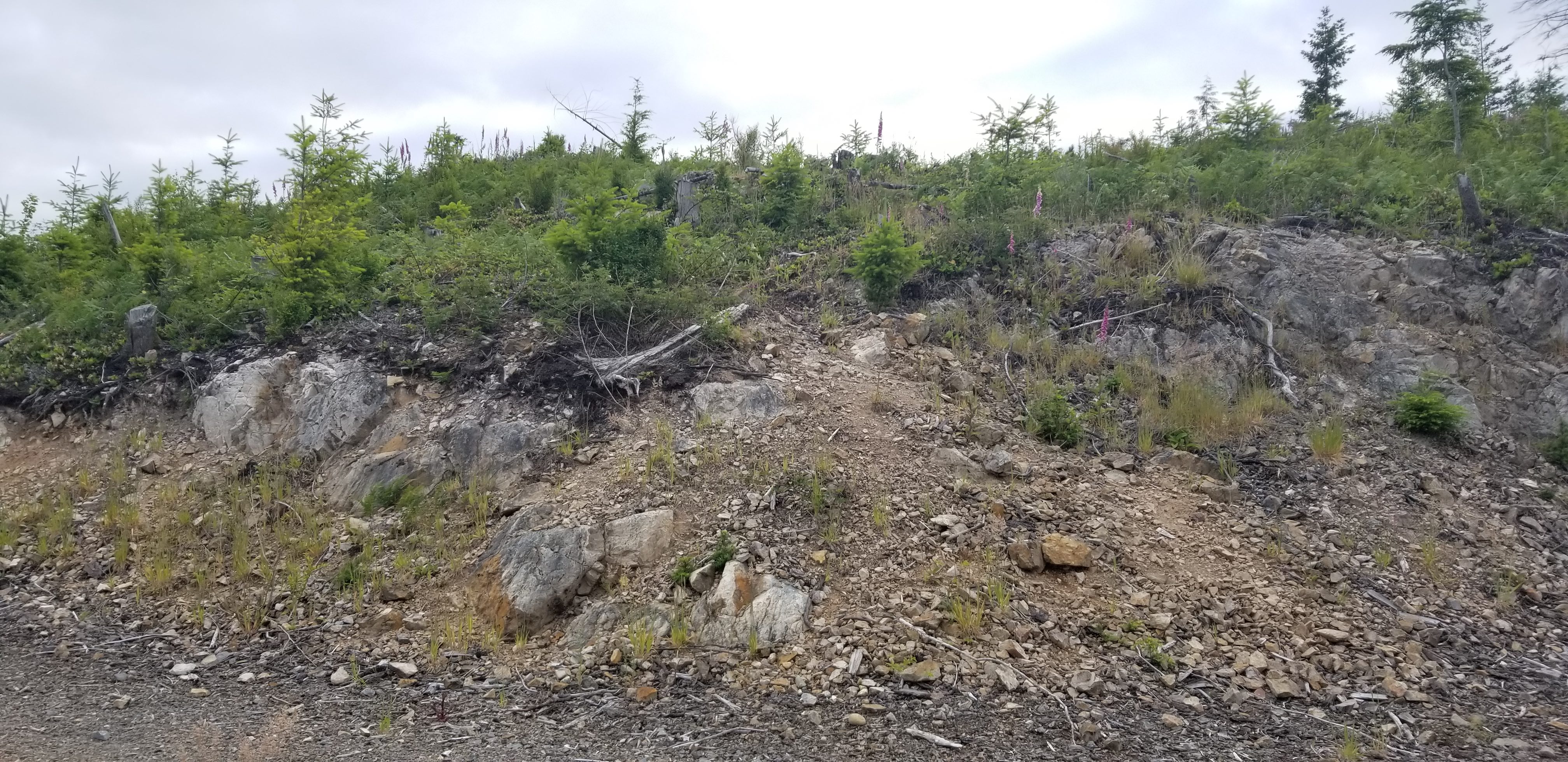
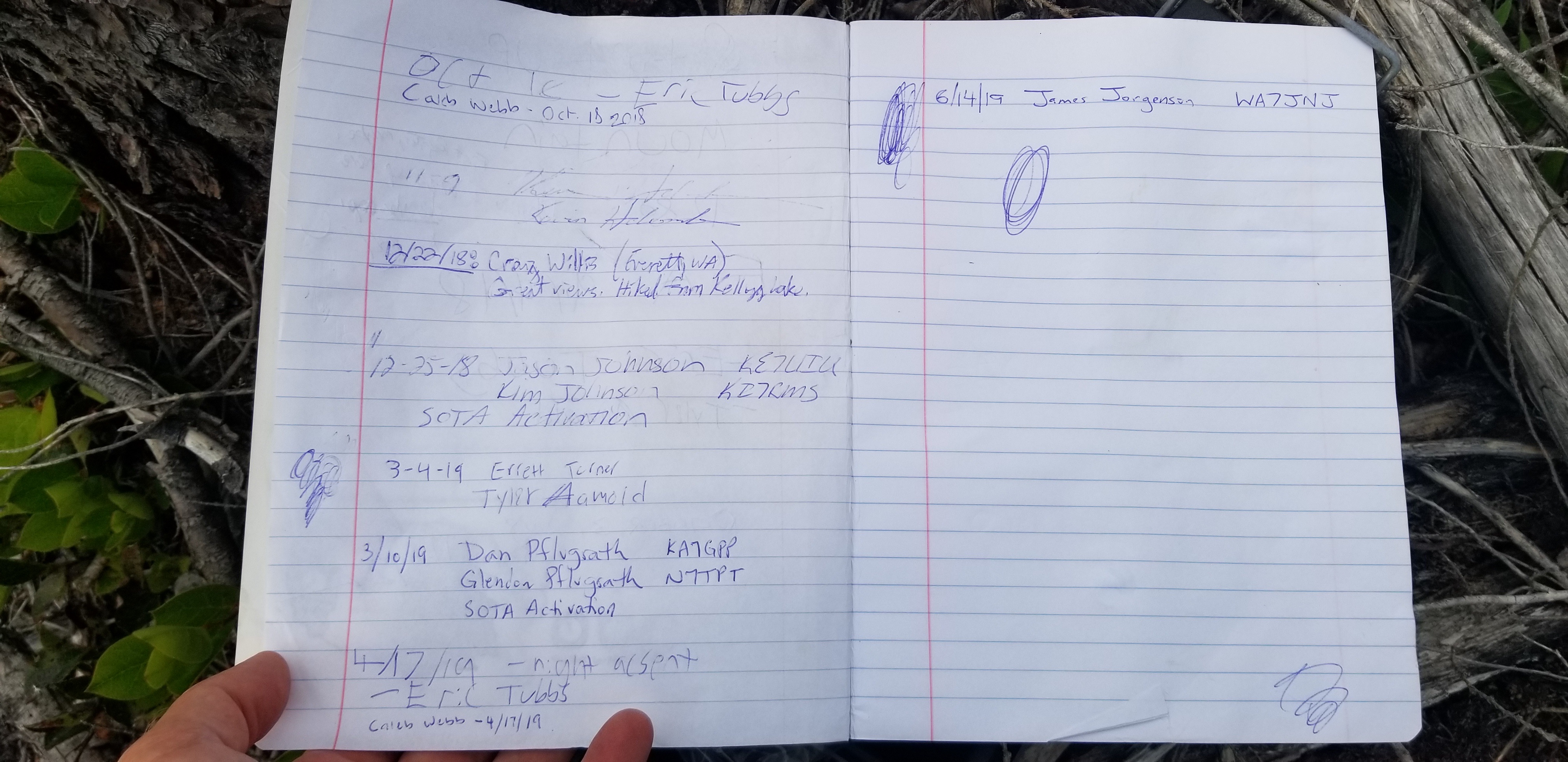
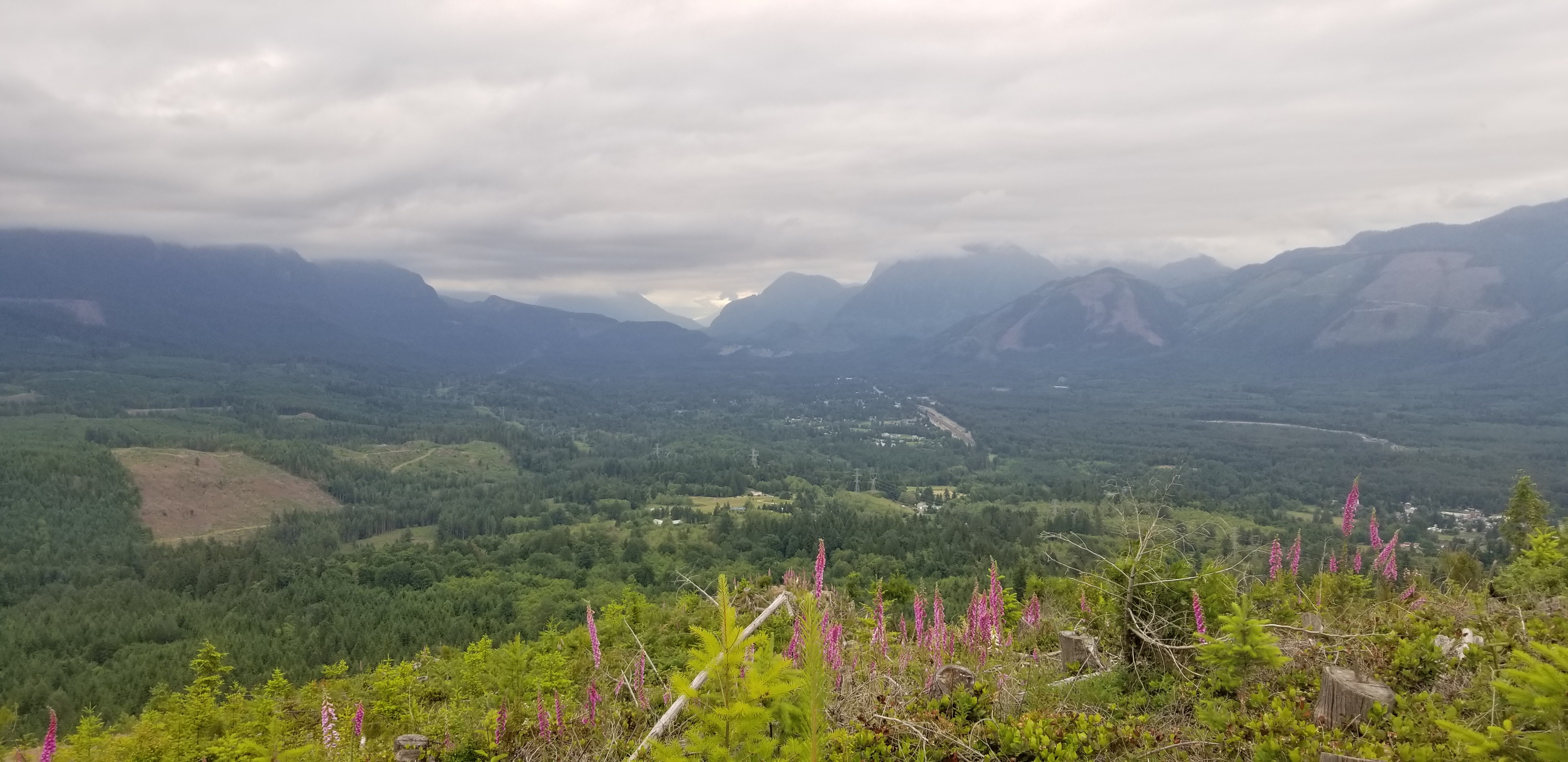
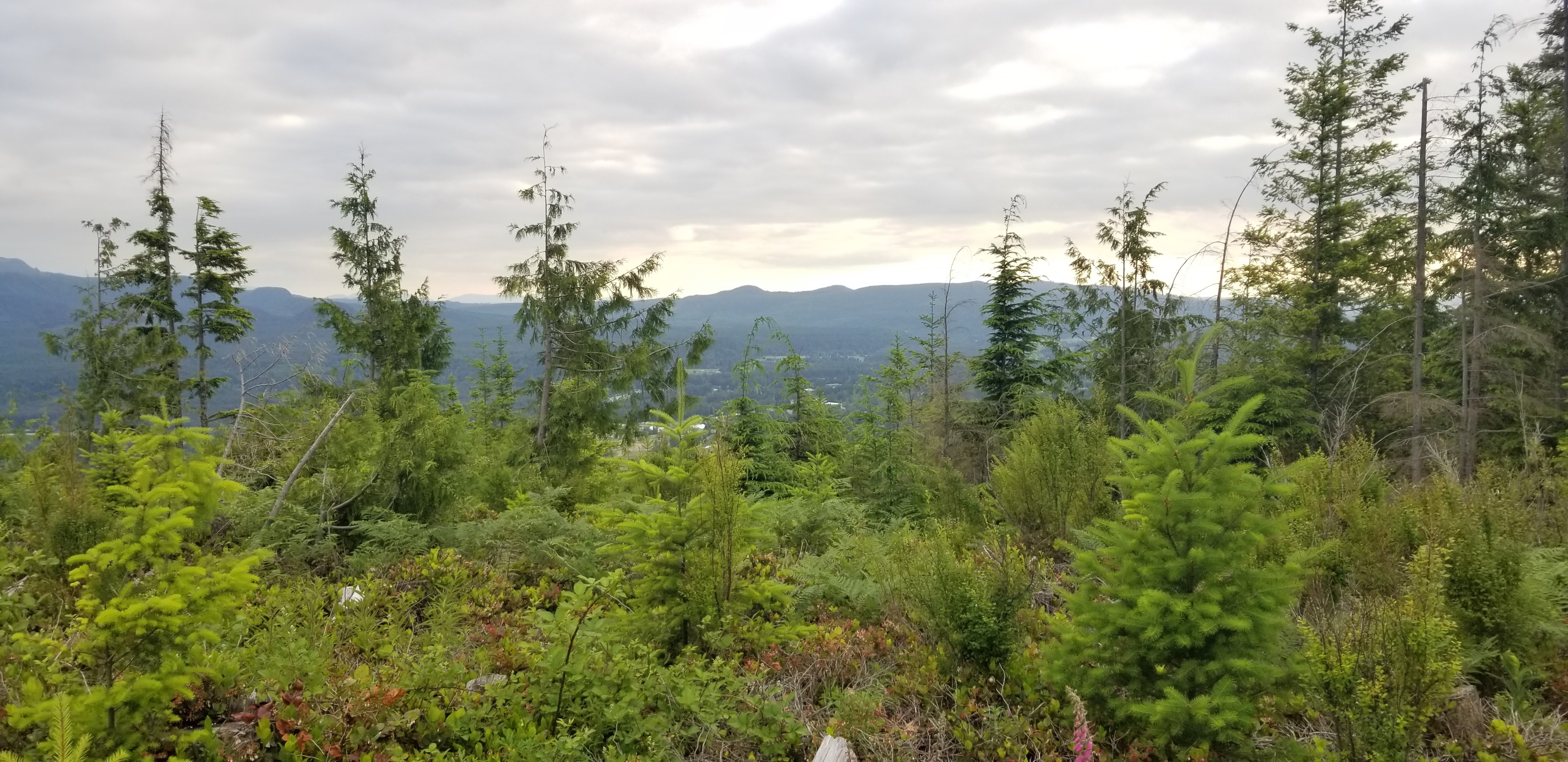
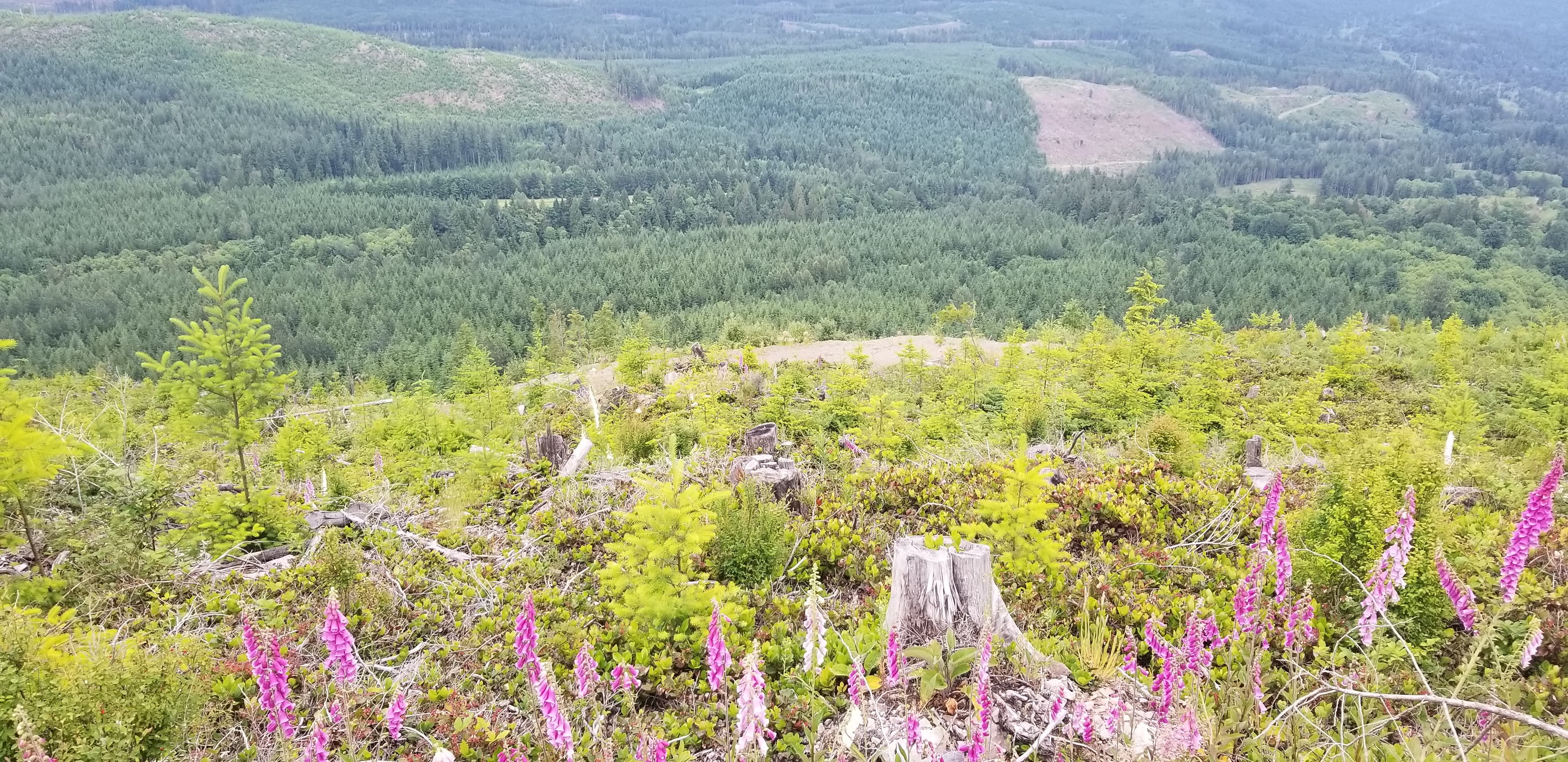
Most of the 1.6 mile hike to summit was on logging roads, and only the last ~100 feet were off trail. For a 1 point summit, views were nice looking NE, East, South, and West. Summit was open with low vegetation. After signing the summit log, I leaned an extension mast with J-pole antenna against a stump. For a Friday night, was excited that able to send SOTA spot via app, and made 5 contacts. 4 contacts were very clear in Bothell, Lynnwood, Everett, and Port Townsend. Thank you to KG7EJT, N0PBR, KG7SXF, AA7FY, and K7SCN!
Below is Alltrails tracking, and please see pictures and comments for additional info.
https://www.alltrails.com/explore/recording/recording-jun-14-07-55-pm?p=-1