3820 Mt. Transponder involves a long drive on forest service roads followed by a very short bushwhack to the top of a forested summit that is deep into the western part of the Gifford Pinchot National Forest. This summit can be combined with nearby 3780 Top Loaded Mtn (W7W/PL-089) for an easy twofer. The roads are easily tackled by a Subaru, but probably not a Prius.
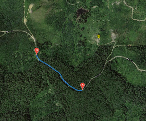
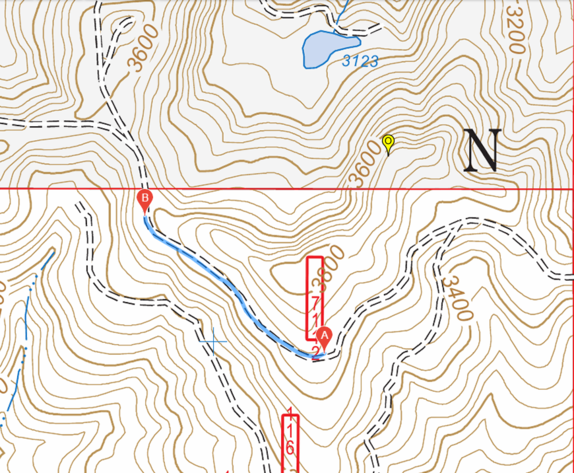
Josh, WU7H, and I attempted this first activation in early August 2021. Our intel suggested that we might drive to a ledge just off the main road that was potentially in the activation zone at the Northeast corner (point O on the maps below). Alas when we got there, we could not convince our eyes or our GPS devices that we were within a continuous 82' ring of the activation zone. We were close, perhaps right at the elevation of the AZ. But the terrain seemed to descend in all directions toward the summit, putting us outside the AZ. So a bushwhack was in order.
We first tried following an abandoned road, visible in the aerial view, that likely would have taken us to the summit. But the road was not good, with slash, thorny plants and dense ground vegetation that made it difficult to see where one was stepping. Next, we tried going through the trees, but this was worse as there were many young conifer trees that rendered the route nearly impenetrable.
We decided to try the west ridge next, with easy parking where the road is blocked by a Weyerhaueser gate (point B on the maps). The ridge ascends nicely here, but it was blocked by recently cut trees for quite a distance along the ridge. Our third attempt was up the south ridge (point A). This proved to be an easy and short hike, over a fairly clean forest floor. The hike was ¼ mile and about 200 feet of elevation gain. We stopped about 20 feet short of the summit to avoid going through a wall of Devils Club.
Cell data service was spotty. We managed to make three easy 2m QSOs before setting up HF. There were plenty of trees for wire antennas. The trees were sparse enough to make setting up a dipole easy.
Getting there: From I5 take highway 508 about 20 mile east through Onalaska and just past Cinebar. Turn left (north) onto FS71 (46.6047, -122.5052) and follow it about 12 miles to the intersection of FS7112 (46.6779, -122.4512). Turn left onto FS7112 and head west for 1.5 miles to the high point in the road (46.6730, -122.4736). There are places to park along the road.