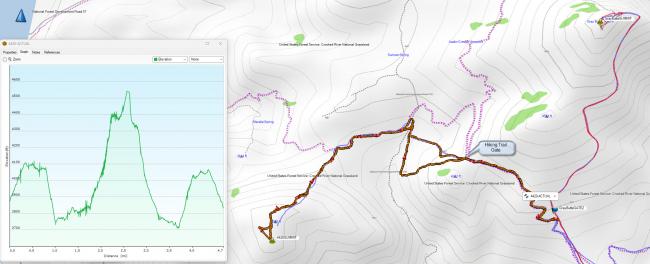
This is an alternate summit route to what W6PZA wrote up here: http://www.pnwsota.org/blog/w6pza/2020-november-30/summit-4420-or-november-2020 . You can take the Cole Loop Trail 854 that crosses the road near the second gate on the road going up to Gray Butte. From the intersection of the road and Cole Loop Trail and back to that point is about 4.5 miles and 1500 vertical feet.
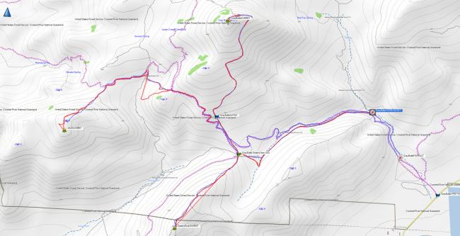
Images of my GPX tracks are below, blue is planned route and orange is my actual. You can see I probed horizontally at the Cole Loop trail gate to see if I could save descending into the valley to then climb back up, but it did not look like a good route. I suggest following the trail straight down the hill after going through the gate, that is the way I returned.
After you leave the tail to head to the summit, it gets steep and keep in mind that you are heading up to a false summit. Once you get to what looks like the top, there is another small walk and ascent to get to the summit proper.
On the January day I activated, there were 25-30 mph winds on the summit ridgeline, I was fortunate to get enough 2M contacts via my HT in the Bend area on 146.580. There was one chaser that monitored SOTA Watch spot, then he got on the repeater for me and routed a few guys over to my frequency. I posted summit pictures to SOTA Atlas.
I did 4420 after activating Gray Butte, then on the way out, I activated Sisters View ( http://www.pnwsota.org/blog/k7atn/2019-july-06/sisters-view-or-peak-4260-may-2014 ). I started my hike at the seasonally locked gate at N44.40761° W121.07348°. The entire three summit trek was a bit over 13-mile hike and approximately 4400 feet vertical.


