Depending on how far you choose to drive, Gray Butte will be a 1.4 mile road hike (OW) with about 1200 feet gain. There's another summit that could add another two points with 1.8 miles of hiking. Although I was thinking that the road might require high clearance, a Prius drove up after me - so know your vehicle.
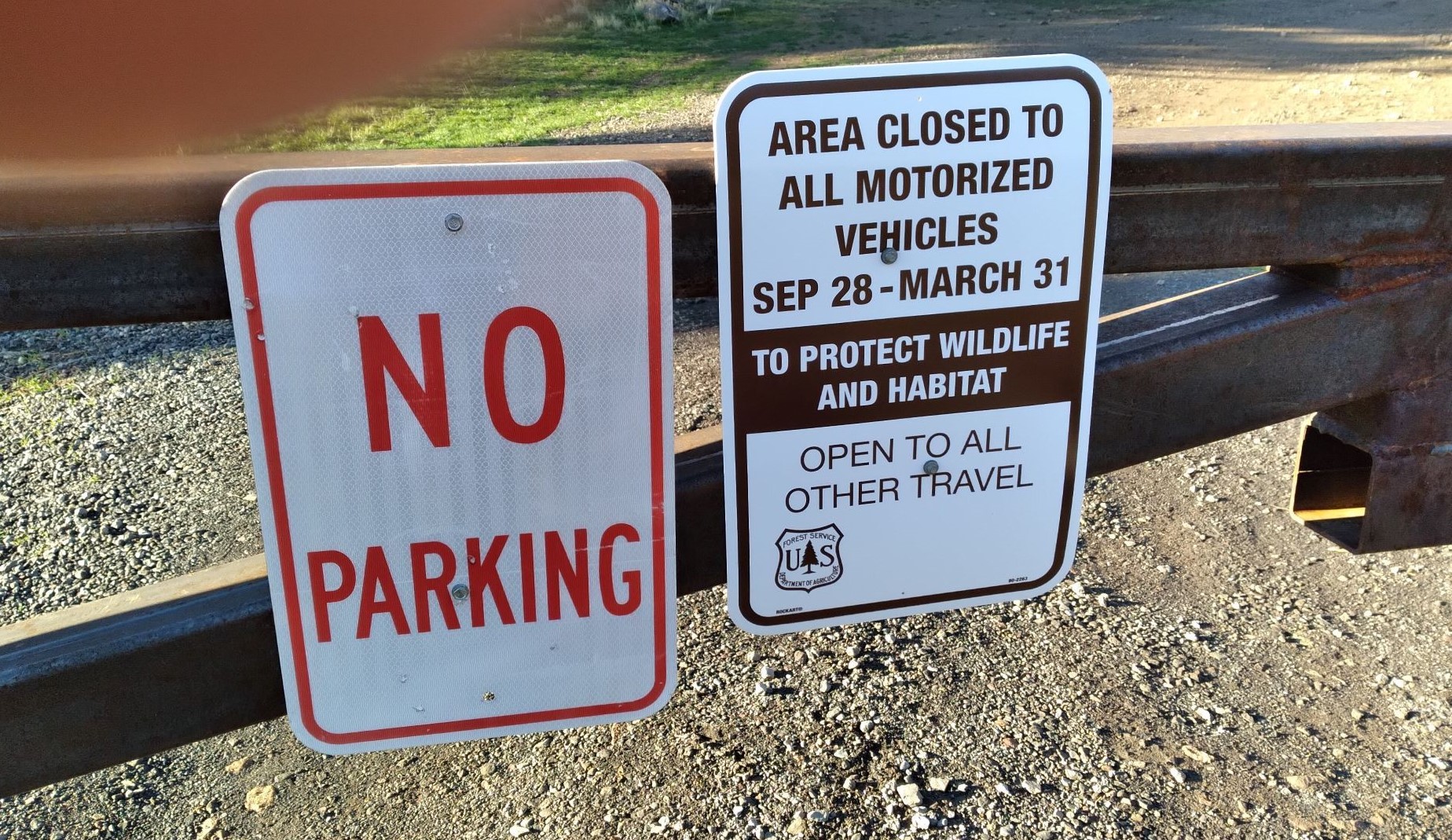
There are seasonal road closures for Gray Butte and Peak 4260 that will add several miles of road walking betwen Sep 28 and Mar 31 - see the photo below. This summit is near several others that are not behind a gate, Grizzly Mountain-W7O/CE-135 and Pine Ridge-W7O/CE-208.
From Prineville go 13 miles west on Highway 26 or from Madras travel east also about 13 miles on Highway 26 and take Lone Pine Road and proceed south. Turn left onto Skull Hollow Road (Forest Service Road 5710). Skull Hollow Campground will be on the left.
From Skull Hollow Campground, head NW on NF-1395. After about half a mile you’ll pass a parking area near 44.401, -121.068 where you can take a trail that will parallel the road if you prefer hiking. After 1.1 miles, turn left onto another dirt road where you'll see a large gate.
After 1.5 miles more, you pass an “intersection” near 44.3997, -121.0982 where it's likely best to park. Peak 4260 - W7O/CE-303 is only 0.9 miles south on a very rough dirt road. You may also wish to camp here.
For Gray Butte continue past this intersection on the main track where you will find a gate after 0.4 miles near 44.4047, -121.1024. It would be best to park several tenths before the gate. From the gate the road hike is 1.4 miles to the summit.
This summit can be a popular destination. There's a bunch of RF sites on the summit but no interference was noticed. The Gray Butte Trail #852 does not go near the summit but winds around the west side.