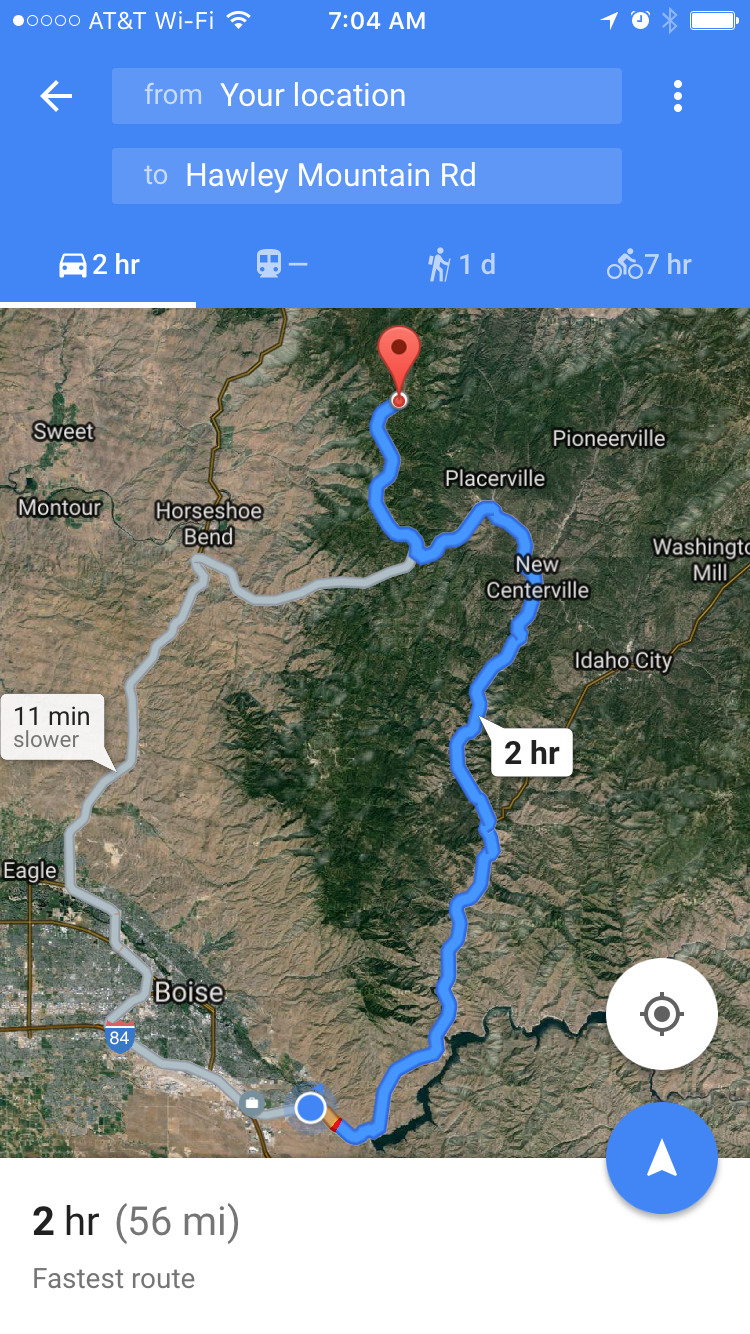
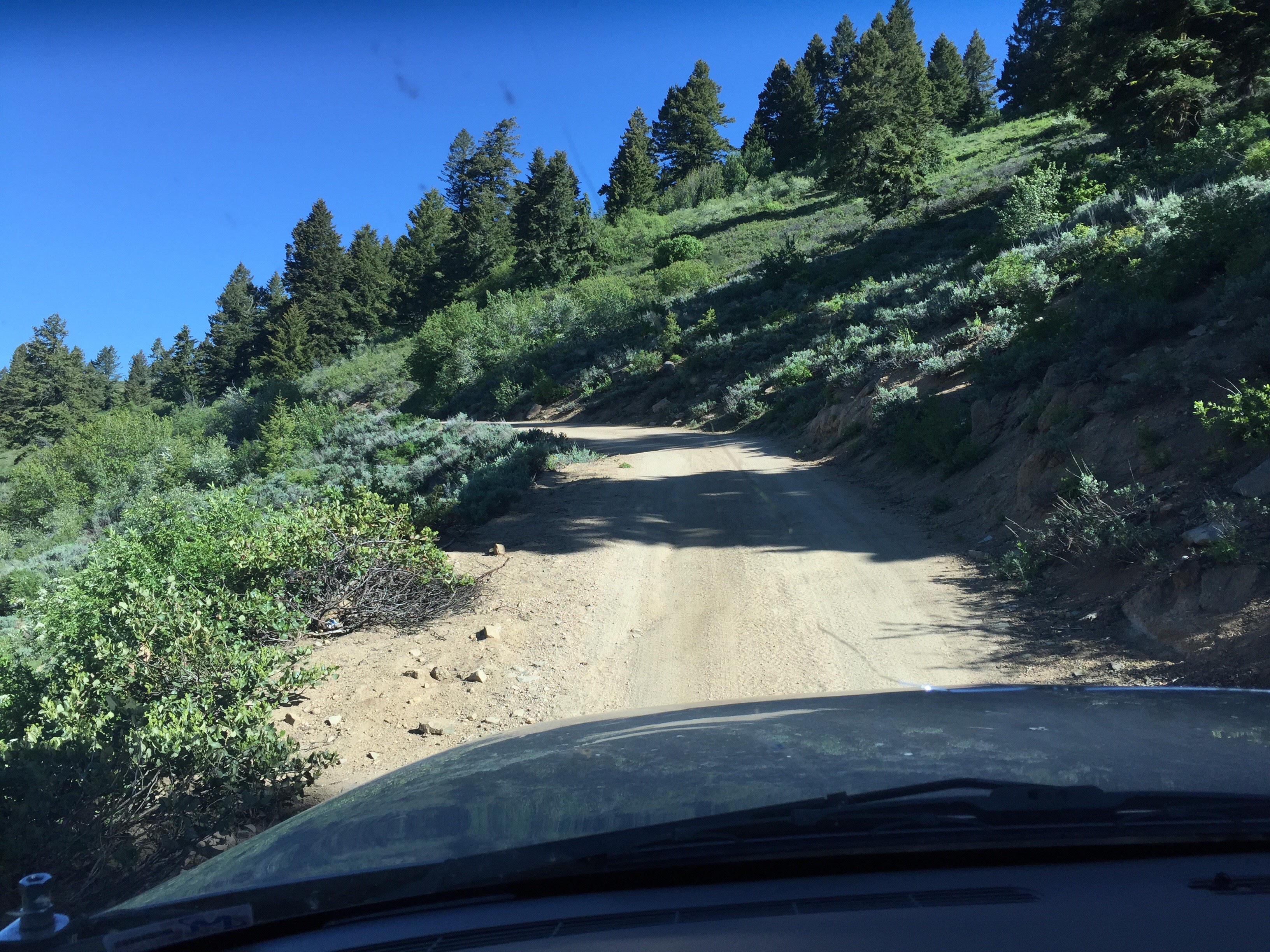
Peak 7057 is the first peak along the FS374 ridgeline north of the Harris Creek Summit. The second peak is Hawley Mountain (W7I/BC-069). Harris Creek Summit (saddle) can be reached from Harris Creek Rd. which connects Horseshoe Bend and Placerville, Idaho. It is a dirt road in good condition. From Harris Creek summit, FS374 is a resonably good single track road. SUV or other high clearance vehicle recommmended, but I did see a sedan parked at the base of Peak 7057! Minor rocks and ruts along the road so should be passable by most cars/trucks depending on your level of scraping desired.
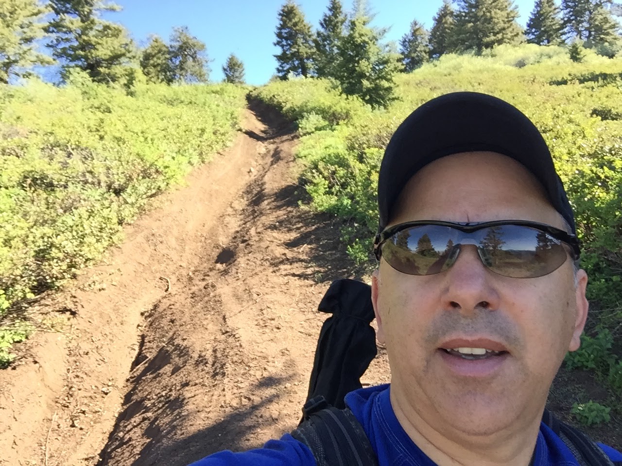
At the base of Peak 7057, where a trail/road heads up to the summit, there are a couple of parking/camp sites where you can leave your rig off the main road. The trail/road leading up to the summit starts off as a steep/rocky rut. Best to hike up this, but could be passable with 4-wheeler, RZR, etc or someone adventurous in an equipped Jeep. About half way to the summit the rut ends and the road becomes easier to navigate.
Distance to the summit from FS374 parking is 0.4 miles and 231 vertical feet. More data at the Strava report here: https://www.strava.com/activities/599492835
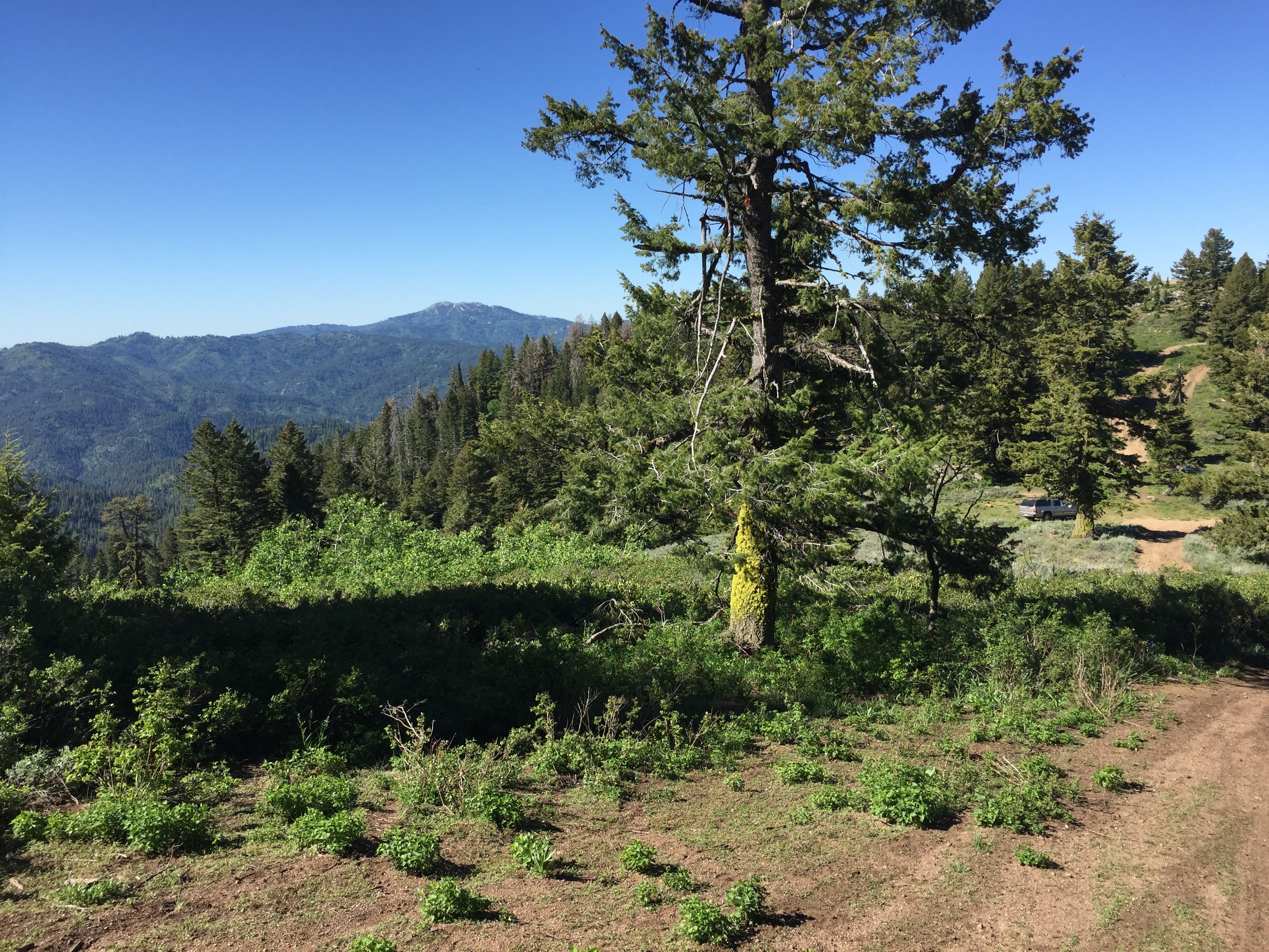
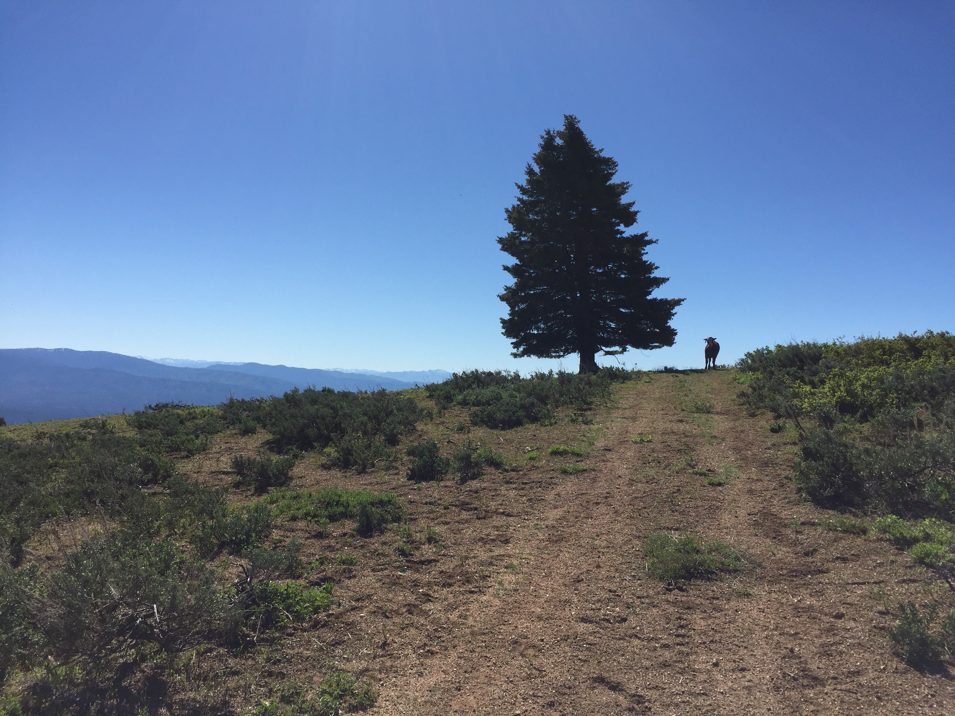
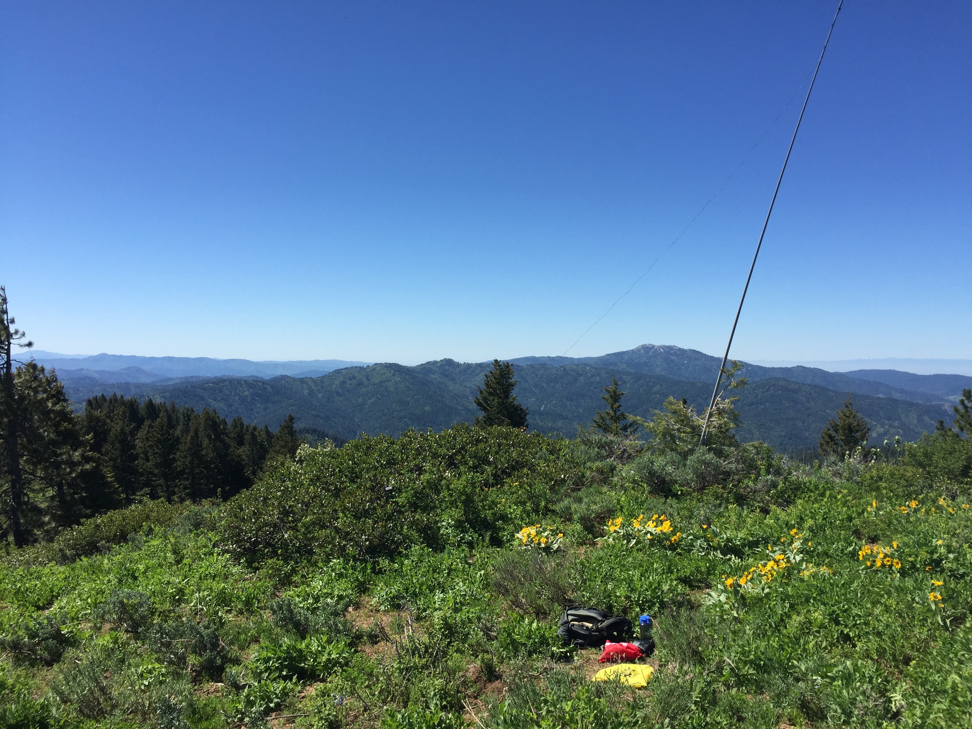
I was greeted by a lone cow about half way up to the summit. She occompanied me up the road to the summit, but wasn't quite sure if she wanted to get on the radio or not. I guess just looking for companionship as it appeared she was quite lonely seperated from the heard. The summit itself is rounded with plenty of options to setup a station. A few large trees are available, but I ended up trapping my sotapole to a shorter scrub tree near the SW side of the peak. Quite a bit of short scrub brush/weeds on the summit so I found a flat dirt spot to setup my gear. No shortage of biting ants though.
Cell coverage was "okay" at the summit, but would occasionally get a no signal. So finding the right spot was sometimes needed. APRS coverage was good from the mobile APRS system. Unfortunately, the Shafer Butte (Bogus Basin) digipeter is still offline (it would only be a ~5 mile trip). So a handheld APRS setup would have to make the trip to CNABAR (Owyhees) or SNOBNK (Cascade).
Great vistas from the summit. Also, this was my second CW activation since getting back into CW. Getting better at it, but still need some work!
More pictures here: https://goo.gl/photos/orVZjp3JQJbs63eEA