This is a 1-point peak in Stimson Logging land, accessible via a hike from their gate on the edge of the Clatsop State Forest. The majority of this hike is on gravel and grass logging road, but the last section of the approach requires a climb across open clear-cut land. This peak would combine well with NC-085 in the same day, as that peak can be accessed by some of the same forest roads without too much backtracking.
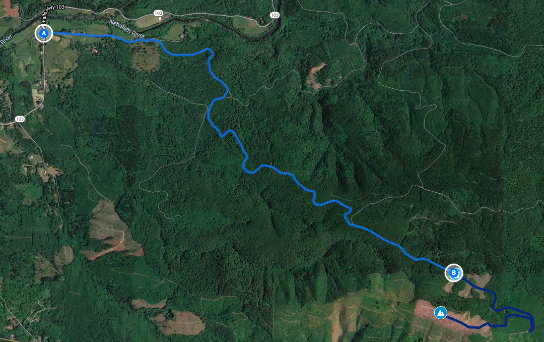
To drive to the gate, start at Mullenbach road off Highway 103 and follow along Military Creek Rd. As of this writing, asking Google Maps for directions from Mullenbach Road, Seaside, OR to (45.86607, -123.47419) gives the correct path. The gravel forest roads have the usual amount of potholes but are very passable in a passenger car.
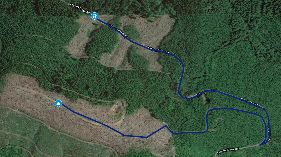
At the gate, begin walking down Military Creek Rd. Just short of a mile, take the switchback to the right onto another less used unnamed road. This road goes another half mile to the base of the clearcut area. Pick a good spot and start climbing in a general west-southwest direction.
From the base when you begin climing across the clearcut, it's about another half mile to the summit AZ. It's not very easy going, but it helps to look for the heavy machinery tracks (consult satellite maps) and follow those where you can. Trekking poles highly advised to aid with both the climb and descent. The total hike is about 2 miles one-way and 700ft elevation gain.
The clearcut is a desolate area over the whole AZ, but offers plenty of places to sit, setup gear, and get good views of the surrounding peaks. Some of the clearcut area was a little soggy in early April; I would wear good boots or trail shoes regardless, but plan to go only when the ground will be relatively dry.
There is a shorter route available (about 3/4 mile total) which is slightly more challenging: climb the slash slope immediately next to the parking spot, turn right/southwest and walk to the end of the road, then climb up through the forest at the end of the road. It'll deposit you right up into the AZ slash.