Twin Rocks is a pair of peaks above a ridge. The best access road is NF-54, from Carson, WA to nearly the trailhead for Soda Peaks Lake, then turn left on NF-34. NF-54 is almost entirely paved, but NF-34 is a lower-quality gravel road with overhanging branches and small rocks rather than large gravel. Having high clearance really helped, although a substantial distance could be made in a sedan, and the rest easily walked.
This is actually a pretty easy bushwhack - proceed on NF-34 to the saddle point between the twin rocks, at 45.8718, -122.0945, at which point you will find a road going west. I recommend hiking this, although if your vehicle can handle it, go right ahead. This road ends after an eighth of a mile or so, and you will be bushwhacking from here.
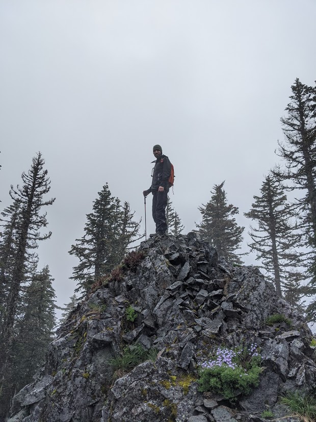
There is no clear path - you will be pushing through small trees and blueberries most of the way - but it is only a few hundred feet and a few tenths of a mile to the summit. Head from the clearing mostly north on the east side of the clearing, on the easiest path to the ridge, and follow the ridge along the path of least resistance. The ridge is the easiest path, usually, and the south side is much less steep (the north side is a cliff in places, it is not recommended). The summiot is two rock pinnacles, both climbable, at about the same height. I activated a little further into the trees away from that point, but I recommend taking advantage of all the height you can manage.
This is not a hard peak to bag, and I recommend it on any trip to Bare Mountain (W7W/LC-O61) or West Soda Peak (W7W/LC-052).