A short brushy hike will take you to this numbered summit near Ariel, Washington.
The gravel forest road route is Priusable all the way to the trailhead - although you'll be dodging a number of potholes. You'll circle all around the summit to come at it from the north. There is a brushy uphill bushwack included in the adventure. There is an alternative route through second growth marked with an X on the map below - that route isn't as pleasant.
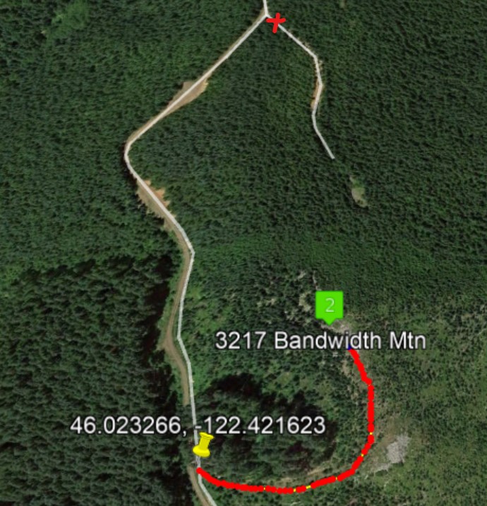
Get to Woodland, Washington and head east on the Lewis River Highway - 503 . About 7.7 miles east of the wide spot that is Ariel, turn left off the Lewis River Highway to Rock Creek Road and go about 3.6 miles to a sharp right turn. Continue on about 1.5 miles to keep left at a fork. Continue about 1.5 miles to a wide intersection and a right turn onto a somewhat narrower road - on this road you'll go about 0.9 mile to a bermed road on the left. Find a place to park near 46.023266, -122.421623. On foot you travel a closed road for about 0.2 miles through brush to the summit. There you will find plenty of trees for your wire antennas.
A Garmin GPS took us to this spot navigating the forest roads - YMMV. We easily worked two stations in Portland on 2m FM but am not sure you can count on stations with good VHF reception to get your four contacts.