The Hike
Devil’s Peak is located in the Salmon Huckleberry Wilderness area on Mt. Hood. The summit has an altitude of 5045 feet. There is a decommissioned fire lookout at the top (which is available for camping). There are a variety of ways of getting up there. I chose to take the Cool Creek trail, which is short (3.7 miles) but very steep (3200 foot elevation gain). I hiked up here on July 20th, 2019. Also see http://www.pnwsota.org/node/177 for another approach.
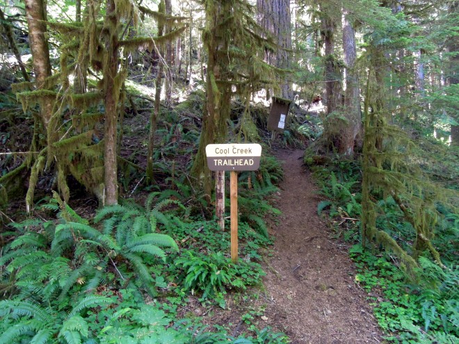
The trail starts steep. It does not change.
Roughly a year before this writing, a hiker was killed by a mountain lion in this area. When you’re in the wilderness, it is important to remember that other species make their homes here. Situational awareness is critical.
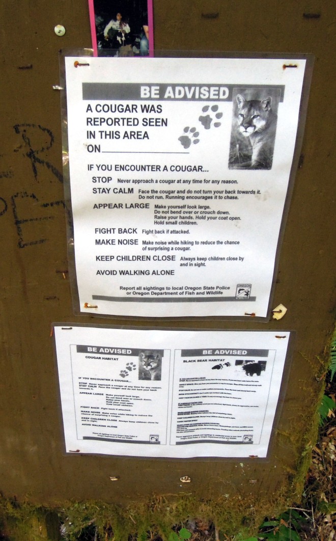
Stay vigilant.
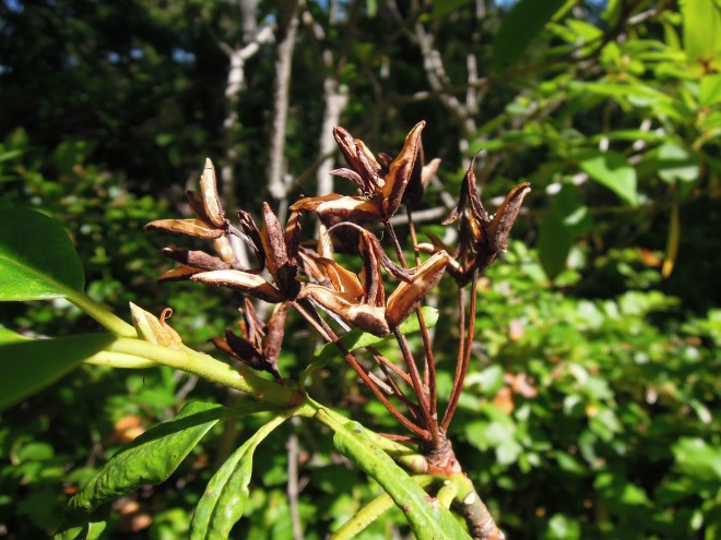
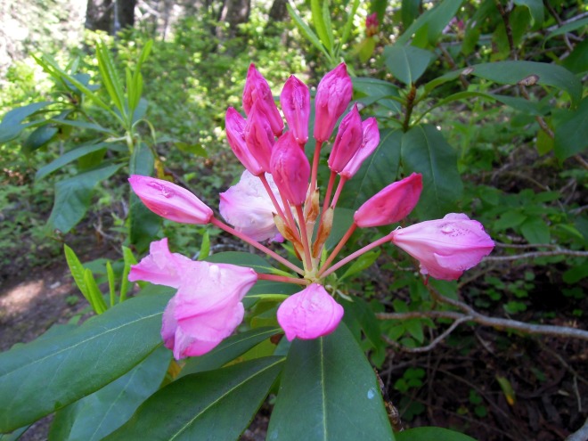
There are many rhododendron plants in the area. They tend to bloom in early June, but the remains of the bloom are still interesting.
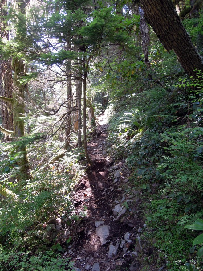
The trail continues in its usual steep, rocky character. There are multiple opportunities to trip and fall. Trekking poles are strongly recommended.
Onward and Upward
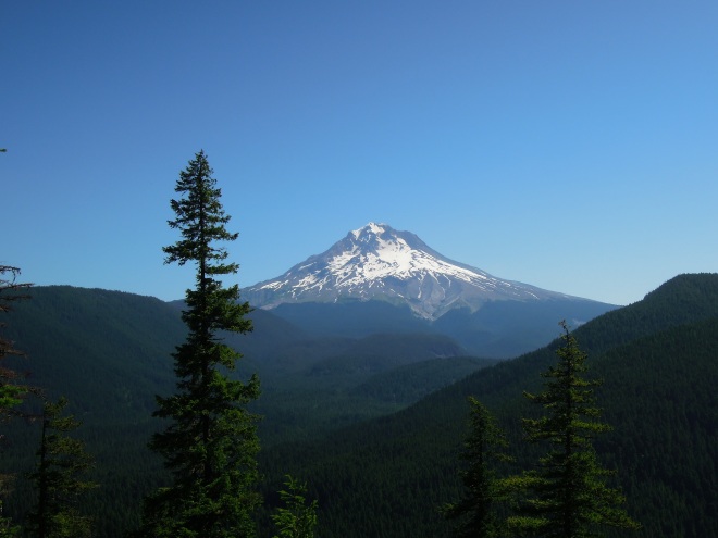
As time progresses, you are treated to a view of Mt. Hood.
Also, it looks like rhododendrons bloom later at higher elevations.
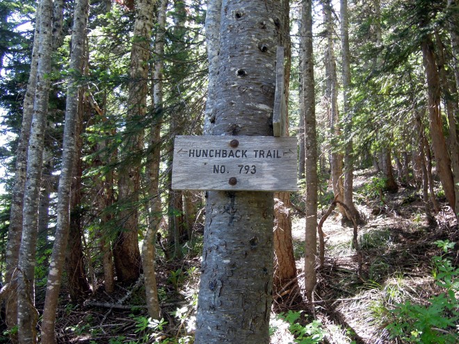
The Cool Creek trail meets the Hunchback Trail. To go to Devils Peak, hang a right.
A little bit further, and you’re almost there.
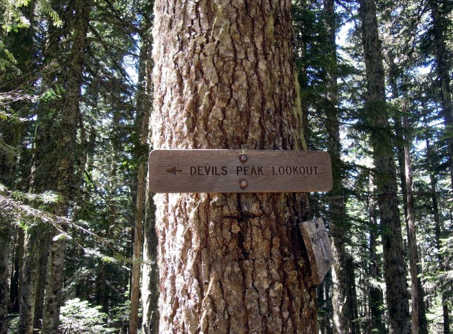
So close!
As soon as you emerge from the forest, the lookout is immediately visible.
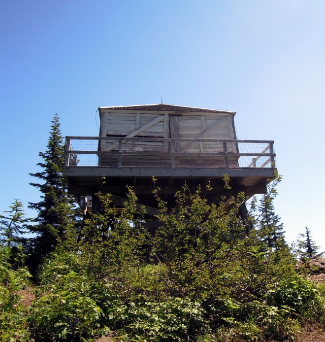
Success!
The lookout is no longer used by the Forest Service, but it is kept in serviceable shape and available to campers. I didn’t come equipped to camp due to time constraints, but I wish that I had.
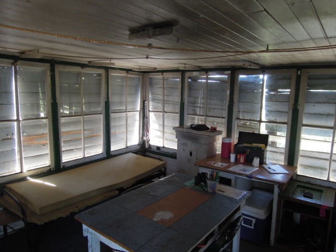
Although it isn’t shown in the photo, there is a woodstove in the lookout. I might come back out here in the fall for some solo time.
The SOTA Activation
Now, it’s time to get nerdy.
What is SOTA
SOTA stands for Summit On The Air, which is an amateur radio sport where hams take their radios into the field and make contacts for points. More difficult summits are rewarded with higher scores. Devil’s Peak is worth 4 points. Peaks have different identifiers. This one is W7O-CN033.
Equipment Used
I used very basic equipment for this activation, a Baofeng UV5RA and a roll up J-Pole Antenna. The Baofeng claims to put out 5 Watts (but it’s closer to 4). The antenna shapes the RF radiation into a donut shaped pattern (instead of a sphere) and sends the energy that would be going straight up and down outward. This is called gain. The J-Pole claims to provide 2.1dB of gain. Some quick math shows that this provides an effective radiated power of just under 6.5 Watts.
Contacts Made
I managed to get in touch with these fine gentlemen:
- K7FO – Bill, located in Welches, OR
- AG7TW – David, who was doing another SOTA activation of West Soda Peak up in Washington (W7W-LC052)
- AG7QH, Michael, in Salem, OR
- K7RMO, Rusty, in Sherwood, OR.
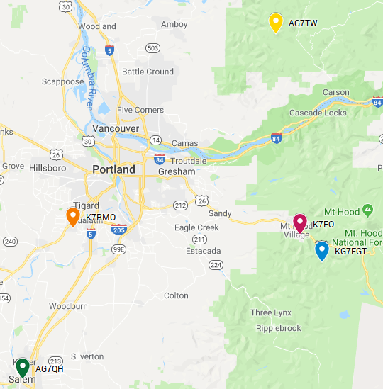
I put a map together to help visualize the distances of some of my contacts. Most of them were pretty far, especially considering the low end gear I was using.
Conclusion
This was my first SOTA activation, and it was pretty enjoyable. I’ve ordered a slightly less crappy Chinese radio that puts out more power, and I’m planning to build a Yagi antenna with a gain of 7dB. This should give me an effective radiated power of just under 40 watts. That should make for easier activations in the future.