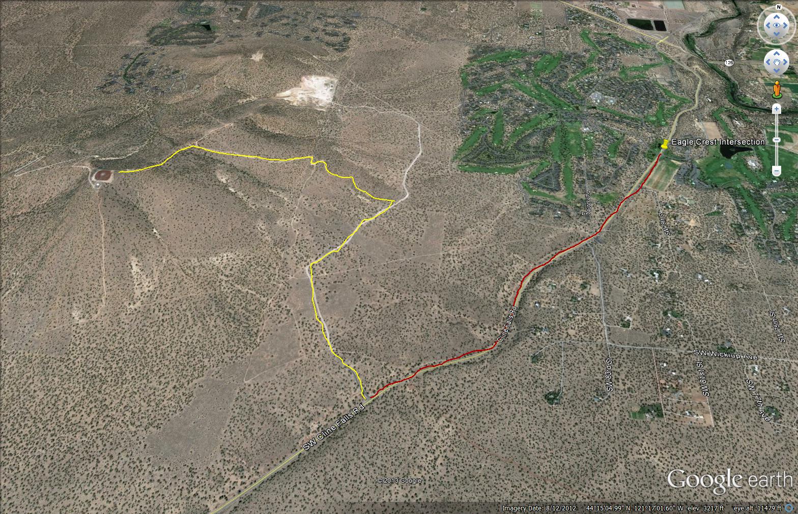
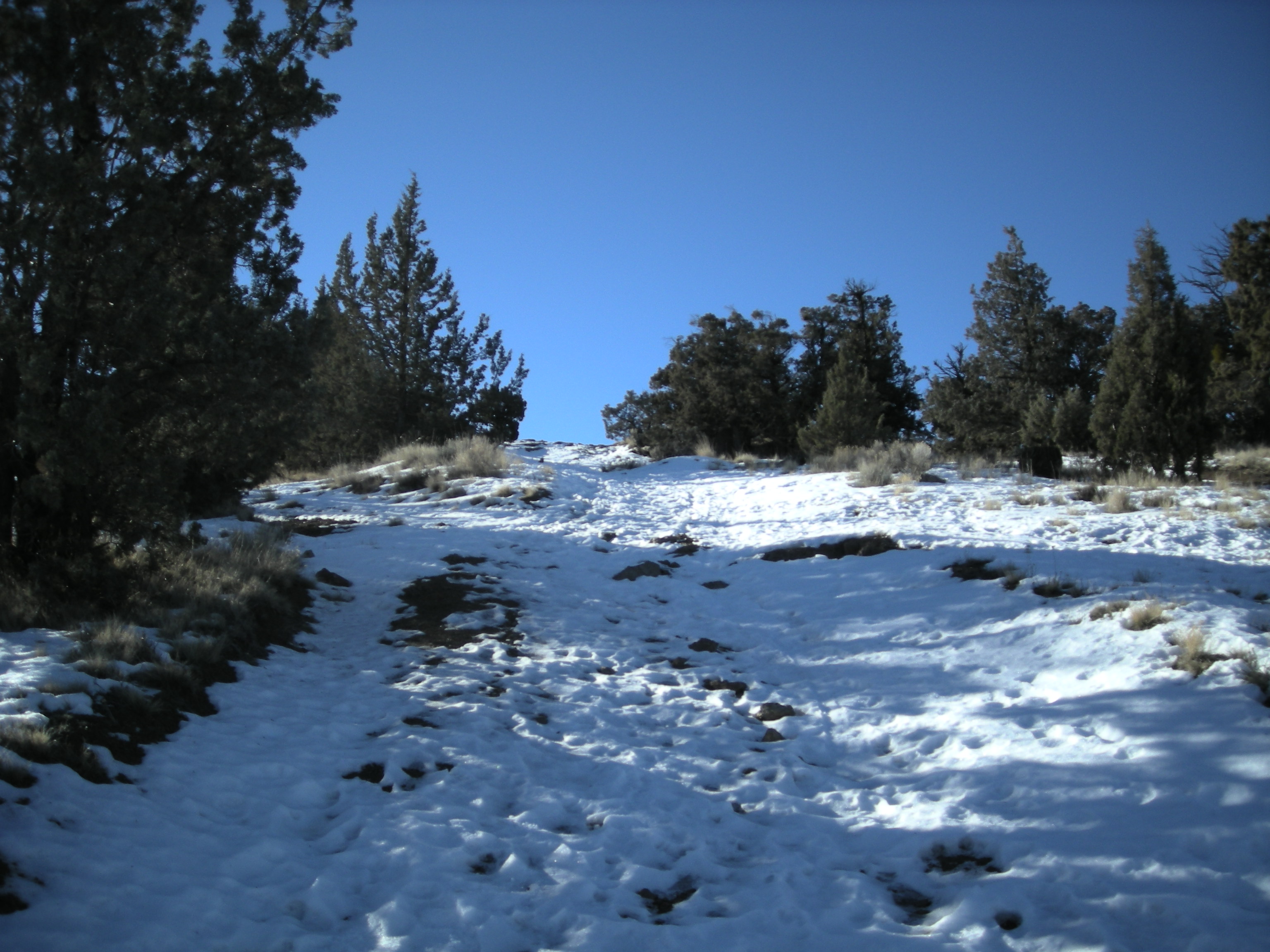
Spent the weekend at Eagle Crest just outside Redmond, Oregon and decided to activate Cline Butte which is nearby on MLK Day. Left the trailhead at 08:00 with very cold (25 degrees) clear conditions with patches of snow on the ground. Followed a road most of the way to the top then cut off on a jeep trail the remainder of the way. Trip up is a little less than a mile with a 800 ft elevation gain. I added a map from Google Earth with the route I took up.
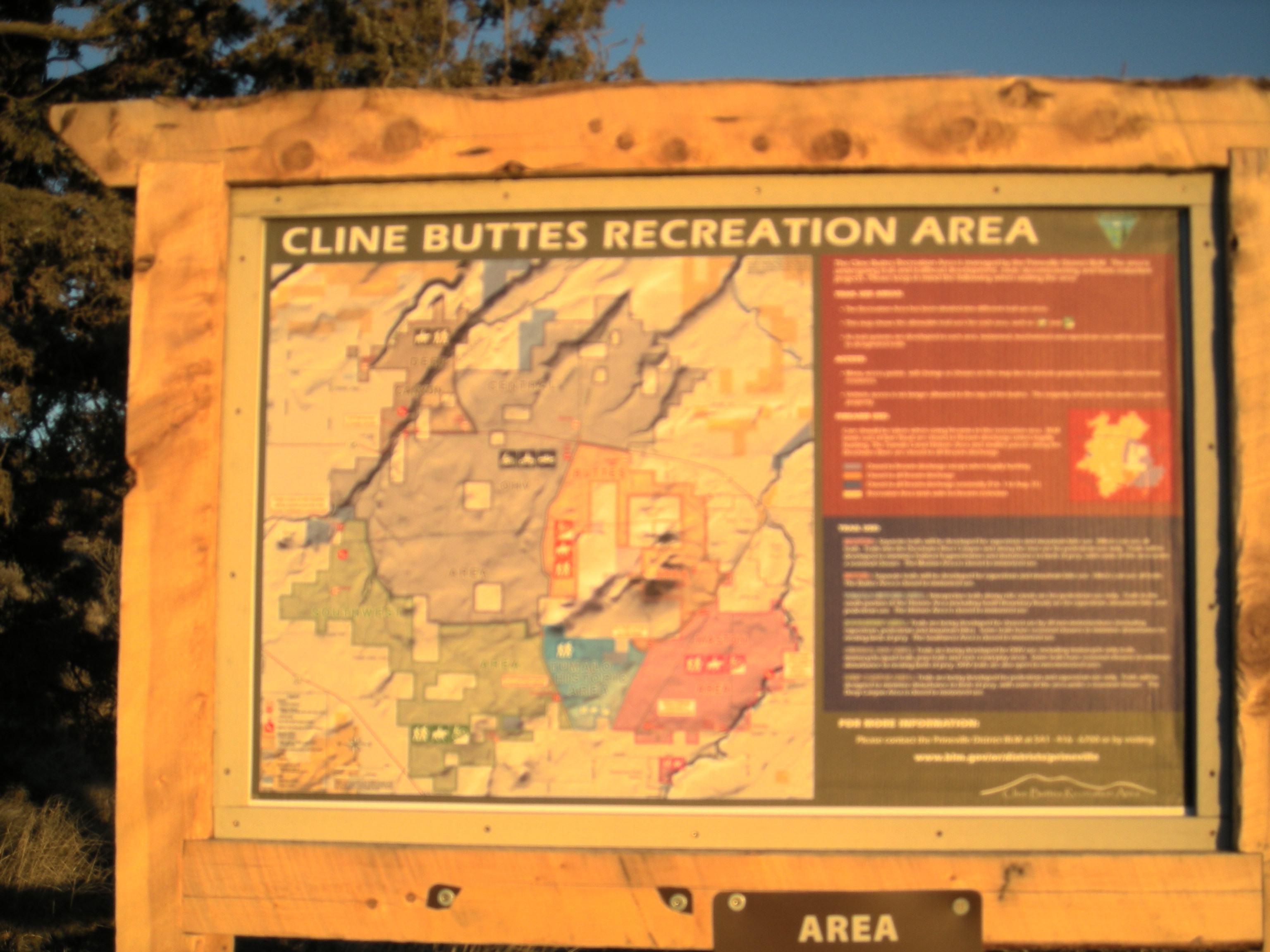
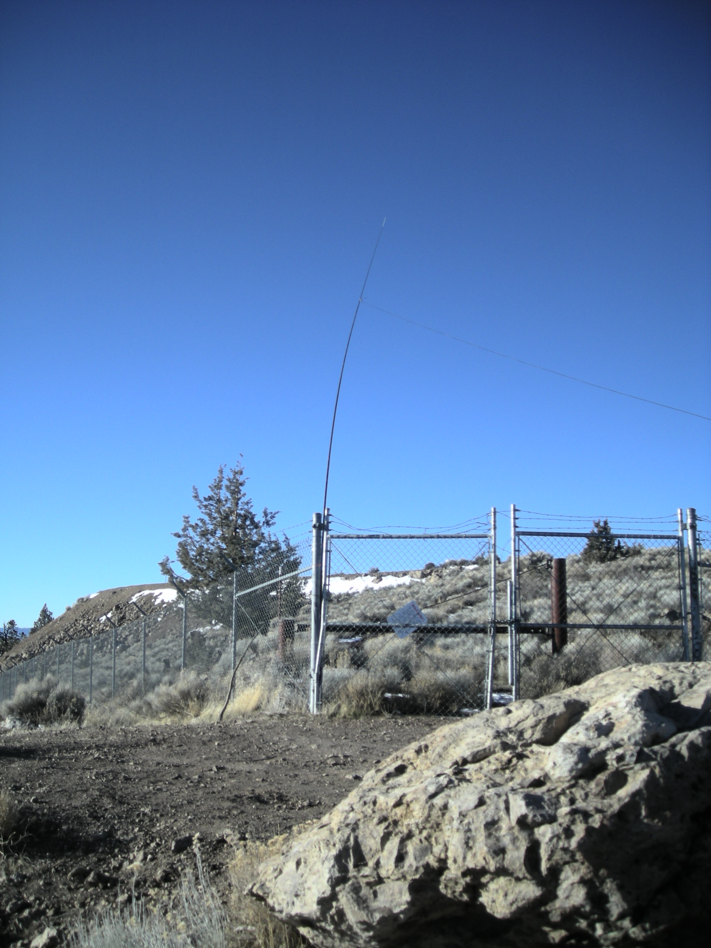
Much of the land in the area is managed by the Bureau of Land Management (BLM) but there is still a lot of private property mixed in. BLM has put up several new signs advising what property is private and whether you can operate motorized vehicles on the trail. This route had a "No Motorized Vehicles" sign at the trailhead. Cline Butte has an FAA radio navigation station on the top (or what us pilots call a VOR). There is a road on the south side of the Butte but according to a map and the signs it was private property so I took the northeast route. The top is completely fenced in with six foot chain link fence and barbed wire at the top.
I was able to setup within 50 ft elevation of the top just outside the north gate using a 20 ft fishing pole and a 20 meter end fed antenna. This was my first cold weather activation and the wind was quite brisk from the east. Was able to sit on my foam pad behind a big boulder which was OK for keeping warm.
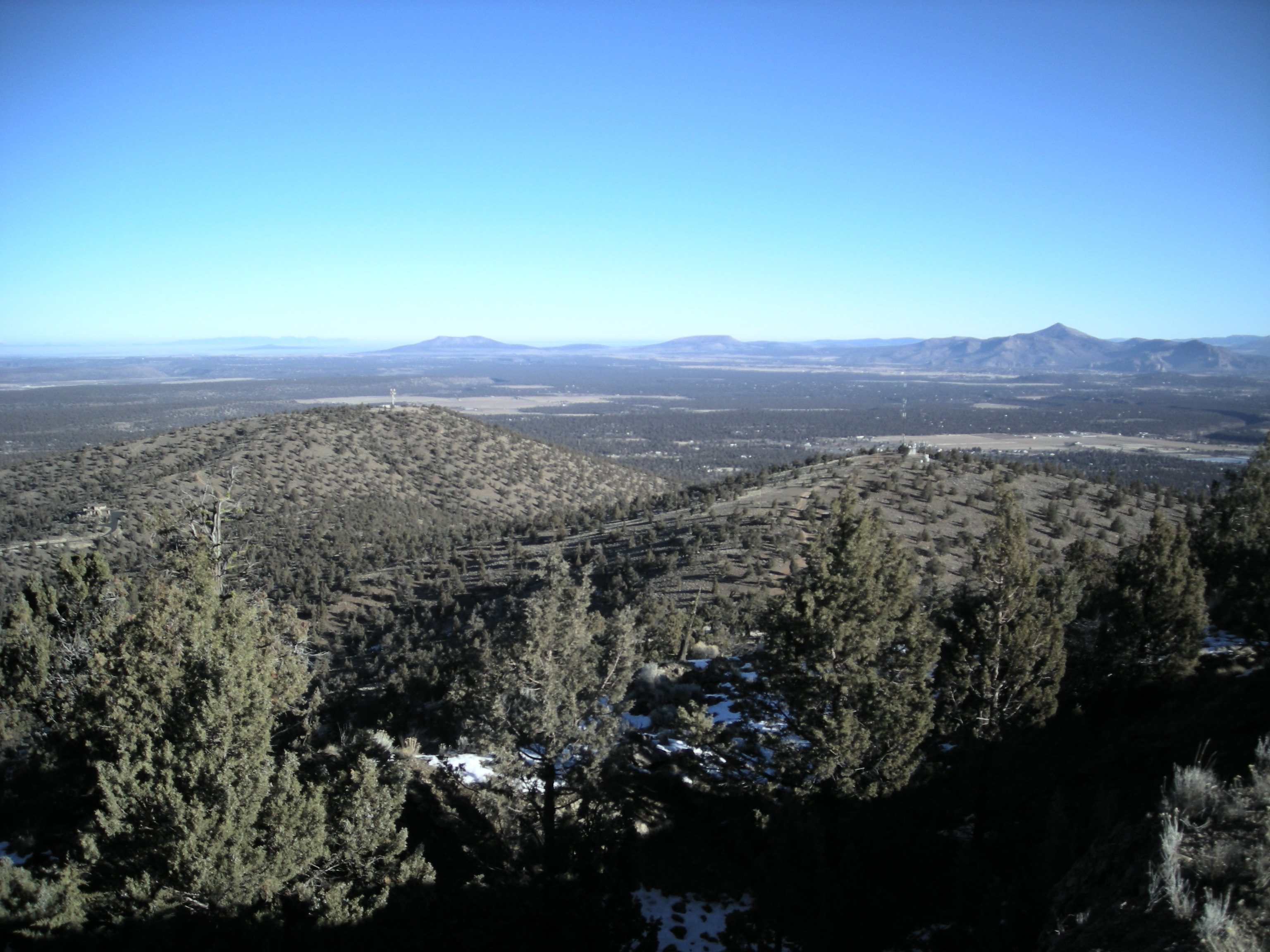
Initially was planning to use 14.342 as my main frequency but everybody and their brother was either on that frequency or adjacent to it. Moved down to 14.285 which was out in the open. Made my first contact there and I asked someone to spot me because my hands were too cold to work my phone. Was up on the top about 45 minutes and made 7 contacts. I had good conditions but many of my contacts commented about noisy conditions in their area. In spite of the cold I enjoyed the great views and the chance to get outside.
Directions: The map I attached shows a red line going south along Cline Falls Road from Eagle Crest. The distance is 1.5 miles before you come to a BLM sign on the left for the Juniper trailhead. Just past this sign is an obvious road on the right. Take that road one mile up until you come to another BLM sign next to what is a primitive road. Park off the road because gravel trucks use the road from the rock pit at the end. Start hiking up the primitive road. About halfway up you will come to a livestock gate but it is not locked and there are not signs. Almost to the top the main road goes to the right to another radio site. There is a jeep road that takes off to the left which you follow to the top of Cline Butte.