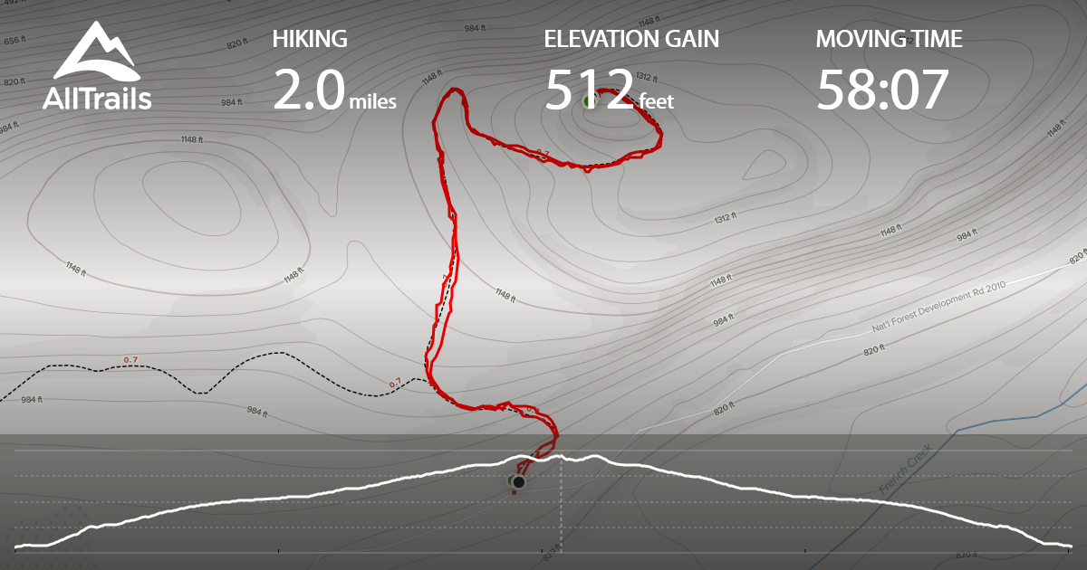
French Point is the site of a former lookout west of Darrington in Snohomish County, and a 1 point summit. I decided to activate later on a June day, after activating two other summits near Darrington. The hike is 2 mile round-trip, with ~500 feet of gain. While a relatively short hike on a decommissioned service road, it's made a bit more difficult with what summitpost.org called "tank traps". There are multiple deep ditches dug across the road to limit access, and it was more of an annoyance as parts of the road continue to grow over. This was the first SOTA summit where I wish that I had brought some clippers, or a machete to get through blackberry vines in just a few short "tank trap" sections. After reaching the summit, decided to quickly try activating on 2m with a rollup j-pole...and was grateful to get 4 contacts in about 3 minutes, especially due to location and height of summit. Not sure I would recommend this summit for the newer SOTA activator, as there are other better summits for the experience (ex. better views, trail conditions, etc). With that in mind, it's always fun to explore summits we haven't been to before.
In reasearching the summit, willhiteweb.com and summitpost.org had good information about. The city of Darrington had information about the French Point Lookout until recently, but could not quickly find as of July 2020.
http://www.willhiteweb.com/washington_fire_lookouts/french_point/stillaguamish_081.htm
https://www.summitpost.org/french-point/883281
http://www.firelookout.com/wa/frenchpoint.html
Directions to trailhead:
8 miles west of Darrington on Highway 530, take French Creek Road. After driving ~2.5 miles on French Creek Road, there will be a small road turning right with a blocked gate (the gate is covered with stumps). Park at the entrance to this road, and begin the hike.
Summit Area:
Within the activation zone there is a grassy area at the end of the service road. There are limited views, with trees available for stringing antennas. I focused on 2m meter, and was successful using a rollup j-pole on an extension fishing pole mast.
Below is a picture of the entrance to the blocked service road.

Starting early into road hike...

Upper portion of trail there is a little more vegetation. Difficult to see, but there is a ditch or "tank trap" in the lower portion of this picture.

Always enjoyable to stop and enjoy the flowers...

Summit activation area looking south / southwest

Summit area looking northeast

on the way back, upper portion of the trail and looking south / southwest