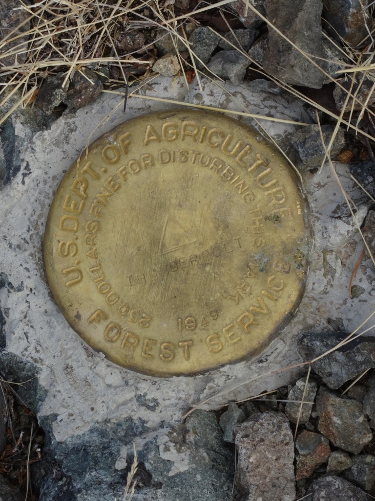
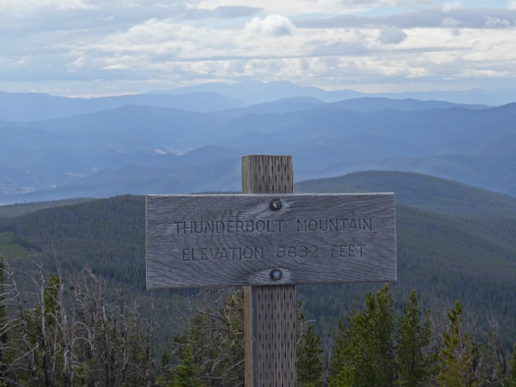
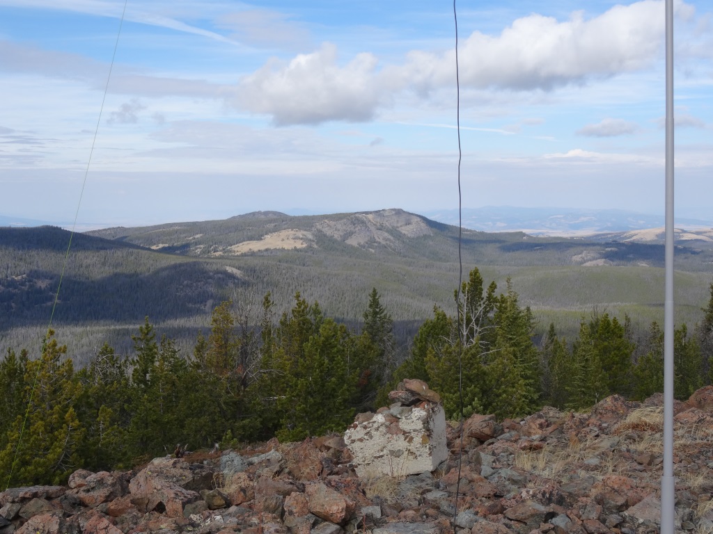
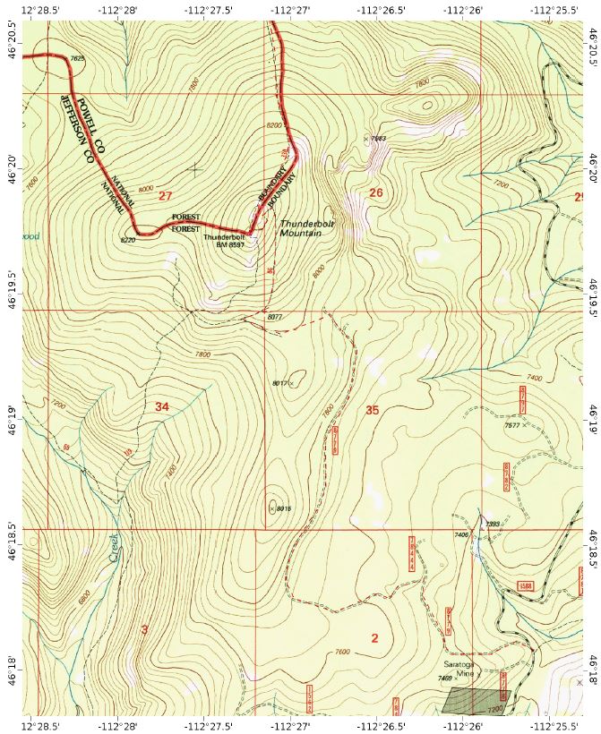
On-Trail Hike (5-miles, 1,500 ft)
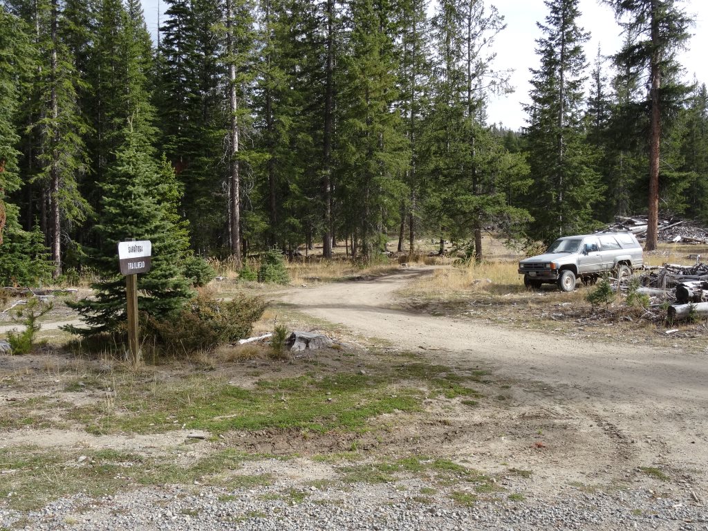
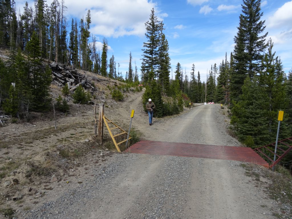
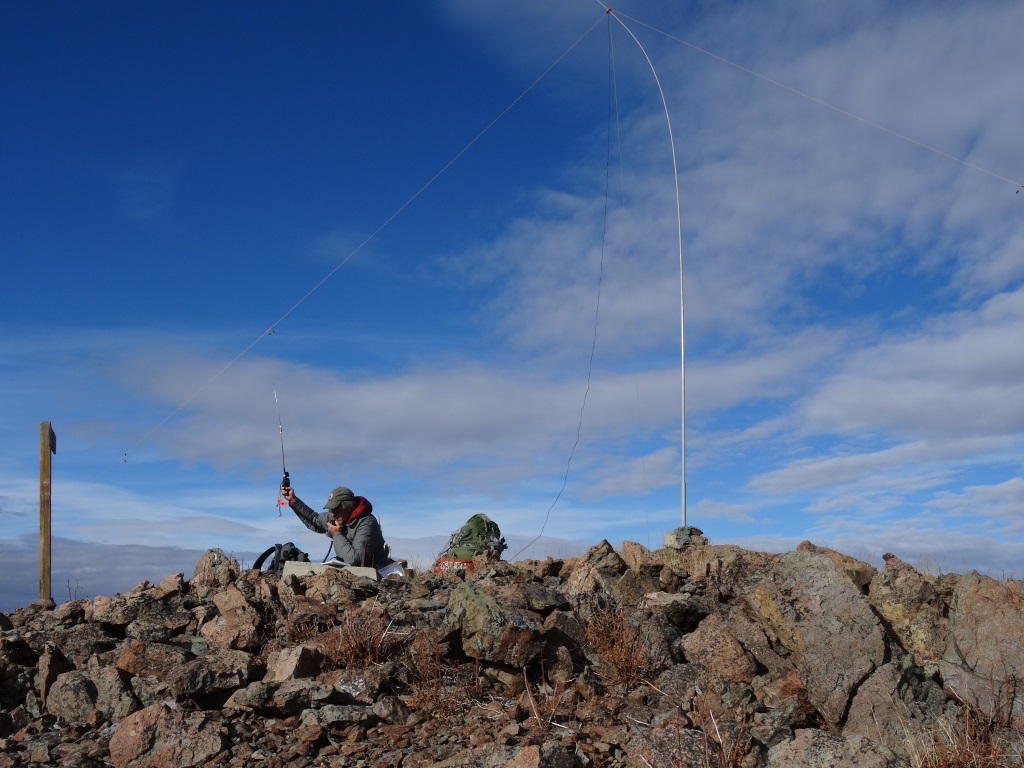
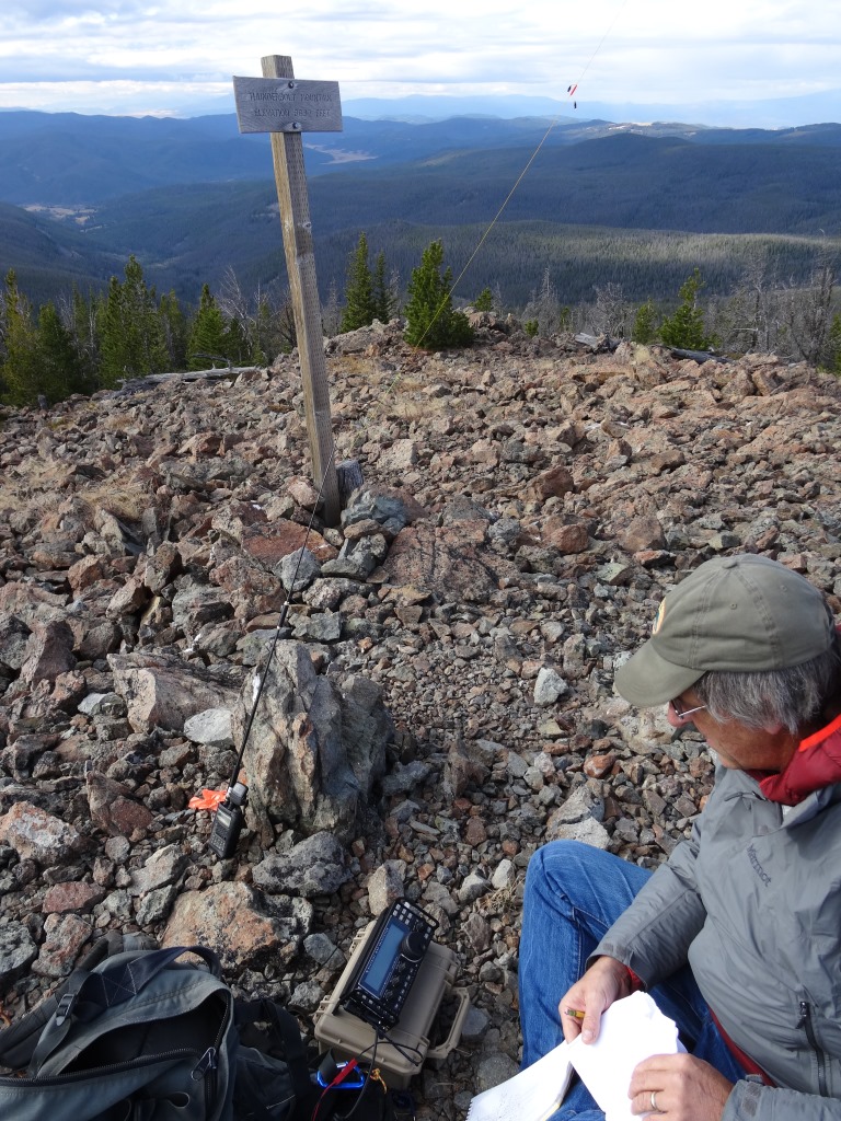
From the I-15 Bernice exit (west of Basin), follow the Boulder River road 3(ish) miles and turn right, cross the river, and continue for another 3(ish) miles to FS-1588. Turn right (north) on FS-1588, a well maintained gravel USFS road. Follow FS-1588 for 6(ish) miles as it skirts the west side of the Red Rock Creek basin. Park at the Saratoga Campground on the right side of the road. Begin the hike by following the 2-track that heads northwest from just north of the cattle guard. Follow the 2-track for about 1-mile and turn sharply to the left at the “T”, staying on the most traveled road. Continue following the 2-track as it winds about, eventually heading north towards Thunderbolt Mountain. After another 2(ish) miles, the 2-track will be mostly blocked, and a foot trail will depart directly up the hill to the left. This junction is marked by a “snowmobiles only” sign. Follow the foot trail as it ascends west to the crest of the north-south trending ridge. The path will fade in spots, but is delineated by periodic blazes and cairns. Upon reaching the crest of the ridge, the path becomes very obvious and is marked with blue reflectors. Follow it as it continues north and eventually descends a bit (50’ – 100’) down the west side before ending at a “T-Junction” on the steeper north slope of Thunderbolt Mountain. Turn right on the well-marked trail (CDT-trail) and follow it as it gently spirals up around the east side of the mountain. Upon reaching the north side of the mountain, the trail will reach another junction – continue up to the summit. Note that the true summit is further north than the first rocky pile that the trail passes. The summit includes the burnt remains of a 1930’s vintage R-4 lookout that used to be perched on 40-foot poles. It was destroyed in 1965. The summit offers scenic 360-degree views.