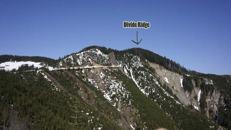
2012-05-11 Divide Ridge W7/KG-094 CN97FD65
Start elev.: 3948 ft (1203 m)
Max elev.: 4870 ft (1484 m)
Elevation gain: 1058 ft (322 m)
Trip odometer: 2.5mi (4.023km) Up: 1.3mi (2.092km) Down: 1.2mi (1.931km)
Total time: 8h42m Up: 2h38m Down: 1h32m
Video link later
APRS
For the International SOTA Weekend I wanted some easy summit. Unfortunately this did not happen. I could not go near enough to the summit on forest roads. Got high centered and dug the car for an hour. After this I hiked somewhere around 10 miles total, but could not make up to the summit. The slope had a serious deep melt and i was suffering with snowshoes on also. I decided to turn around. For my Friday PTO I choose an easy summit. Well, it was two. Huckleberry Mountain and Divide Ridge. Both of them can be reached from forest roads with little hike. If I can drive up the same elevation than last week, then I have to hike much less than if I try Huckleberry Ridge again. At 0523 I am already in my car. Pop by a McDrive to get some calories and driving south from Seattle.
I loaded waypoints into my GPS and studied the forest roads and terrain. Next to the river is all private land. I hoped that just like on my previous hike, driving on FR is allowed even if it goes through a private land. As I was approaching to the FR70/410 junction I stopped the navigation on the GPS and this somehow erased my summit waypoints. I was very unhappy. Because I studied the terrain I was able to locate one summit and carried on with my drive. I turned on FR70 and reached a bridge which I had to cross. Very near to the bridge there was a Private Property, No trespassing etc… sign. I stopped.

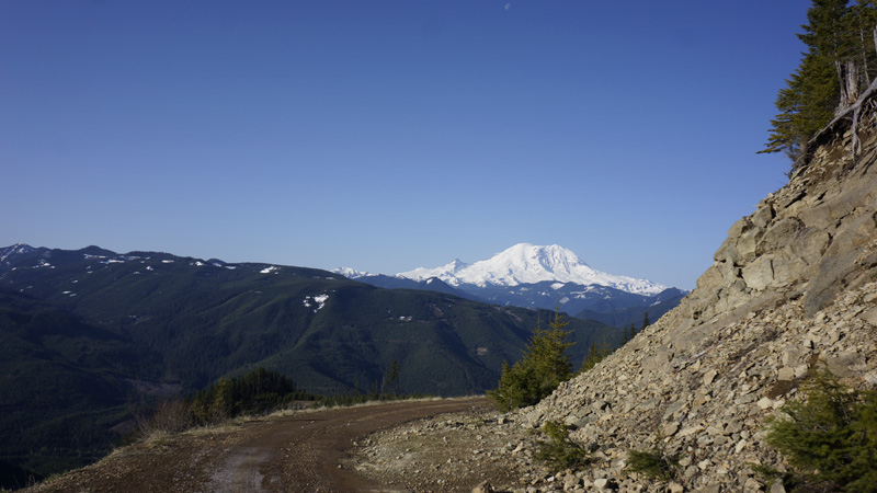
Started to check the GPS map for other access roads, but it was not easy because the unit has a small screen. When I zoomed out it did not display enough detail, when I zoomed in I did not see the big picture. I played with this for a while when a car passed by on 70. Quickly I got after him. Luckily he stopped not far away and I could ask him about the roads. He said that it is private land, but if I am on the forest road it is not a problem, but do not leave the road. Cool! Back to the bridge and start my ascent on the gravel road. The volcano from the forest road.
During my climb with the car there were some very good sights, mainly on the big volcano Mount Rainier. At a higher elevation I had to stop and put up the chains. Only needed for a short section though. I was able to drive up to 4000ft. Above this the only way could have been forward on snowmobile. Parked the car near the wall and started my hike. Turned up the legs on my trousers to increase my heat dissipation. It was a fantastic sunny day. This was the exact reason why I requested a day off. Started towards Huckleberry, I thought, and walked to Divide Ridge. I had no idea that the summit in reality is the other one. :D
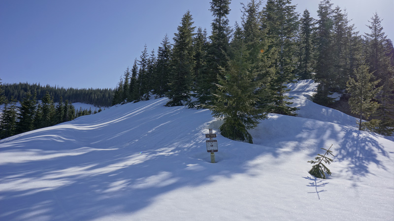
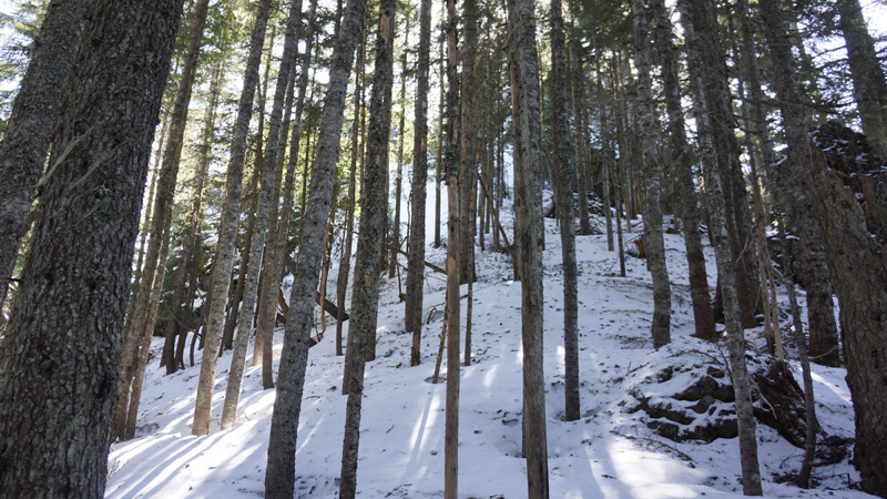
Made a good progress on the snow covered forest road and soon reached the ridge line. Off course I hardly had to walk any serious distance and there was no significant elevation gain either, so this fast progress is understandable. This is exactly what I wanted. Get out and have only a short distance walk and some QSOs. Well, it turned out a little different. There are pine trees in the middle of the picture. To left the Divide Ridge trail, which here goes below the ridge line. To right an old logging road. I am hiking in between staying on the ridge. Climbing the first summit, descend back to the col and climb the second peak which is the SOTA summit.

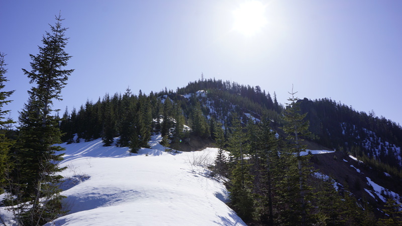
There are still plenty of snow just above 4000ft If only I would know who the hell brought it here!? :D I carry on amongst the pine trees and a steeper climb starts here. As I get higher and higher at one place I stopped and put on the crampons. After this I was able to walk faster.
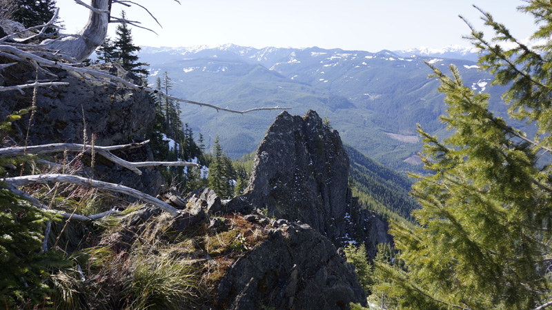
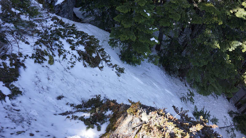
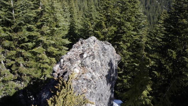
 Passing by this rock formation I was happy that the summit is not this one. It would not be easy to get to the top of this. This time I have no idea, that although the actual summit is not as bad as this, but quite similar.
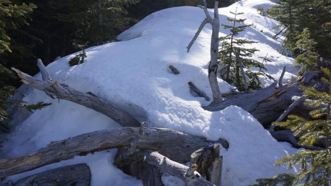
Old tree blocking my way. It was not that bad right now. It will be much worse on my way back, when the snow will be slushy and you have to be very careful with each step.

Right now is like in a dream. Everything is just perfect. The snow is hard, but not icy. With crampons on I could have not wished for better conditions. There is bright sunlight but temp is not high. Beautiful colors everywhere, bright sparkling white snow cover, green evergreens and crystal clear blue sky. I also heard birds singing, which is not common here in a pine forest for me. Just like in a dream. I really like it. Reaching the first summit and descended back to the col which is covered by tall pines.
It is time to wake up! Stop the dream, this is getting serious. At the back it looks like a huge rock wall and there is a rock formation on the right side too. I don’t like it. I will go round it, and there will be a good flat summit. It won’t be this steep. I thought. When I reached the wall I found one small gully where I thought I can climb up and I do not have to go around. Put the walking sticks away and tried to obtain my ice axe while kept my knapsack on. I spent some time and after my medium weight pack almost knocked me out of my balance, I took it off and grabbed my axe. Let’s climb this gully.

It is cannot be really seen on the picture, but it indeed was really steep. Maybe 50+, or something. The truth is that it was not easy. Especially as I did not put my gloves on and my palm did not like the icy snow. The real surprise is just to come.
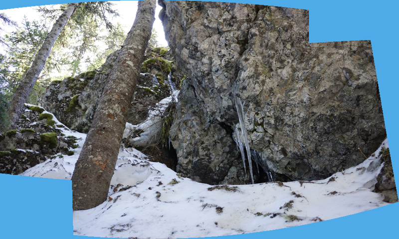
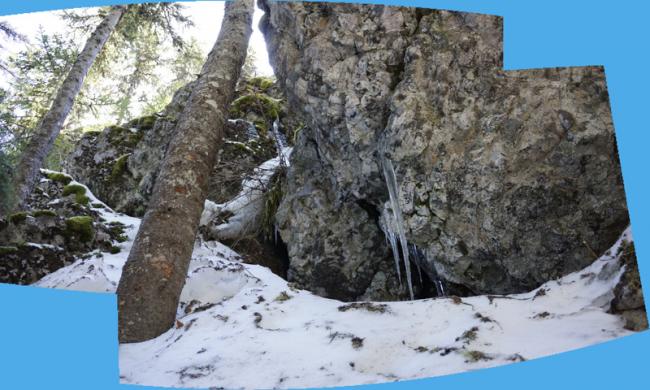
This is not a summit top. In fact it is only a very narrow rock wall. I cannot go back and I don’t want to. To the other direction there is a bigger wall above me.
Here with a lot of suffering caused by the poles and antenna parts attached to my backpack blocking my movements as touching the rocks, I made my way to the steep snow covered slope. Here there are some pine trees also. I am climbing up on the left side of this tree and soon I am on top of the rock. When I walk out of the cover I realize that this is not even the summit yet. I acknowledge this with some “nice” Hungarian words. I go back under the trees and stepping on some rock walls finally I reach the true summit. This was not easy that is for sure! It is not finished yet either.
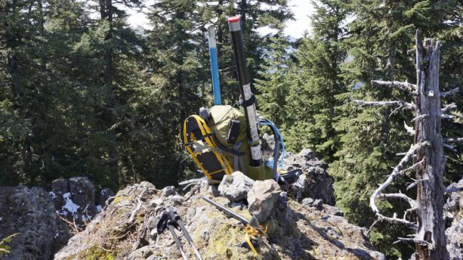
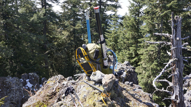
The summit is also nothing else but a narrow rock wall. No place for an antenna. From here I cannot climb down with my backpack. To the left I saw a flat area which still will be way in the activation zone. That’s the place where I will set up my aerials.
The summit is just blocked by the tree. The red arrow depicts the location where I lowered my knapsack with a 15ft 5mm rope. I use this rope to hang the Yagi from the fishing pole. Once I had no weight on me, I was able to easily climb down in that crack. The height of the wall is approx 6ft.
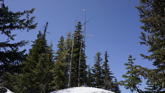
With two turns I hauled my stuff over to the new location and started to raise the antennas. It was around 1100. I hardly covered any distance, but it took me two and a half hours. I could not tune the Budipole on 20 again, but it was better than on my next mission. On 2m SSB there is not a single guy. Try to hunt down some FM people, but as it is Friday lunchtime, there are not many of them either. Made 1 QSO on 20m and 4 on 2m. Around half past four the afternoon I started my hike back to the car. Before that I looked around a bit and had some cheese pasta as lunch. I had no idea which summit I was on. My plan was that if SOTA would have started on the band then I would have asked someone to verify my position on aprs.fi. There was no need to give SOTA ID to anyone. I thought I was on Huckleberry.
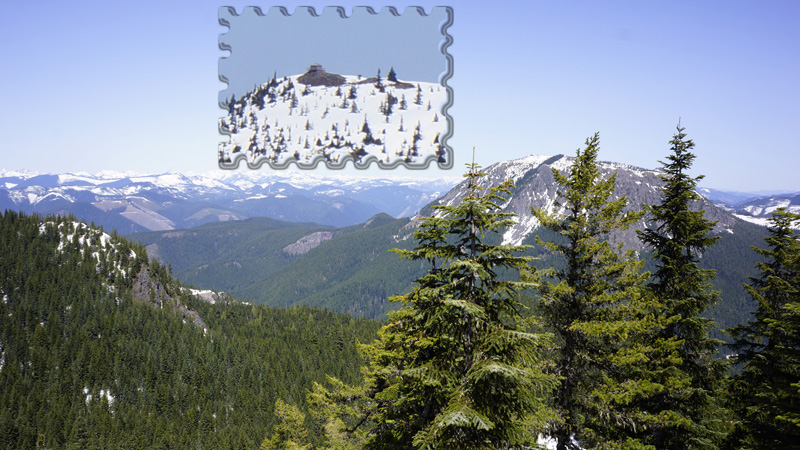
Behind the pines there is Kelly Butte, with its lookout. Once the forest roads will melt out little more I will try that.
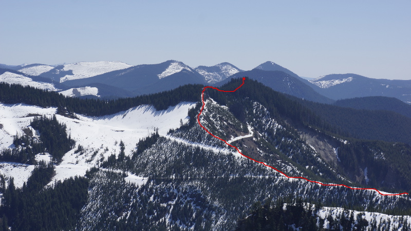
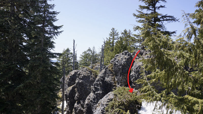
On my way down I choose a different route. I descend inside the forest. The slope even here is very steep, at least 45 degrees. Using my ice axe and hope that it will not end with a big rock wall. Luckily there is no wall here. As I got some elevation down I orient myself towards the saddle. So I go round those parallel narrow rock walls. Once I reach the saddle I am very happy. Danger is over. From here is all fun and laughter to get back to the car. On the picture is my route. Photo was taken 2 days after from Huckleberry Mountain.
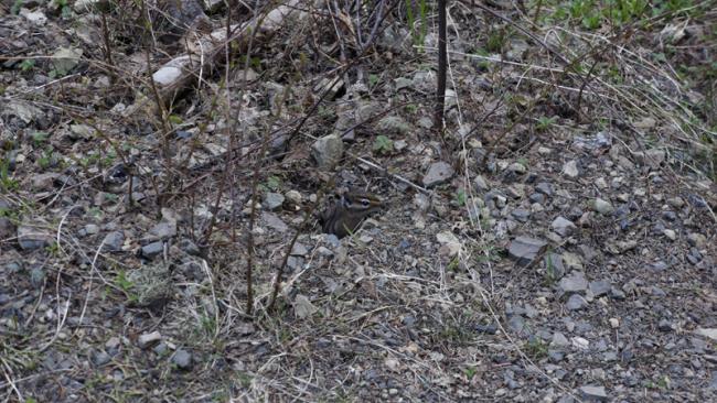
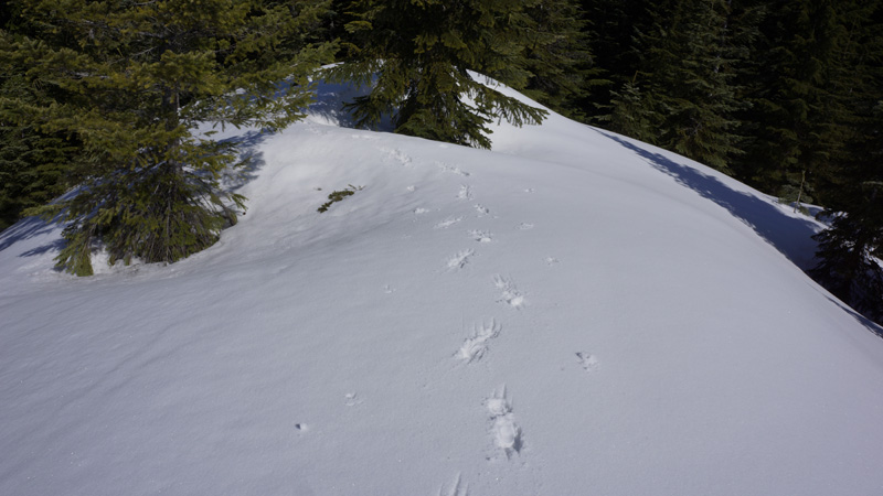
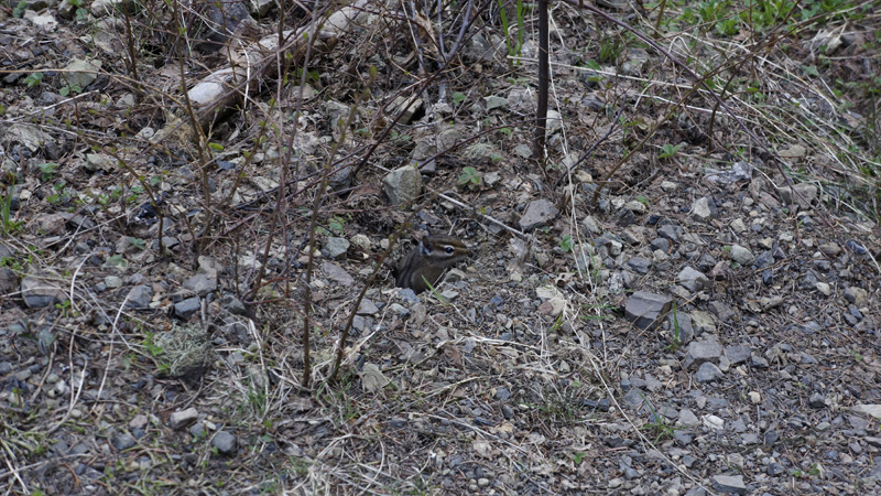
During my way down I try to stay in the forest longer. I cover my wound on my left hand with some resin. That has a very nice smell. The snow outside of the forest is very slushy and I am sinking sometimes up to my knees. Once I reach the open area I swap the crampons to snowshoes. A chipmunk next to a forest road.
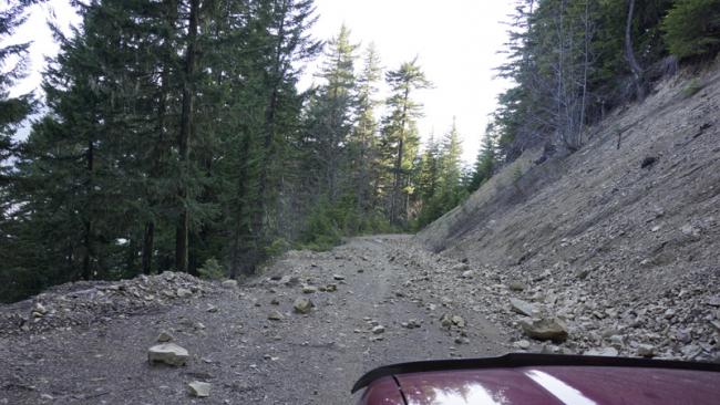
Forest roads can pose different dangers like trees across the road, wash outs, mudslide and rock fall. Here is a small rock fall across the road on my way down. I think I should get at least a chainsaw into the car.
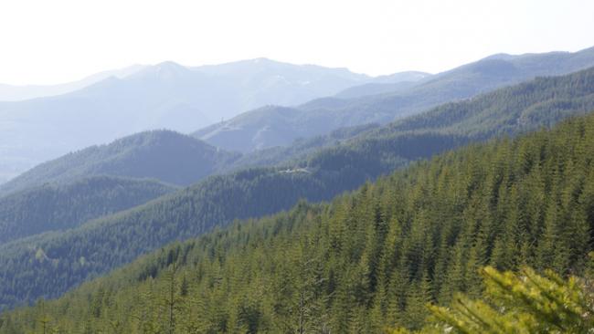
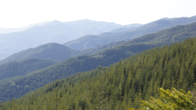
Endless evergreen forest.
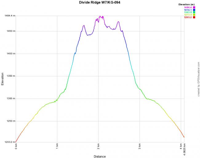
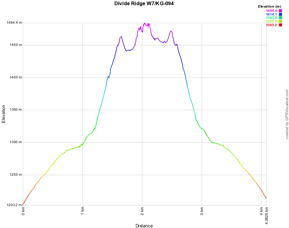
The elevation graph
It was not a big, long hike and elevation gain is also small, but still I would not say that it was an easy task. It was not what I wanted, but it was not bad. The conditions during my ascent were fabulous. Sadly the radio portion did not go well and if I want to do more HF I should dedicate more time for this Budipole. 4 points collected! :)