
2012-05-13 Huckleberry Mountain W7/KG-093 CN97FD27
Start elev.: 4291 ft (1308 m)
Max elev.: 4881 ft (1488 m)
Total ascent: 604 ft (184 m)
Trip odometer: 2.6mi (4.184km) Up: 1.5mi (2.414km) Down: 1.1mi (1.770km)
Total time: 7h20m Up: 1h37m Down: 36m
Video
APRS
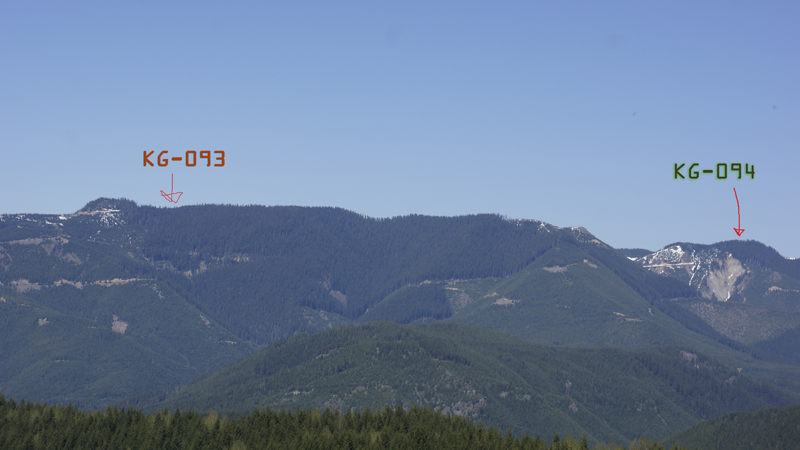
The weather is absolutely fantastic over the weekend. After Divide Ridge on Friday, today I aim towards neighboring Huckleberry. Over the heat I leave Seattle at super early time. At 0400 I am driving already south. Hopefully with this early start I can still ascend on good snow conditions. I got fed up with the morning McDrives before my hikes, so previous night I made two sandwiches from baguettes. Cut in half and put pepperoni, cheese inside. I added half cut baby tomatoes to one, the other sauerkraut. I ate the sauerkraut one during my drive. Yummy! I paid attention to research the maze of forest roads in the area. My planned route again goes through private land and I am afraid that access can be restricted. Thus, I looked for alternatives too. Found one road which connects the road I have used before with the road goes up to Huckleberry. This road is completely in the National Forest and I mark the junction points on my GPS as waypoints. Forest roads are quite tricky. You never know which one exist and where are new roads. This connection road was not on Google Maps, but it was on my 24k GPS topo map. I also found road which was the other way round. KG-093 is hidden behind the ridge.
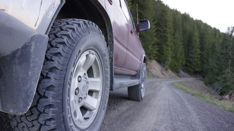
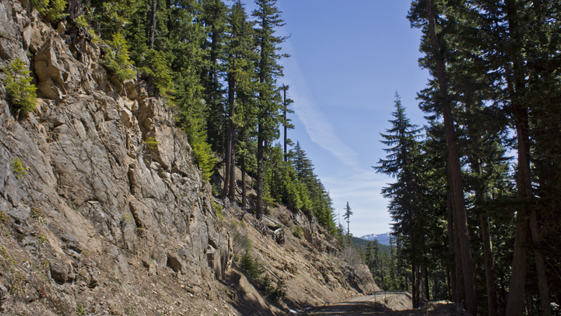
I reach FR70 and soon I am at the bridge. I drove across with confidence. The road I planned to use begins immediately after the bridge on the left. It is closed with a barrier. Damn it! It is good that I have an alternative route. I have no idea at that time whether that road will be there at all and what condition it will be if there. Start my climb with the car on the road I have used before to access Divide Ridge. I reach the junction and state that this road is in perfect condition. It is a gravel road on which you could drive up any car, but for safety I am in 4WD mode. As I drive up on this road I am waiting to reach the junction, where I have to turn right. Suddenly I just saw patchy snow cover on the road. Ohh NO! I thought. I want to get up at least to the junction, so I do not have to walk that much. I stopped and checked my position on the GPS. I already passed by the junction I just did not realized it. The other road is not in use anymore so it was hard to see. I checked it on my way down.
Scenery is good. I pass by some waterfalls. After a while snow covered areas increasing. After a turn I stopped. I did try to go a little further, but in the end I left the car here. If I would have put the chains on I could get over a small deep section but only would have gained approx 250 ft.
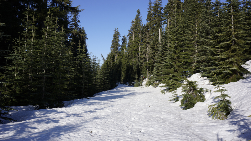
I gear up and start my hike. It is 0635. I already wearing crampons so I do not have to stop later to put them on. After the first bend in the road I have to stop though and take snowshoes on. Snow is not as good as it was on Divide Ridge. Every step it brakes under my weight, I don't sink in, but even this small drop is enough to slow me down. There will be no steep section here anyway, and on flat and modest terrain snowshoes are also good. I do not like snowshoes. On flat ground they OK though, but once it gets steep I hate them. I need a pair of skies especially as with those on down trip is much more fun and also faster.
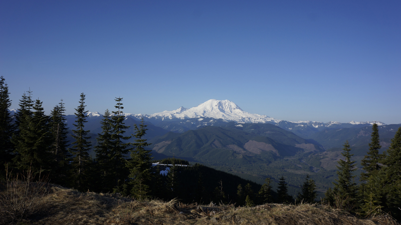
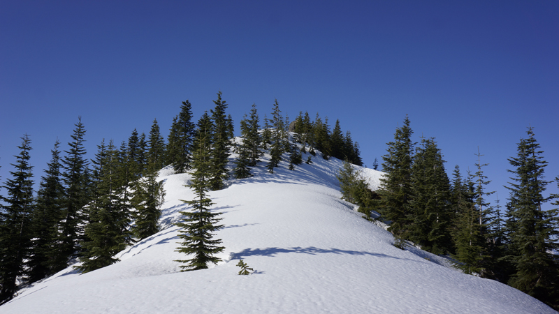
I have a slight „problem”. I have to stop and make pictures all the time. :D Rainier looks really good as it reaches above the Cascades. Light condition is also good as the sun is behind me when taking photos of the volcano. I shoot around 140 pictures. I reach the ridge and walk towards the peak in front of me.

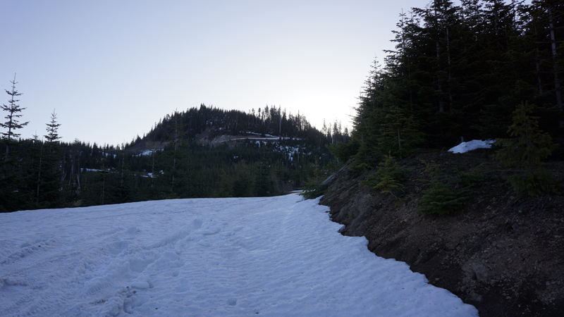
I pass by on right side staying on the forest road. While I am walking, I am thinking that one could drive up to this summit for some VHF hilltopping once the snow is gone. I try to estimate the road quality under the snow.
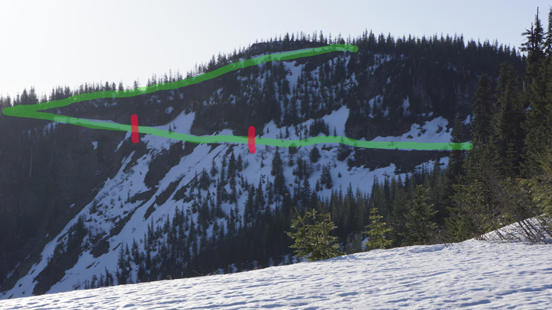
Green line is the forest road. Between red sections the road must be missing.
After passing this peak the road goes in level for a while and soon I have sight on Huckleberry Mountain peak again.
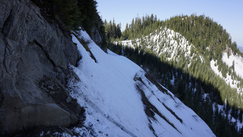
In no time I am under the peak and route became very steep. I do not have to climb though; I have to traverse this section. Swap the snowshoes for crampons and thought that I will cross here quickly. I left the walking sticks in my hands and did not take the ice axe. After two, three steps I realized that this was very stupid. Here the snow is very steep, somewhere around 45 degrees and snow is not hard enough. Only the top section is frozen properly, I pay extra attention to get steps inside the hill. If I fall here, then I am done. That’s for sure. I aim towards a small flat area where I can obtain my axe immediately. I think the road is missing here. Taken by some avalanches, mudslides. I guess.
Once on the flat, I feel much better. However, the terrain did not get much better in front of me. Here I go with my axe and making progress much faster and safer. Quick climb over this section and I am at the last bend in the road.
I walk easily here and I feel that I will make it to the top. As I got higher I saw that there are some rocky sections here also from this side. Easily transferred from snow to rock and on the top without any issues. It is just over 0800. The only problem I had is the steep traverse. I would have been happy to skip that, and I decide that, no way I will go back that direction.
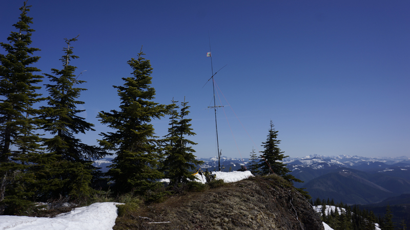
Take off my sweaty shirt and lying on a pine tree to dry. I am enjoying the sun and the view meanwhile assembling my Yagi and the Buddipole. I deploy my fishing pole as a mast and start calling on 2 meters. First a Canadian station replies. Local big guns also came by for a chat. During Sunday there is a NET here, but I think it is over by the time I got everything set up. After some QSO we try 70cm with Dale. What is 59 on 2m with 5W, is only 51 on 70cm with 20W. The QSO quality is good though. Here on 70cm Mike also gives me a call and we go back on 2m for some chat.
I called a lot towards north to get more station from BC and also tried south many times for Oregon stations, but either was blocked or no one was by the transceivers. Take my shirt back on and apply plenty of sun cream. Sun is getting very strong as approaching the Zenith. Let’s see some HF. Buddipole is not working fine again. I post myself via APRS, but only able to make some stations as my SWR is horrible. I check whether everything is set according to the instructions and adjusting it many times, but not able to get it right. I leave 20m and try 10, but no activity here. Back to 144. No one. OK, maybe the Yagi pulling the Buddipole’s SWR away. Take it off and playing more time with the tuning. Shortly after I gave up.
I did put snow into my stove’s pot and left it on the sun. With this I can save gas. By lunchtime the snow melted and I only had to boil the water. I prepare my lunch and disassembling the station. It is around 1200 and the sun is very powerful. I managed to knock off some antenna parts of the peak onto a steep southern slope while I was playing with the snow and some pipe. I was shooting out the snow from the pipes, which was fun, but now the driven elements are down there. No problem. Take my boots on, climb down onto the steep slope, obtain the elements and climb back. Sat into the shade to eat my lunch.
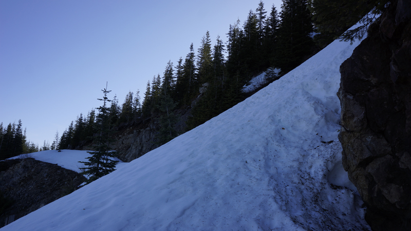
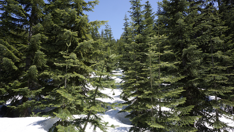
After lunch start my hike back with snowshoes on. I go through the sparsely forested slope. Some can easily climb up here too. Doing this I have avoided the steep traverse. Less than 40 minutes and I am back at my car.
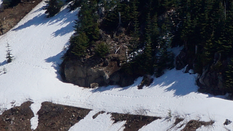
The steep section on my way back to the car. I do not think a car could pass there. So the summit is not accessible by car. Note my steps in the snow. :)
It was a really good hike. I could have stayed longer and try to get more contacts on two, or on HF, but at least I can make it home in time. Before the Sunday rush-hour. It was really good to have good 2m contacts again. On my drive down stopped at one waterfall and got some water. I drank that on my way home. Luckily I did not get sick.
HG1DUL 2012-05-18