On 5 June, 2013 I headed up to Wildcat Mtn. in the Salmon-Huckleberry Wilderness section of Mt. Hood National Forest OR for my first attempt at a SOTA activation. This is a quick and easy trip out of the Portland area, so give it a go!
Douglas Trail #781: route described below starts at Upper Douglas Trailhead
Driving Directions:
I originally tried to take SE Weber road off of 26 past Sandy, but had to turn back due to logging operations.
The recommended route is 26 to Sandy, a few miles past Sandy take a right on SE Firwood Rd, continue South on SE Firwood Rd. and take a left onto SE Wildcat Mountain Drive. Continue on SE Wildcat which turns into NF-36 and then NF-3626. You'll take a right on NF-105 and follow that until it ends in a heavily signed "no shooting" gravel pit (the green P on the map). On the Google map it looks like you can continue on 105 until the huge gravel pit at the end of the road - this road has been heavily decommissioned by the forest service and is impassable (it's not a pleasant hike over either, see below).
Hiking Directions:
I went in the middle of the week and there was only one car at the "lot" - a couple geocacheing. Shooting is illegal out here, but I saw lots of shotgun shells and heard someone shooting in the distance. Along the drive you'll see a ton of no-shooting signs. If this bothers you you may want to park down the road a bit (at the pink P ?). I parked in a shady spot next to the marked OHV trail. This is a decommissioned trail with an anti-OHV pit you can easily go around through the brush next to the road.
While unremarkable in scenary the OHV road is a good way to head up the mountain as it's very gently graded. There was some snow on the ground in a couple of spots, but nothing serious. You'll follow the road to the top of the hill - marked by the gray pause bubble on the map. At this spot there's an opening to your left through a couple boulders where you will find unmarked Douglas Trail #781. Take a left here onto the trail and continue past the Salmon-Huckleberry Wilderness Boundary sign (no wilderness sign-in box at this location).
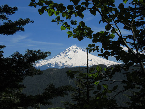
Once past the sign you'll be looking for a slight fork to the left (not the sharp left turn that's before it), take that and continue up and along the ridge. You'll start to get peeks of Mt. Hood on your left along this route. Once you can fully see Mt. Hood through the trees keep your eyes open for the trail up to the top that will be on your right. It's taped, and the cut trail is fairly obvious. The climb up to the top was the only challenging part of the hike. There was some snow and Rhododendron growth over the path making the way difficult (bring a machete! :) ). It's a quick climb, .1 mile, to the top though, so don't let that deter you.
Total distance to the top is about 1.7-2 miles.
Gear Set-up:
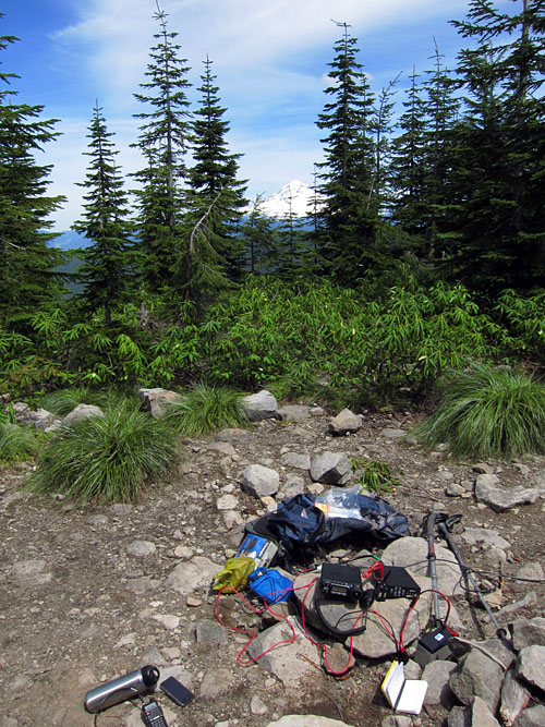
I forgot my hang bag so I strung out my dipole horizontally at around 8 feet. There are some large trees to hang from that circle the open spot at the top (see picture below). On HF I was running my Yaesu 857-d with ldg tuner and a g5rv-jr off a 12v 7.5 ah slab. I also had my HT running on battery with slim jim on VHF. I could hit the ARRG Mt. Hood repeater, but no one answered. I tried for a contact on 146.520, someone heard me, but they were mostly static on my end. On the HF side I could hear plenty of folks, but only had the one contact with AB7YL on 40m- thanks for the contact!
I hung out on the top for a couple hours, ate lunch, then packed up and headed back down. Very peaceful place to spend an afternoon. I'd like to give the antenna another go, assuming I can hang it properly and get it in an inverted-v, but I'm also looking at other options.
The Hike Down
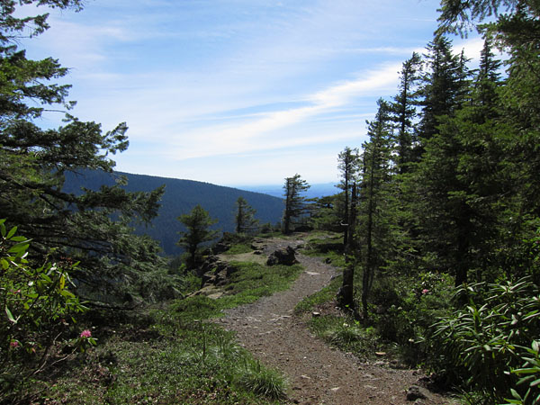
Instead of returning on the OHV trail, I decided to take the Douglas Trail back down. Much steeper trail for sure, but makes a nice and more scenic loop for the return route. The bottom part of the trail overlooks the Eagle Creek Canyon. The bear grass and rhodies were just coming into bloom along the trail, and in a couple of weeks this short section of the trail should be magnificant. After coming off the trail at the large gravel pit I ended up hiking the decommissioned section of 105 (not recommended - lots of scrambling and loose gravel) back to the car. I didn't do any scouting but the geocachers said there's a better trail from a parking spot somewhere close by - I outlined a possible route in pink on the map. It's likely there are several optional ways of reaching the trail. I'll be going back at some point to scout a route - but if anyone gets up there please let us know.
Options for Hiking
The OHV route is a great option if you're looking for an easy quick trip to a summit, <4 miles r/t. Douglas Trail #781 starts further to the west, and connects up with the Eagle Creek trail #501 at some point. Supposedly it's about a 7-8 milke hike one way from the Douglas Trailhead. Lots of potential spots for setting up camp once you're in the wilderness, but no water that I could see.
A great trip all around, and look forward to many more summit trips in the future.