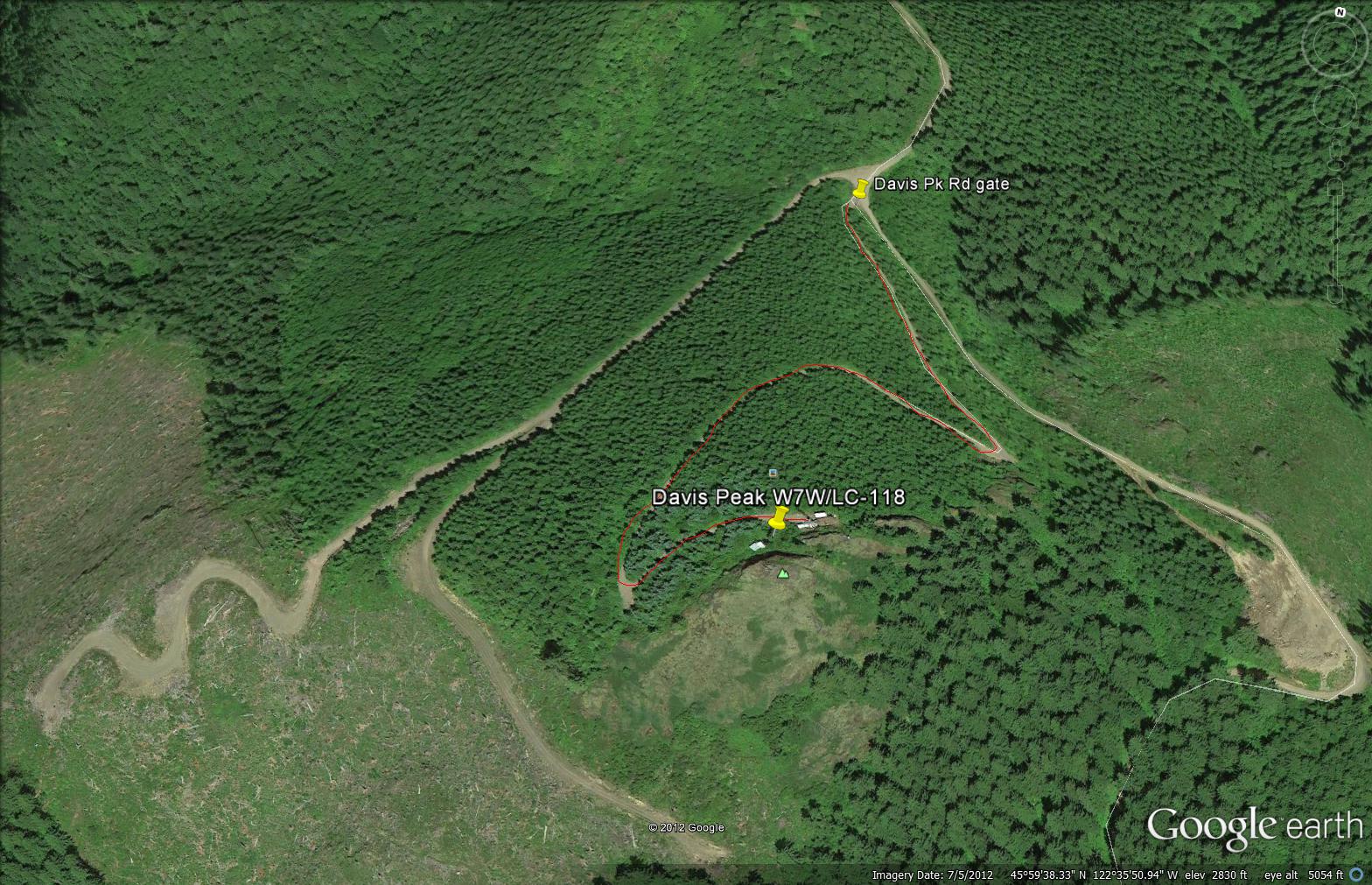
This was my first SOTA summit activation. Due to the weather (rain and heavy fog) I chose a summit close to home. Davis Peak is a major radio repeater site about 13 miles east of Woodland at Exit 21 from I-5.
Access requires a little logging road navigation but a good GPS will get you in the area. Drive east on SR#503 (Lewis River Road) from Woodland and turn left onto the Little Kalama River Road then up the hill to the Aho-Carson Road where you will turn right. When the Aho-Carson heads down at a right turn, take that right turn onto Old Crow Road until you come to a triple fork in the road at a large intersection. The center fork has a gate on it (hard to see) and is the road you will want to hike up to the summit.
Hike is about 1/2 mile to the top where there are several radio towers and a generator in operation. I am sure there are great views but not on my trip. Several good places to setup but I am not sure how much the RF from the site impacted my activation. In spite of that I made six contacts and learned a lot.
No pictures because of the fog but I will make sure to do so on my next activations.