On August 8, 2012, myself and hiking companion Ms Pat WT7N again on a conditioning day hike to prepare for an upcoming long backpack, hiked up to Shriner Peak, W7W/RS-036, located in Mt Rainier National Park. The goal was the view and physical conditioning and if possible I’d get the radio out and set the antenna up.
See: http://www.wta.org/go-hiking/hikes/shriner-peak
We’ve been to Shriner peak every summer for at least 10 years and half of those visits I’ve operated my QRP radio from there… but I didn’t know about SOTA then.
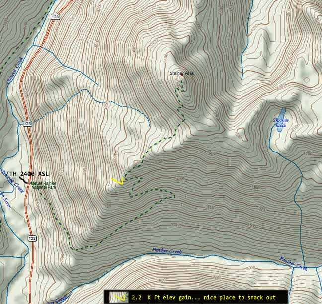
This hike begins at MP-9 on WA Highway 123 which is within the park boundary. The start elevation is 2400 and the summit is 5834 ft. The last three miles are exposed facing the southern sun, if it’s sunny. At 4600 ft, a little more than half way, here’s a nice spot to stop and have a break and take in the eastern side of Mt Rainier that provides a couple of SOTA peaks to wish for. There is no reliable water source along the trail.
Shriner Peak’s summit is vast and flat with a National Park Service fire lookout which is now a day’s used for park service radio repeaters and an APRS digi-peater. The summit also provides two backpack camp sites (permits required) with a privy with a nice view. There is no water to be found unless snow that has not melted still lingers.
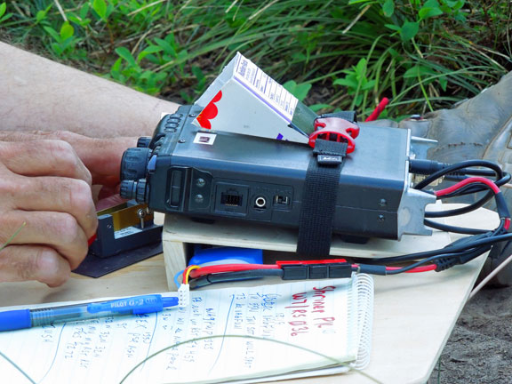
The hike took us less time than anticipated so I set up my station, a FT-817, Paddlette key, and lithium ion battery. My antenna a home brew ¼ WL vertical dipole, the BuddyStick equivalent mentioned in the previous report.
I was on 14.061 CW 20 minutes before the anticipated time I placed on the sotawatch.org alert page. Chasers were waiting. My Morse was challenged either due to the quick elevation gain from sea level to 5800 ft or something was in one of the key contacts. After six or seven QSOs I mentioned to Ms Pat that I was going to stop and eat. Her Morse is good enough to know that chasers were still calling and insisted I continue until there no more. 13 QSOs were logged.
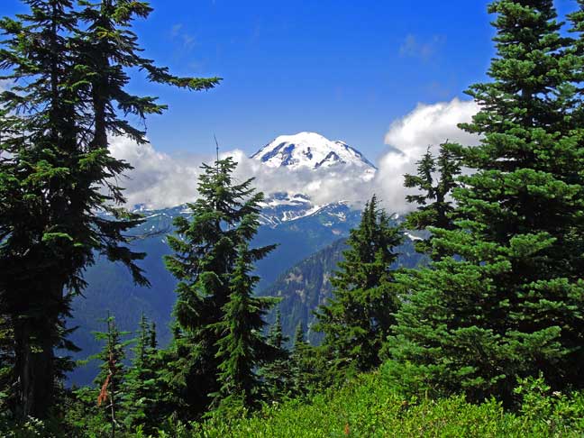
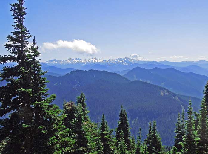
The summit views are spectacular… to the west and NW is Mt Rainier and Lil Tahoma. To the south is Mt Adams, the Goat Rocks, Mt St Helens, and sometimes Mt Hood can be seen.
Thanks to the chasers who provided me those Qs to complete this SOTA activation.
Best Regards… Rich KR7W