28 October, 2013 Bandera Mtn W7W/KG-073
Our original hiking destination for this day was going to be 7000 ft Norse Peak, an 8 pointer, near Crystal Mtn Ski Resort, a bit north and east of Mt Rainier National Park. The Mt Rainier WX report predicted 30-40 MPH winds at Paradise and Camp Muir in the National Park. We took off for our backup hiking destination: Bandera Mtn.
Readers note: This text has been edited to clear up a misunderstanding I had about the "Activation Zone". 'Added note' Corrections below...
Directions are here: http://www.wta.org/go-hiking/hikes/bandera-mountain The WTA trip description is not entirely accurate. I suggest the SOTA activator read a few trip reports for additional info.
This days outing was for me and Ms Pat WT7N to hike the Ira Spring Trail towards Mason Lk. If it was overly windy then we’d continue onward to Mason Lk for the views. At the fork in the trail there was little or no wind… so off to Bandera we went.
K7ATN had posted his ‘not recommended’ trip report for this SOTA summit almost exactly one year before. Read it here: http://www.pnwsota.org/blog/k7atn/2012-november-10/bandera-mountain-wa-nov-2012
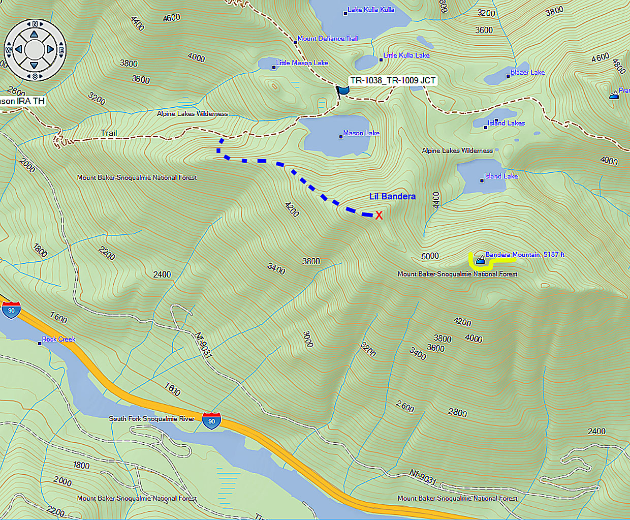
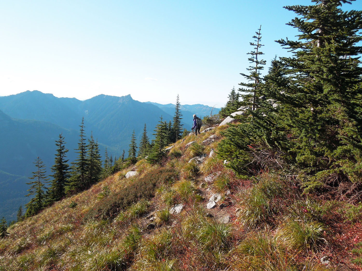
From the intersection the Bandera trail is an unmaintained boot track that ascends almost straight up most of the way to the View Point, called Lil Bandera on my Green Trails map. My GPS said the elevation here is 5140. This spot is very scenic and the warm sun on a cool day was inviting. I wanted to operate my radio from this point. I knew I was approx 60 ft from the true summit but I couldn’t remember how low the activation zone was. So it was decided to press on the remaining .8 mile to the true summit.
It wasn’t obvious to us how to proceed to the true summit from this spot. Then a hiker and his dog came by and continued on downhill (which defies my mountaineering training of avoiding losing elevation whenever possible). So we followed him until he decided to turn back. The trail looses about 200 ft of elevation and the climb back up was one of those hikes where it’s handy to grab tree branches. After following the faint rabbit trail a ways… Garmin said we were 500 linear and 20 vertical ft from the proper summit. At this I proclaimed, sort of like I imagine Brigham Young proclaiming, “This is the place!” The Green Trails map was correct by saying, “No views here”. Peering through the tall trees I could just make out the top of Lil Bandera and Mt Defiance. Not much sunlight made it through the trees for warmth while being surrounded with snow that hadn’t melted from last week’s storm. The bonus is that the insect population had frozen to death.
I was glad we stopped at this location because I could hear the group of young men who began their hike from the TH just before we did. They were on the true summit being primal and un-stressing by making blood curdling animal sounds. I wanted to walk over and tell them how ridiculous they sounded but instead I made 29 CW contacts on 7, 10, and 14 MHz as well as two difficult dot five two FM QSOs. After 45 minutes we decided to pack up and leave because we were getting cold in the shade.
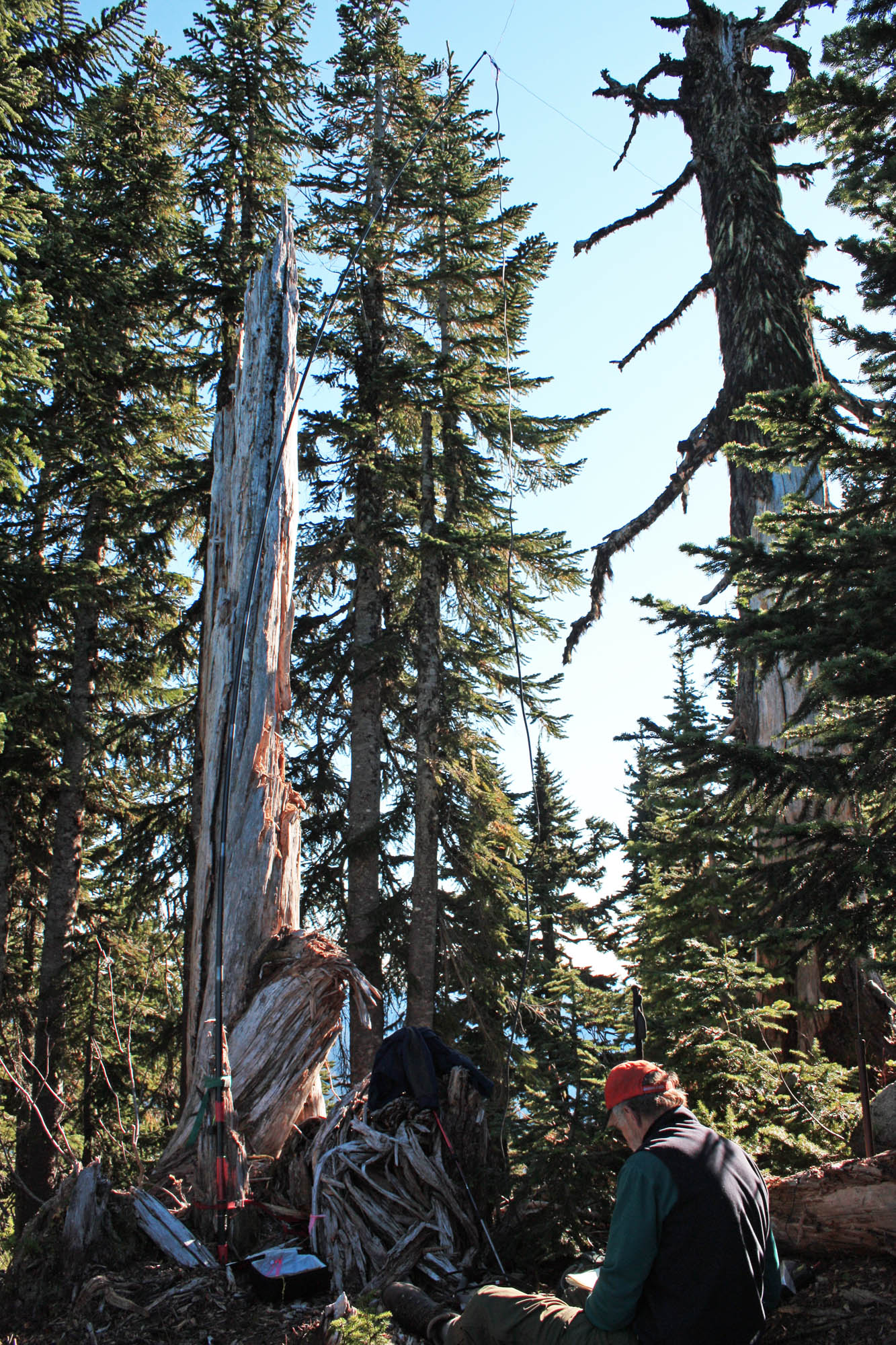
The return route down the saddle and back up to Lil Bandera was a different path than our arrival route. The trail was sometimes lost but easily found. I always had the top of Lil Bandera in sight so I never felt lost. A couple of times it took some effort to push through branches only to find we should have zig zagged another way. The route from Lil Bandera down to the Ira Spring trail required some concentration to place each step carefully but with trekking poles navigation was easy without falling down. Once on the Ira Spring trail to the TH it seemed like a six lane freeway in comparison.
Once back home I re-read the SOTA ARM manual for W7W/WA. The summit operation area or Activation Zone is 30 vertical meters (98 ft) from the summit. If I had it to do over again I would have operated from the top of Lil Bandera which is 60 ft below the summit and well within the AZ.
Added Note: Above I mention that Lil Bandera is in the AZ... after careful reading, I think I understand that Lil Bandera is NOT in the AZ. The UK's General Rules, section 3.5.2 states, "the terraine between the Operator Position and the Actual Summit must not fall below the permitted Vertical Distance."
Added Note: The WA SOTA ARM manual does not use the term Vertical Distance... but I think this text from the WA ARM (sec 1.3, para 2) manual sums it up: "Another way to describe the AZ is any plact that has a route to the summit point that does not dip below 30 meters of the summit point"...
Summary with recommendations: I liked this hike because the WX was right for it and it was challenging without over doing it. When I go back I will probably activate Mt Defiance first and if I have energy on the way back… hike the short but steep boot track to Lil Bandera and activate from there. (Added note: This will not be a valid activation)... My Mt Defiance trip report: http://kr7w-sota.blogspot.com/2013/07/mt-defiance-w7wkg-043-july-19-2013.html
Be aware that there’s not much room on top of Lil Bandera for lots of view seeking hikers and a SOTA HF operator. But it should be easy to get four 2 meter QSOs into Tacoma, North Bend, towards Eastern WA. To navigate the big rocks and gully of a trail from the Bandera trail turn off to Lil Bandera I highly recommend trekking poles. This trail has southern exposure so extra water is important.
Flickr fotos here: http://www.flickr.com/photos/kr7w-sota/sets/72157638153348205/
End of Report
-30- KR7W