Mt Fremont – W7W/RS-005 – 2 October 2014
Mt Fremont is accessed from the Sunrise Visitor Center, elevation 6400 ft, in Mt Rainier National Park. My GPS tracks reveal that I walked 5.0 miles RT and gained approx 900 ft.
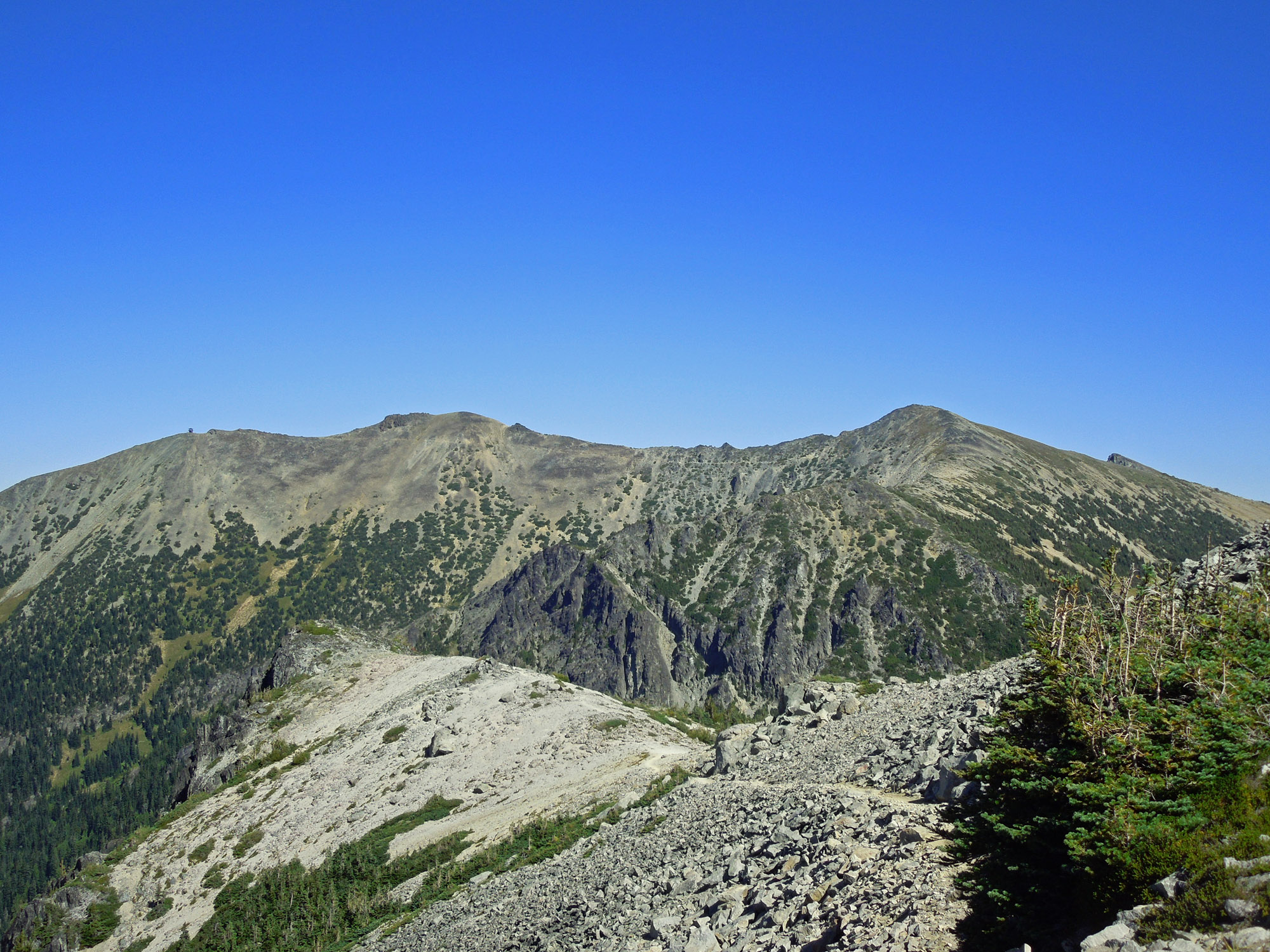
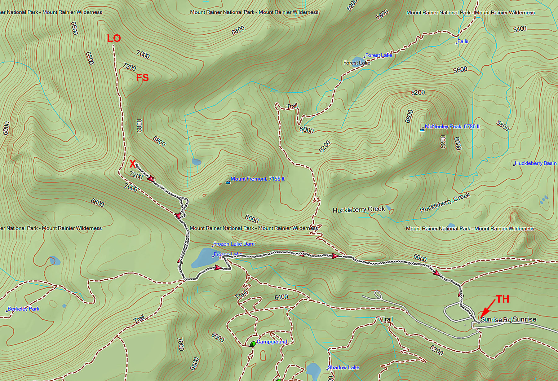
There are two prominent summits on Mt Fremont. The real summit is about 50 ft higher than the false summit. The two summits are separated by a saddle that dips down almost 200 ft which means that the false summit (FS on map below) is not within the 90 ft activation zone of the real summit (X on map below).
The route to the real summit jumps off the trail to the Historic Mt Fremont Fire Lookout (LO on map below). See WTA.org for the way: http://www.wta.org/go-hiking/hikes/mount-fremont-lookout
The WX for this activation was mild. 40 degrees at the TH at 10:30 AM. It had snowed about 3 inches a day or two before and melted out in areas of southern exposure. My trek was not hampered by the snow. It took about 90 minutes to reach the summit. By that time it had warmed up to 45 or so… and was most pleasant in the muted sunshine. I sure felt like taking a nap due to the high elevation lack of oxygen and the warmth of the sun in my face.
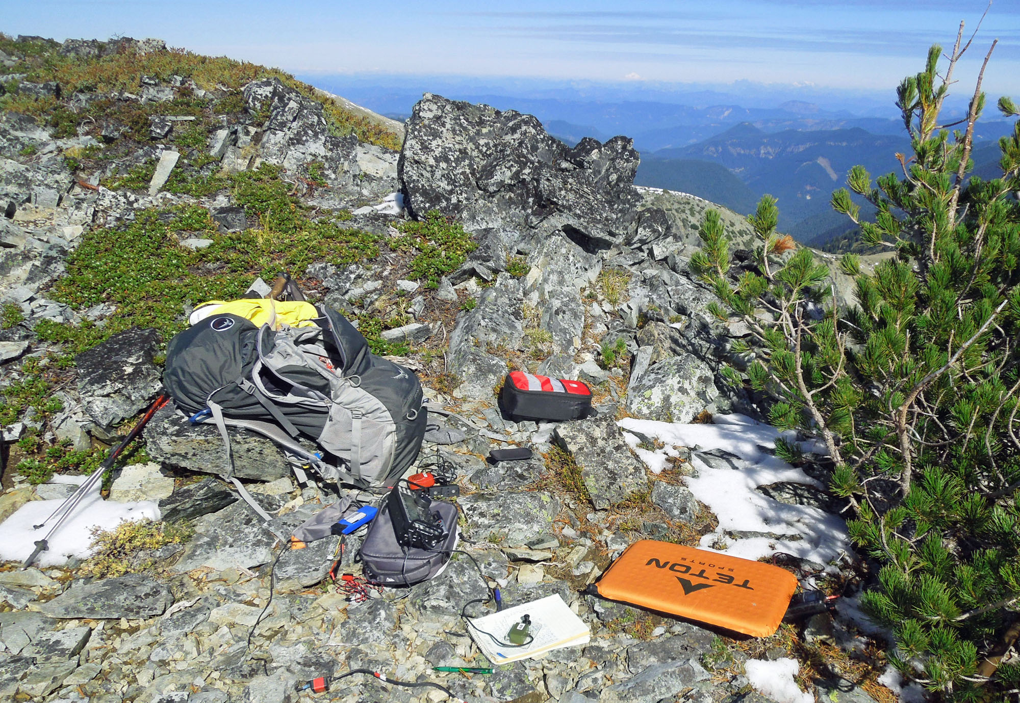
This summit has a wide clear path to the east and north which makes it great for VHF work. At 1900 I started out on 2 meters FM. The first ham I spoke with complained about SOTA ops hogging the calling frequency and suggested that I move off. I thanked him for the advice and would take it under advisement … then called CQ SOTA. Eight 2M QSOs were logged. I was quick and left breaks between transmissions. Hardly any hogging, IMHO. A page and a half of HF QSOs were made.
After I trekked back to the ‘official’ trail, I was approached by some National Park Volunteers who call themselves Meadow Rovers. Their job is to patrol the trails, give advice and directions to visitors, and make sure visitors do not step on the fragile vegetation. Of course they were curious about my collapsed fish pole and 2 meter antenna. I told them about SOTA and making radio contacts. Of course they ask, “How far away did you contact?”. I could easily tell them that NJ was the furthest and KS was the second furthest. Since I’ve been requesting that chasers give their STATE in the exchange- I know how well my station and propogation is working. Hats off to the chasers who give out their location. This outing… only 3 out of 34 QSOs did not make it into my log. After that- the Meadow Rovers wanted to know if I stepped on the fragile vegetation. “No, I was careful to walk around it while off the trail”, I replied as I looked at my boots.
This summit location is an easy way to score 8 Activator points and take a nice scenic hike to boot. The first time I activated here... I only had my 2M HT and easily made 6 or 7 QSOs. However, some people may have a hard time with the 7300 ft elevation- especially coming from sea level just a few hours before.
Movie of this outing:
https://www.dropbox.com/s/1dwu73s6od0xrp5/Mt%20Fremont%20SOTA%2010_2_2014.wmv?dl=0
End of Blog. 72 KR7W
+++ Hover mouse over photos below to see captions +++